
High instability fuels Monday severe storm risk, rotation possible
Stay weather aware again on Monday as a risk for thunderstorms builds across both Ontario and Quebec
Warm, muggy air will linger over portions of Ontario and Quebec to start the workweek, providing the instability needed to fuel a renewed round of thunderstorms for our Monday.
Some of Monday’s storms could turn severe—and portions of Quebec could see the risk for a tornado or two.
DON'T MISS: Texas storms triggered a ‘large and deadly flood wave’
Flooding risk through the overnight hours
Active weather that arrived on Sunday will continue into the overnight hours. Widespread rain and embedded thunderstorms will persist Sunday night into early Monday for parts of cottage country east of Georgian Bay, as well as into southwestern Quebec.
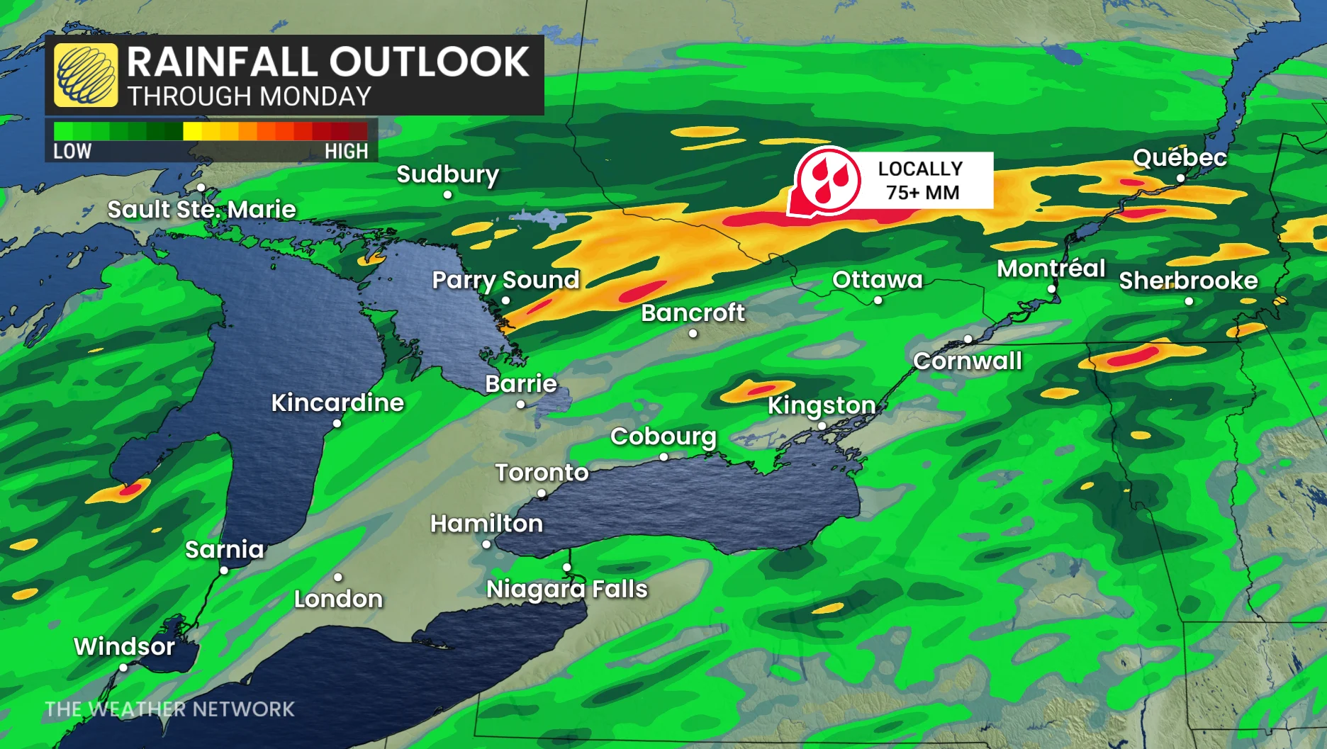
Some areas could see more than 70 mm of rain through Monday as precipitation lingers along this slow-moving boundary. Localized flooding is likely during this rainfall event.
Additionally, the risk for non-severe storms will build across the Greater Toronto Area through the pre-dawn hours Monday as the boundary sinks southward.
Severe storm threat rebuilds on Monday
An approaching cold front will send temperatures and humidity falling to more comfortable levels. But heat and humidity ahead of that front will provide energy for thunderstorms to develop—some of which could turn severe.
A slight risk for severe thunderstorms will build around the Niagara Peninsula and portions of eastern Ontario as the approaching cold front slides into pockets of higher instability lurking over the region.
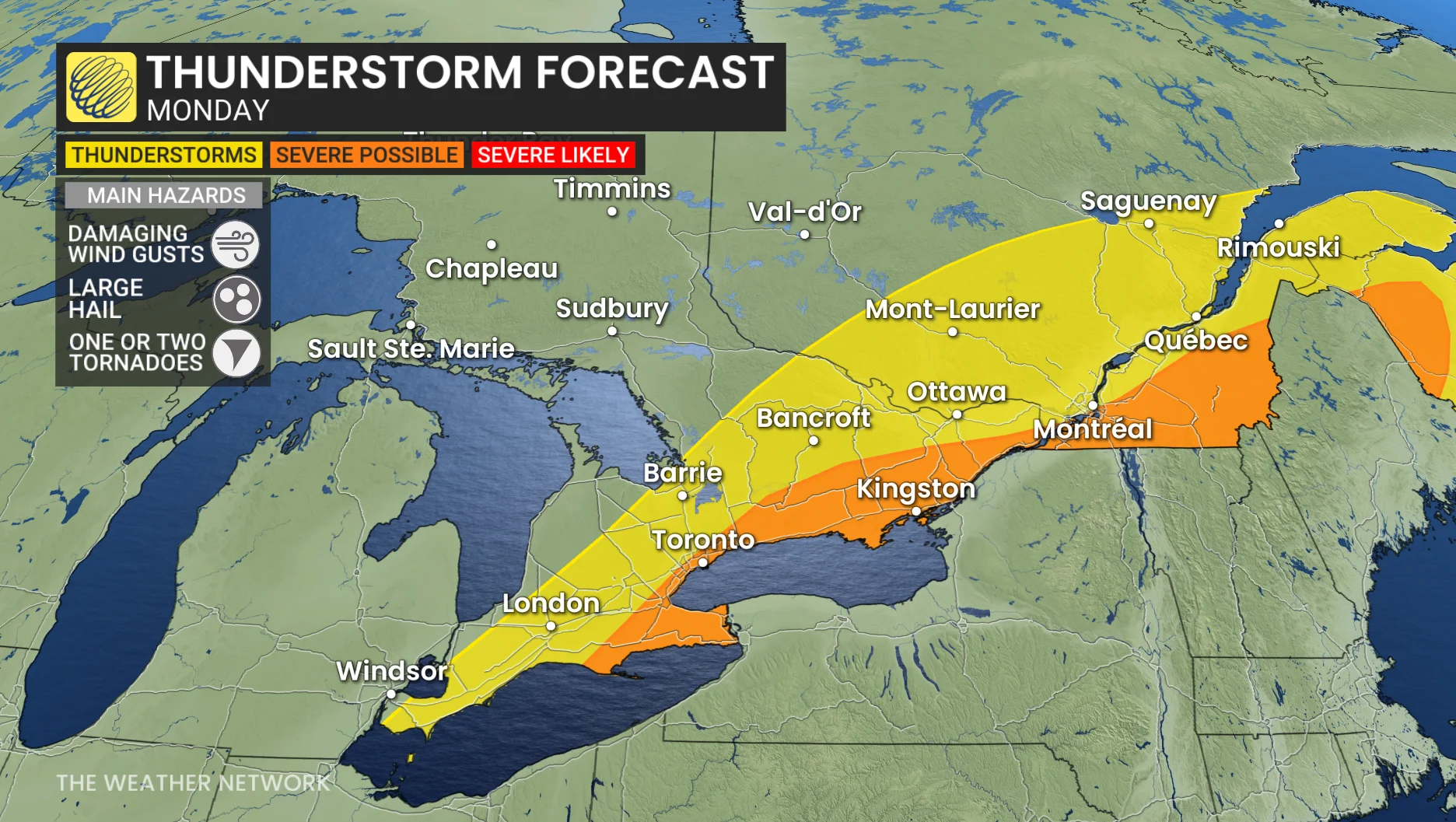
The greatest threat from the strongest storms here will be damaging wind gusts, large hail, and heavy rainfall.
Meanwhile, over in Quebec, the thunderstorm threat will peak in the early to mid-afternoon hours southeast of Montreal. These storms could produce damaging wind gusts, large hail, and heavy rainfall.
A bit of rotation in the atmosphere could allow one or two tornadoes to develop across southeastern Quebec on Monday afternoon. Stay alert for rapidly changing conditions and pay close attention to watches and warnings in your area.
There’s a bit of uncertainty with the timing and coverage of the storms in southern Quebec given the tight temperature gradient across the region.
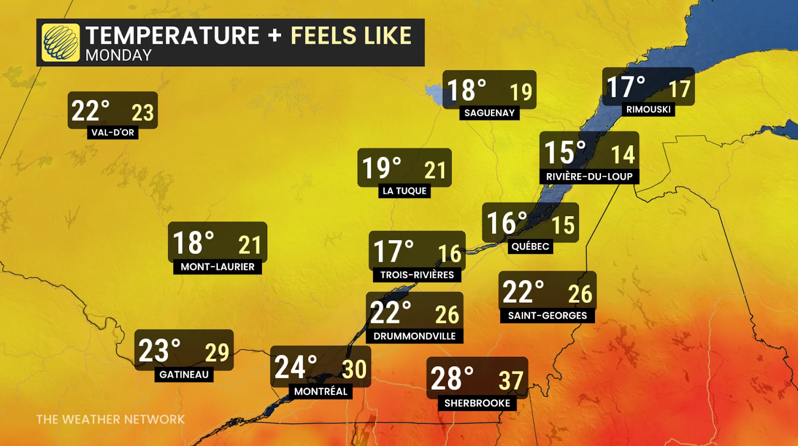
Check out that temperature swing across the province—Monday will see a feels-like of 15 in Quebec City at the same time we’ll have a feels-like of 37 down in Sherbrooke.
Stay with The Weather Network for all the latest on your forecast across the region.