Highly humid air mass fuels Ontario storm, flood potential on Monday
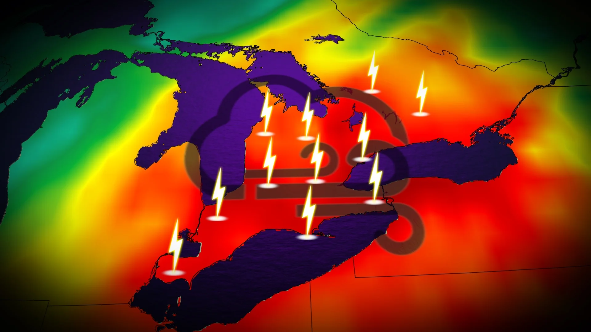
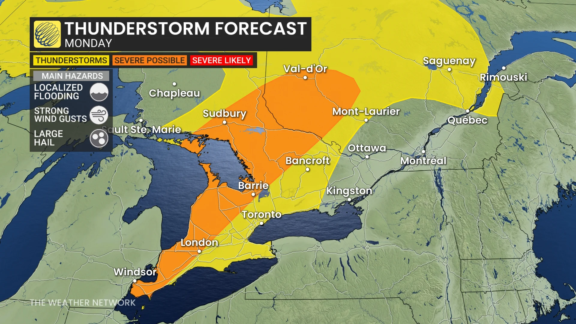
A muggy air mass and a cold front will team up to bring a widespread risk of thunderstorms to southern Ontario on Monday, elevating the threat of localized flooding with the soaking rains--along with a chance of strong winds and hail for some areas
Enjoy Sunday’s pleasant weather across southern Ontario while it lasts.
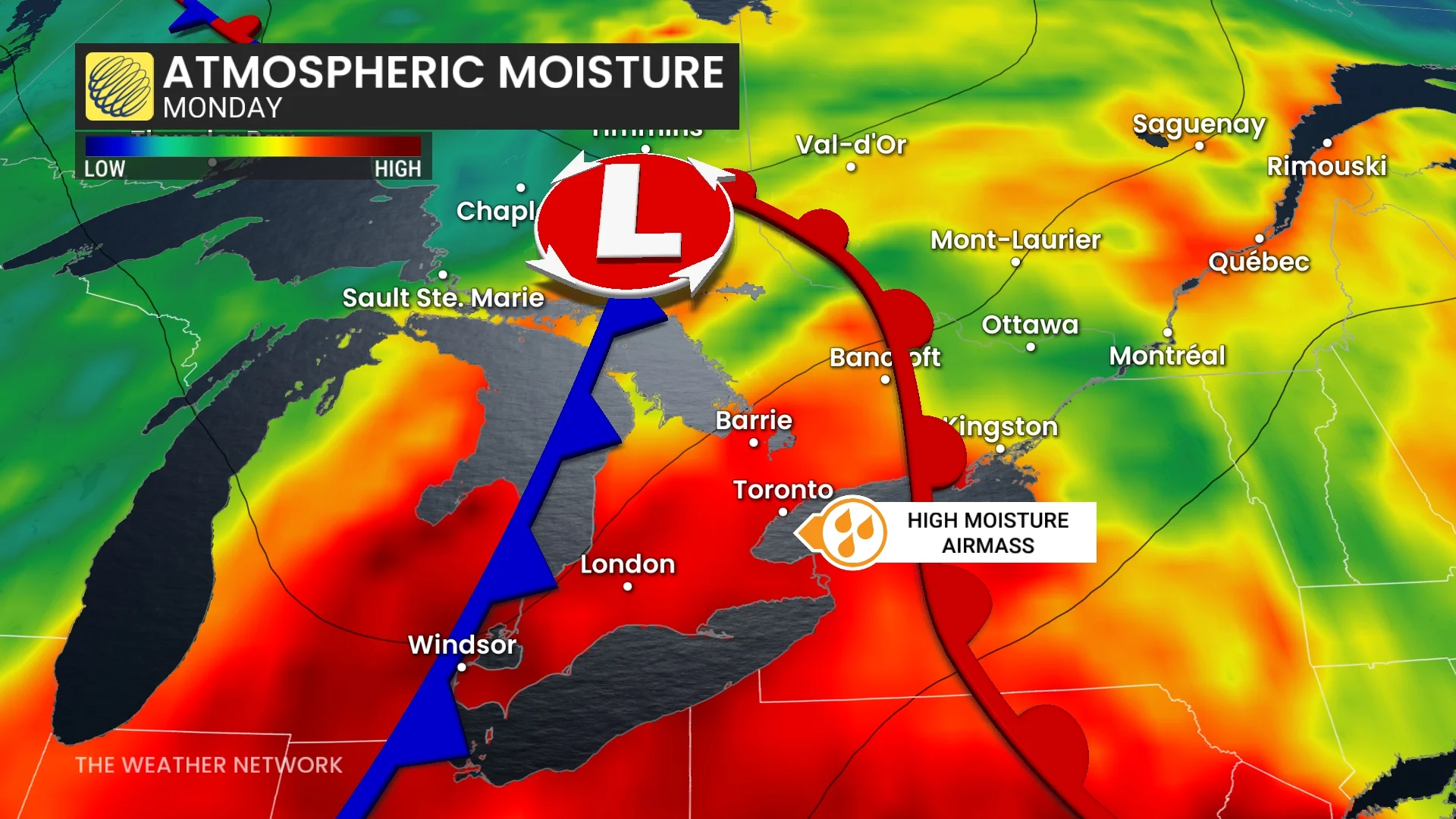
Monday will see a change take place as a warm front lifts across the region, dragging a humid air mass north of the border. That will not only bring back the hotter temperatures and muggy conditions, but also rain and a risk of severe thunderstorms, as well, ahead of a cold front.
DON’T MISS: What is a mesoscale convective system? How an 'MCS' can spell danger
With the ample amount of moisture in the atmosphere, thunderstorms that develop will have the potential to bring heavy downpours, increasing the threat of localized flooding. Thunderstorms in very humid air masses are notorious for overachieving in rainfall amounts. Other threats include strong, potentially damaging winds and up to nickel-sized hail.
Stay aware of the forecast for your area, and as always, have a way to receive severe weather watches and warnings the moment they’re issued.
Severe storm, localized flooding risk arrives on Monday
Elevated moisture, daytime heating, and an approaching cold front will spark and fuel a risk for thunderstorms across most of southern Ontario, stretching into northeastern sections of the province. This includes the Greater Toronto Area (GTA).
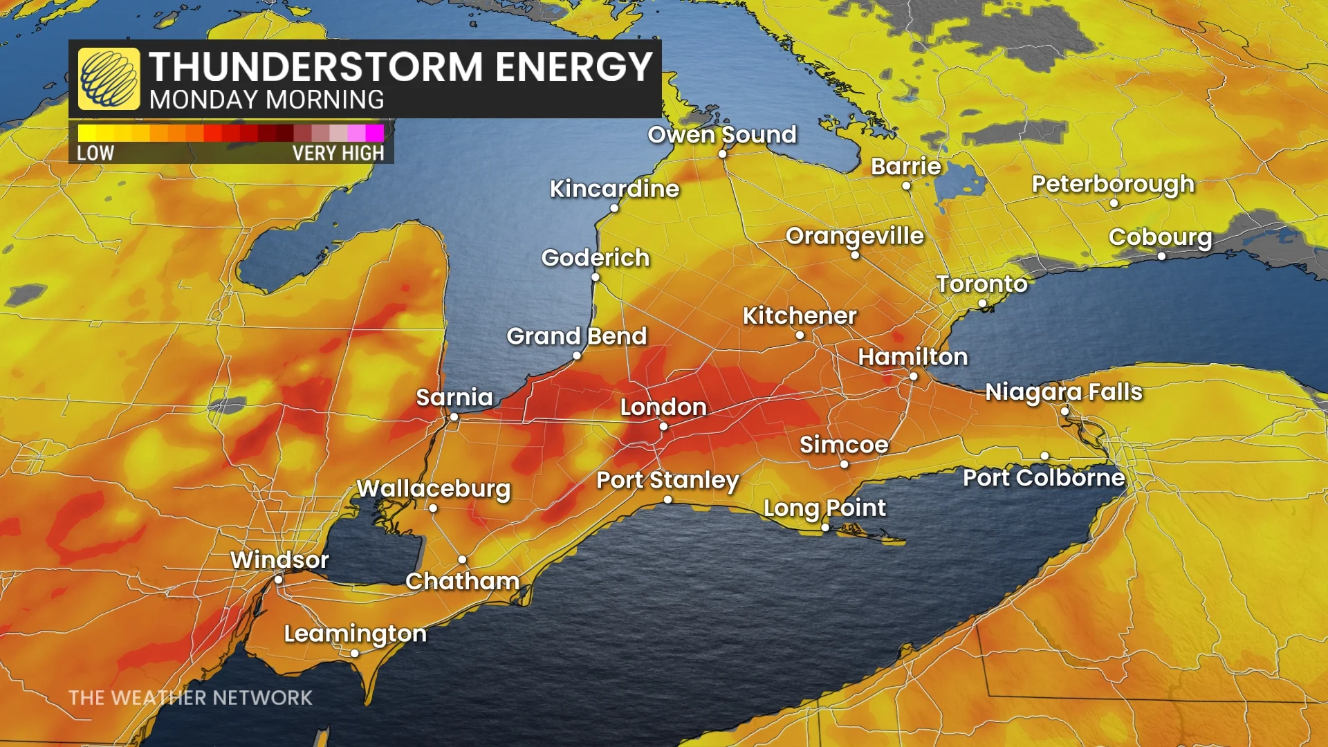
Dynamics are most favourable for severe thunderstorms from Windsor north through Sudbury, including London, Barrie, and Parry Sound.
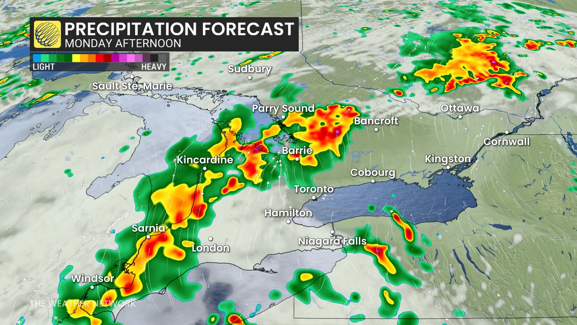
The warm front will cross southern Ontario on Monday afternoon, triggering a first round of thunderstorms from Georgian Bay into southwestern Ontario. As the cold front approaches Monday afternoon and evening, multi-cell clusters are expected to line up along the system, bringing very strong winds.
The GTA should escape the storms on Monday afternoon, but by late evening, expect storms to track in. As the cold front passes Monday night into early Tuesday, expect storms to rumble across the GTA, Niagara, cottage country, and into the Ottawa area by the pre-dawn hours on Tuesday.
Tuesday morning will see the storms moving out of the GTA, continuing east into cottage country. Early celebrations on Tuesday in the National Capital Region will be met with showers and thunderstorms.
There will be up to twice the normal amount of atmospheric moisture available for storms to tap into.That brings an increased risk of localized flooding in heavy rainfall that occurs in the heavier thunderstorms. Other possible hazards include strong, potentially damaging winds and up to nickel-sized hail.
The timing of the storms remains uncertain as they depend on the arrival of the cold front. The most likely window for thunderstorms on Monday will stretch after 2 p.m. until 10 p.m. However, an earlier window exists through southwestern Ontario and cottage country, and later for the GTA.
Severe weather safety
Lots of folks have plans to spend time outdoors during the long Canada Day weekend. Severe weather safety is paramount when you’re outdoors enjoying the summer weather.
Remember: if you hear thunder, you’re close enough to be struck by lightning.
Have a way to receive severe weather warnings the moment they’re issued. Stay close to safe shelter in case a thunderstorm approaches your location. Strong wind gusts can knock down trees and power lines. Large hail can cause serious injury.
Never try to drive across a flooded roadway. It’s impossible to tell how deep the water is until it’s too late. It only takes a small amount of water to cause a vehicle to lose grip with the roadway and become stranded. Just 15-30 cm of moving water can carry a vehicle away.