How southern Ontario was spared from active weather this Thanksgiving
While much of eastern North America is dealing with significant, stormy conditions and rainfall, southern Ontario found a way to land in a rare, atmospheric gap.
While models last weekend highlighted the potential for a system south of the Great Lakes, there was some uncertainty about just how far north the low would drift north.
Well, as it turns out, it didn't go as far north as one scenario predicted, allowing for southern Ontario to avoid a Thanksgiving disruption this year.
DON’T MISS: An abrupt transition to winter? Check out Canada’s winter sneak peek!
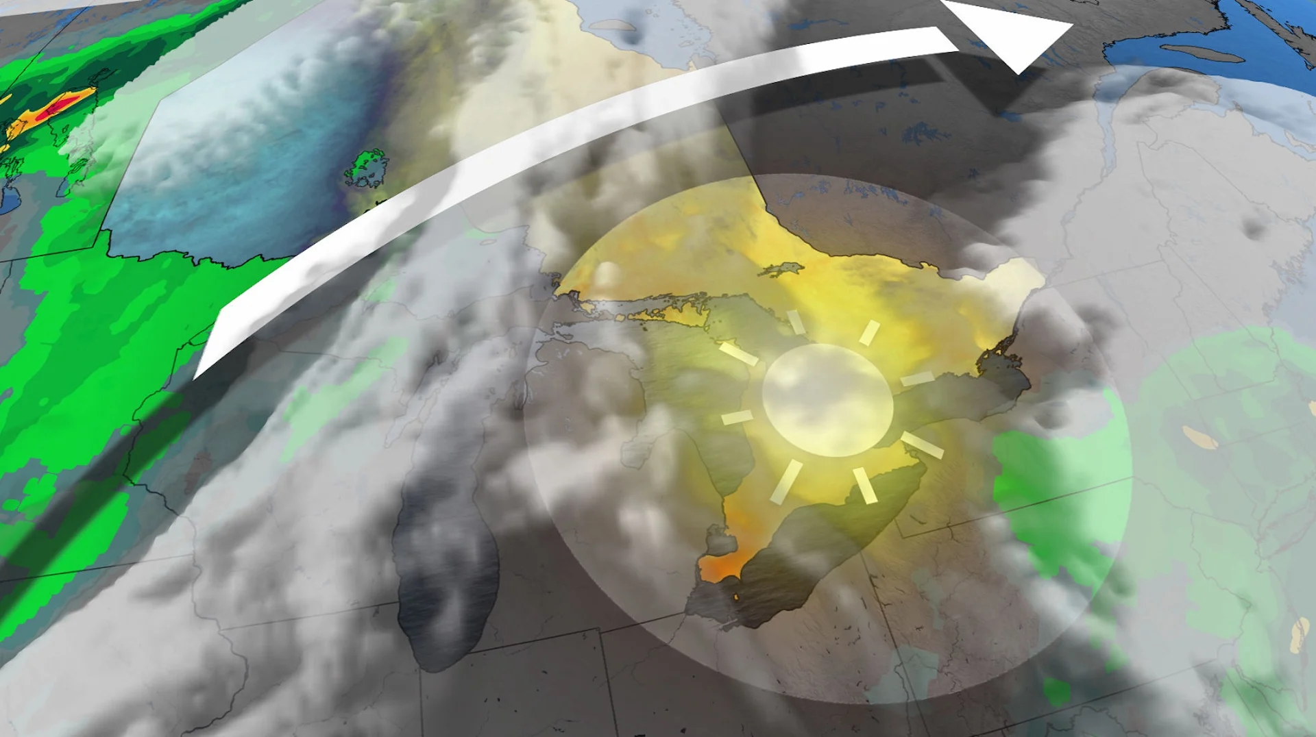
Southern Ontario is caught between two storm tracks, forcing the jet stream to arc across northern Quebec.

If either one of those systems pushed just a bit farther north or if an Atlantic Canada high-pressure ridge was weaker than predicted, a Thanksgiving Monday washout would have been possible for southern Ontario.
What happened to Ontario's weather?
The region is flanked by two regions of seriously adverse weather.
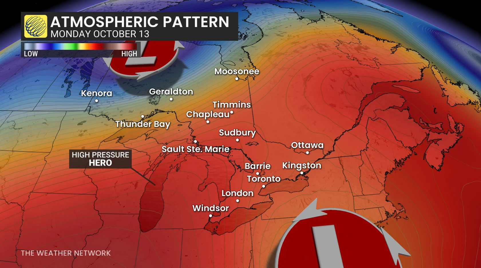
One is bringing heavy snowfall across northern Manitoba, while the other coastal low is pestering the U.S. northeast with heavy rains and gusty winds.
RELATED: How Rex blocks can affect Canada’s weather

The high-pressure system over Atlantic Canada deserves an honourable mention, maintaining its position over the area over the next couple of days, keeping the southern low trapped farther south.
Had either system nudged a bit farther, or the high pressure in Atlantic Canada had been weaker, a holiday Thanksgiving Monday washout could have been on the table.
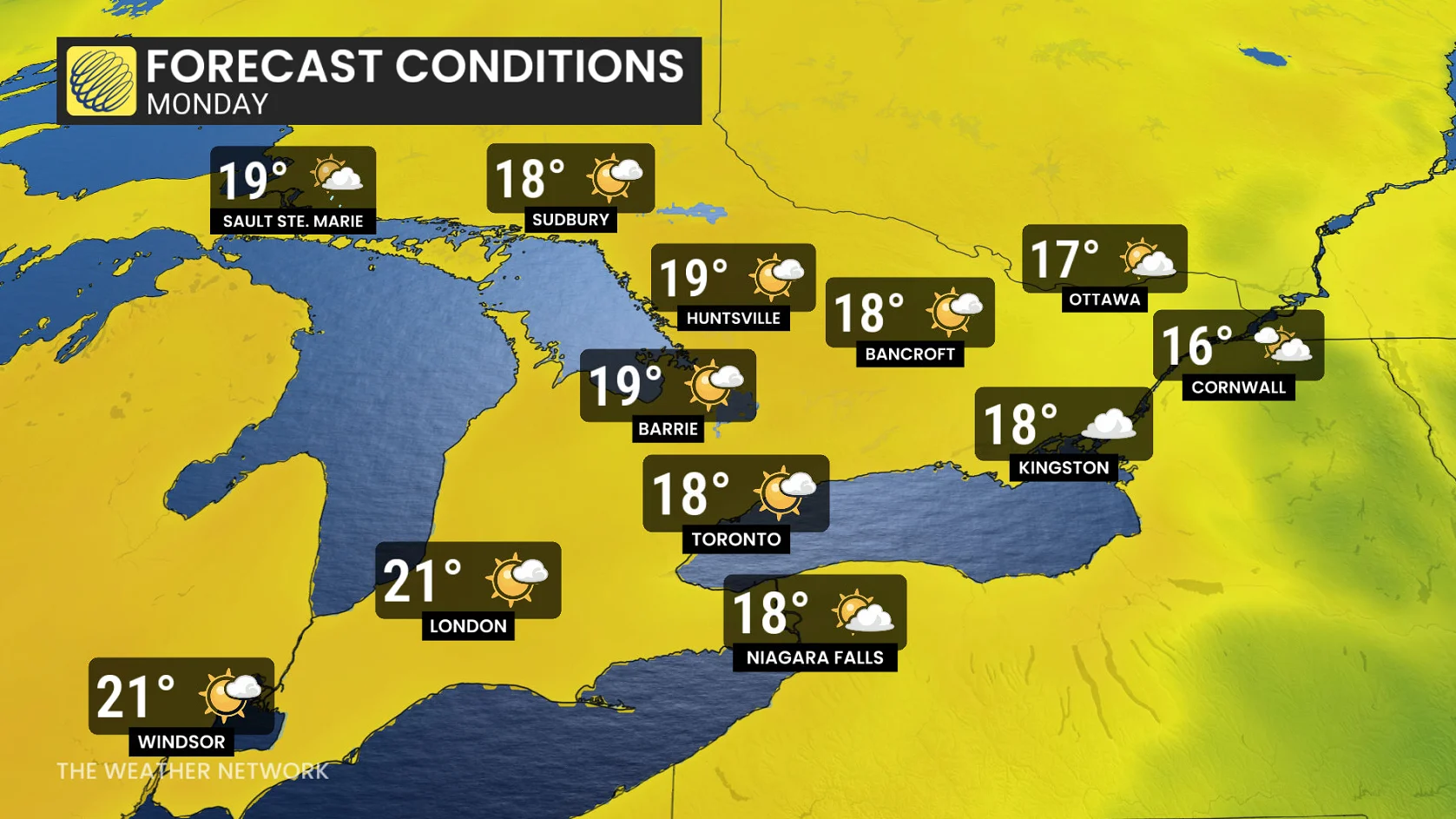
Temperatures are seasonably warm on Monday, perfect for time outdoors or some holiday travel.
This meteorological near-miss is a gift, making this the best weather story that never happened!
The love from high pressure will likely extend through the bulk of the week for southern Ontario, meaning rainfall will be running 10-20 mm below normal for mid-October.
Be sure to check back for the latest weather updates across Ontario.