
Humberto and Imelda creating hazardous conditions to Atlantic locales
Imelda is expected to bring hurricane conditions to Bermuda by Wednesday evening as Hurricane Humberto's track lets the storm bring dangerous surf and rip currents to the western Atlantic coastline through this week
With Hurricane Humberto and Hurricane Imelda in full swing, interests in the Atlantic basin are bracing for a variety of potent impacts, from dangerous surf and rip currents to flooding rains and blustery wind gusts, depending on where you are.
However, Bermuda looks to take the brunt of the effects as it will see impacts from both hurricanes through Wednesday night.
DON'T MISS: The incredible history and tools of the Hurricane Hunters
Humberto is causing dangerous surf and life-threatening rip current conditions to beaches in the northern Caribbean, Bahamas, Bermuda, and much of the U.S. East Coast. It is also impacting Bermuda with gusty winds with its outer rain bands. Meanwhile, Imelda eyeing Bermuda with hurricane conditions by Wednesday evening.
Humberto weakens to a Category 1 hurricane
Humberto continued to lose its strength Tuesday as it entered an area of high wind shear, and has now weakened to Category 1 strength. As of Tuesday evening, its maximum, sustained winds are near 130 km/h with higher gusts.
Continued weakening is forecast and Humberto is expected to become a strong, extratropical system on Wednesday.
Forecasters with the U.S. National Hurricane Center (NHC) expect the storm to recurve out to sea through this week, steered along by a strong ridge of high pressure parked over the central Atlantic.
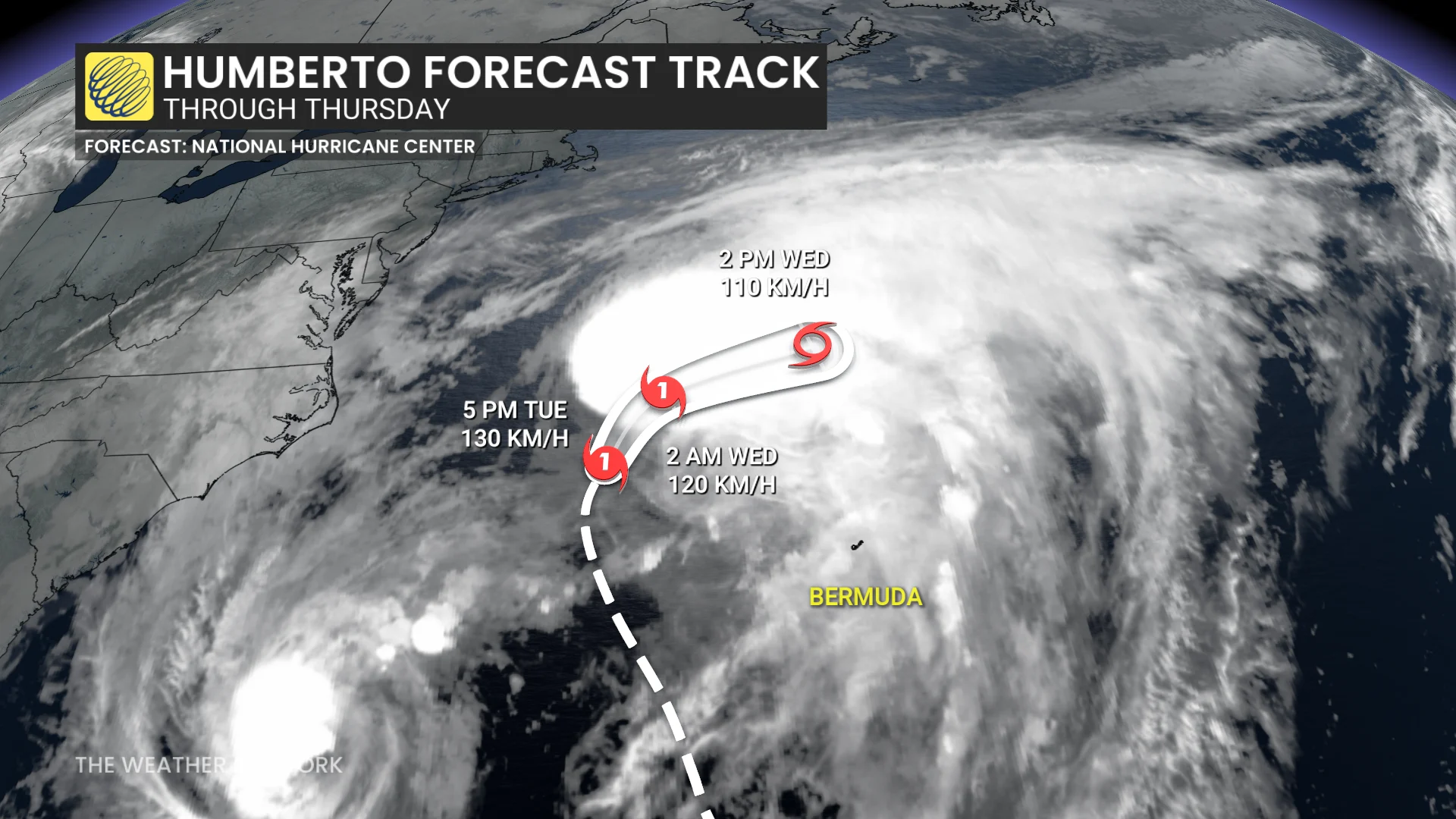
On the forecast track, the centre of Humberto will pass west of, and then north of Bermuda through Wednesday.
Dangerous rip currents are expected across the northern Caribbean, Bahamas, Bermuda and the U.S. East Coast this week as Humberto continues to churn through the region.
WATCH:How the Fujiwhara effect can send hurricanes spinning off course
Imelda intensifies again on Tuesday
Imelda’s structure has been improving, with more symmetric banding around the centre, despite fighting against dry air. The system officially reaching hurricane status early Tuesday.
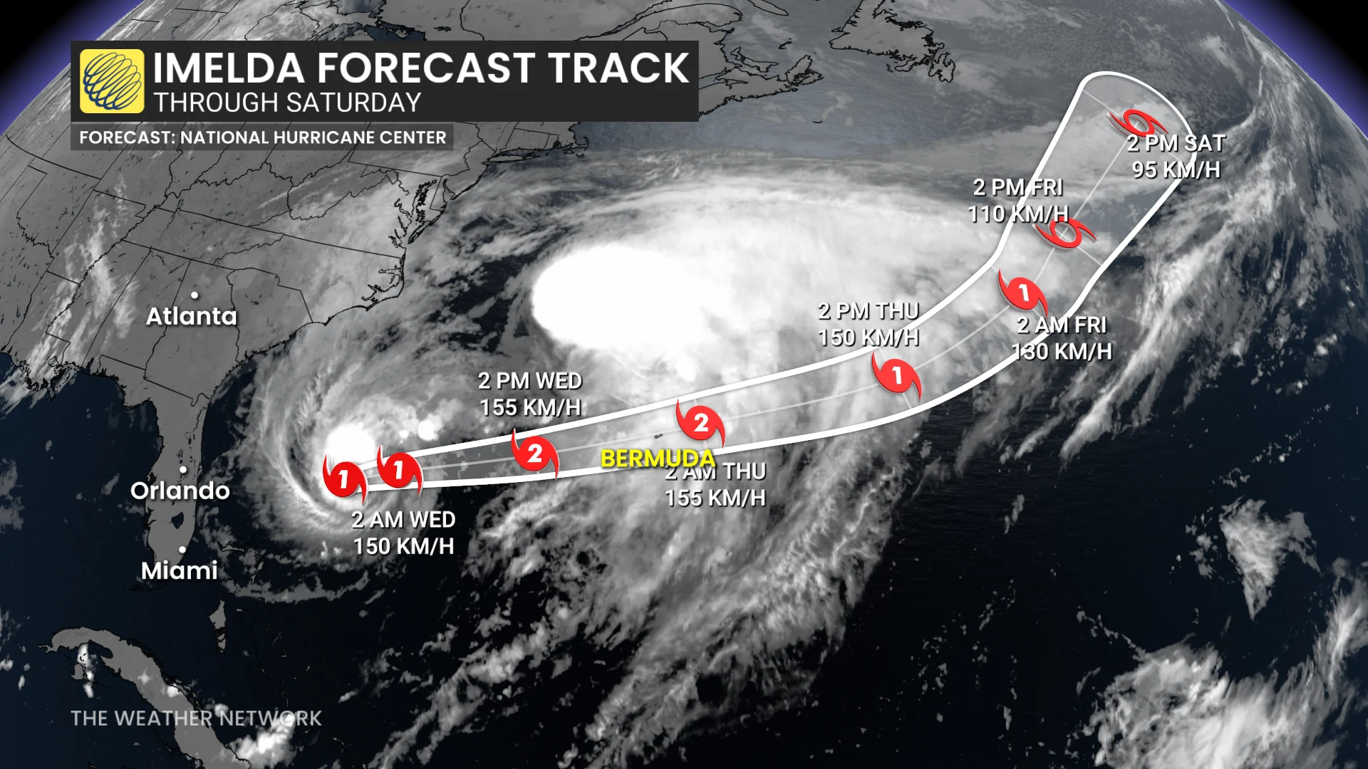
As of Tuesday evening, Imelda's maximum, sustained winds are near 140 km/h with higher gusts. Some additional strengthening is forecast during the next day or so. Imelda is then expected to become an extratropical low in a couple of days.
The storm has turned away from the Bahamas and is now accelerating toward Bermuda. A hurricane warning has been issued in Bermuda ahead of the expected impacts from Imelda.
An east-northeast to northeast motion at a faster forward speed is expected over the next couple of days. On the forecast track, the centre of the hurricane will be near Bermuda Wednesday afternoon or evening.

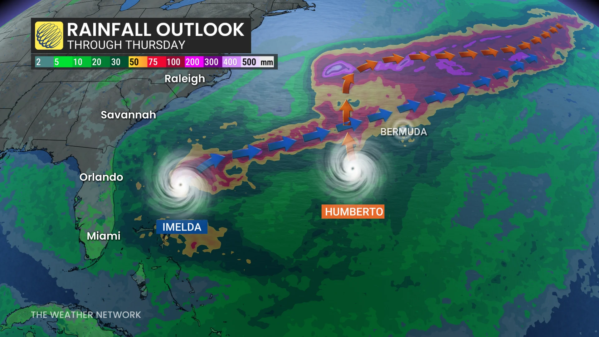
As Imelda passes near Bermuda, 50 mm to 100 mm of rainfall is expected from Wednesday into Thursday, the NHC says, potentially leading to flash flooding.
In Bermuda, a dangerous storm surge is expected to produce coastal flooding in areas of onshore winds. The surge will be accompanied by large and damaging waves.
Interests on the island should pay close attention to forecast updates in the days ahead.
RELATED: Hurricane terms everyone should know as the season heats up
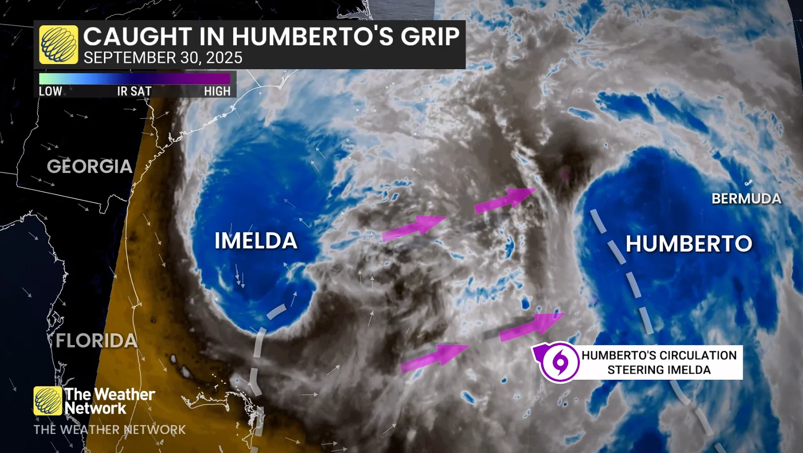
The system’s slow development and sluggish, forward movement, will likely prove beneficial for the southeastern U.S. coast. Hurricane Humberto will cause a weakness in that ridge of high pressure over the Atlantic, providing Imelda an off-ramp of sorts to make a hard turn toward the northeast.
This sharp deviation will significantly reduce the amount of wind and rain expected along the U.S. coast. Folks will still see locally heavy rainfall, however, with minor flash flooding and coastal flooding. Dangerous swells and rip currents will also stick around for the next few days.