Hurricane Erin: Watching for dangerous surf in Nova Scotia and Newfoundland
Erin is forecast to remain well offshore of Nova Scotia and Newfoundland on Friday and Saturday. The primary impacts are expected to include dangerous surf and rip currents along Atlantic coastlines in both provinces.
As of Thursday morning, Hurricane Erin began shifting away from the United States. The large and powerful storm continues to churn the Atlantic Ocean, however, maintaining hazardous conditions along more than 1,500 km of the East Coast.
Officials warn than coastal areas should remain vigilant for strong waves and dangerous rip currents.
DON’T MISS: An inside look at Hurricane Erin’s astounding rise to Category 5
Erin has already caused significant disruptions for coastal communities, particularly in North Carolina's Outer Banks. The storm has generated life-threatening rip currents and rough surf for several days, and is expected to continue pushing high waves and elevated water levels onto coastlines through at least Friday.
Erin's centre is forecast to move through the western Atlantic, staying between the U.S. East Coast and Bermuda through early Friday before passing south of Atlantic Canada on Friday and Saturday.
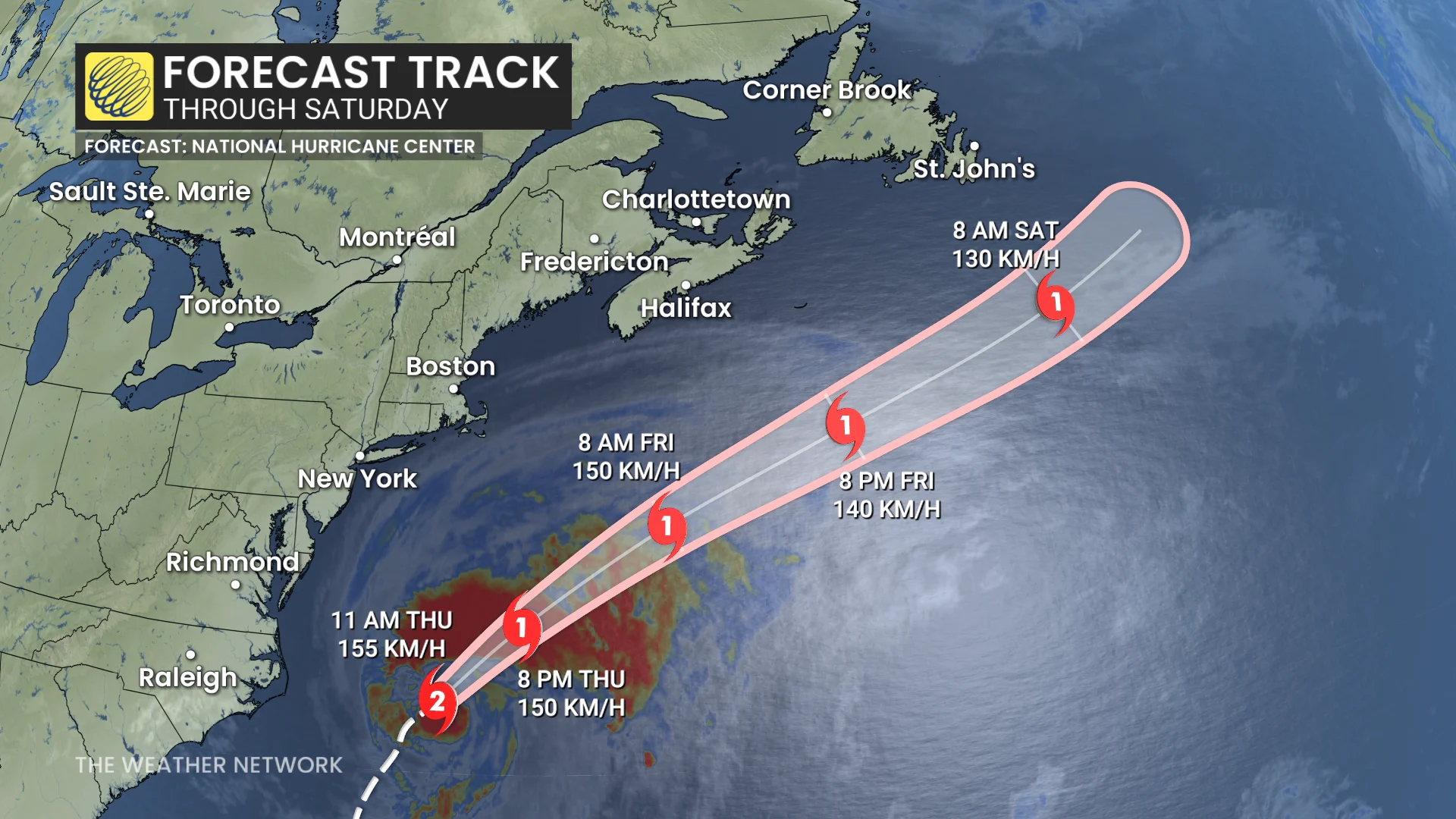
Gradual weakening is projected over the next couple of days, with Erin expected to transition into a post-tropical system by Saturday.
Dangerous surf and powerful winds in parts of Atlantic Canada this weekend
Erin is forecast to remain well offshore of Nova Scotia and Newfoundland on Friday and Saturday. The primary impacts will be dangerous surf along Atlantic coastlines in both provinces.
Coastal areas in southwestern Nova Scotia could also see some gusty winds during this period.
STAY SAFE: Rip currents are a natural hazard along coasts – here’s how to spot them
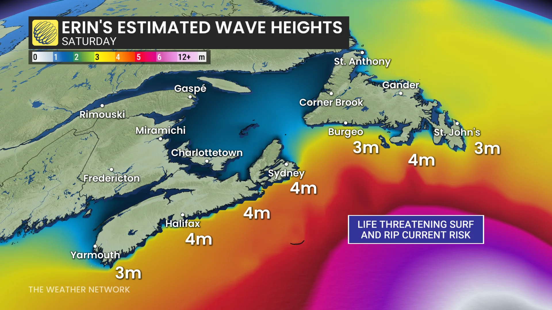
"Gale to storm force winds are in effect for most waters adjacent to and south of Nova Scotia, while Hurricane force wind warnings are in effect for southern slope waters," said the Canadian Hurricane Centre (CHC) in its Thursday morning update. "Gale to storm force winds are expected for southern Newfoundland marine waters Saturday."

According to the CHC, seas in the southern offshore waters could reach heights of 8 to 10 metres. Along the coasts of Nova Scotia and Newfoundland, breaking waves are expected to range from 3 to 5 metres. Coastal areas should remain alert for hazardous conditions.
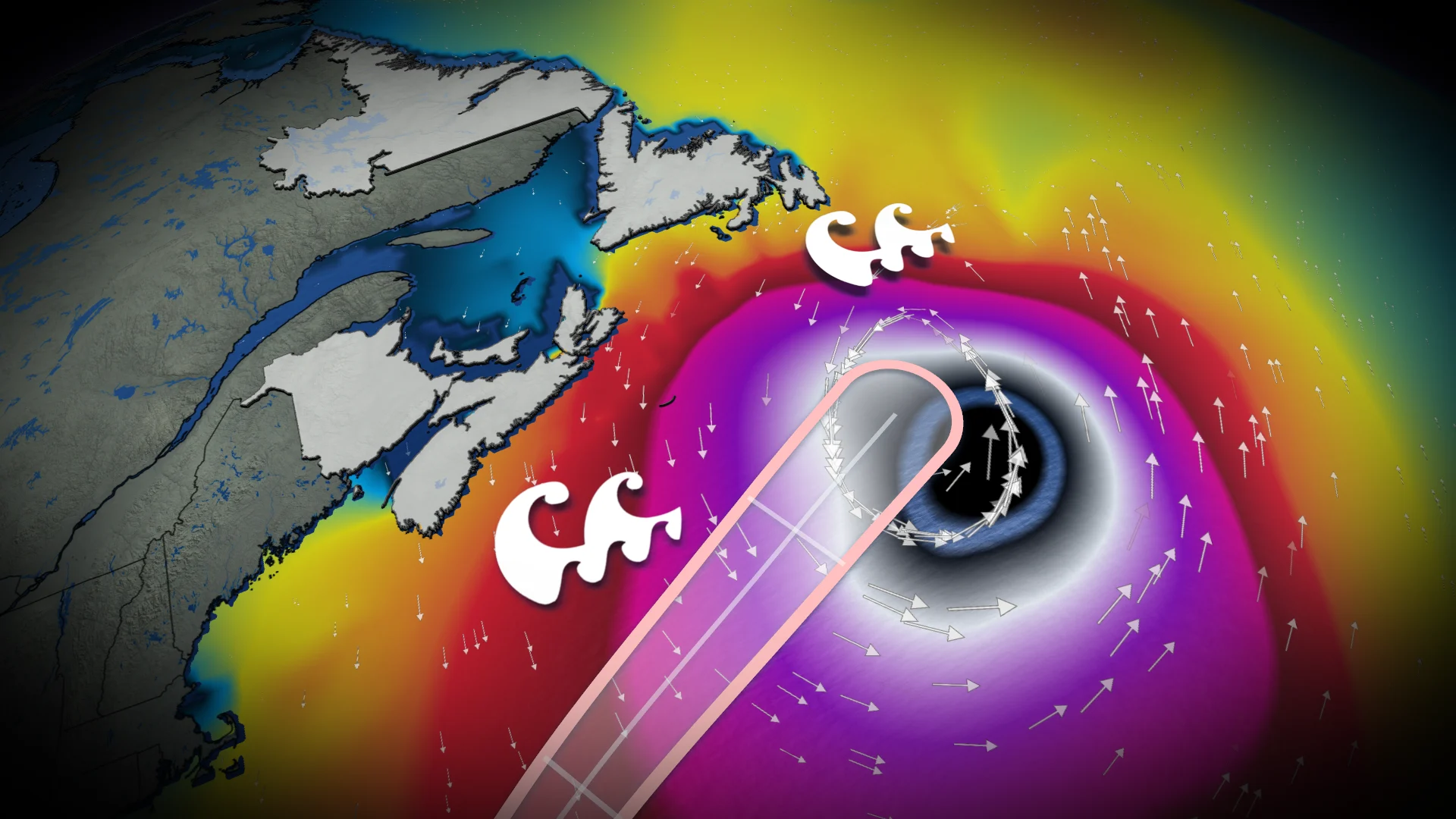
Erin's wave field could span 5,000 km
Erin is a large system, with hurricane-force winds reaching up to 165 km from its centre. Tropical storm-force winds extend even farther, up to 520 km outward.
The extensive wave field of the storm is projected to span over 5,000 km, reaching from Bermuda and east of Atlantic Canada to Europe in the coming week.