Hurricane Erin will slide past Atlantic Canada with large waves, powerful winds
Erin is expected to stay well offshore of Nova Scotia and Newfoundland on Friday and Saturday. The main impacts will likely involve hazardous surf and rip currents along the Atlantic coastlines of both provinces.
Hurricane Erin is forecast to brush past Atlantic Canada, with its impacts limited to high waves, strong winds, and overcast skies near the coast this weekend. The storm’s centre will pass south of the region on Friday before accelerating across the North Atlantic.
DON'T MISS: Hurricane Erin is huge, how does it compare to previous storms?
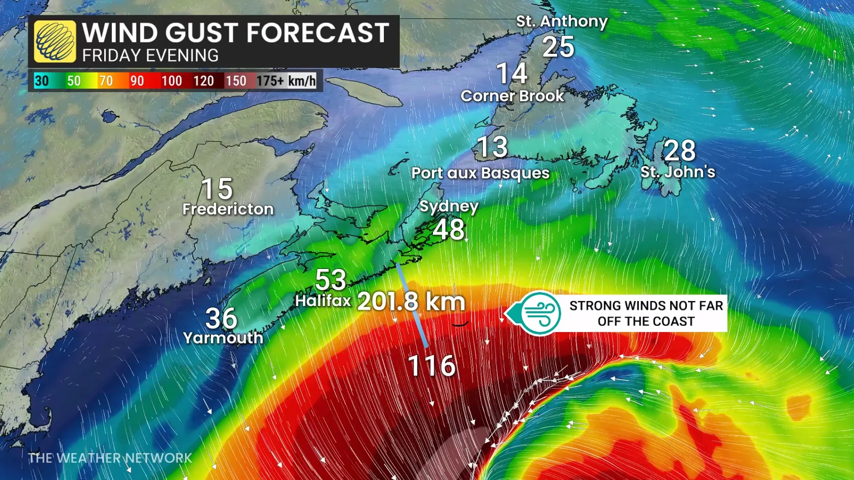
By Friday night, Erin is expected to transition into a post-tropical system while maintaining hurricane-force strength through the weekend. On its current track, the storm’s most significant effects will remain over 200 km offshore, where wind gusts exceeding 100 km/h and rainfall near 200 mm are occurring.
If Erin's track had shifted just a few hundred kilometres west, its impacts on Atlantic Canada could have been much more severe.
Beware of dangerous surf
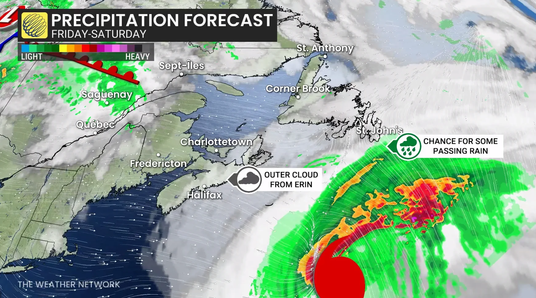
Hazardous surf and rip currents are expected to affect Atlantic coastal areas of Nova Scotia, Newfoundland, and Prince Edward Island. Wave heights of 3 to 5 metres are forecast along the Nova Scotia coast and the southern Avalon Peninsula in Newfoundland.
Cloud cover and gusty winds across much of the Maritimes will be the primary indicators of Erin's presence as it remains offshore in the Atlantic Ocean.

"The highest water levels along the Atlantic coast of Nova Scotia are expected to occur with the high tide this evening," said the Canadian Hurricane Centre (CHC) in its Friday morning update.
According to the CHC, no wind impacts are expected, but gusts up to 70 km/h are possible along exposed areas of the southwestern coast of Nova Scotia and the southeastern Avalon Peninsula of Newfoundland on Saturday.
WATCH: Atlantic Canada's coastal impacts from Hurricane Erin
Erin's wave field could span 5,000 km
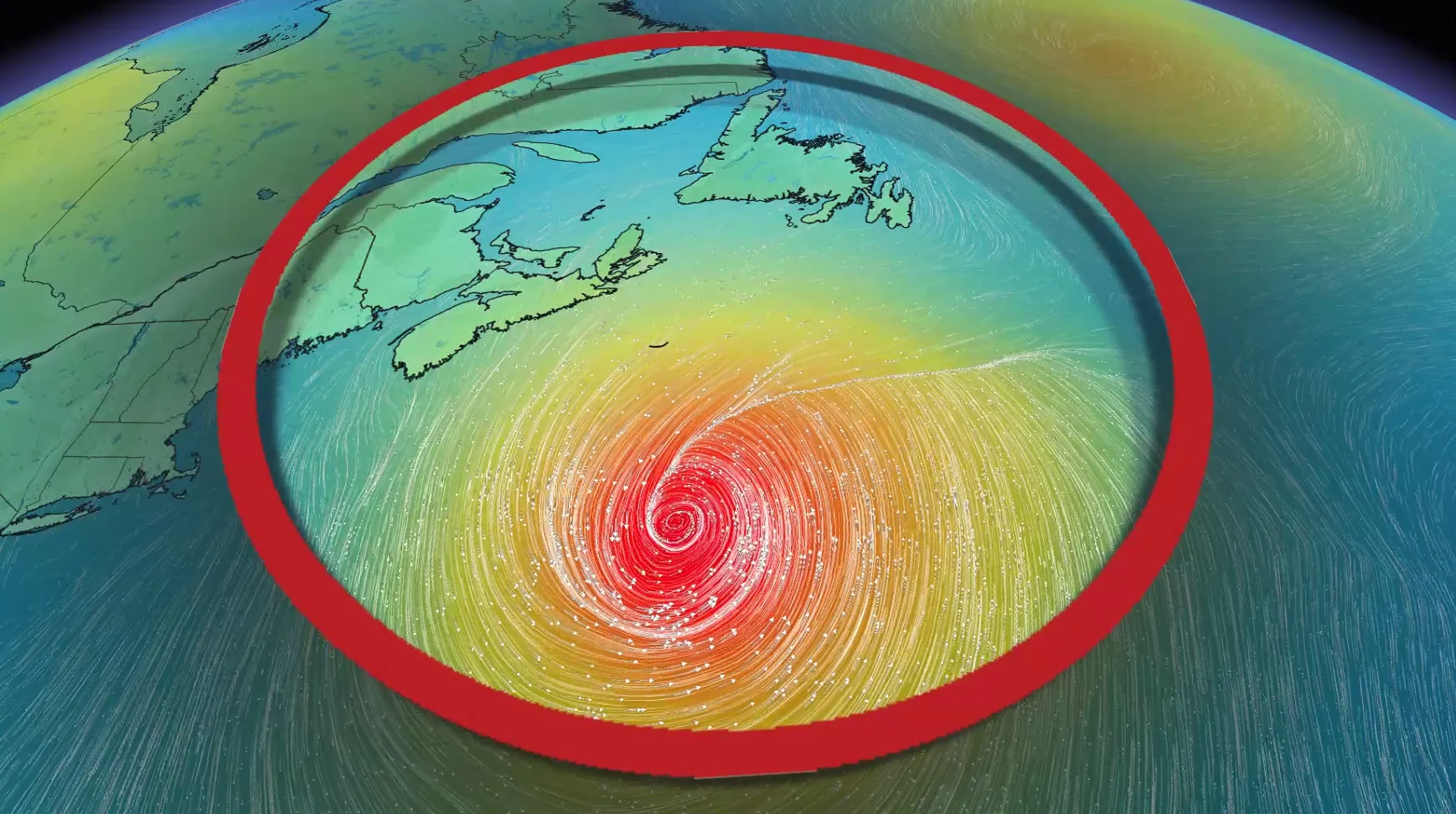
Erin remains a very large hurricane, with hurricane-force winds reaching up to 205 km from its centre. Tropical storm-force winds extend even farther, up to 595 km km outward.
The extensive wave field of the storm is projected to span over 5,000 km, reaching from Bermuda and east of Atlantic Canada to Europe in the coming week.
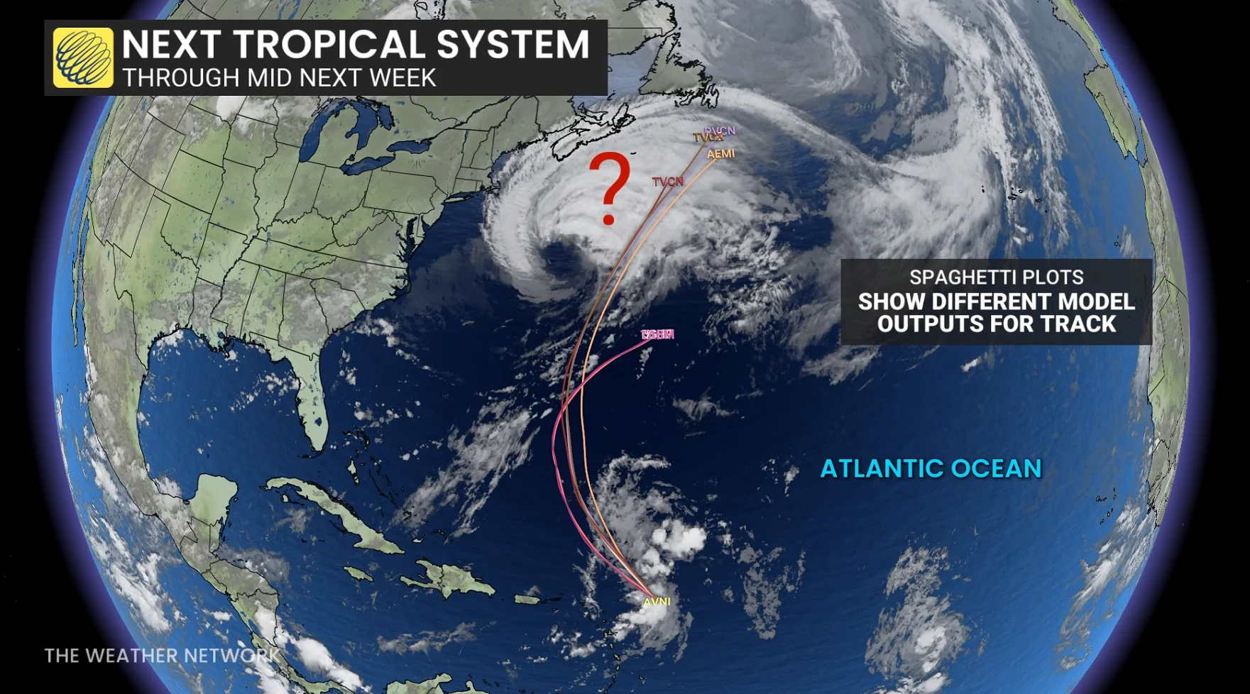
Another tropical system to keep our eyes on
Warm tropical waters continue to support the formation of tropical cyclones, with another system forecast to follow a track similar to Erin.
STAY SAFE: Rip currents are a natural hazard along coasts – here’s how to spot them
This will require close monitoring into mid-next week for Atlantic coastal communities.