Icy, snowy mess continues for Ottawa and Montreal into Sunday
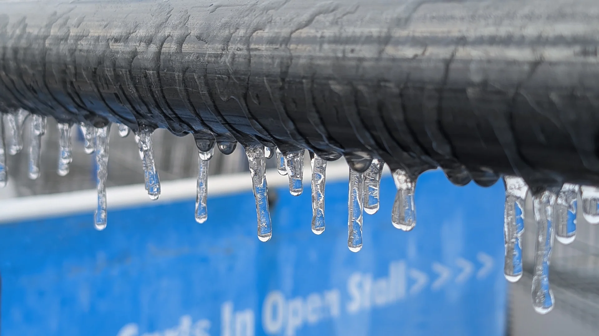
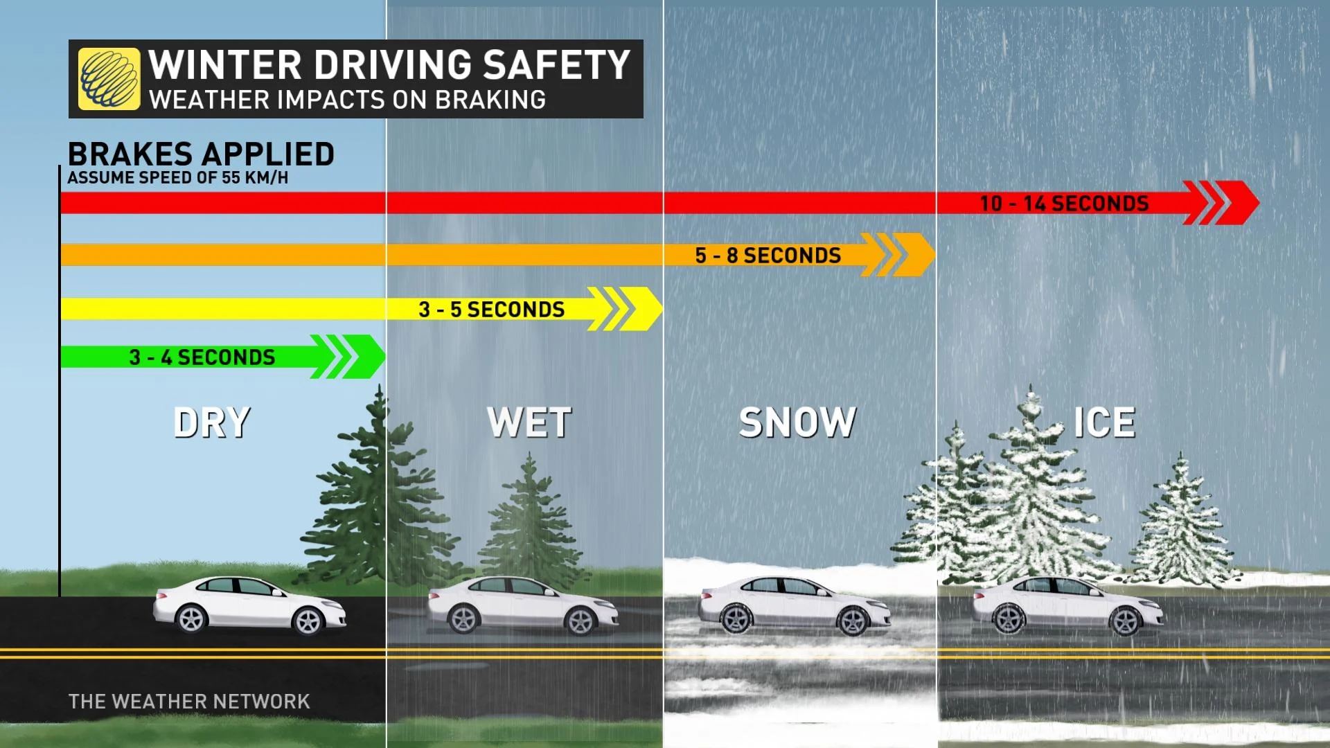
Beware icy roads, steps, and sidewalks where extended periods of freezing rain have occurred
A messy storm spreading through eastern Ontario and southern Quebec will continue producing headaches for folks in Ottawa and Montreal as rain, ice, and snow hit the region.
Widespread freezing rain warnings remain in place as the storm persists into Saturday night.
Conditions may vary considerably over short distances as slight temperature variations will determine what type of precipitation falls in each community.
Anticipate some travel delays or impacts on Saturday night through Sunday as the bout of the wintry weather occurs, especially in areas seeing freezing rain and/or snow. Scattered power outages and dicey travel are possible where freezing rain occurs.
SEE ALSO: La Niña continues, but these factors may matter more this winter
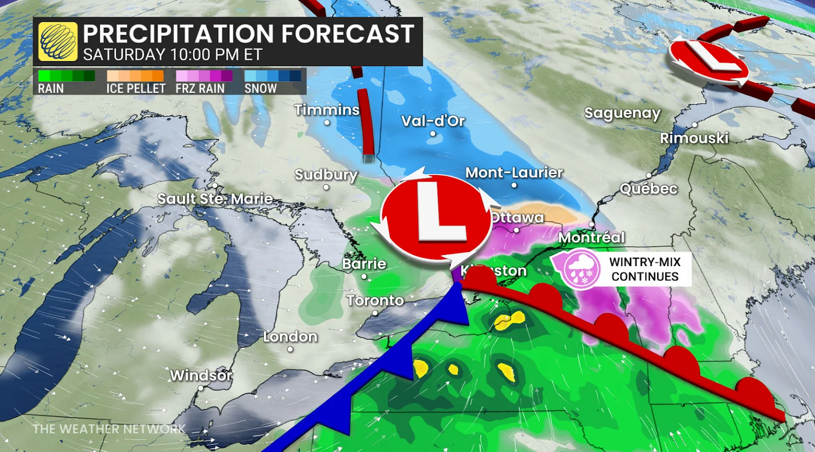
Freezing rain, snow continue into Saturday night
Our storm pushed into eastern Ontario and southern Quebec during the day Saturday and spread a wintry mix across the region.
An extended period of freezing rain in the Ottawa Valley is expected to continue into the evening hours before tapering off through the overnight.
Some areas may see up to 10 mm of ice accretion, which could cause sporadic tree damage and power outages. Use caution as icy roads, steps, and sidewalks are expected.
A freezing rain warning extends into Metro Montreal, where 5-10 cm of snowfall is expected with bouts of freezing rain throwing a touch of ice accretion into the mix.
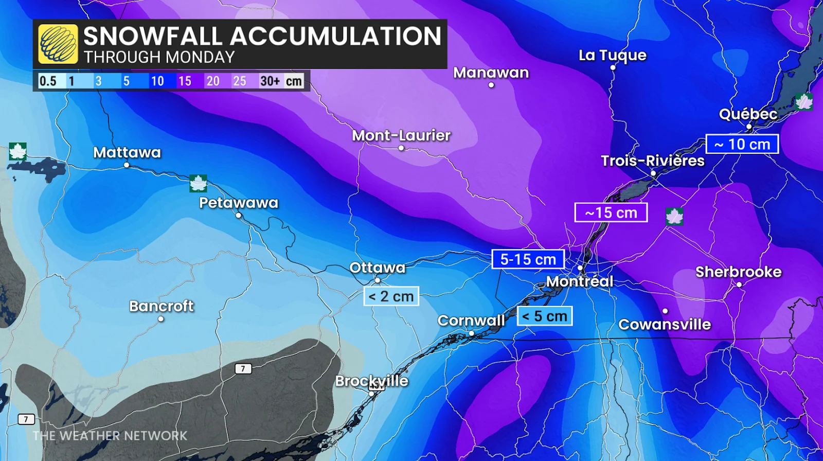
Temperatures throughout the atmosphere are more uniformly cold just to the north, allowing up to 15 cm of snowfall toward Trois-Rivières and even higher totals into Mont-Laurier and Val-D’or.
Looking ahead
A couple of significant systems are expected to approach the region later next week and weekend. The storm track is uncertain and that will be critical to whether we can get a stretch of mild weather versus changeable temperatures, with a risk for messy impacts. At this point, a milder and wetter scenario is favoured, especially for southern and western parts of the region.
However, a very wintry pattern is expected to dominate during December with colder-than-normal temperatures. An active pattern is expected to accompany that transition during the final week of November.
Stay tuned to The Weather Network for the latest forecast updates for Ontario and Quebec.