
Tornado warning issued in Ontario amid severe storms
Stay alert for a potent line of strong to severe thunderstorms on Friday expected to sweep across southern Ontario
8:00 p.m. EDT - Severe thunderstorms prompted a tornado warning in southern Ontario on Friday evening.
Environment and Climate Change Canada issued a tornado warning for the following areas in southern Ontario:
Hanover - Dundalk - Southern Grey County
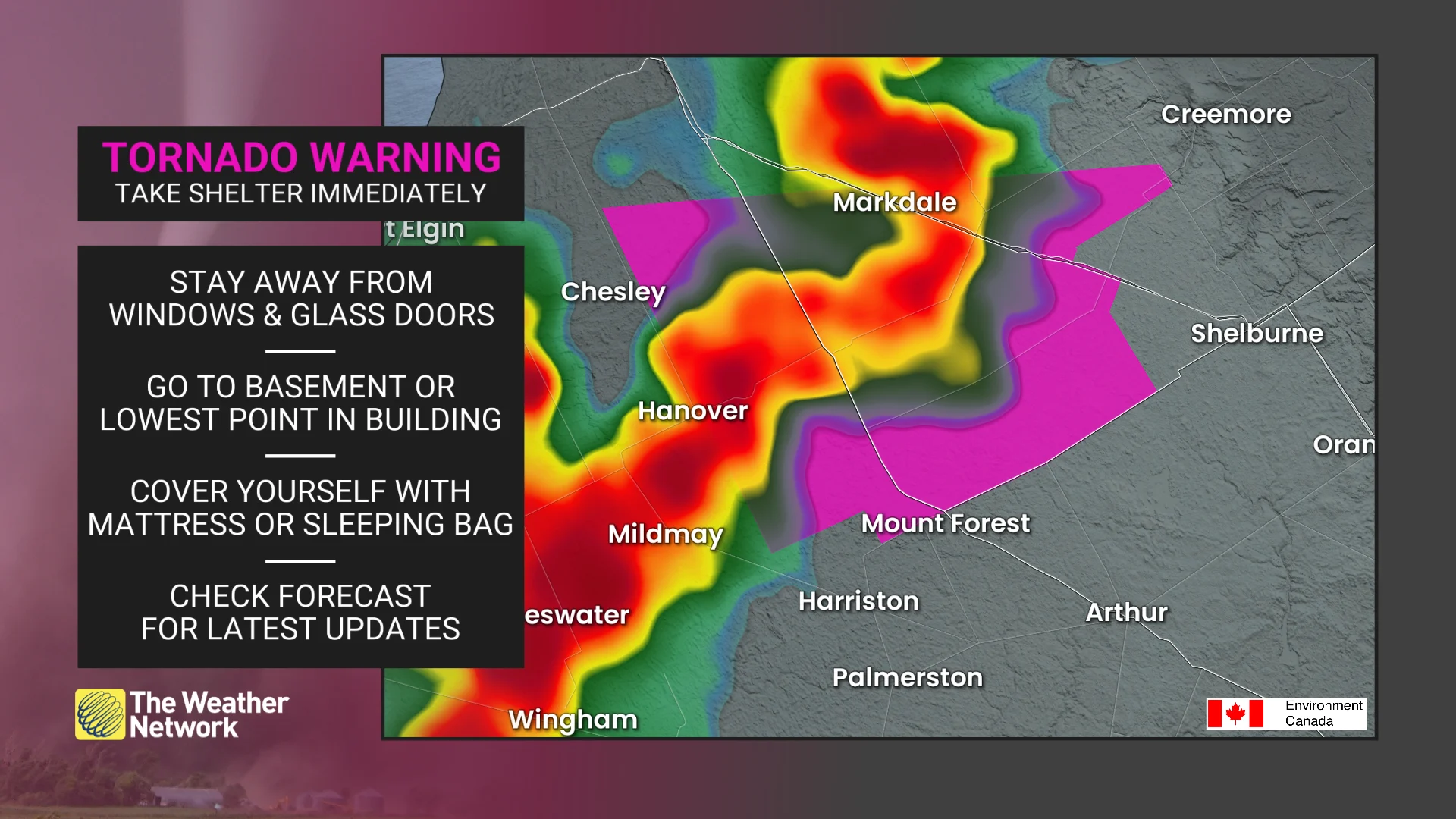
"This is a dangerous and potentially life-threatening situation. Take cover immediately, if threatening weather approaches," ECCC said in its warning.
The agency added: "Go indoors to a room on the lowest floor, away from outside walls and windows, such as a basement, bathroom, stairwell or interior closet. Leave mobile homes, vehicles, tents, trailers and other temporary or free-standing shelter, and move to a strong building if you can. As a last resort, lie in a low spot and protect your head from flying debris.”
CURRENT TORNADO WARNINGS (ONTARIO):
Hanover - Dundalk - Southern Grey County
The original article with the full forecast for Ontario continues below.
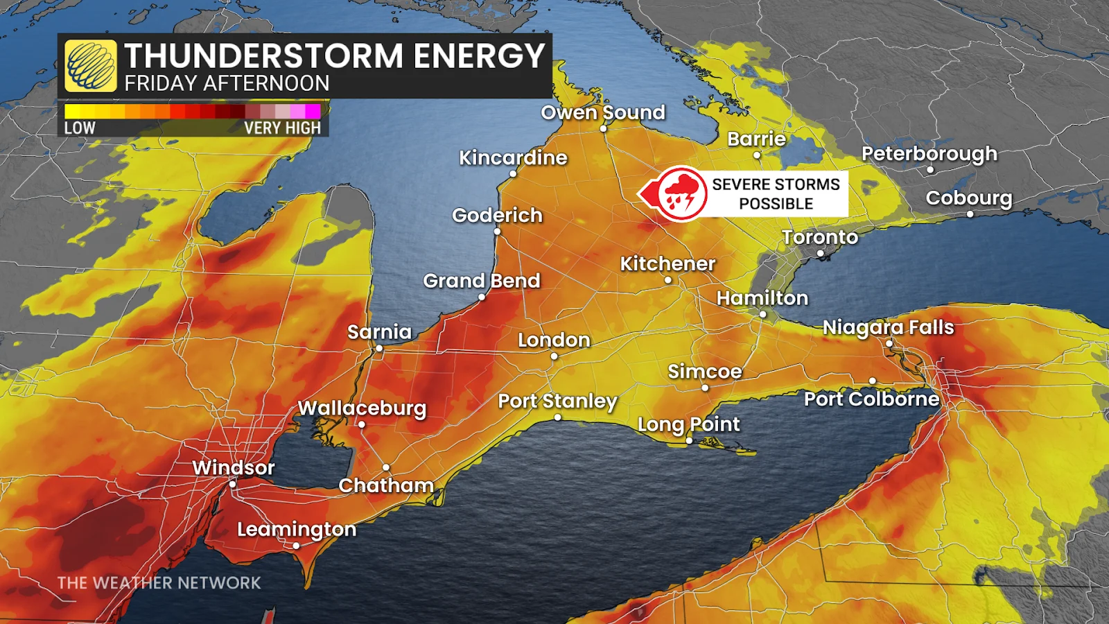
Strong to severe thunderstorms pushing into southern Ontario from Lake Huron and Georgian Bay will sweep through the region Friday evening.
These storms will carry the risk for all hazards—including the potential for one or two tornadoes.
Be sure to keep up with the latest severe weather watches and warnings in your area. Know what to do if a tornado warning is issued for your location, whether you're at home, work, or on the road.
DON’T MISS: Don’t fall victim to these seven dangerous tornado myths
Severe storms likely in southern Ontario on Friday
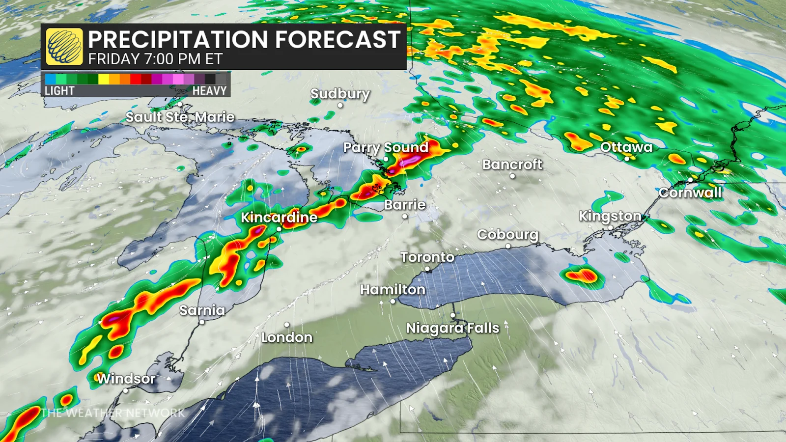
Showers will spread across the Greater Toronto Area during the morning hours as a warm front lifts across southern Ontario. Persistent showers are expected in northeastern Ontario in the morning, moving into the Ottawa region by the evening.

WATCH: See the intense shelf clouds forming as severe storms track through southern Ontario
Unstable air moving in behind that warm front will set the stage for a round of strong to severe thunderstorms during the late afternoon and early evening hours on Friday.
A cold front pushing in from the west will collide with the unstable air and trigger a strong line of thunderstorms along the shores of Lake Huron and Georgian Bay.
These storms will develop amid an environment capable of supporting 2+ cm hailstones, strong wind gusts of 90-100 km/h, and the risk for embedded rotation. An isolated tornado cannot be ruled out. Damaging straight-line winds and microbursts are also a major threat that will be in play with these storms, which could cause major tree damage and outages.
We’ll see this line then move northeast and weaken as it approaches the Greater Toronto Area overnight.
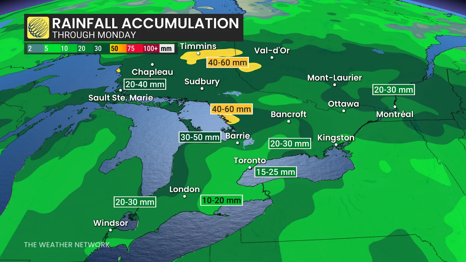
Saturday will feature improving conditions across most of southern Ontario. The persistent rain will ease across central and eastern portions of the province during the morning hours.
Scattered showers will remain possible through Saturday afternoon, but overall we’ll see conditions clearing up. Temperatures will finally inch into the lower 20s for folks in eastern Ontario.
Stay with The Weather Network for all the latest on conditions across Ontario.