Increased flood risk as heavy rain and snowmelt impact Newfoundland
Storm hits Newfoundland with snow, heavy rain, winds, and flood risks
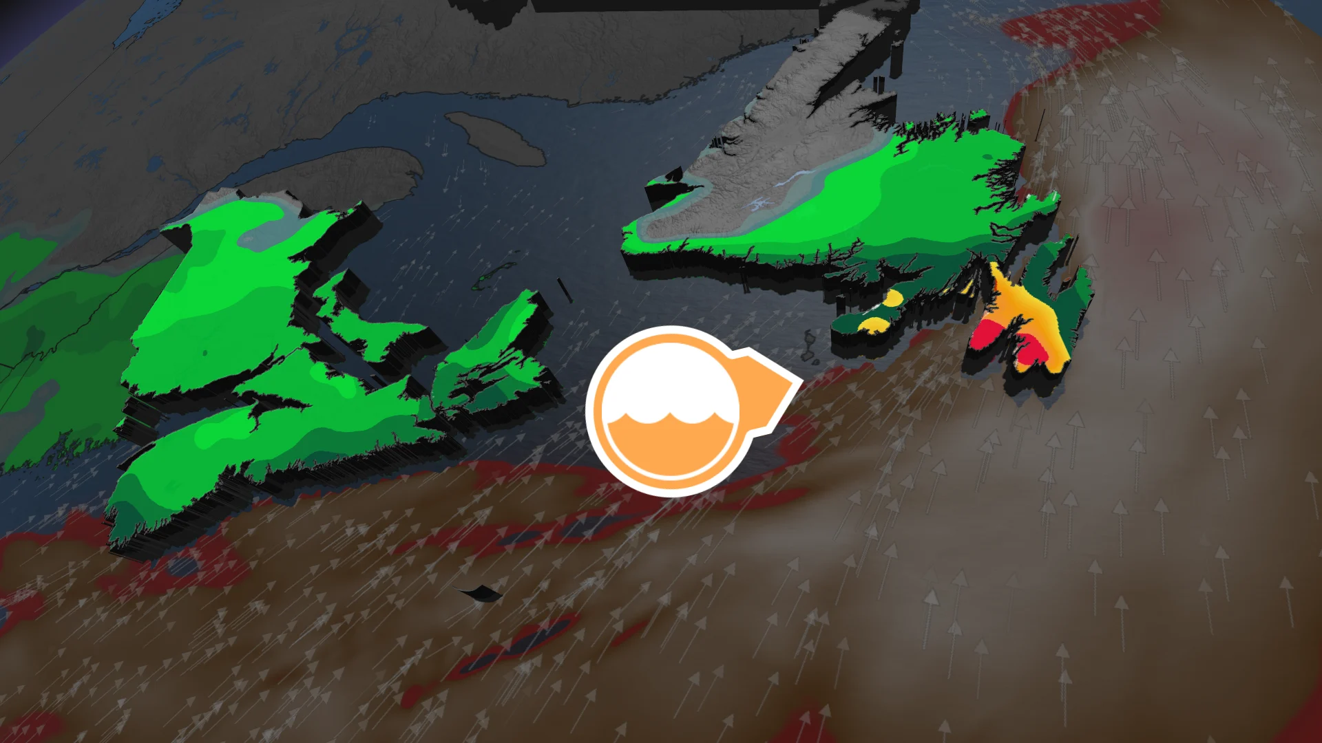
Newfoundland faces an elevated risk of localized flooding as heavy rain combines with ongoing snowmelt. A strengthening low pressure system is set to enter the mouth of the St. Lawrence and bring wet snow to the region late Thursday before transitioning to rain by Friday morning.
DON'T MISS: The high cost of plowing St. John's snowiest February
The Avalon Peninsula is particularly at risk, with strong winds also forecast to reach 90-100+ km/h, potentially resulting in power outages.
Residents are urged to prepare for possible flooding and monitor conditions, and weather alerts closely.
Heavy rain, strong winds, and snowmelt threaten Newfoundland through Friday
By Friday morning, snowfall in Newfoundland is expected to shift to heavy rain as the storm tracks northward.
Winds will remain strong for the Avalon Peninsula, with gusts between 80-90+ km/h.

The heaviest rainfall is forecast over the Burin and Avalon peninsulas Friday afternoon.
St. John’s could see 30-50 mm of rain, while areas farther south may exceed 50 mm.

This follows a recent storm on Tuesday, March 24, which left over 30 cm of snow and ice pellets in St. John’s.
DON'T MISS: Tips to stay safe during a flash flood as peak season draws near
Around 20 cm of snow remains on the ground, and its melting combined with heavy rainfall could lead to localized flooding, particularly in the Avalon region.

Strong winds may also cause power outages. Residents are urged to remain cautious and monitor updates.