'This could be big': Snow projections continue to rise for B.C. South Coast

Increasing threat for an extended period of heavy snow for the South Coast of B.C. this weekend.
Thanks in large part to the Fraser River outflow, bitterly cold Arctic air will continue to funnel into southern British Columbia, keeping the province firmly engulfed in the coldest air of the season, with daytime highs well below freezing for many. Adding to the ordeal, forecasters are also watching an increasing threat for an extended period of heavy snow for the region this weekend, with winter storm watches already in place for Vancouver Island. Some areas may end up with more than 20 cm of snow. More on the timing and impact, below.
WEATHER HIGHLIGHTS:
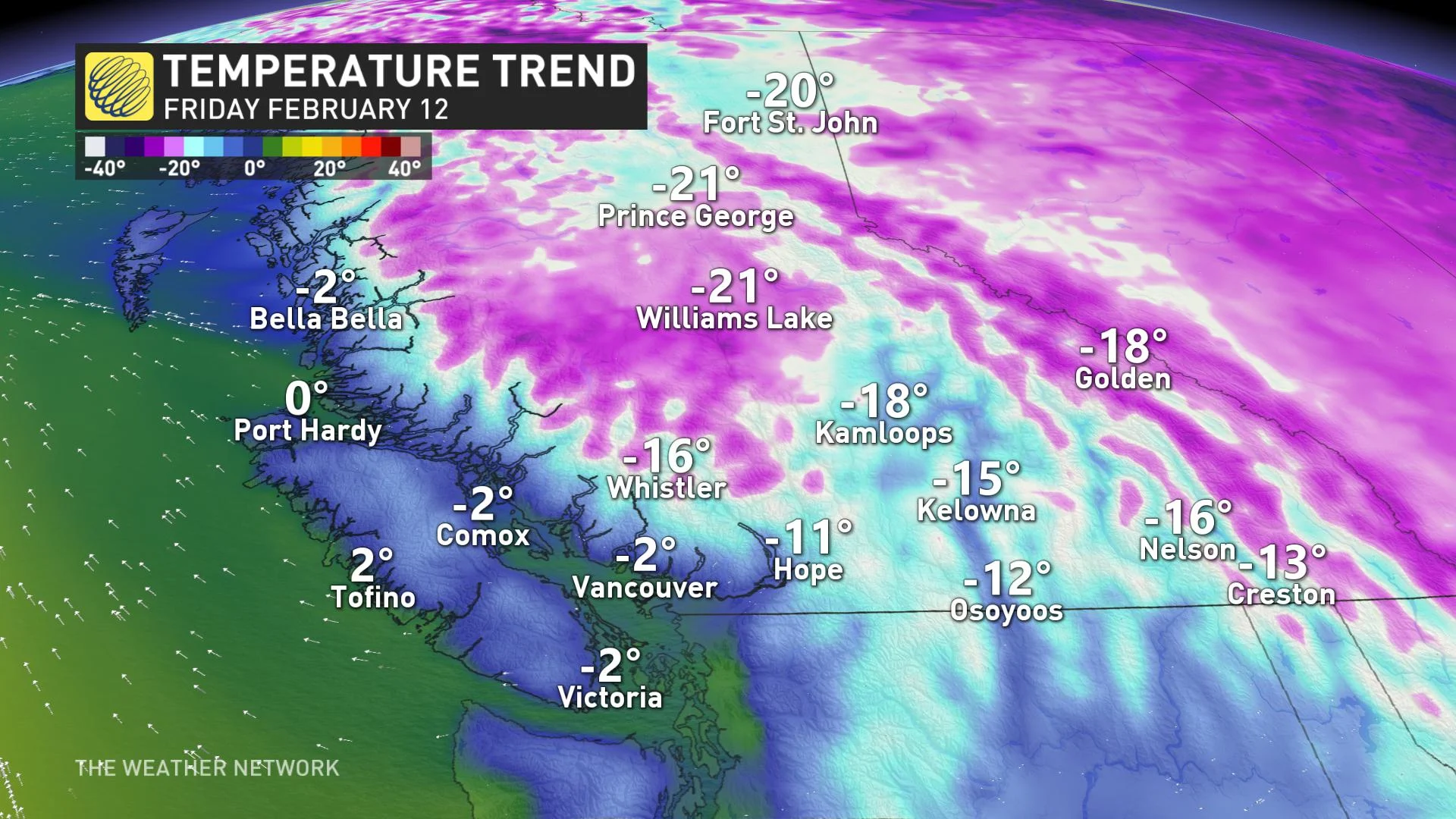
Arctic air dominates into the weekend, coldest weather of the season for the South Coast, temperatures sitting well below freezing for Vancouver and Victoria
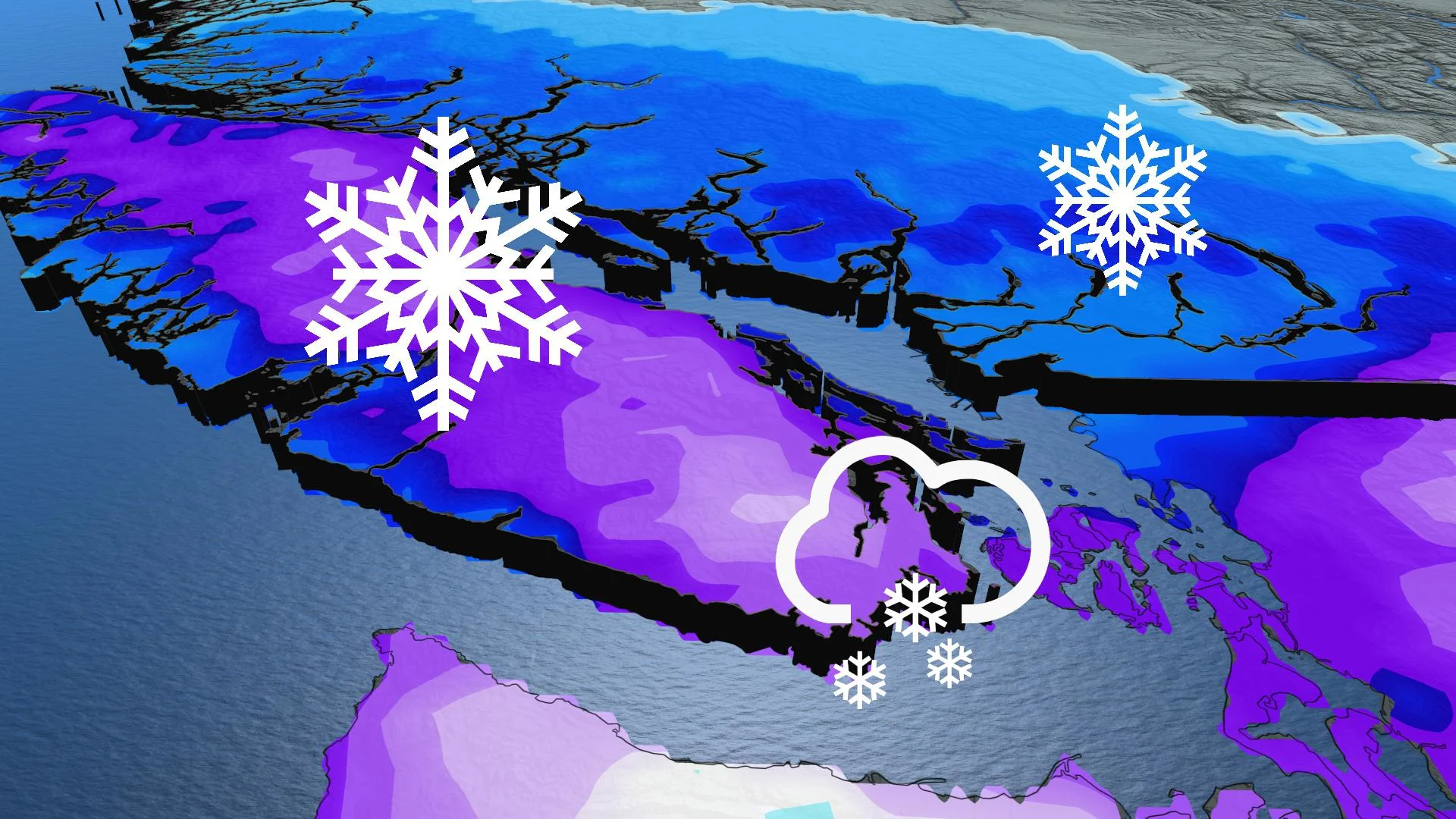
Increasing threat for heavy snow for the South Coast this weekend, developing late Friday and becoming heavy into Saturday
Potential for impressive snow totals for Vancouver Island including Tofino and Victoria
THURSDAY THROUGH FRIDAY: ARCTIC AIR DOMINATES
Strong winds have begun to churn down the Fraser River, which means that northeast winds are creating some of the coldest conditions that the South Coast has experienced this winter.
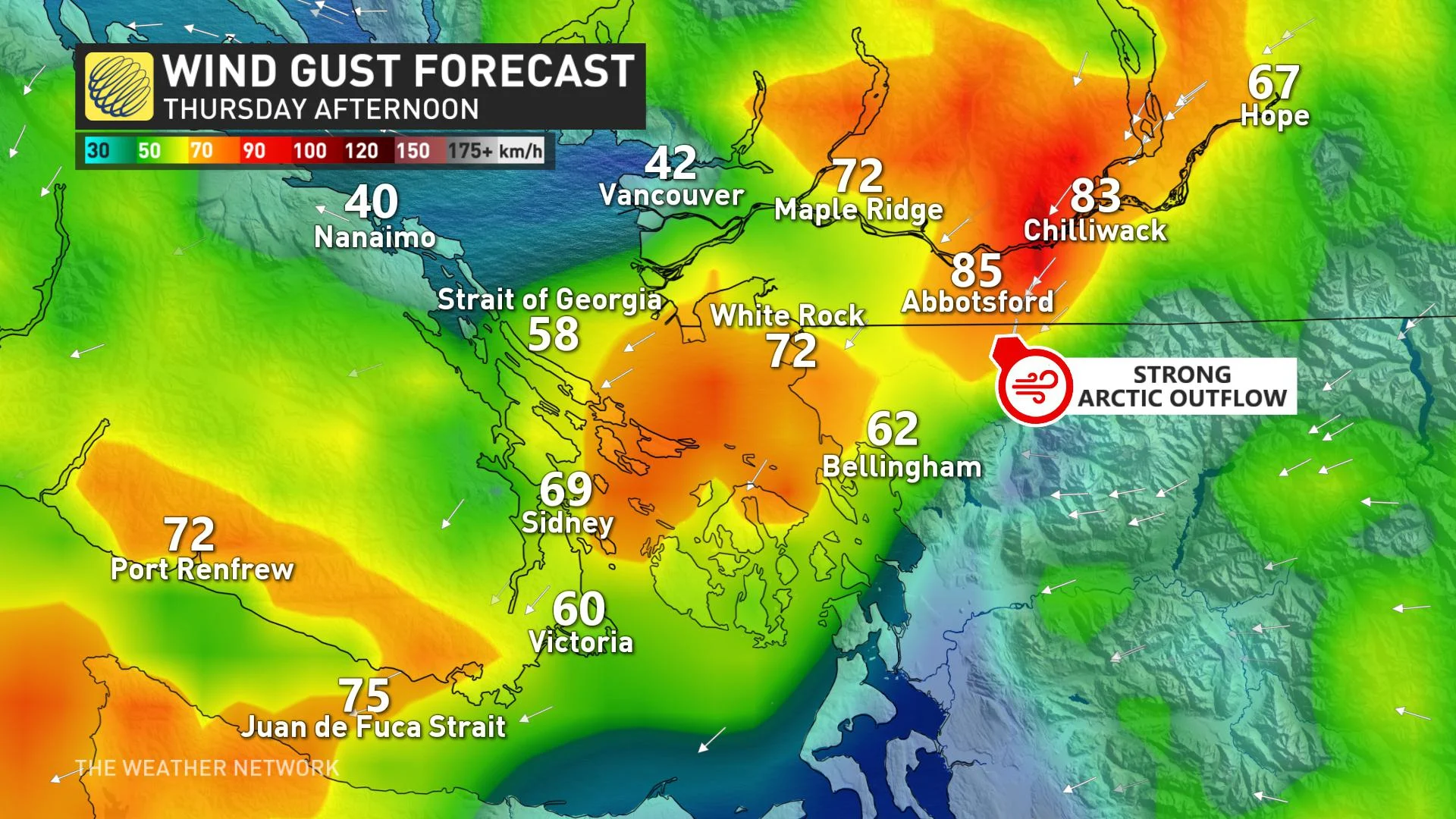
We’re watching the prominent valleys across the North and Central Coast as well for the potential for damaging winds accompanied by wind chills near minus 20, which is quite rare for the coastal region. Even normally balmy Victoria is set to feel wind chills as low as -15, or even -20.
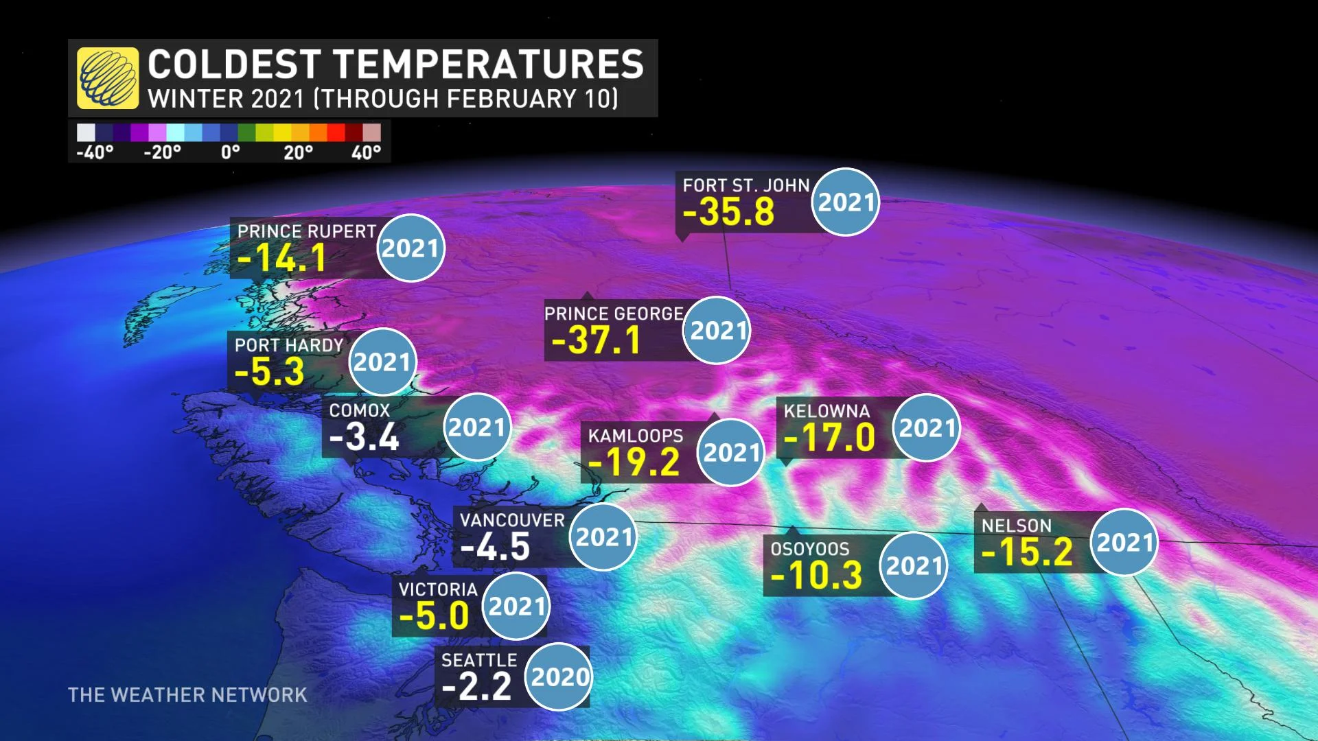
New seasonal low temperatures have been set throughout southern B.C.:
MUST SEE: Canada set to endure the most widespread cold this century
On Thursday, it’s possible that Kamloops will have had its coldest February temperature in recorded history. The benchmark to beat is -24.5°C back on February 1, 1989.
Environment Canada has issued special weather statements across the South Coast, with extreme cold warnings peppering parts of central and Northern regions featuring wind chill values of near minus 40 to minus 45. Arctic outflow alerts remain in place for a swath of coastal regions, highlighting the strong pressure gradient and unusually low temperatures paired with gusty winds.
“Extreme cold puts everyone at risk. Cover up. Frostbite can develop within minutes on exposed skin, especially with the wind chill,” Environment Canada warns.
THE WEEKEND: WINTER STORM WATCHES ISSUED ACROSS VANCOUVER ISLAND
The perfect recipe for heavy, low elevation snow is in the cards for late Friday, as Arctic air interacts with a moist Pacific trough careening in from the west. As the trough approaches, it’s able to draw chilly air from the interior of the province, increasing the odds the system remains as snow throughout the duration of the event.
The snowfall forecast is in flux, but odds are increasing that large parts of Vancouver Island are potentially looking at over 20 cm of snowfall through Saturday. The Lower Mainland is also likely to see over 10 cm of snowfall with this event, but a little more uncertainty exists for the area.
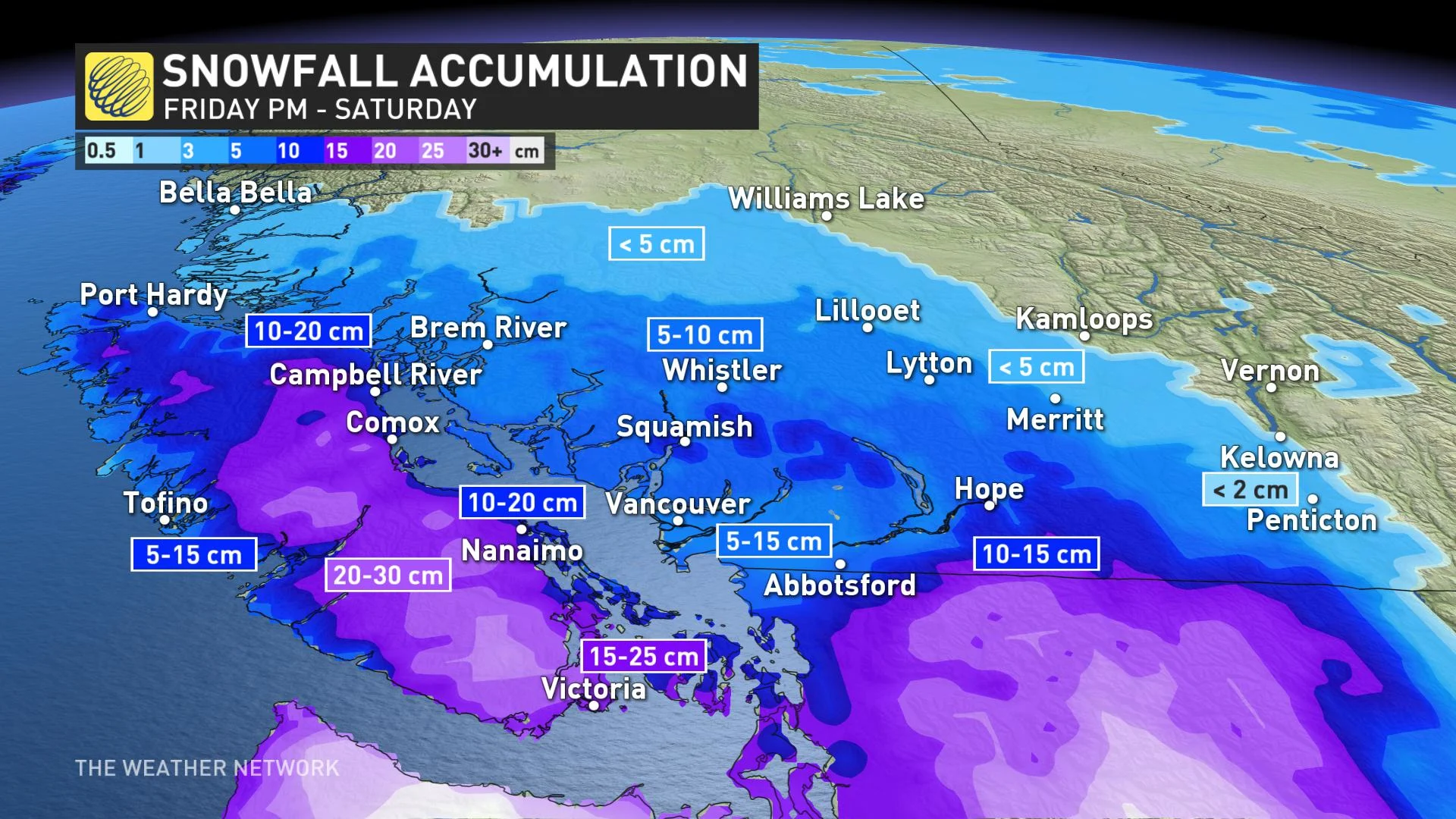
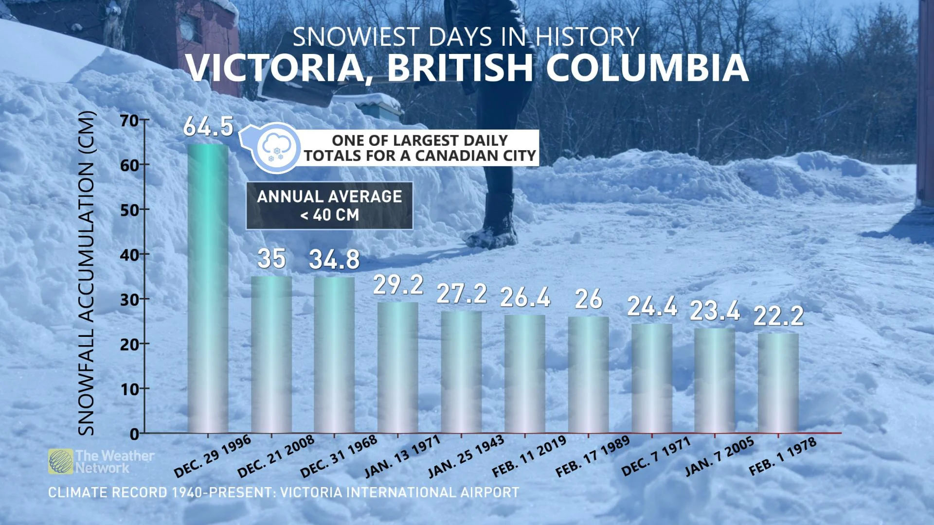
It’s likely no ‘blizzard of 1996,’ the infamous storm that dumped 65 cm of snowfall on Victoria; nevertheless, it could become a top 10 heaviest snowfall event over the past several decades for the capital region.
MUST SEE: Remember when Canada's 'snow-free city' was completely shut down by snow?
Be sure to check back for updates on this extended snow event for B.C.'s South Coast.
Thumbnail image courtesy - Michelle Sullivan