It may be hard to believe, but there are snow chances this weekend
Ready or not, the first signs of snow, and frost, move into Alberta this weekend
Mild and sunny conditions have been a hallmark of this early fall, with major Alberta cities wrapping up September with record-high warm temperatures.
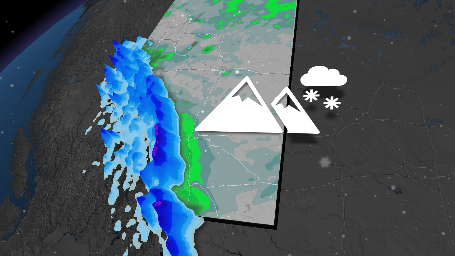
October is a time of weather contrasts, bridging lingering warmth with winter's first signs. While milder conditions still look to dominate much of this month, snowfall is expected to make an appearance in Alberta’s Rockies as early as this weekend, showcasing a seasonal shift.
DON'T MISS: Summery September breaks records in Alberta
WATCH: Preparing your vehicle for winter starts now, here's your checklist
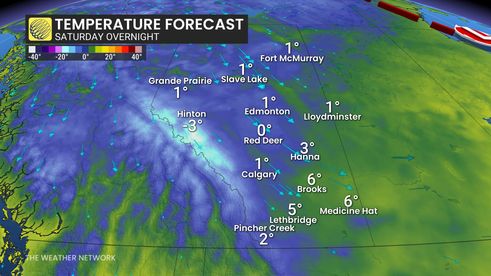
Sharp cold front with snow chances Saturday and Sunday
A sharp cold front pushing across Alberta this weekend will bring significant weather changes. Freezing levels are expected to drop between 1,500-1,200 m in the Rockies, with surface temperatures hovering just above 0°C by Saturday night.

Precipitation will begin along the Rockies late Saturday afternoon, spreading to southern Alberta by early Sunday morning. Alpine regions are forecast to see snowfall, with a rain-snow mix possible in areas like Banff.
In Calgary, rainfall is expected to end September’s record dry streak, with 5-15 mm in the forecast.

This fast-moving system will likely bring brief, but intense precipitation.
SEE ALSO: Understanding Canada's 'frost zones,' and when that first frost may hit
Temperatures in Calgary could drop low enough to prompt the season’s first frost this weekend.
Looking ahead to next week, daytime highs around Calgary are forecast to hover near or slightly below the seasonal average of 15°C.