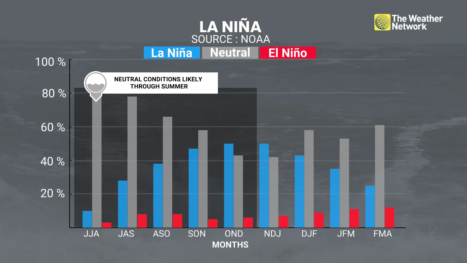
La Niña could return in a quick burst this fall and winter

The current pattern may not last much longer
El Niño and La Niña are absent from the Pacific Ocean this summer—but that could change over the next couple of months.
Forecasters announced Thursday that water temperatures in a key region of the Pacific Ocean remain around average for this time of year, which could have implications for the peak of hurricane season.
Check out The Weather Network’s hub page for all the latest on El Niño, La Niña, and what it means for your seasons ahead!
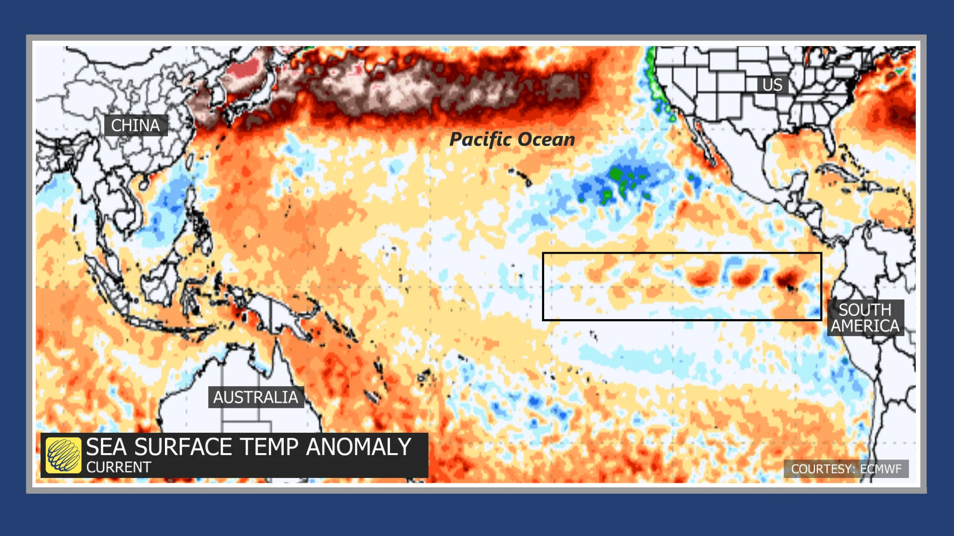
El Niño and La Niña have significant effects on global weather patterns. These warm (El Niño) and cold (La Niña) water temperature anomalies can influence everything from drought in Australia to heat over the heart of Canada.
Neither El Niño nor La Niña conditions are present right now, forecasters with the U.S. Climate Prediction Center (CPC) reported on Thursday, marking a continuation of ‘ENSO-Neutral’ conditions that began this past spring.
This current pattern may not last much longer.
Projections suggest that we could see a return of La Niña conditions later this year. The CPC’s official forecast reflects a 50 per cent chance of a short-lived La Niña during the late fall and early winter months, with neutral conditions likely to return by the start of next year.
DON’T MISS: What happens when El Niño and La Niña disappear?
ENSO-Neutral conditions are most likely to influence our weather in Canada by affecting the Atlantic hurricane season.
Water temperatures hovering around normal in the Pacific could reduce the amount of wind shear blowing east over the Atlantic, potentially aiding the development of tropical systems across the basin.
Header image created using graphics and imagery from Canva.