Lake-effect snow squalls continue through New Year's Eve in southern Ontario
Bands of lake-effect snow and frigid temperatures will keep parts of southern Ontario freezing until Wednesday, with rapidly changing travel conditions before improving Thursday.
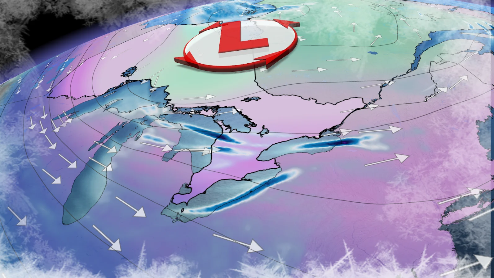
Southern Ontario is entering the new year under the brunt of a stubborn Arctic air mass, paving the way for a multi-day lake-effect snow event that'll keep drivers guessing and snow belts busy until midweek.
A powerful storm has moved north, leaving behind bitterly cold air that will last for days. Daytime highs will stay below freezing, with wind chills expected to feel closer to the minus-20s at times.
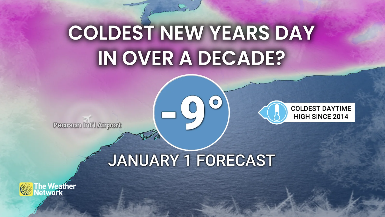
Yet, if current forecasts are correct, New Year's Day in Toronto could be the coldest in more than a decade, with a preliminary high of -9ºC, the coldest since 2014.
Snowfall amounts and road conditions may differ greatly from one region to the next, depending on where snow bands form and how long they last.
DON'T MISS: Feeling burned out? Try these tips to manage your holiday stress
Snow squalls bring rapidly changing conditions Tuesday
On Tuesday, lake-effect snow squalls along with blowing snow will hit parts of southwestern and central Ontario, including London, Kitchener-Waterloo, Barrie and the surrounding snowbelt areas.

Visibility may suddenly drop under heavier bands, resulting in hazardous driving conditions over short distances.
Snow squalls however are expected to calm down by Tuesday evening as a weak low-pressure system approaches from the Prairies. Still, the break will be brief in many areas.
CHECK OUT: Is warming up your car in winter a smart move?
WATCH: Has it been the snowiest December on record for Toronto?
Public safety alerts issued amid hazardous travel
Extremely dangerous conditions have prompted official warnings in parts of central Ontario. The Township of Springwater declared a significant weather event, urging residents and motorists to stay off the roads.
Emergency Management Ontario has also issued a public safety alert for the area, warning that emergency services may be unable to respond, advising that all non-essential travel be avoided.
New Year's Eve snow possible as bands shift and expand
By Wednesday morning, the weak system could bring a brief period of widespread snowfall before lake-effect bands continue their meandering pattern.

Some squalls could grow strong enough to move inland toward Highway 401, with brief effects as far east as Toronto on Tuesday and Wednesday.Those with any New Year's Eve plans should monitor the forecast closely and check road conditions before heading out.
Conditions are expected to gradually improve on Thursday as Arctic air loosens and lake-effect activity decreases, resulting in a more peaceful end to the week.
WATCH: OPP issues urgent winter travel warning across Ontario
Stay with The Weather Network for the latest updates across Ontario.