Large hail, damaging winds possible with Prairies severe storm setup
Southern areas of Alberta and Saskatchewan will the zones to watch on Saturday as the threat for large hail, damaging winds and even isolated supercells will be present
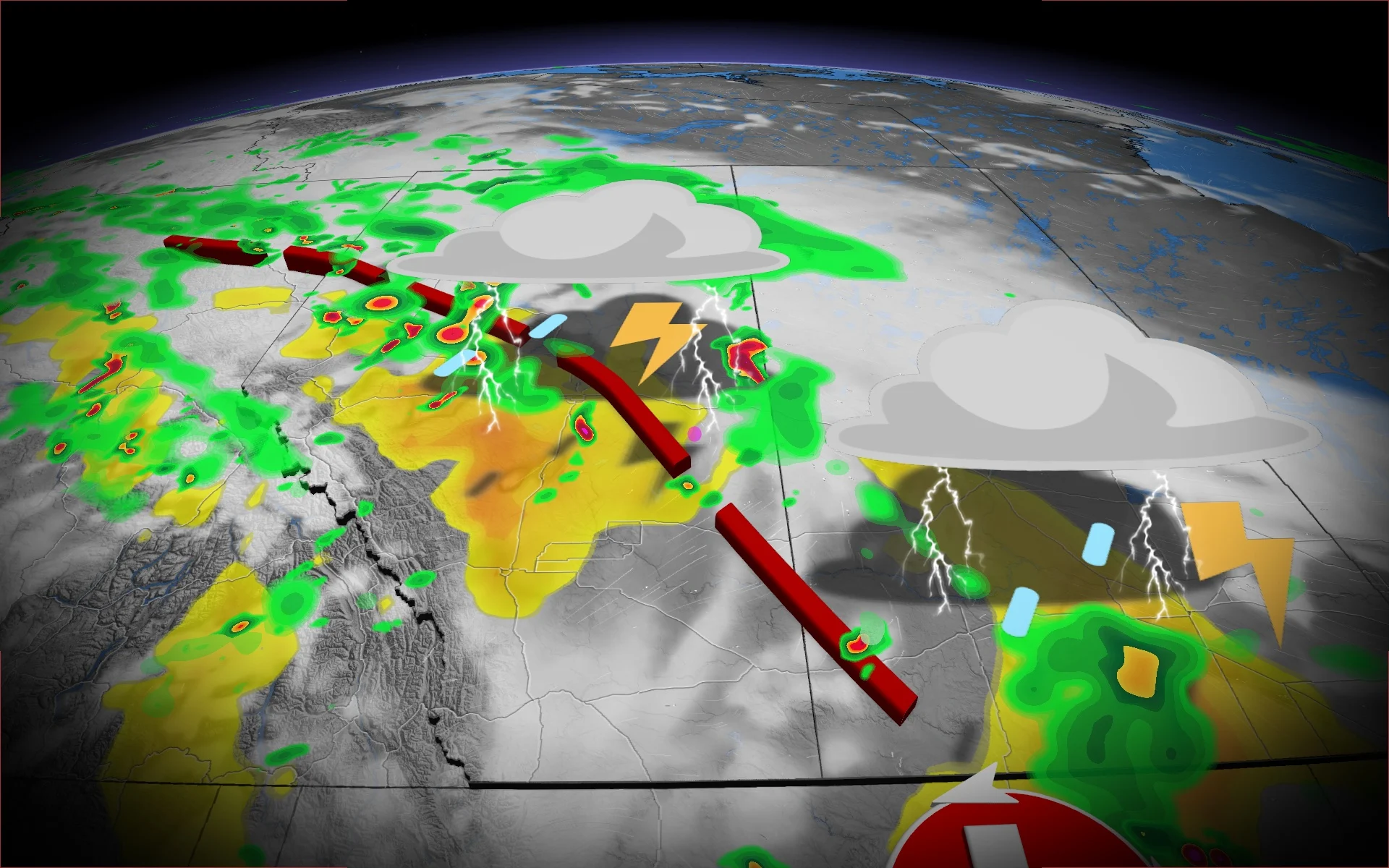
Saturday will be a day to monitor the skies and forecast closely in southern Alberta and Saskatchewan, with a prime environment for severe storms, large hail, damaging wind gusts and even isolated supercells.
A trough is expected to trigger storms Saturday evening, bringing the threat for large hail, damaging winds and heavy rain. One or two tornadoes is not out of the question, but that is all dependent on the environment.
DON'T MISS: Get the latest wildfire news and safety tips to help you stay safe
It'll be important to remain weather-aware, and stay up-to-date on all of the latest watches and warnings as conditions change.
Saturday: Severe storm risk pops up with large hail, damaging winds possible
A trough will develop Saturday afternoon in central Alberta, extending southeast to bring the chance of severe storms--stretching from Grande Prairie into Edmonton, Alta.

Lots of moisture is available to tap into eastern and central Alberta, as we can see isolated supercells kick off along the trough.
DON'T MISS: 2025 is Canada's second-worst wildfire season on record for area burned
Areas across northern Alberta, will primarily expect to see showers and heavy downpours at times. As the boundary drapes down to the southeast, we can expect to see our chance for severe storms develop for southern Saskatchewan through the late afternoon into the overnight hours--bringing the threat for strong winds and heavy rain.

Storms are expected to be quite isolated in nature and slow-moving as they develop into Saskatchewan.
Possible hazards include damaging wind gusts (exceeding 90 km/h), large Hail up to four centimetres in size and an isolated tornado if favourable dynamics come into play.
Beware if you're travelling along the QE2 and Highway 16 in Alberta through the evening as this is when storms could impact driving.

The parameters for severe storms are in store in Alberta, but it depends if the temperatures can warm up enough to overcome the cloud cover.
Northern and central areas of the Prairies will be much cooler than seasonal through the weekend while warmer conditions will be found across southern areas. The warmth will expand north and dominate most of next week.
However, a shot of much cooler weather will spread across the region late next week and eastern areas will be cooler than normal for next weekend--with highs in the teens across Manitoba and mid-20s to lower 30s returns to Alberta. Warmer-than-normal temperatures are expected to dominate during the final week of August.
Be sure to check back for the latest updates across Alberta and Saskatchewan.