Severe storms continue Friday across Alberta, Saskatchewan
Stay alert: Severe thunderstorms target parts of the Prairies, but will provide some temporary rain relief in wildfire zones
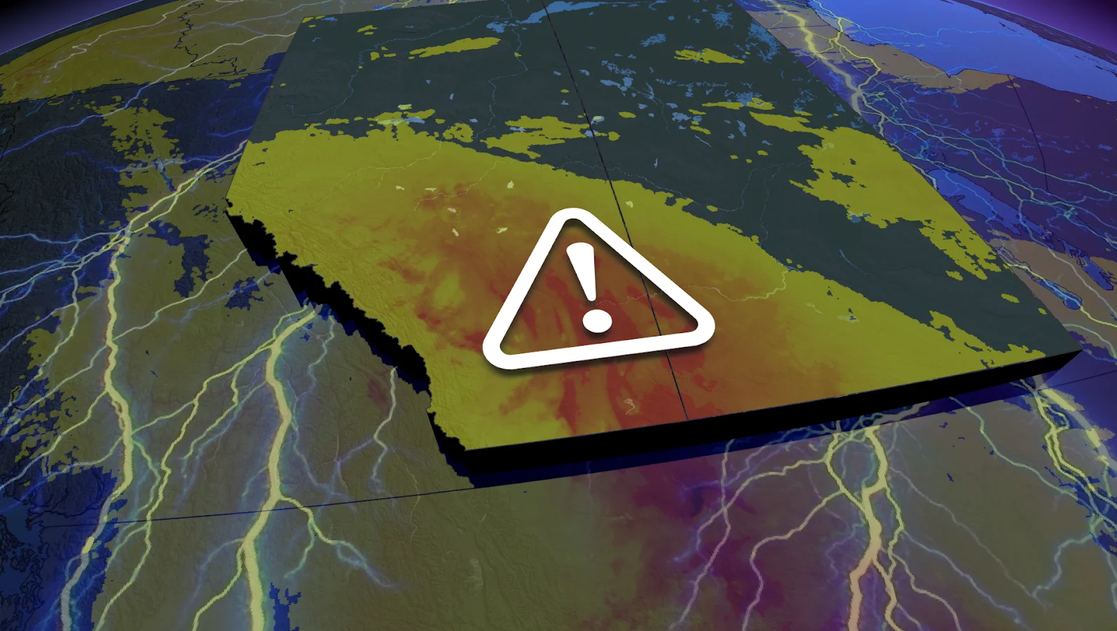
A developing system over Alberta is laying the groundwork for a multi-day period of active and at times, hazardous weather.
While the risk of severe thunderstorms remains, the incoming rain may provide some relief to wildfire-affected areas across the Prairies.
CHECK OUT: Officials say this "gateway to hell" is closing up
Environment and Climate Change Canada (ECCC) issued a severe thunderstorm watch for much of southern Alberta and southwestern Saskatchewan on Friday afternoon. This includes the communities of Edmonton, Red Deer, Airdrie, Drumheller, Medicine Hat, and Swift Current.
Stay up-to-date with the latest watches and warnings in your area, and have a plan in place to seek safe shelter if severe thunderstorms threaten your location on Friday and Saturday.
Storms fire up Friday afternoon, slight risk of rotation
On Friday, a low-pressure system will move north into Alberta, bringing plenty of moisture and energy to fuel storms.
A developing low in central Alberta will trigger large hail-producing thunderstorms between roughly 3 and 9 p.m. MT.
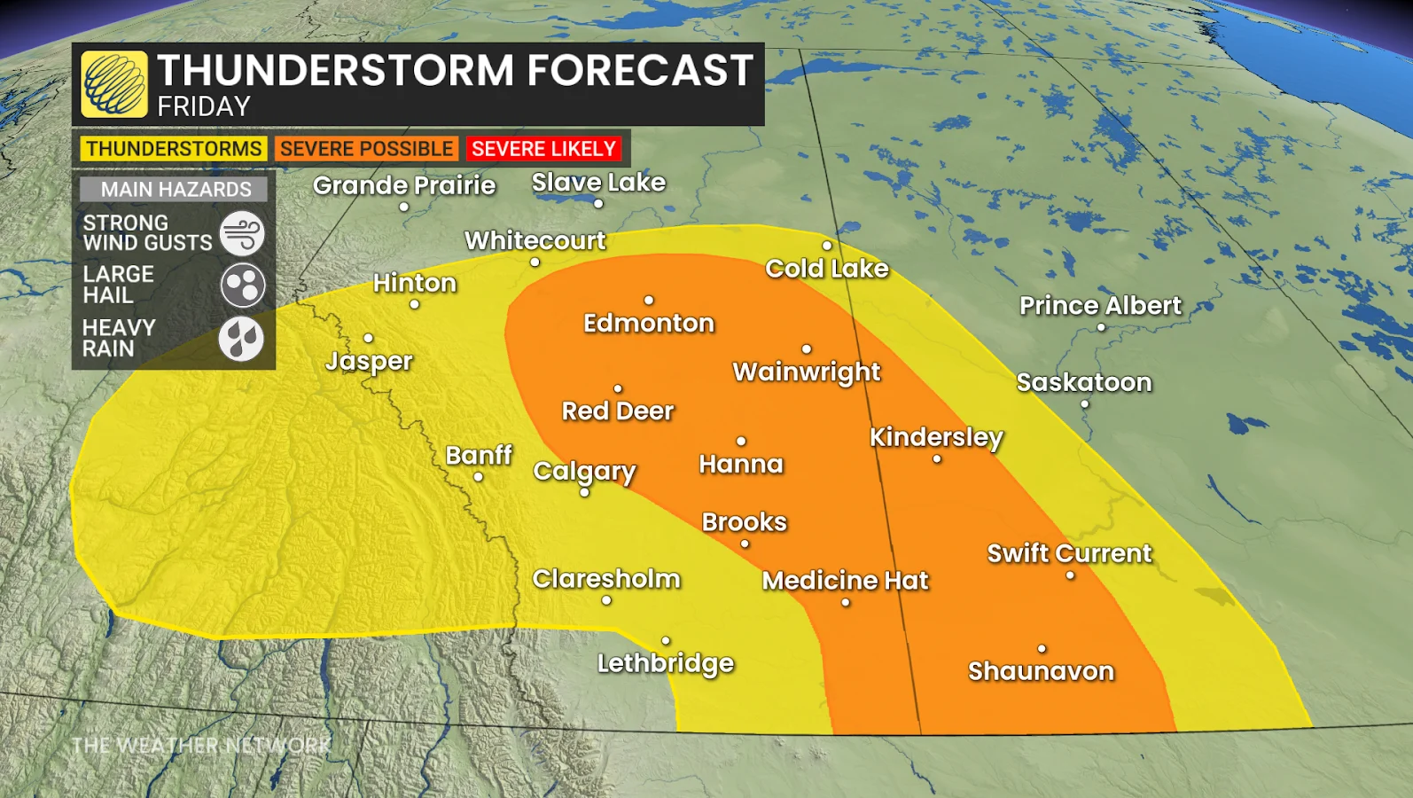
This setup will bring a slight boost of low-level shear, helping sustain some of the stronger storms.
While not a guarantee, there is a slight risk near Edmonton, Alta., for funnel cloud sightings or even a brief landspout tornado.
Storms may also form later in the afternoon, around 4 p.m. MT, in southeastern Alberta, near the Saskatchewan border.
DON'T MISS: More dangerous than snow: Why driving in the rain can be a bigger hazard
In southern Saskatchewan, storms are expected to fire up along the warm front, producing mostly elevated thunderstorms capable of generating large hail.
These cells may also become severe as they move east into Saskatchewan during the evening, increasing the risk of damaging hail and winds for communities in their path.
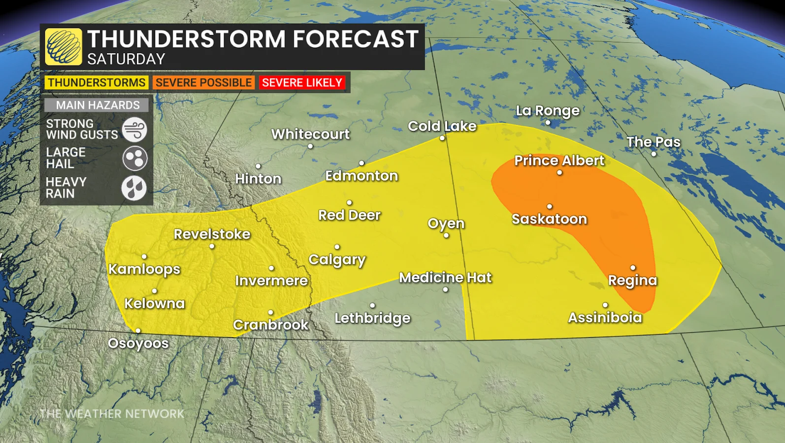
Stay alert: Storm risk shifts into Saskatchewan for Saturday
Heading into Saturday, the system will continue its eastward push into Saskatchewan. Strong thunderstorms are expected to continue, particularly in the province's south and centre.
Large hail and strong winds will be the primary concerns as the storms intensify.
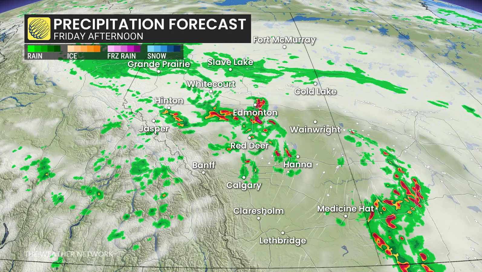
Heavy rainfall a silver lining
Despite the storm threats, widespread rainfall remains a silver lining. The moisture will help to suppress existing wildfires and reduce the risk of new ones, while also providing a boost to agricultural regions that have been dealing with dry conditions.
SEE ALSO: Weather Waves: How the weather could influence your music taste
Still, for many communities, the coming days will be a balancing act between anticipating rain and remaining vigilant for more severe weather.
We will be closely monitoring Alberta and Saskatchewan and residents are encouraged to stay updated on weather alerts as the system unfolds.
Thumbnail credit to Rachel Modestino, a meteorologist at The Weather Network.