
Large hail threat with severe storms over the Prairies into Wednesday
Relentless thunderstorm risk spans the Prairies this week, with the threat for heavy rain, strong winds and large hail. Stay alert to the changing conditions
After Monday brought tornado watches and warnings in Saskatchewan, the risk of thunderstorms will continue across the Prairies over the next few days.
The focus for severe storms shifts into Manitoba on Tuesday, before returning to Alberta and Saskatchewan on Wednesday. These storms could bring strong wind gusts and large hail.
Be sure to monitor local weather alerts and incoming conditions throughout the day.
SEE ALSO: What is a mesoscale convective system? How an 'MCS' can spell danger
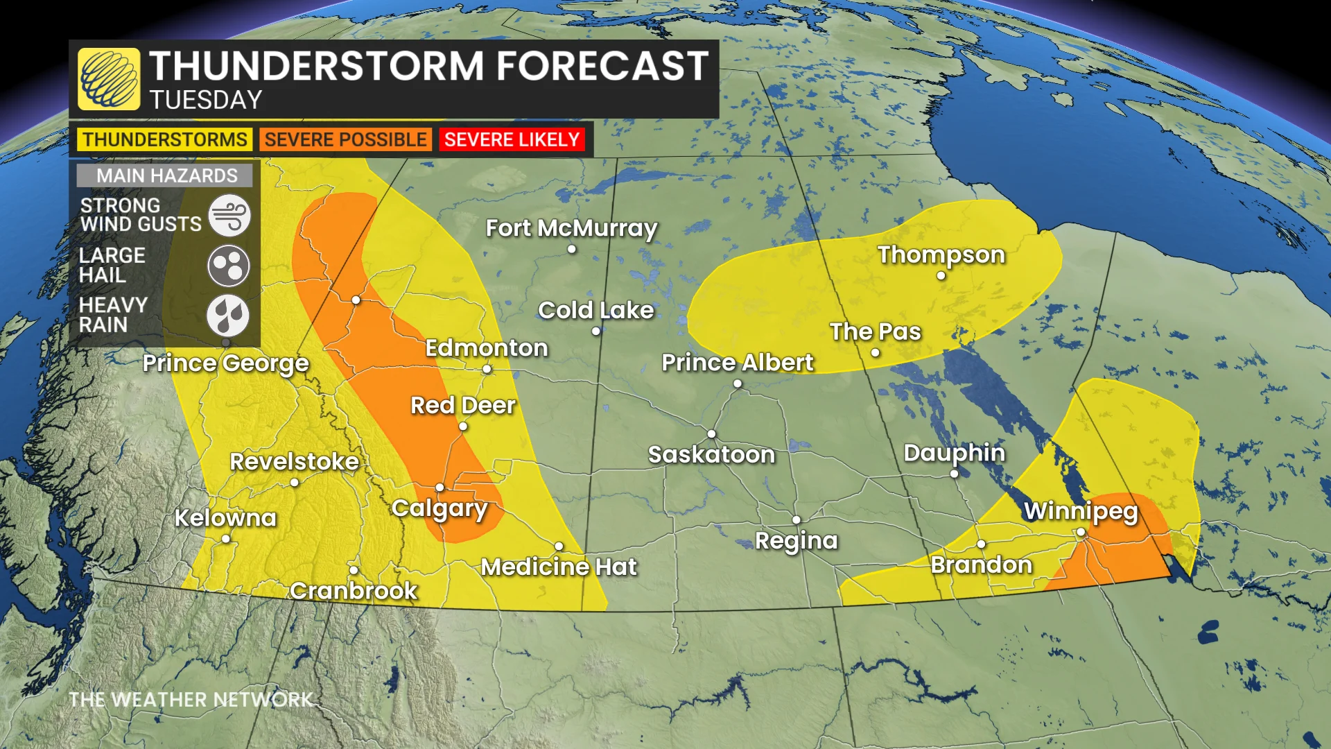
Severe storm chances hit Manitoba Tuesday
Tuesday will see another day of thunderstorms as a system moves eastward into Winnipeg, Man., and persists in the Rockies. Severe thunderstorms are possible, with storms developing along the foothills and tracking east by the late afternoon.
RELATED: Calgarians warned to stay off the Bow River after weekend rainfall
Southeast Manitoba could see a brief window for severe storms Tuesday afternoon and evening.
The primary hazards include strong wind gusts and hail, potentially up to toonie size, in both risk areas.
Storm threat lingers through Wednesday
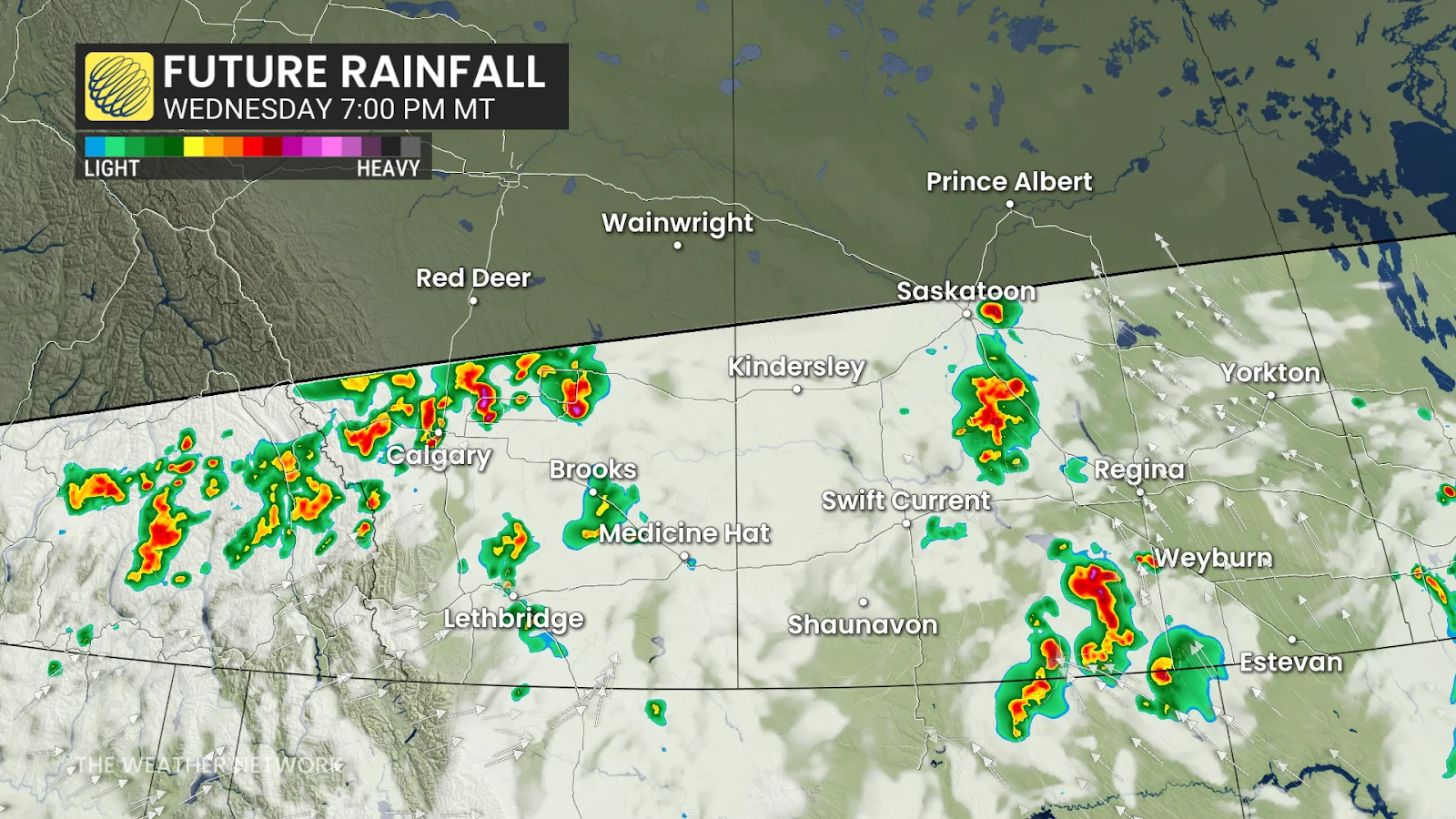
Alberta and Saskatchewan will face another round of thunderstorms on Wednesday.
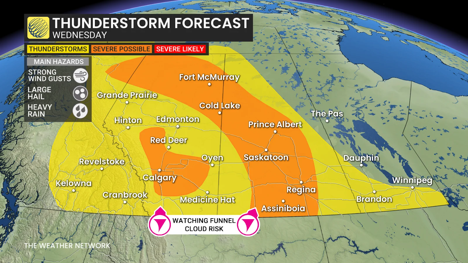
Severe storms are expected to develop along Alberta's foothills Wednesday, including supercell-hybrid types capable of producing more than two centimetres of hail and 90+ km/h winds near Calgary and Red Deer.
In Saskatchewan and northern Alberta, storms forming along a trough may bring isolated and linear storms, with the latter posing a risk of 100+ km/h winds in southern Saskatchewan.
Forecasters are also monitoring a low chance of a funnel cloud or land-spout tornado.
DON'T MISS: The Weather Network's new Fire & Smoke map helps you plan ahead and stay safe
Residents should stay updated with the latest weather alerts as the thunderstorms move through.
After a rather chilly start to the week, temperatures will trend back to near seasonal by late week. A warmer pattern will develop next week, with above seasonal temperatures forecast for early July.
Western areas are expected to see a few days of drier weather early next week. However, Alberta is likely to experience unsettled, stormy conditions during the latter half of the week.
WATCH BELOW: Can you predict a storm with a straw and a cup?
Stay with The Weather Network for more information and updates on your weather across the Prairies.