
Localized flood threat with Tuesday's training storms, major cooldown next
A cold front advancing through Ontario on Tuesday could intensify to severe levels in some areas. This system is expected to bring a sharp drop in temperatures, marking the end of the recent stretch of warm weather
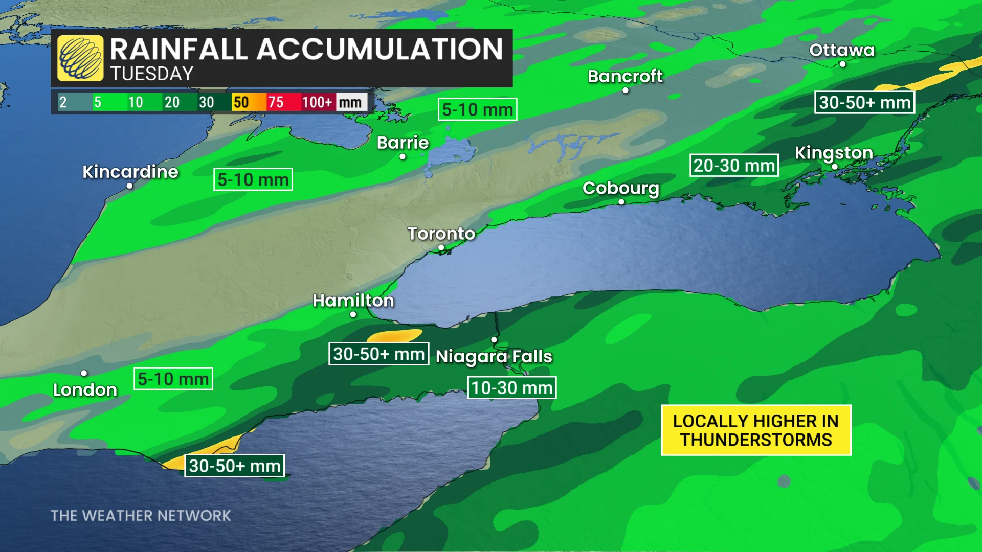
A cold front is moving through southern Ontario, triggering thunderstorms and heavy rainfall in some areas. The Niagara Peninsula could see up to 30-50+ mm of rain by Tuesday evening.
Localized flooding is a possibility in areas of intense downpours, which may lead to slower commutes throughout the day. Residents are advised to monitor conditions and avoid water-covered roads where flooding occurs.
SEE ALSO: Canada's October wild card: Record warmth on the table, but snow still in play
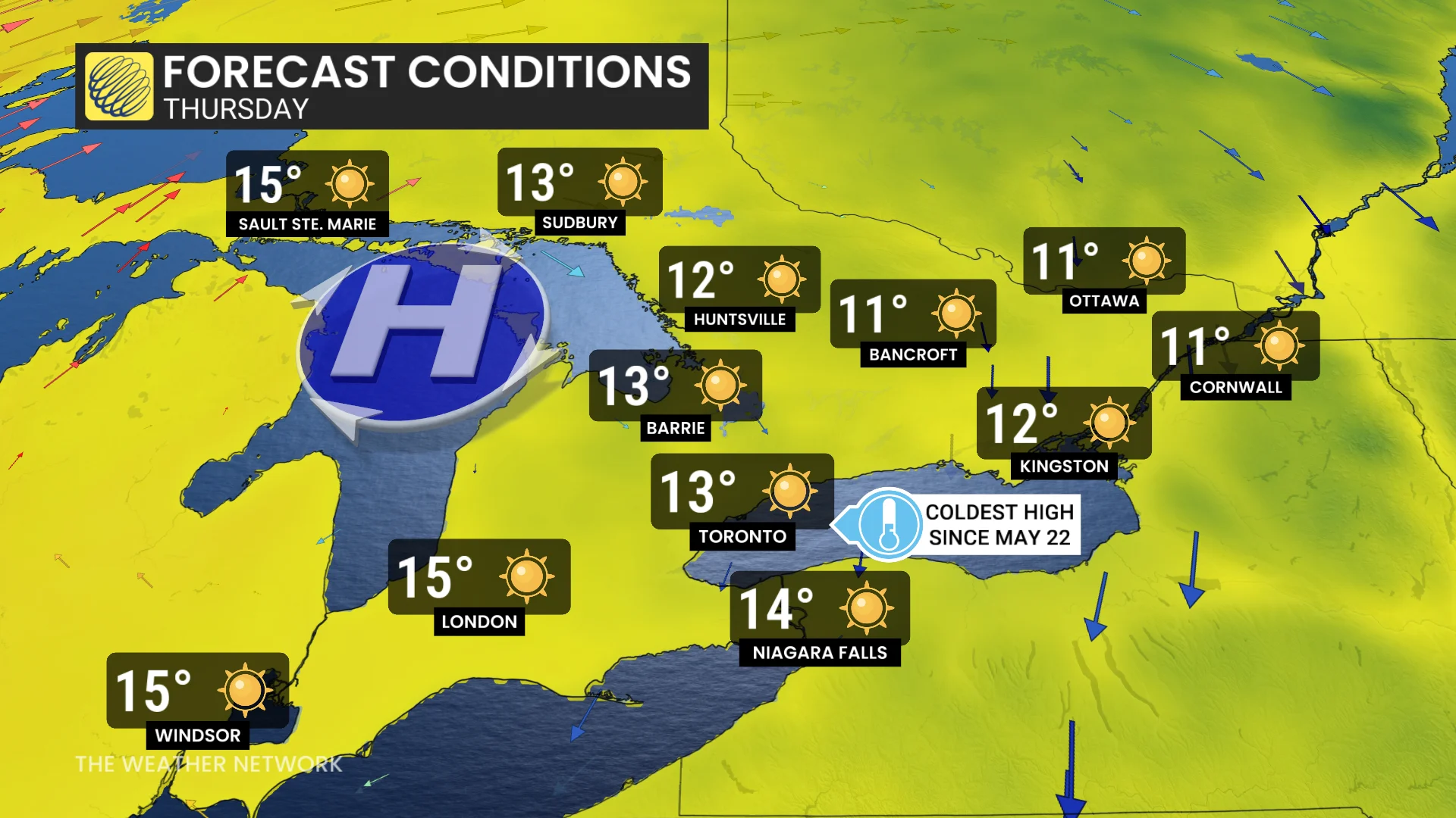
By Wednesday and Thursday, the weather will make an abrupt shift to autumn territory. Some areas north of the Greater Toronto Area (GTA) will struggle to hit 10–12°C. Frost is likely Thursday morning, especially in rural and suburban areas, marking a notable transition from the recent summer-like warmth.
Brace for slower commutes with Tuesday's heavy rain
Following a record-breaking warm October weekend, a strong cold front will bring colder weather and significant rainfall to southern Ontario through Tuesday. The sharp temperature shift will fuel thunderstorms along the cold front, impacting different regions at various times.
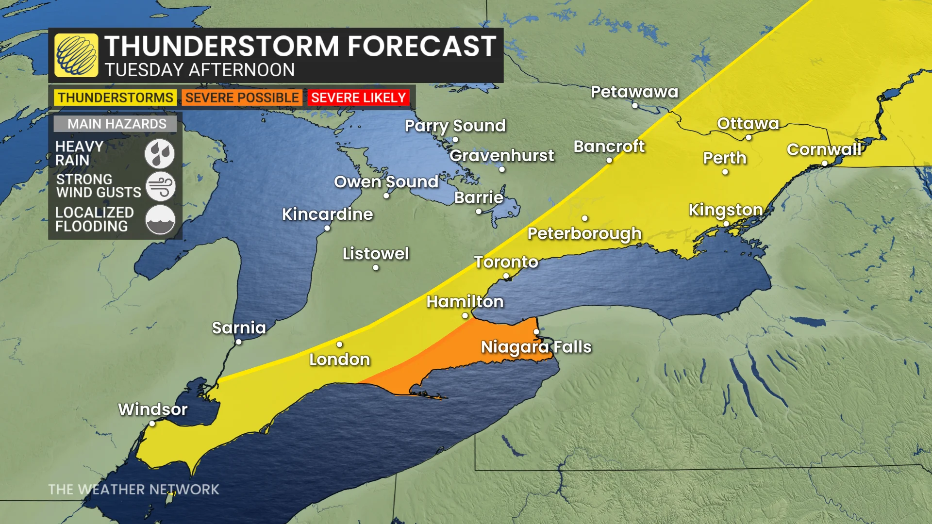
Storms developing along the Niagara Peninsula carry the primary risk of heavy rainfall and localized flooding.
RELATED: Get ahead of disaster: Six tips to manage flooding
The chance of a severe thunderstorm is marginal, but possible through the late afternoon.
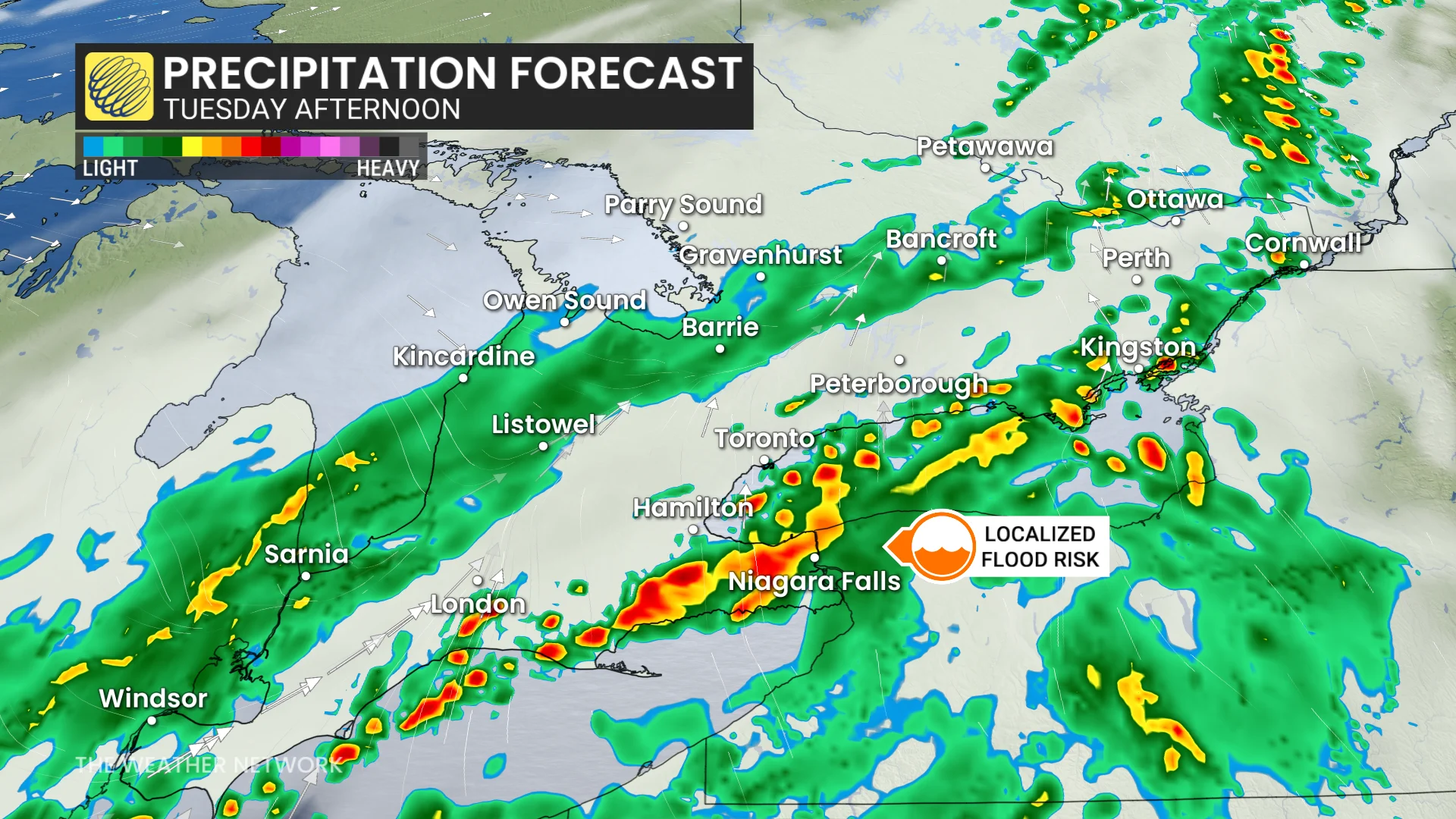
For the GTA, rainfall amounts are expected to range between 5-15 mm, while areas in the Niagara region could see 30-50+ mm in persistent training thunderstorms.
These conditions may lead to slower commutes in the morning and evening hours.
Autumnal chill finally breaks the summer-like warmth
A colder air mass will settle over Ontario by Wednesday, bringing seasonal October temperatures in the low to mid-teens for the rest of the week.
Morning temperatures will feel especially chilly, so plan to dress in layers starting mid-week.
DON'T MISS: Canada ends September with its first -20°C reading of the season
Thursday’s forecast high of 13°C in Toronto would mark the city's coldest daytime high since May 22, a span of 137 days! Stay prepared for cooler mornings and autumn-like conditions ahead.
Mostly dry Thanksgiving long weekend in store with gradual warming trend
The long weekend will see near seasonal temperatures to start, with a gradual warming trend bringing slightly above seasonal conditions by the end of the weekend.
Warmer-than-normal temperatures are expected to persist through the middle of next week, with minimal rainfall anticipated during this period.
DON'T MISS: What’s the difference between hurricanes, typhoons, and cyclones?
We are closely monitoring the potential for a significant cooldown late next week as a strong cold front could arrive. This shift may be linked to the effects of a recurving typhoon in the western Pacific. Further updates will be provided as the situation develops.
WATCH: Can Canada expect snow in October? Find out in our monthly weather outlook, below
Stay with The Weather Network for more information and updates on your weather across Ontario.