Long weekend start could see severe storms delay Quebec plans
Make sure to stay alert on Saturday as severe storms could push their way into southern Quebec, threatening to delay any outdoor plans. The potential also includes a tornado risk
While the astronomical start to summer is still just more than a month away, the unofficial beginning of the season has arrived.
But it won't be a particularly pleasant long weekend weather-wise for Quebec, especially on Saturday. Outdoor plans this weekend will need to include indoor backup schemes as heavy rain and thunderstorms are forecast at times.
SEE ALSO: Does a May heat wave indicate a scorching summer ahead?
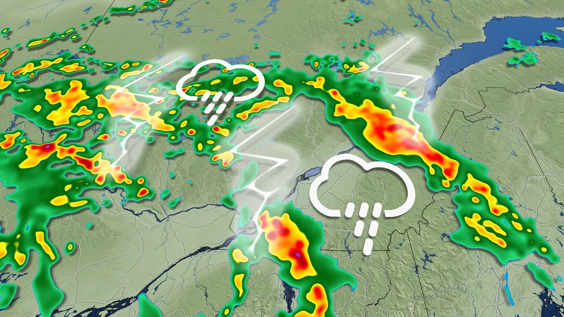
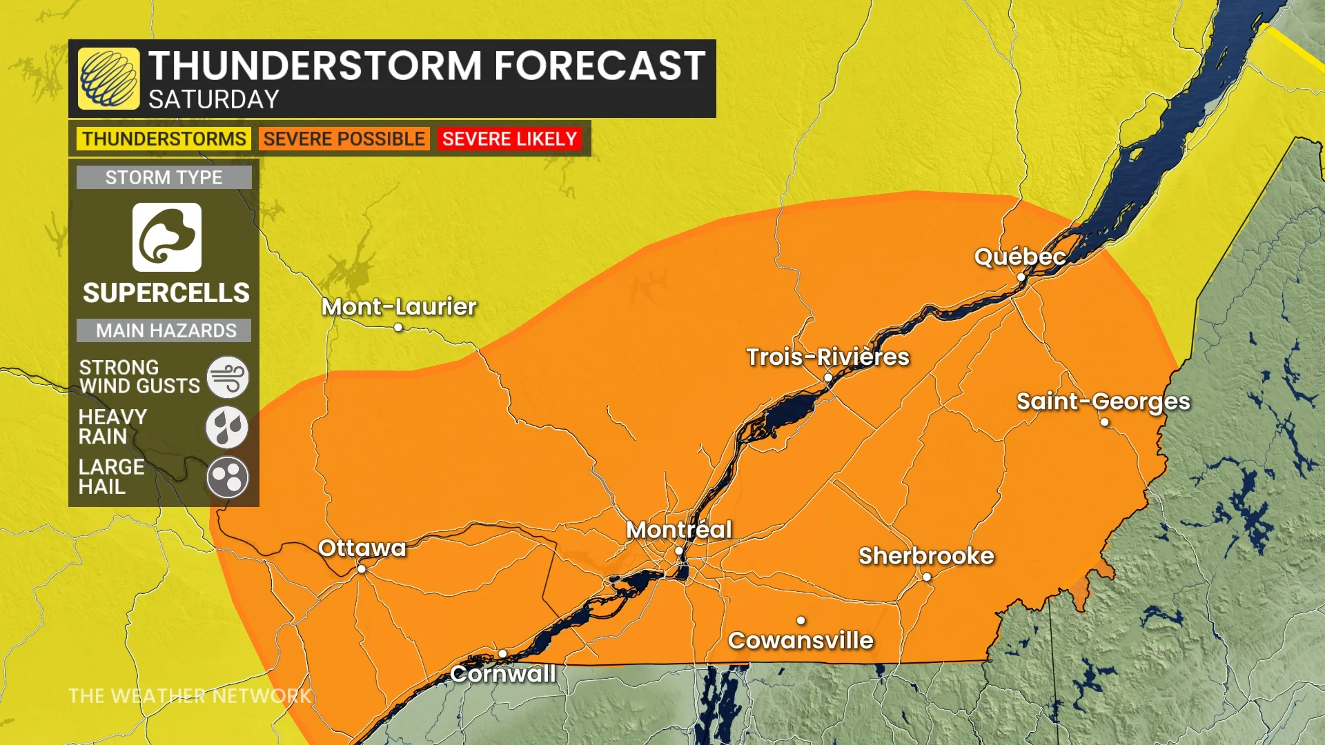
Saturday will be the day to be most alert, with a risk of severe thunderstorms popping up in southern Quebec, including Montreal. Severe thunderstorm watches are already in effect for areas such as Montreal and Quebec City. The main hazards are large hail and strong winds, but there is a low, non-zero risk of a tornado, as well.
Keep an eye on local weather alerts for your area before heading out and be prepared to adjust any outdoor plans this weekend, especially on Saturday.
Long weekend kicks off with a severe storm, tornado threat
A large low-pressure system is slowly on the move into Quebec on Saturday.
The heat and humidity buildup from the past few days of above 20-degree weather will add to the instability for thunderstorm initiation on Saturday.
Larger hail, heavy downpours and strong winds are the main hazards. There is even a low, but non-zero risk of a tornado as there will be favourable, atmospheric conditions for supercells.
Supercells are severe thunderstorms that rotate--the most dangerous type of storms that typically produce tornadoes under the right atmospheric conditions.
Severe thunderstorm watches are already in place for parts of Quebec, including for Montreal.
"Water activities could be hazardous due to sudden, violent wind gusts on water bodies," Environment and Climate Change Canada (ECCC) warns in the watch, which includes a risk of power outages from the potent winds associated with severe storms
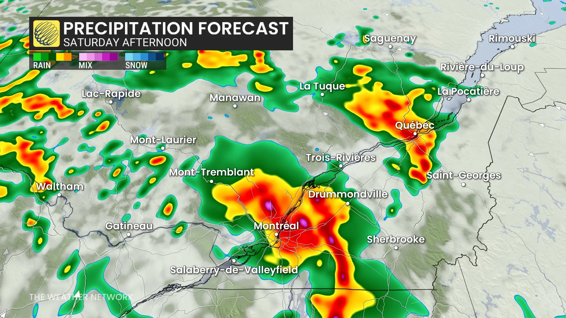
Strong thunderstorms will track into the Montreal area later Saturday morning, then move up the St. Lawrence River through the afternoon.
While most of southern Quebec is in a non-severe storm risk, severe storm potential is included from the Ottawa Valley in Ontario to Quebec City, extending southward to the U.S. border through Saturday evening.
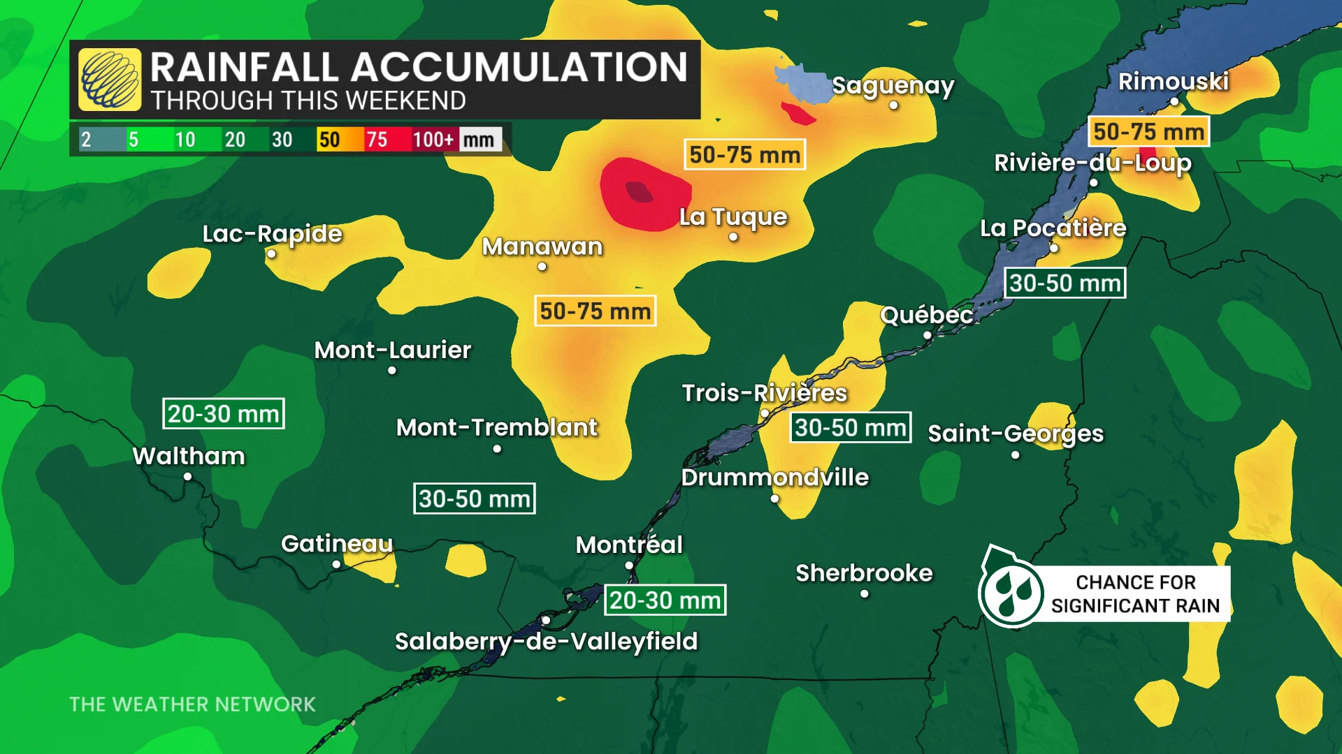
Very heavy rainfall totals are expected, increasing the threat of localized flooding. Some regions seeing up to 75 mm of rain through the long weekend.
Most of next week will be cool and unsettled.
Much cooler-than-seasonal temperatures will dominate through next weekend and into the following week. Temperatures should trend back to near seasonal as we head into the start of June.
Stay with The Weather Network for more information and updates on your weather across Quebec.