Major U.S. winter storm will have Canadian ramifications. Here's where
Travellers heading to, from or along the East Coast will likely need to postpone their plans on Sunday and Monday as a major Atlantic storm is set to bring a swath of heavy snow, blustery, potentially damaging winds, and even blizzard conditions for many locales
Millions of people will be in the path of a potent nor'easter Sunday and Monday, putting all modes of travel in peril.
A significant storm that will develop somewhere in the Mid-Atlantic to New England area will put numerous major U.S. and Canadian cities in the path of a winter wallop into early next week, including New York City, N.Y., Boston, Mass., and Halifax, N.S., among others.
RELATED: Parts of Atlantic Canada face weekend winter blast before nor'easter
As a result of the impending nor'easter, blizzard warnings and winter storm watches have popped up stateside, stretching from West Virginia to Nova Scotia. It should be noted that only winter storm watches have been issued in Nova Scotia. The alerts cover more than 1,700 kilometres, an astounding distance for any storm.

The low-pressure system is forecast to undergo rapid intensification, enough so to classify the storm as a weather bomb, or bomb cyclone, as it's also known as..
Blizzard warnings are stretching along the U.S. Eastern Seaboard, from Massachusetts to Delaware, a distance of more than 600 kilometres--continuing to expand as of Saturday afternoon.
It is the first time in four years that a blizzard warning has been issued for Long Island and New York City.

Rain transitions to snow through Sunday, with the heaviest snow impacting New Jersey, New York and Rhode Island into Monday morning.
Snowfall rates as high as 2-4 cm an hour, combined with wind gusts up to 80 km/h.
Coastal flooding is a risk, as well, resulting in many roads floodings due to the high winds.

With the heavy snow and strong winds, there is an elevated risk of branches breaking and widespread power outages. Major travel delays are expected to continue on Monday.
Snowfall totals in the U.S. will range from 25-50+ cm across the blizzard-warned areas, with the highest amounts expected for Rhode Island due to enhancement off the ocean. New York City could see 30-40 cm of snow by the time the storm departs.
Canadian impacts
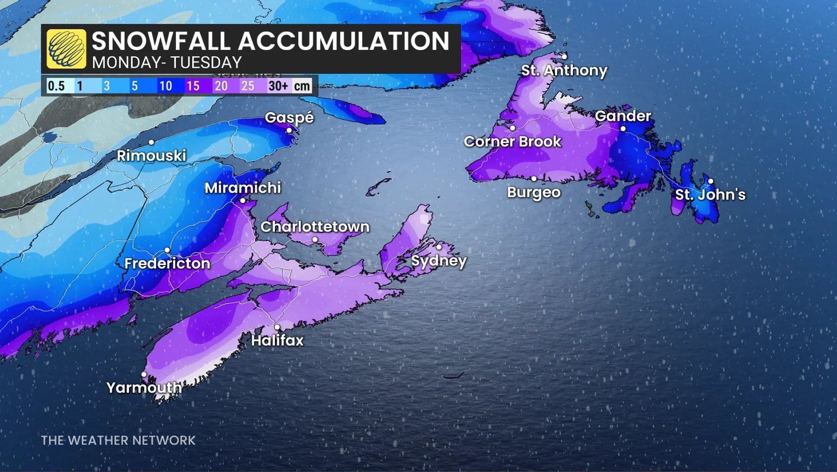
This system is expected to lose a little steam as it makes its approach to Atlantic Canada, but blizzard conditions are still expected for Nova Scotia and P.E.I. heading into Monday overnight into Tuesday.
Expect power outages, strong winds, and coastal flooding across the Nova Scotia coastline.
And as of now, snowfall projections of 25-35 cm is expected across Nova Scotia and P.E.I.

However, the system still has the ability to shift. With a shift farther out to sea, that can lowers of the totals where as a track farther inland can result in some areas shifting over to rainfall, reducing snowfall totals.
