
Messy winter storm in Atlantic Canada raises risk of power cuts, travel woes
Two areas of low pressure merging are bringing a wintry mix of multiple weather hazards to the Maritimes and Newfoundland through Tuesday.
Another winter storm is impacting Atlantic Canada, bringing the same messy mix of weather that hit southern Ontario and Quebec.
The combination of cold surface air over Atlantic Canada and moist air aloft has helped fuel an environment for ice, rain, wind, and snow to start the week.
RELATED: Freezing rain and ice pellets are dangerous winter hazards
Roads and walkways will likely still be icy and slippery into Tuesday. Local utility outages are possible. Expect difficult, even hazardous travel in areas seeing heavy snowfall.
More rain and snow sets the stage for dangerous travel, outages
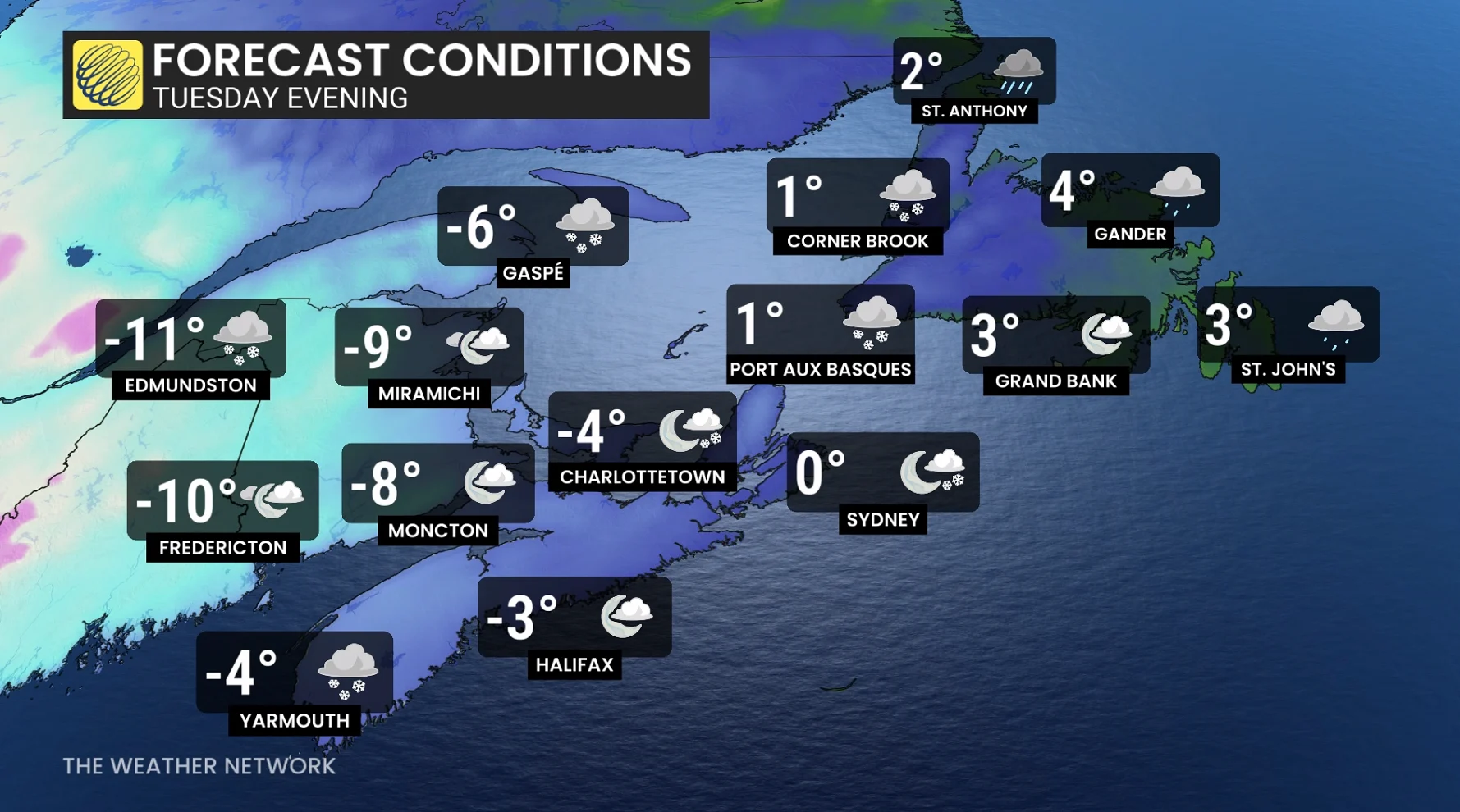
Mild temperatures nose into the Maritimes with mid-single-digit highs, peaking through the overnight hours.
Rain will continue to push off towards the Gulf of St. Lawrence and into Newfoundland into the pre-dawn hours on Tuesday.

SEE ALSO: A winter storm's track can make or break your forecast
Rain will transition to mixing and snow from north to south across the Maritime provinces through the overnight, and into Tuesday morning.
On Tuesday, temperatures will fall through the day across the Maritimes, transitioning any remaining rain to mixing or snow, with sea-enhanced snow squalls developing through the day.

Blustery winds are forecast widespread across the region, with local areas and coastal, exposed communities expected to experience wind gusts of 60-80 km/h.
Rain and snow will spread across Newfoundland through the day.
Beyond, temperatures will remain cold across much of the Maritimes Wednesday and Thursday before another chance of snow spreads across parts of Atlantic Canada for New Year's Day and on Friday.
Shots of cold air is forecast to stick around into early 2026.
Stay with The Weather Network for more information and updates on your weather across Atlantic Canada.