
Missing heat case: Toronto and Ottawa temperature mystery explained

There are numerous reasons why warmth has lacked consistency and commitment across the Greater Toronto Area (GTA) and Ottawa regions over the past several weeks.
After the first nine days of June, those who are craving consistent summer warmth have been disappointed.
If you’ve been wondering why Toronto and Ottawa can’t seem to hold onto any warmth, you’re not alone. While nearby communities have flirted with summer-like warmth, the Greater Toronto Area (GTA) keeps getting left behind in an endless spring loop.
DON'T MISS: Colder than the Arctic Circle: Harsh pattern sweeps most of Canada this week
There are a few main reasons why warmth has lacked consistency and commitment across the GTA over the past several weeks.
Those several factors include the following:
Lake Ontario: Playing it too cool
Literally, the water temperature off the shoreline of the GTA is just 15°C, and that presents a problem with any breeze from the east or southeast that quickly pushes the chillier air inland over the city.
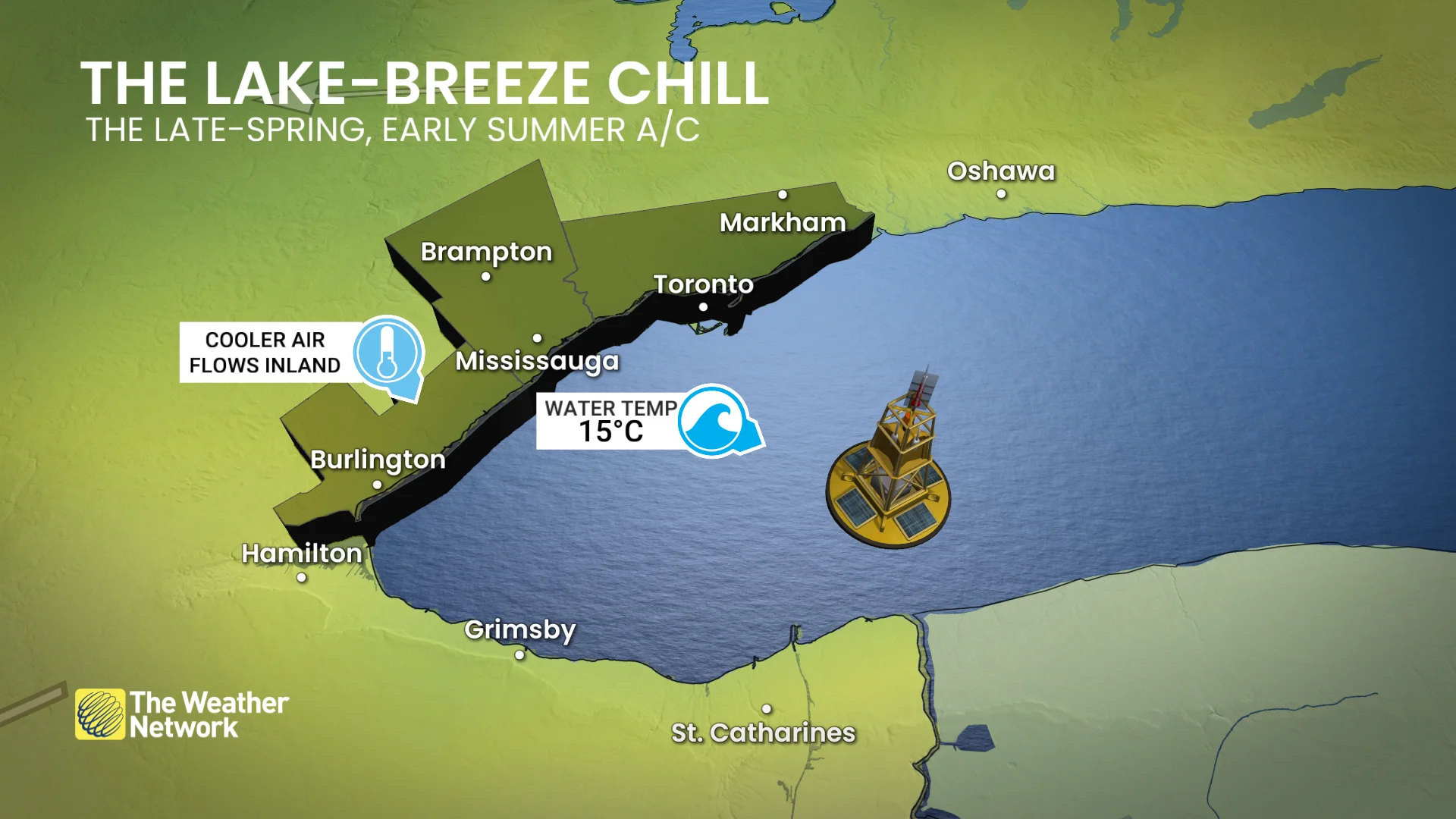
Wind is generally from the west through winter and early spring, but the temperature differences between the water and land create lake breezes by mid-to-late spring.
You can thank Lake Ontario’s slow warm-up, promoting frequent onshore flow (lake-breeze effect).
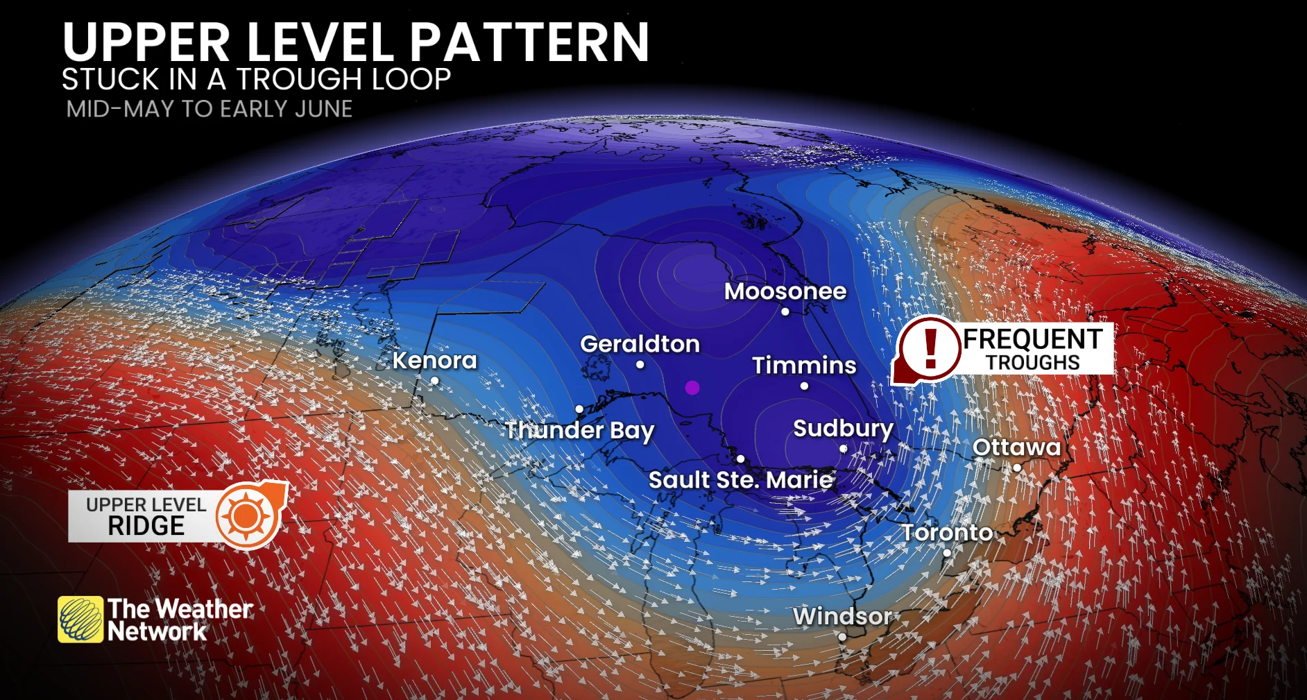
The key: The pattern aloft
Over the past several weeks, the upper-level pattern features a quasi-persistent trough anchored over Ontario, acting like a magnet for unsettled weather. The tendency has been for areas of low pressure to develop on the base of the trough, driving north and ushering in a pesky east wind with clouds and showers
Toronto has recorded rainfall on 60 per cent of days since May 16. The last time the region saw more than two consecutive dry days was a month ago (May 10-12).
Has Ottawa fared any better? Not at all, with close to 60 per cent of days since May 14 recording rainfall, with the bulk of it falling in the second half of May.
Transient ridges have occasionally pushed in, offering brief shots of warmer weather and sun, but they fail to gain a strong foothold.
Ottawa and Toronto have seen just one day above 30°C (June 4). For reference, Ottawa averages about 15 days a year above 30°C, while Toronto’s normal is more 17 days.
Wildfire smoke?
A factor we can’t discount for cooler conditions is the veil of wildfire smoke settling across the province.
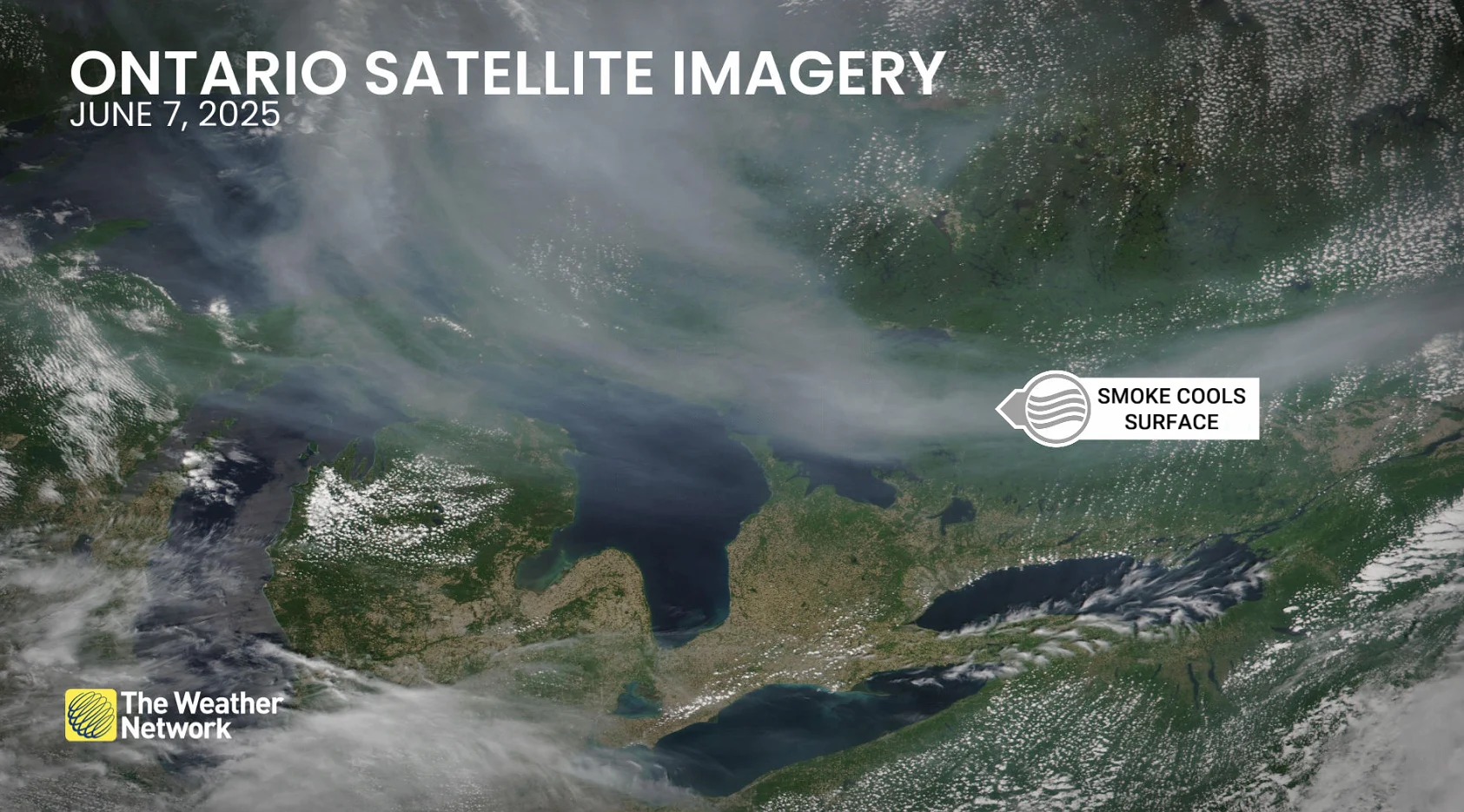
Satellite imagery on June 7, 2025. (NASA)
A thick smoke at the surface can drop the temperature by as much as 3°C or 4°C, reducing incoming solar radiation by as much as 25 per cent.