Monday madness expected across Canada as seasons clash
A classic springtime split will develop across the country to kick off the week
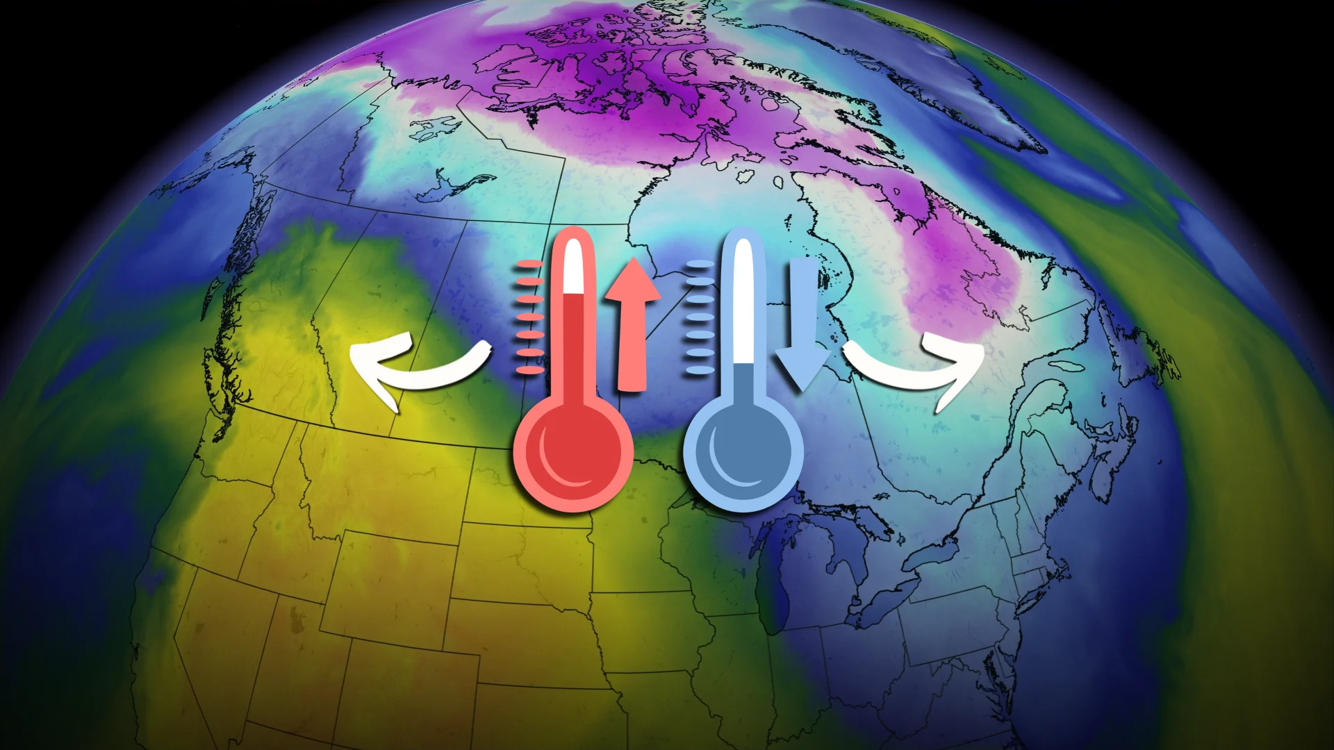
It’s June versus March in the middle of April as a dynamic pattern spreads over Canada to begin the new workweek.
A major divide draped across the country will keep unusually warm air parked in the West while an unseasonable chill dips through the East.
Some communities caught in the middle of the atmospheric tango will trade their short-sleeve shirts for jackets in a hurry.
DON’T MISS: El Niño may split Canada’s summer in two
Dynamic pattern leads to dramatic shifts
Folks in Western and Eastern Canada will remember Monday’s conditions very differently.

A curvy jet stream sliding across the country will feature a big ridge of high pressure over the west while a deep trough digs through the east.
Areas under the influence of ridges tend to see warmer-than-normal conditions, while a trough tends to bring below-seasonal temperatures to communities in its path.

We can expect daytime high temperatures to run more than 5 degrees above seasonal throughout Western Canada on Monday. While it may feel comfortable, remember that we want some gloom across the west to get ahead of the summertime wildfire and drought potential.
Kamloops will see a high temperature of 25°C on Monday, and Vancouver should register close to the 20-degree mark. These highs are more typical of June than what you’d expect in the middle of April.

The warmth will build on the Prairies, as well, with highs in the 20s expected throughout southern Alberta and climbing into the mid-teens in southern portions of Saskatchewan and Manitoba. Don’t get used to it, though, as a sharp cold front will take a huge chomp out of those highs later in the week.
For reference, Canada’s warmest temperature so far this year was a 27.5°C high in Windsor, Ont., back on April 13.
It’s certainly not going to be that warm in Windsor to kick off this week.

RELATED: Eastern Canada may endure a rocky, changeable summer ahead
Conditions will feel positively March-like throughout Ontario, Quebec, and the Maritimes as the trough exerts its influence over the region.
Toronto, Ottawa, Montreal, and Saguenay are all expecting a high of just 3°C on Monday, which is a solid 10 degrees below seasonal for mid-April.
One bit of good news is that a drying trend will afford hard-hit communities in Ontario and Quebec the opportunity to recover from some of the flooding that’s gripped the region in recent days.