Multi-day storm risk with helpful rains targets parts of Atlantic Canada
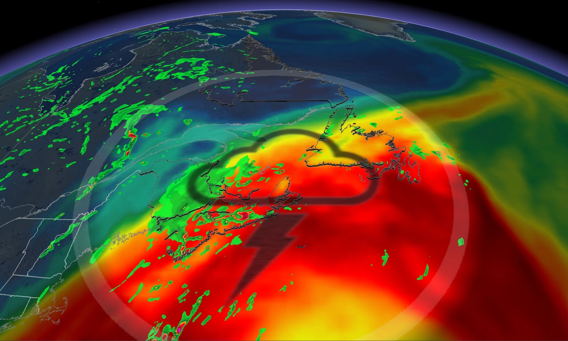
Increased heat and humidity in Atlantic Canada this weekend will raise the risk of thunderstorms, potentially severe in some locales, as multiple systems threaten notable rainfall totals through Monday
While summer is drawing to a close soon, it doesn't mean the warm temperatures associated with the season are finished just yet, especially in Atlantic Canada this weekend.
As B.C. showed earlier this week with record-breaking heat, September is no stranger to the bouts of hot temperatures. While Atlantic Canada won't see that kind of heat, and the region will be warm and humid, and will see some of the wildfire smoke pushing in from the blazes in the West.
SEE ALSO: A look back at the cultural impact of Hurricane Katrina
With the increased heat and humidity comes the raised threat of thunderstorms, potentially severe in some locales, in the Maritimes as multiple systems will bring periods of rainfall through Monday.
It is important to remain weather-aware, so stay up-to-date on all of the latest watches and warnings in your areas as conditions change.
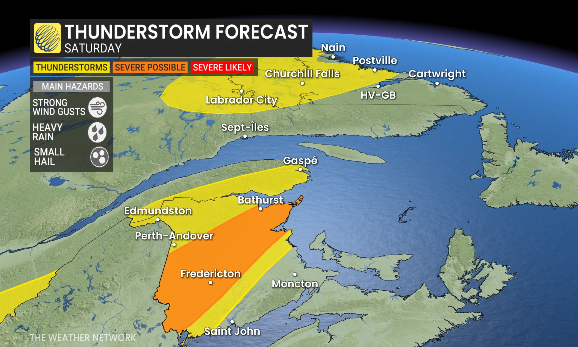
Humidity, heat raises threat for thunderstorms in the Maritimes on Saturday
Heat and humidity will be elevated across Atlantic Canada this weekend, accompanied by hazy conditions from wildfire smoke pushing in from Western Canada on Saturday, as two systems will approach the region.
On Saturday, a low-pressure system alongside a cold front will pull in smoke from Western Canada, likely to lead to some hazy skies across the Maritimes.
Temperatures will be above seasonal and humidex values will be into the low 30s as tropical moisture is being pulled into the region.
A cold front moving in from the west is expected to trigger thunderstorms through the evening hours across New Brunswick. A swath of the province covering the central regions could see severe storms, with a chance of strong wind gusts, small hail and heavy rainfall.
However, storm development could be inhibited by wildfire smoke, so there is some uncertainty in the risk and how strong they could get.
DON'T MISS: Why Hurricane Katrina’s storm surge was uniquely destructive
Nova Scotia and Newfoundland expect to remain on the dry side due to a ridge of high pressure remaining offshore.
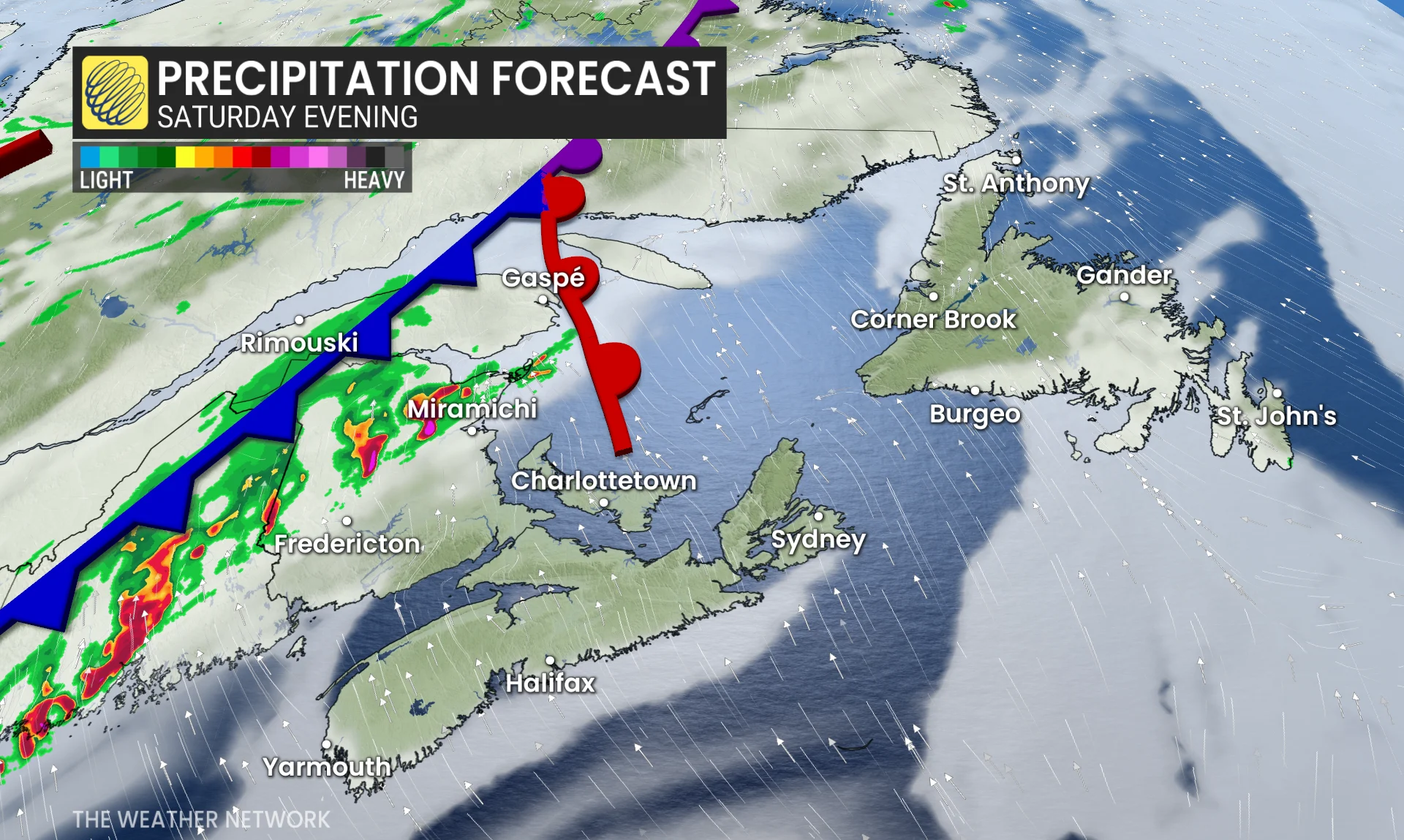
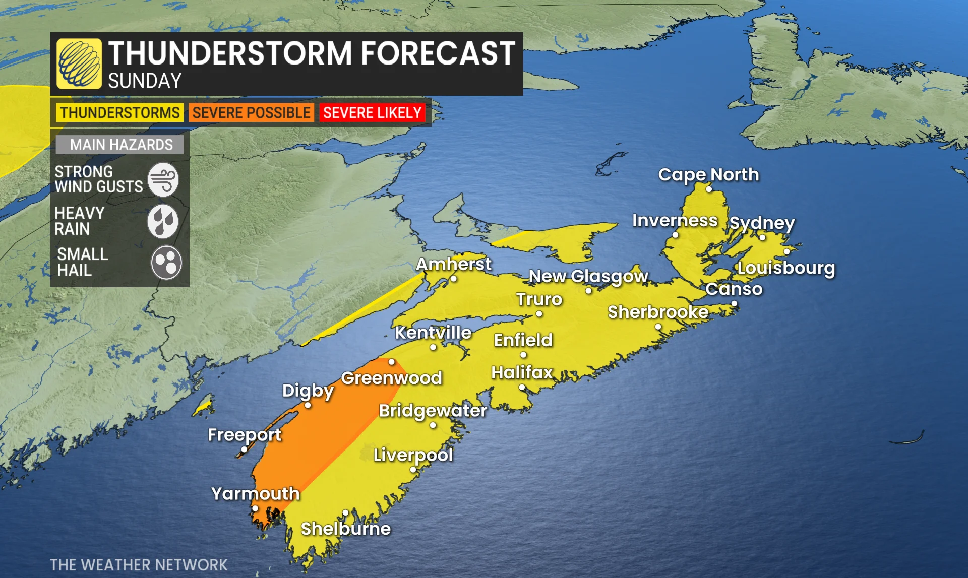
Thunderstorm risk shifts on Sunday, with more rain on the way
Rainfall becomes more widespread on Sunday as a secondary, low-pressure system forms along the boundary that is tapping into more moisture.
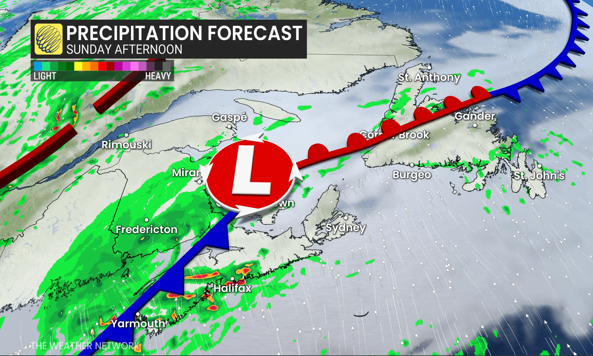
It will bring some beneficial rain to parts of the region, especially to southern Nova Scotia, with localized totals of 20-30 mm, but most of the region will receive much less rain than what is needed.
The threat for thunderstorms shifts south towards Nova Scotia, with the chance of severe storms along the northwestern coast, bringing heavy rain, strong winds and the risk of small hail.
Cooler temperatures are expected with the front, but the humidity will linger in Nova Scotia and Newfoundland.
Rainfall then pushes into Newfoundland Monday before temperatures trend back towards seasonal. Beneficial rain will push in across the Annapolis wildfire zones, though the heaviest totals remain along coastal Nova Scotia.

We will expect to see the rain clear out by Tuesday morning.
However, another system over the Atlantic could bring more rain during the middle of week to Nova Scotia and southern Newfoundland. There is low confidence in the track, but it is a system to watch. Otherwise, a mostly dry week across the rest of the region.
Stay with The Weather Network for more information and updates on your weather across Atlantic Canada.