Multi-day storm threat builds across Ontario and brings severe risks for some
Northern Ontario is set to experience a multi-day storm pattern, with rounds of severe thunderstorms, heavy rainfall, and a slight risk of isolated tornadoes. The storm risk slides south for Wednesday and Thursday
Ontarians should brace for multiple days of active weather beginning Tuesday, with severe thunderstorms and a slight tornado risk taking aim at parts of northern Ontario.
By Wednesday, the storm risk will be much more widespread, with the chance for localized heavy downpours across the southwest. Thursday will be another day to watch closely as the recent high heat and humidity are providing ample storm energy across the province.
MUST SEE: La Niña could return in a quick burst this fall and winter
You'll want to stay updated on the weather alerts in your area as conditions can change quickly when severe weather hits.
Tuesday: Storms target northern Ontario, risk of localized flooding and rotating storms
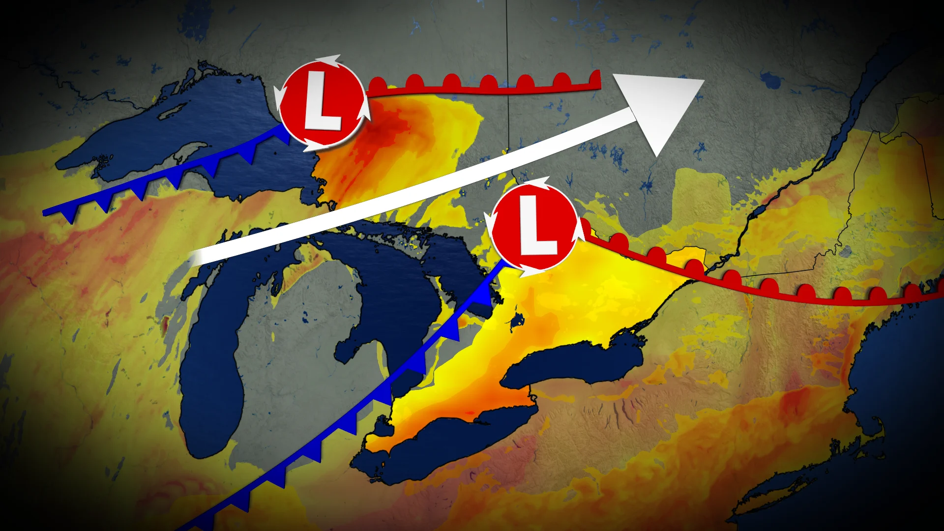
Severe thunderstorms are possible Tuesday afternoon and evening across parts of northern Ontario. An incoming low-pressure system will trigger storms along Lake Superior’s shores, tracking eastward.
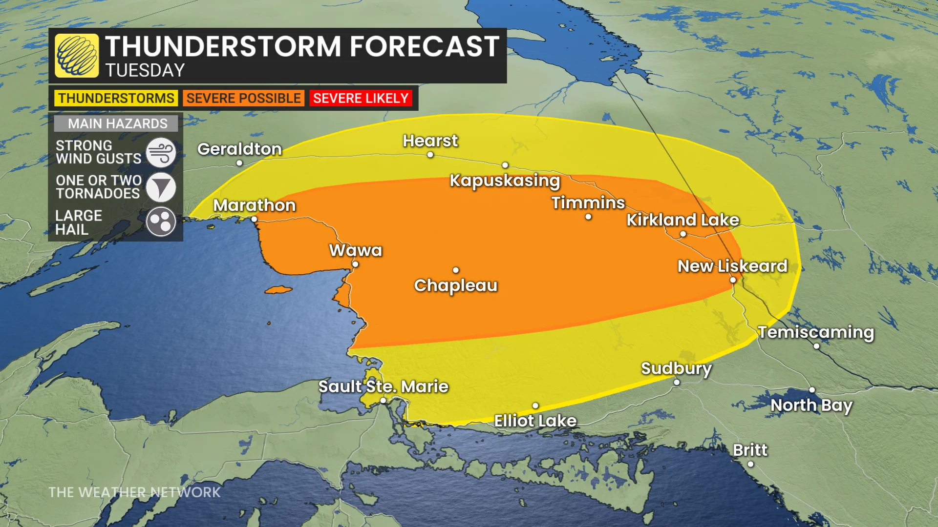
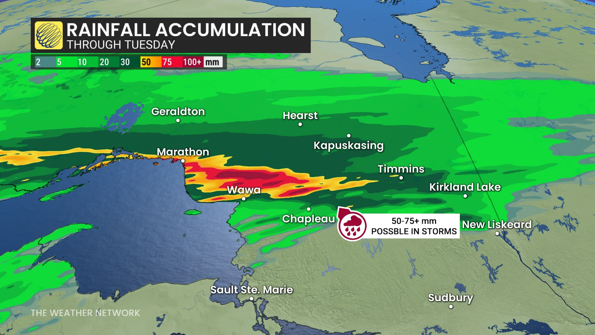
Some areas could see storms forming repeatedly, increasing the risk of heavy rain totals and localized flooding.
Some areas could see between 50-75 mm of rain in just a short period of time.
Large hail and the potential for embedded rotation are also concerns.
Wednesday: More widespread storm risk, with heavy rain chances in the southwest
The active weather boundary shifts south slightly across Ontario on Wednesday, also moving into Quebec.
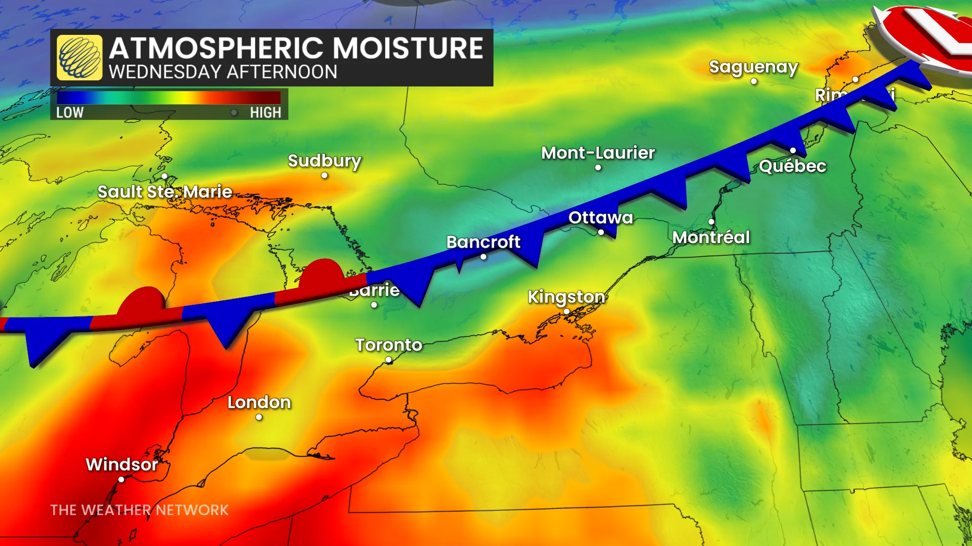
The temperature gradient across the boundary strengthens in northeastern Ontario with a 15°C to 20°C range over a couple hours of driving distance.
Non-severe storms may develop from Sault Ste. Marie to Sudbury, tracking east with. Isolated thunderstorms with heavy rain will be possible in southwestern Ontario--depending on the strength of the lake breezes.

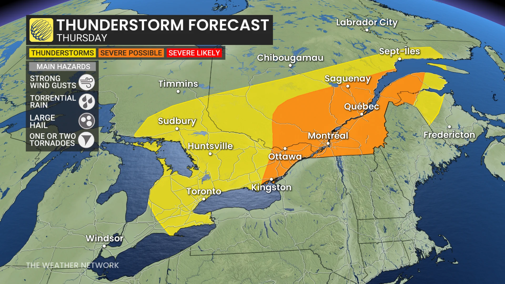
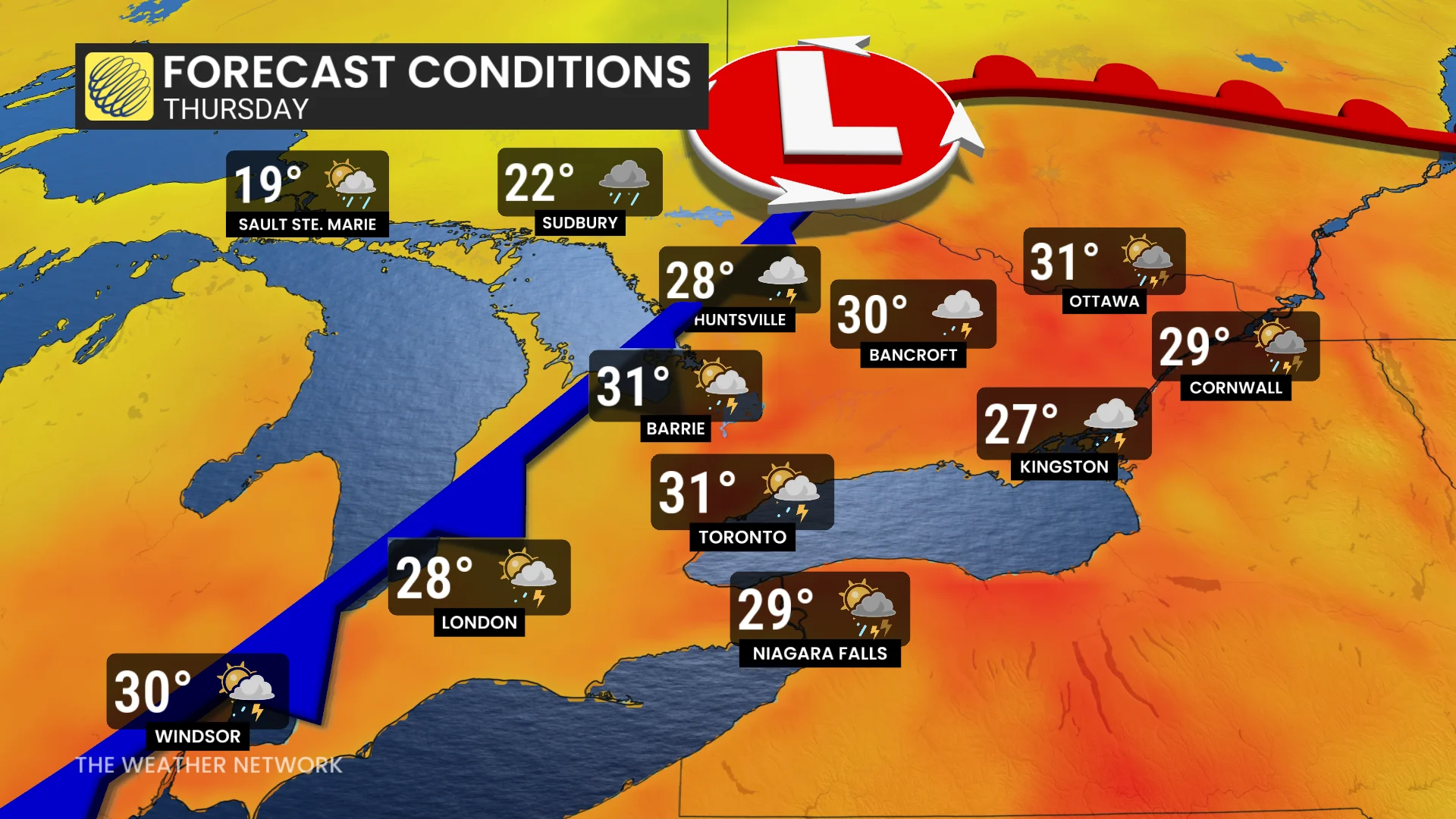
Thursday: Ample thunderstorm energy leads to strong storms, tornado risk
Forecasters are keeping a close eye on Thursday, with a strong cold front expected to bring more severe weather to eastern Ontario and southern Quebec.
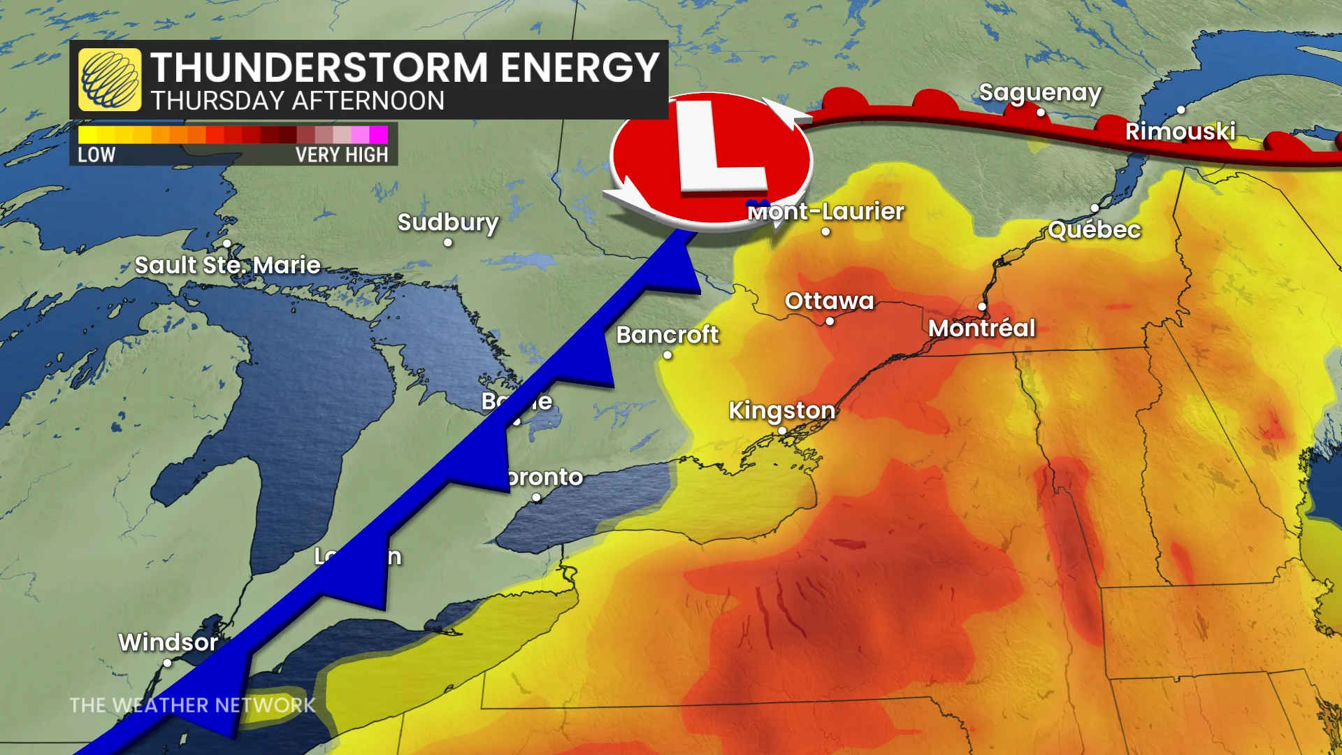
Ample thunderstorm energy, fuelled by several days of 30°C heat and high humidity, could lead to strong thunderstorms.
DON’T MISS: Canada's fire bans and danger ratings explained
The boundary in northern Ontario will start to form an area of low pressure, and will develop a strong and effective cold front. It will track into central and southern Ontario following several days of heat and humidity.
The cold front should move through the Greater Toronto Area (GTA) before peak afternoon energy develops ahead of it.
Thunderstorm energy will be abundant, with ample moisture, and signs of notable shear will result in strong and severe storms.
The Ottawa and St. Lawrence valleys will be concerned with flooding potential, while the developing region for tornado ingredients will likely remain over the Laurentians.
The active weather will be followed by a welcome cooldown, offering relief from the heat.
WATCH: How storm chasers in Canada got into the action-packed job
Stay with The Weather Network for all the latest on conditions across northern Ontario.