Nature may provide southern Ontario with its own fireworks as storm risk rises
Multiple rounds of thunderstorms are on track to move through southern Ontario over the coming days, supplying folks with nature's own fireworks.
As we gear up for the Victoria Day long weekend, folks in southern Ontario may have to endure some stormy weather before it arrives.
Thursday and Friday will see a thunderstorm threat surface, with multiple rounds during the former in southern Ontario. Thursday will see the chance first appear in the afternoon, then rising up again in the overnight period as a stateside system will likely bring storms across the border into southwestern Ontario--possibly within severe limits.
RELATED: Canada's unofficial kickoff to summer won't feel like it for most
Be sure to stay up-to-date on all of the weather alerts and warnings that may be issued in your area.
Beyond, if you have any outdoor plans in southern Ontario this holiday long weekend, you may want to have some backup strategies for the indoors just in case. There is a chance of more rain and scattered thunderstorms at times, but the weekend won't be a washout or a writeoff.
Multi-day storm risk pops up in southern Ontario, chance of severe on Thursday
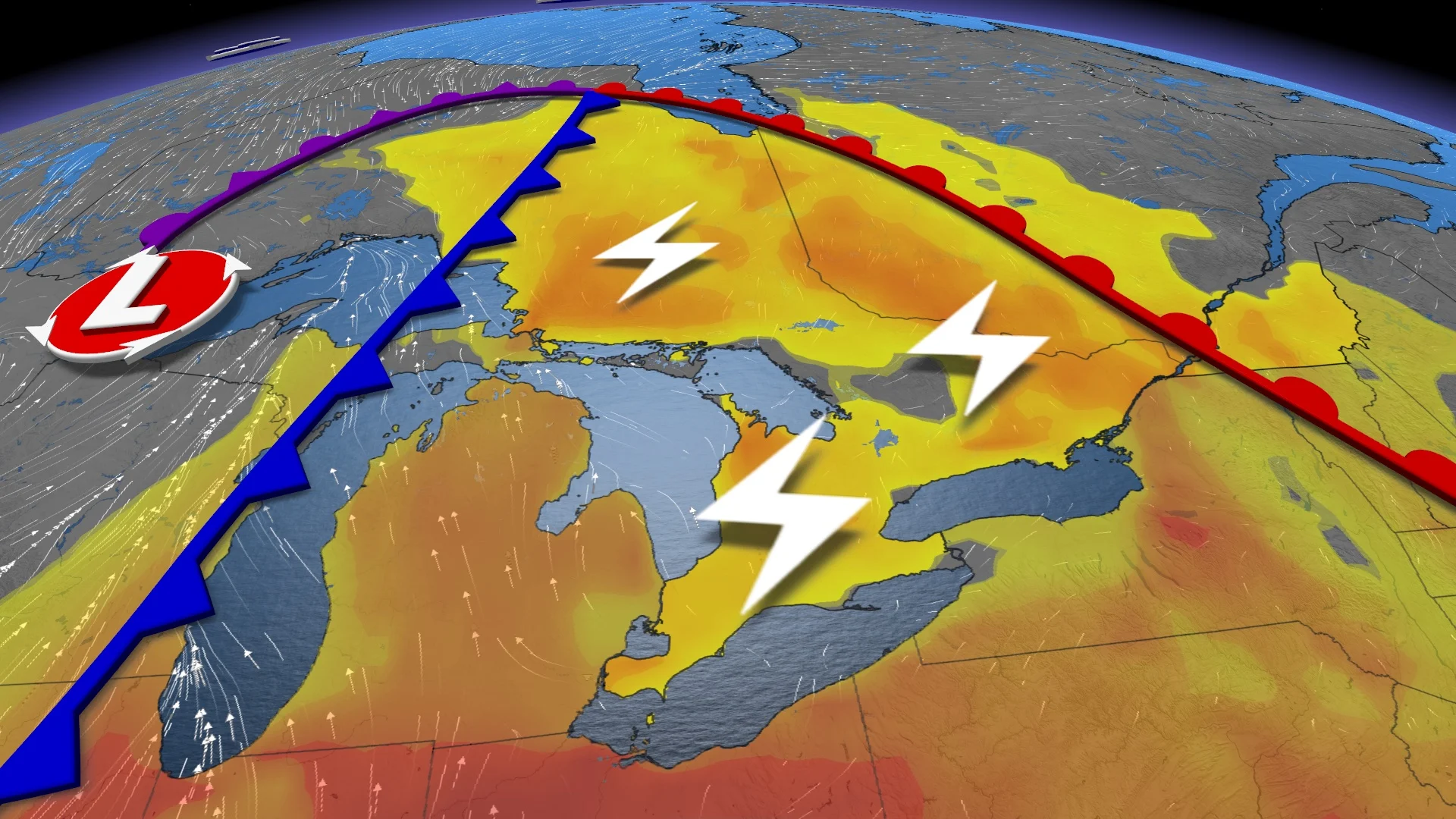
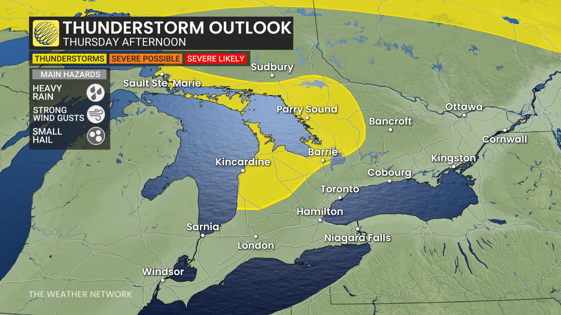
Make sure to stay weather-aware on Thursday. Pop-up thunderstorms will develop near Lake Huron and Georgian Bay Thursday afternoon.
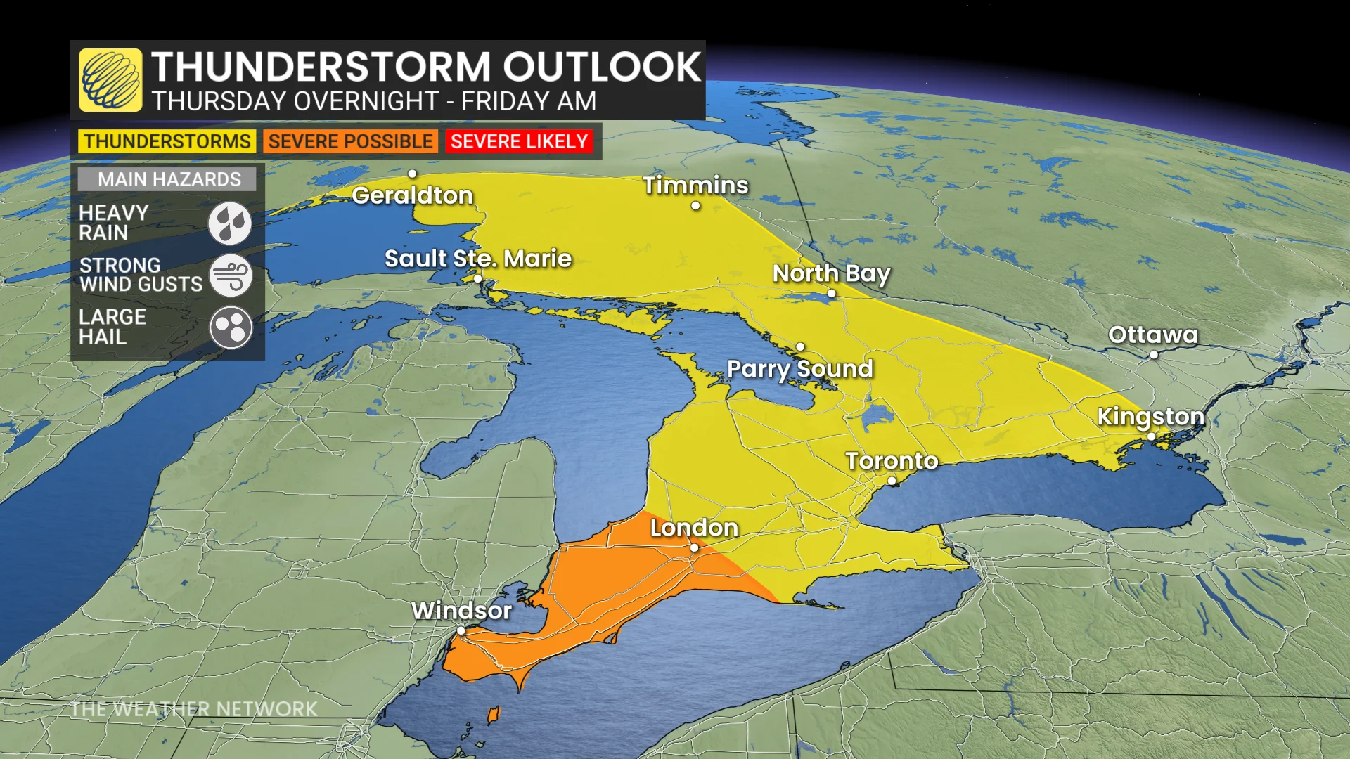
During that time, severe weather is expected to develop in the U.S. Midwest Thursday afternoon along the warm front, which will move into southwestern Ontario late night.
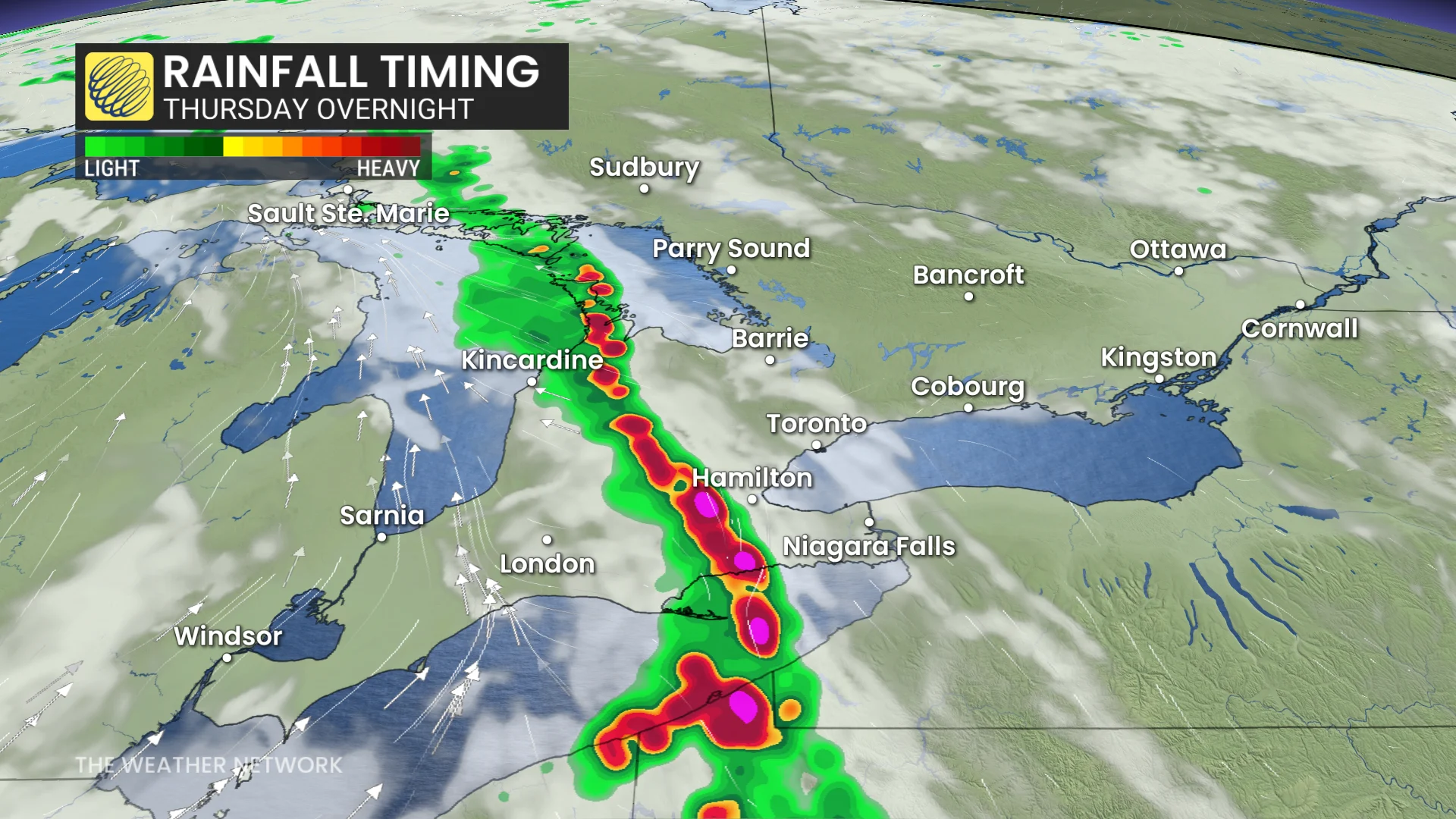
There is the chance for some stronger storms to move into the region, but will quickly weaken overnight as they track towards the Greater Toronto Area (GTA) late overnigh, bringing thunder and lightning, and possibly some large hail.
DON'T MISS: Plant communities in the Arctic are changing along with climate, study finds
The thunderstorms will then ease as they move east of the GTA on Friday morning.
But that won't be the end of the thunderstorm activity.
Thunderstorms will redevelop Friday afternoon for eastern Ontario as they track into Quebec.
Another round of thunderstorms is expected in southern Ontario Friday overnight as the cold front moves in. The timing will be a bit later than Thursday, reducing any severe risk, but having the rain persist later into Saturday morning for southern Ontario.
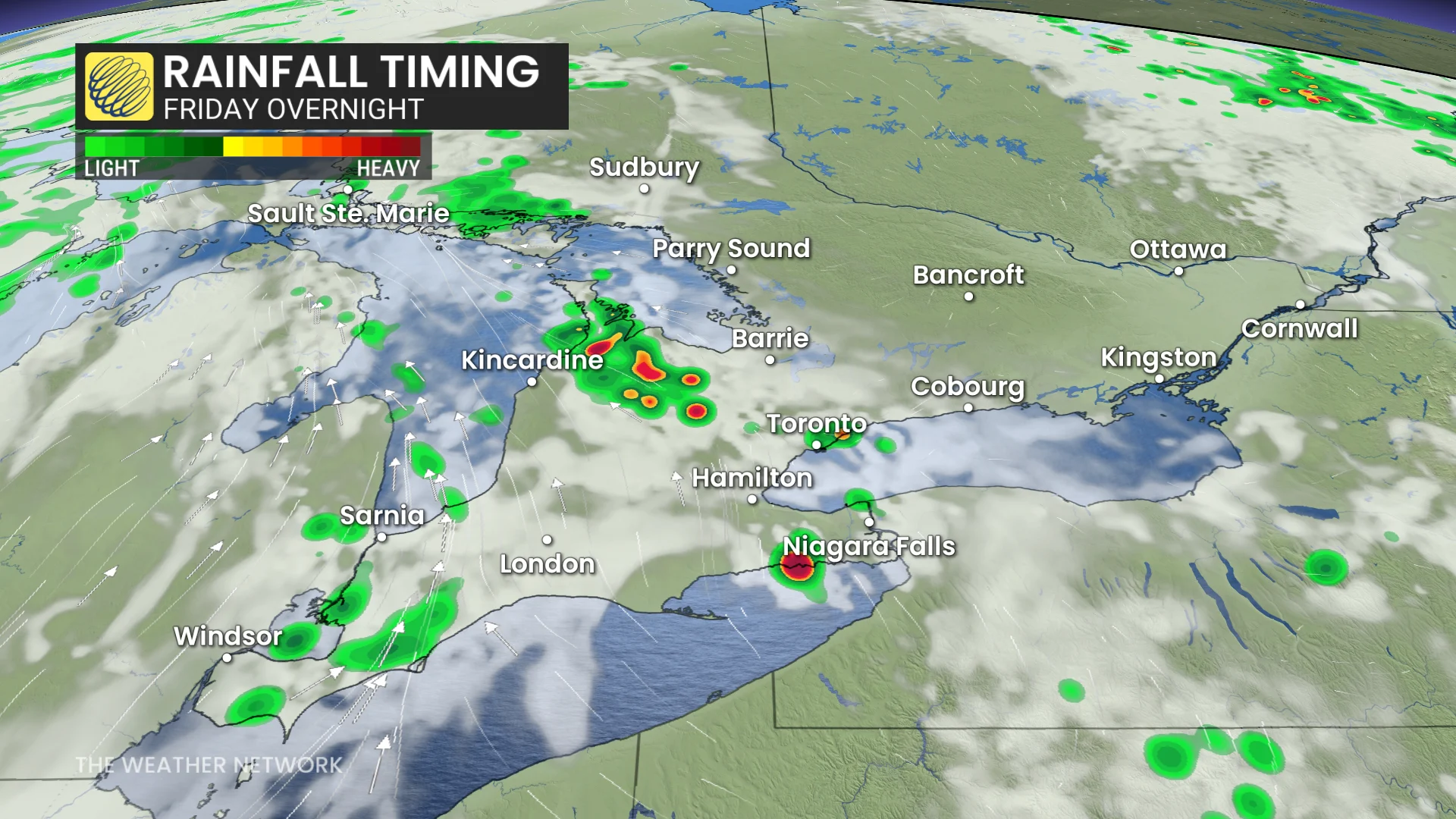
As we begin the long weekend, a few pop-up showers and thunderstorms could linger into Saturday
Another significant low-pressure system could bring widespread rain for the middle of next week.
Temperatures will continue to be changeable, but cooler-than-seasonal temperatures will dominate the rest of next week and continue through the end of May, including a risk for frost, especially for rural areas to the north of the GTA.
WATCH: Late-season snow collides with summer-like heat across Canada
Thumbnail courtesy of Unsplash.
Be sure to check back for the latest weather updates across Ontario.