
Heat event to ramp up in Ontario as storm threat moves around ridge
A heat event will intensify over southern Ontario on Sunday, with soaring temperatures and humidity settling in to start this week
Ontario will swelter in dangerously hot temperatures over the next few days as a widespread heat wave builds over Canada and the U.S.
Heat alerts stretch from Denver and New Orleans to Ottawa as hazardous heat and humidity lock into place heading into the final full week of June.
The thunderstorm risk will move east and north on Sunday, thanks to a heat ridge in place.
DON’T MISS: What is a mesoscale convective system? How an 'MCS' can spell danger
Storm risk shifts north and east on Sunday
A powerful ridge of high pressure developing over the eastern United States will nudge into Ontario through the end of the weekend.
The outer periphery of these heat ridges serve as the ideal environment for the development of thunderstorms, which then ride around the edge of the ridge like trains on railroad tracks.
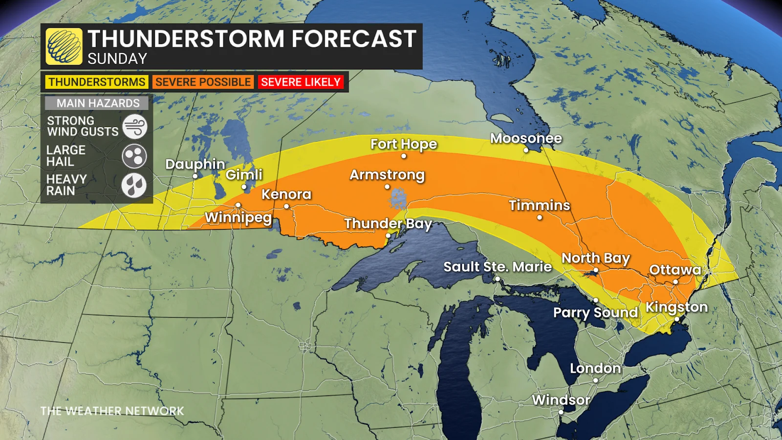
A renewed round of thunderstorms will develop through the day Sunday, with the risk stretching from Winnipeg to Ottawa—including Kenora, Timmins, and North Bay.
Folks in these regions will have to watch for strong wind gusts, large hail, and heavy rain in the strongest storms that develop to end the weekend.
WATCH: Temperature test: Do dark colours really heat up more?
Heat warnings in effect as temperatures soar
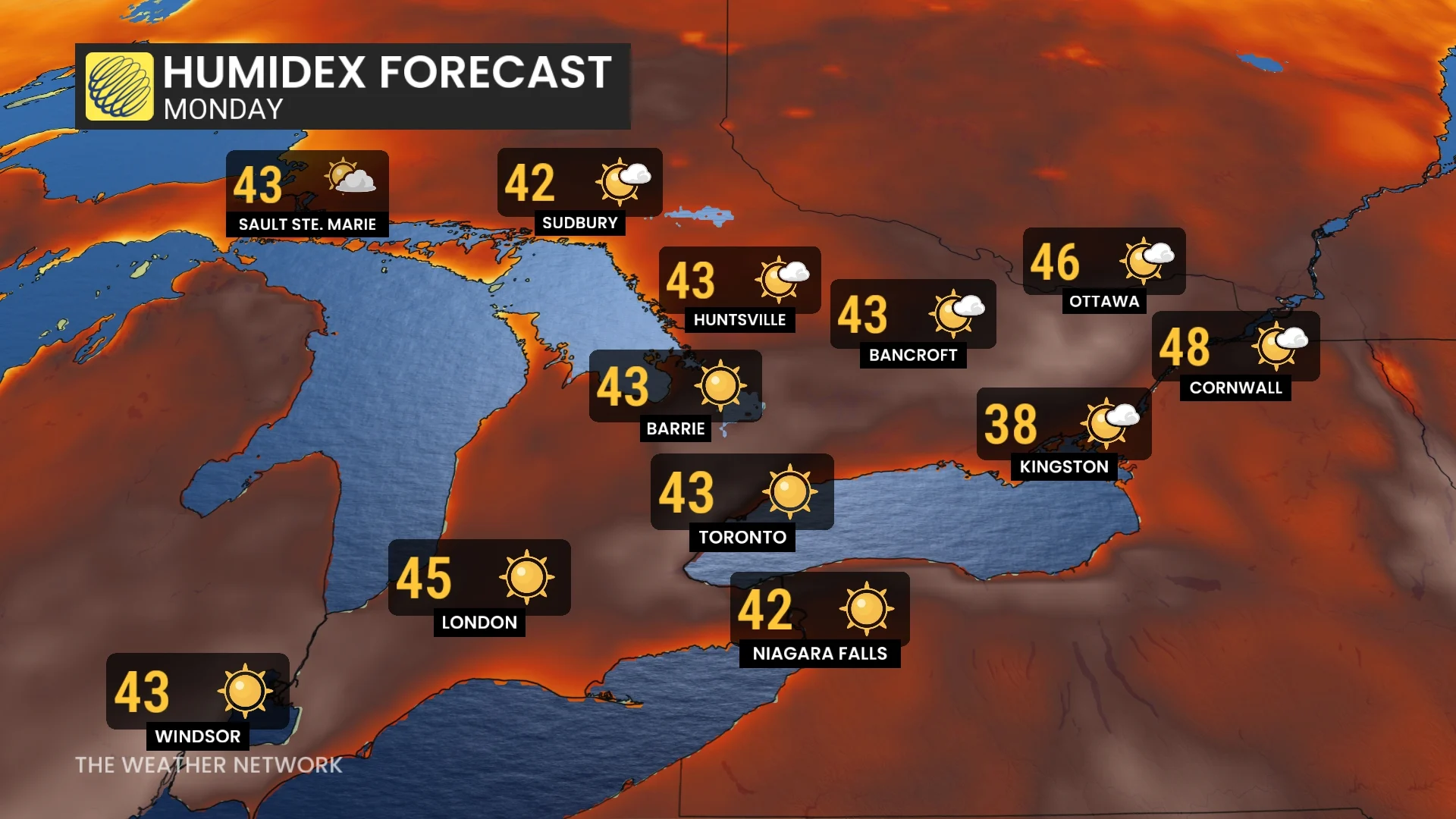
We’ll see temperatures and humidity increase to dangerous levels as the ridge of high pressure intensifies through Sunday and into next week.
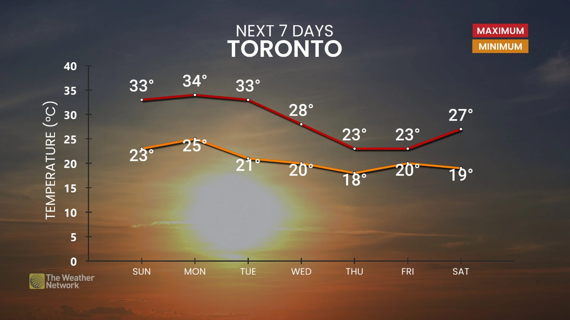
Southern Ontario will endure a multi-day stretch of extreme heat and humidity beginning Sunday, with temperatures climbing into the low- to mid-30s and humidex values rising toward the mid-40s.
Sunday through Tuesday will serve as the focus of the extreme heat and humidity. We’re expecting at least three days of temperatures of 33°C or higher across most of the GTA and southwest—with daytime humidex values into the mid-40s.
Overnight lows will remain in the mid 20s, providing little relief for those living without reliable access to air conditioning.
If Toronto airport reaches a temperature of 35°C, likely on Monday, it would fall in the top-10 warmest June days on record.
If we see three or more consecutive days of 33°C or higher at Pearson airport, it will have been 13 years (since 2012) since we experienced a stretch of heat like this in June.
Record-breaking or not, this is an impressive heat wave that needs to be taken seriously.
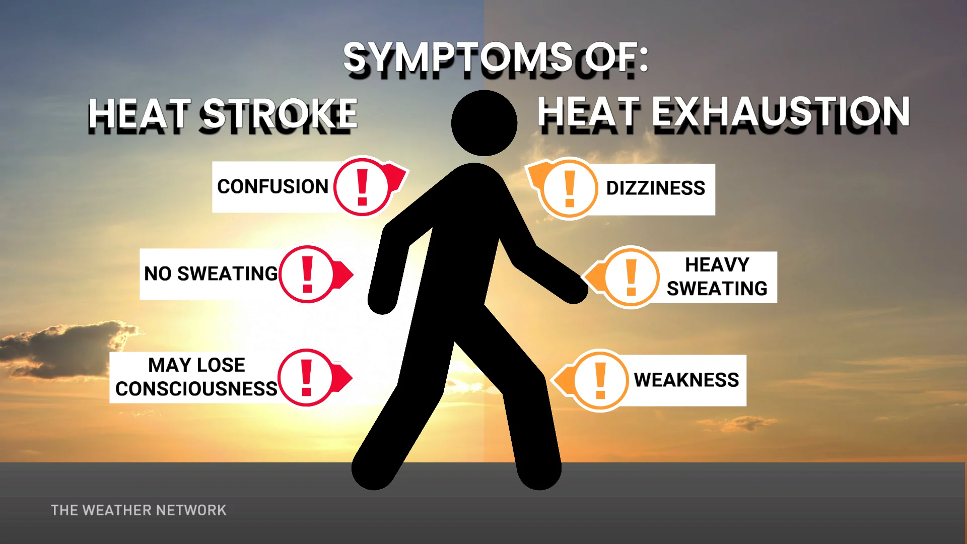
Hot weather safety tips
Drink plenty of water. Avoid caffeine and alcohol, which can be dehydrating.
Avoid direct sunlight, especially during peak hours and when the UV rating is high.
Wear lightweight, loose-fitting clothing.
Use air conditioning when possible. If you do not have access to air conditioning, consider visiting a cooling centre, a shopping centre, or a public library.
Check on elderly relatives and other vulnerable neighbors.
Avoid strenuous activities during the hottest parts of the day.
If you experience symptoms of heat-related illnesses like dizziness, nausea, or confusion, seek medical attention.
Header image courtesy of Raychel Sanner/Unsplash.
Stay with The Weather Network for all the latest on conditions across Ontario.