Nocturnal storms to push across southern Ontario, tornado risk remains
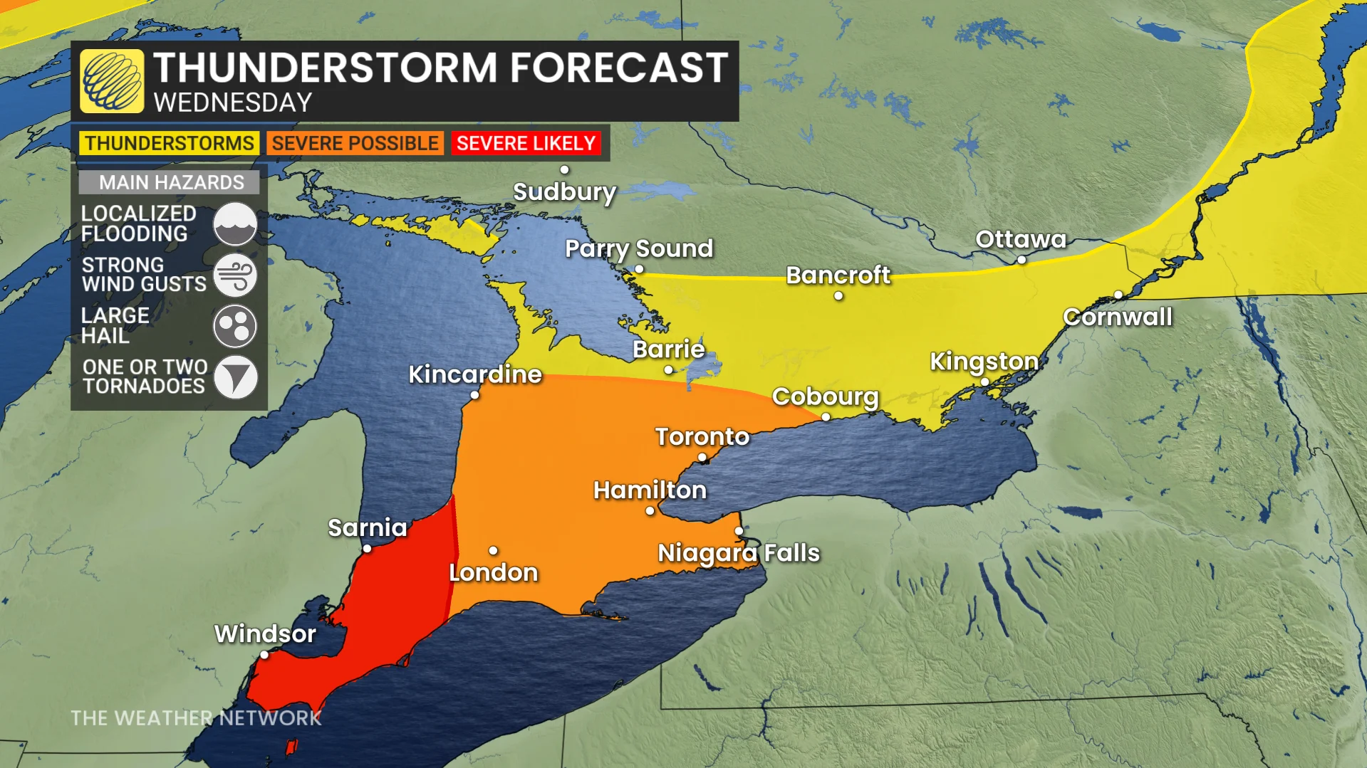
There will be a continued threat for severe weather Wednesday overnight in parts of southern Ontario, with a risk of one or two tornadoes in southwestern areas. Residents are encouraged to stay alert and monitor for updates as the night progresses
After a stormy afternoon in parts of southern Ontario folks will need to brace for the next round, which will continue into the overnight hours on Wednesday.
The primary concerns include strong winds, hail, heavy rainfall, and the possibility of localized flooding. Also, there is a risk of a tornado or two in southwestern Ontario in the overnight hours on Wednesday with the second round of thunderstorms.
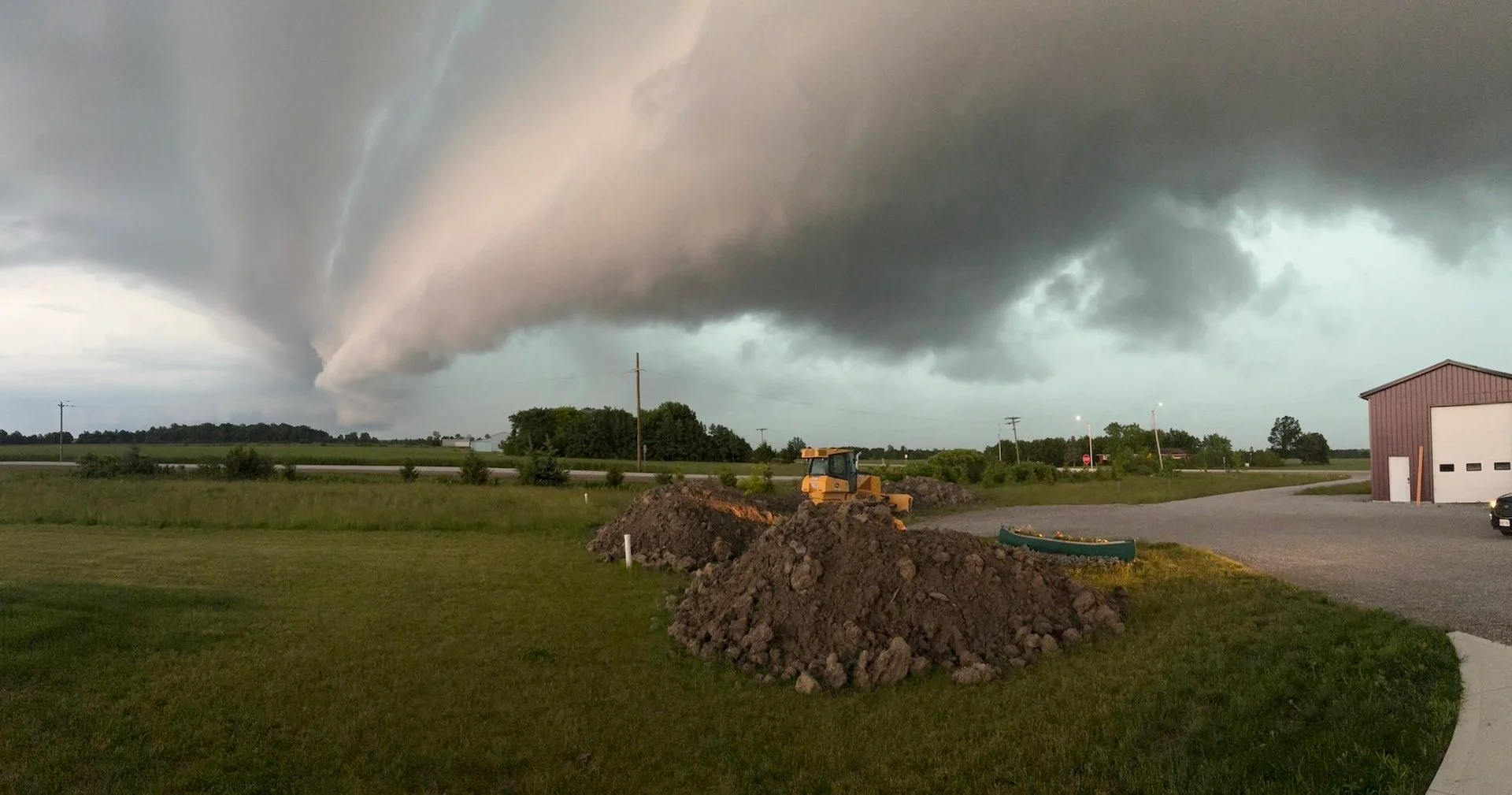
DON'T MISS: PHOTOS: Multiple rounds of severe weather hit parts of southern Ontario
The chance of thunderstorms with more rainfall will pop up again on Thursday in extreme southwestern Ontario, albeit weaker in nature.
Pay close attention to watches and warnings in your area as severe thunderstorms bubble up on Wednesday, and another risk for thunderstorms on Thursday.
Wednesday night: Severe thunderstorm threat continues across southern Ontario
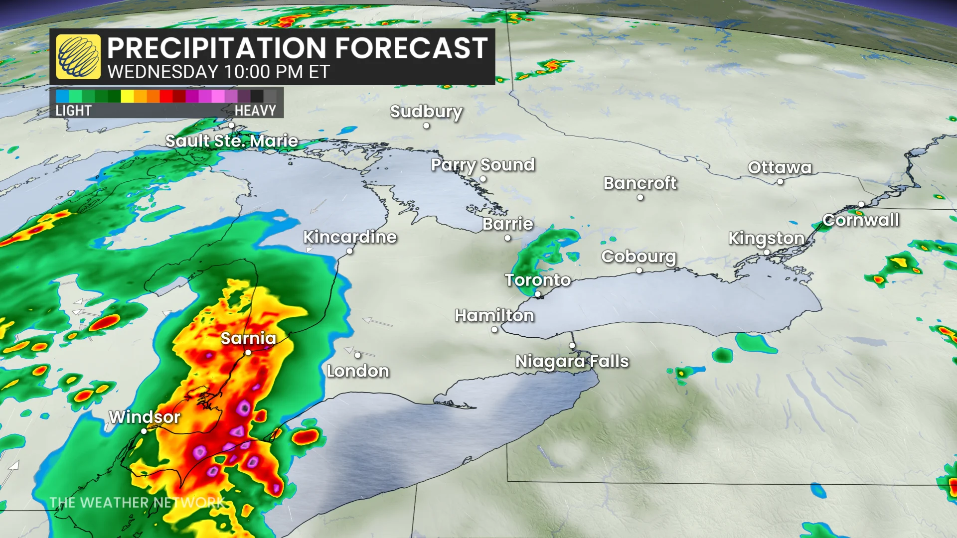
The second round of storms occurred ahead of a cold font that moved into southwestern Ontario late Wednesday night. Its timing was critical to storm strength as the line moved farther into southern Ontario.
Threats include strong wind gusts, heavy rainfall, large hail (up to the size of loonies), and a slight risk of isolated tornadoes.
This cold front is forecast to move towards the GTA Wednesday overnight, bringing the possibility of thunder and lightning, and heavy rain with it.
Did you know? Ontario has had only one tornado confirmation so far this year on May 16, west of Woodstock, Ont.. For reference, in 2024, six tornadoes had already been confirmed by this date. This makes this the slowest tornado start since 2021 in the province.
WATCH: See the rain and wind impacting southern Ontario today
Be weather-aware
Monitor The Weather Network's app or TV channel, and pay attention to local announcements for severe weather warnings and watches.
In case of a tornado warning, identify a safe place in your home where household members and pets will gather during a tornado: a basement, storm cellar or an interior room on the lowest floor with no windows.

In case of frequent lightning, even indoors, you have to take safety precautions in order to prevent receiving an electric shock from a lightning bolt. Below are some helpful tips to keep in mind:
Stay away from windows.
Unplug appliances.
Do not use a landline telephone.
Avoid running tap water.
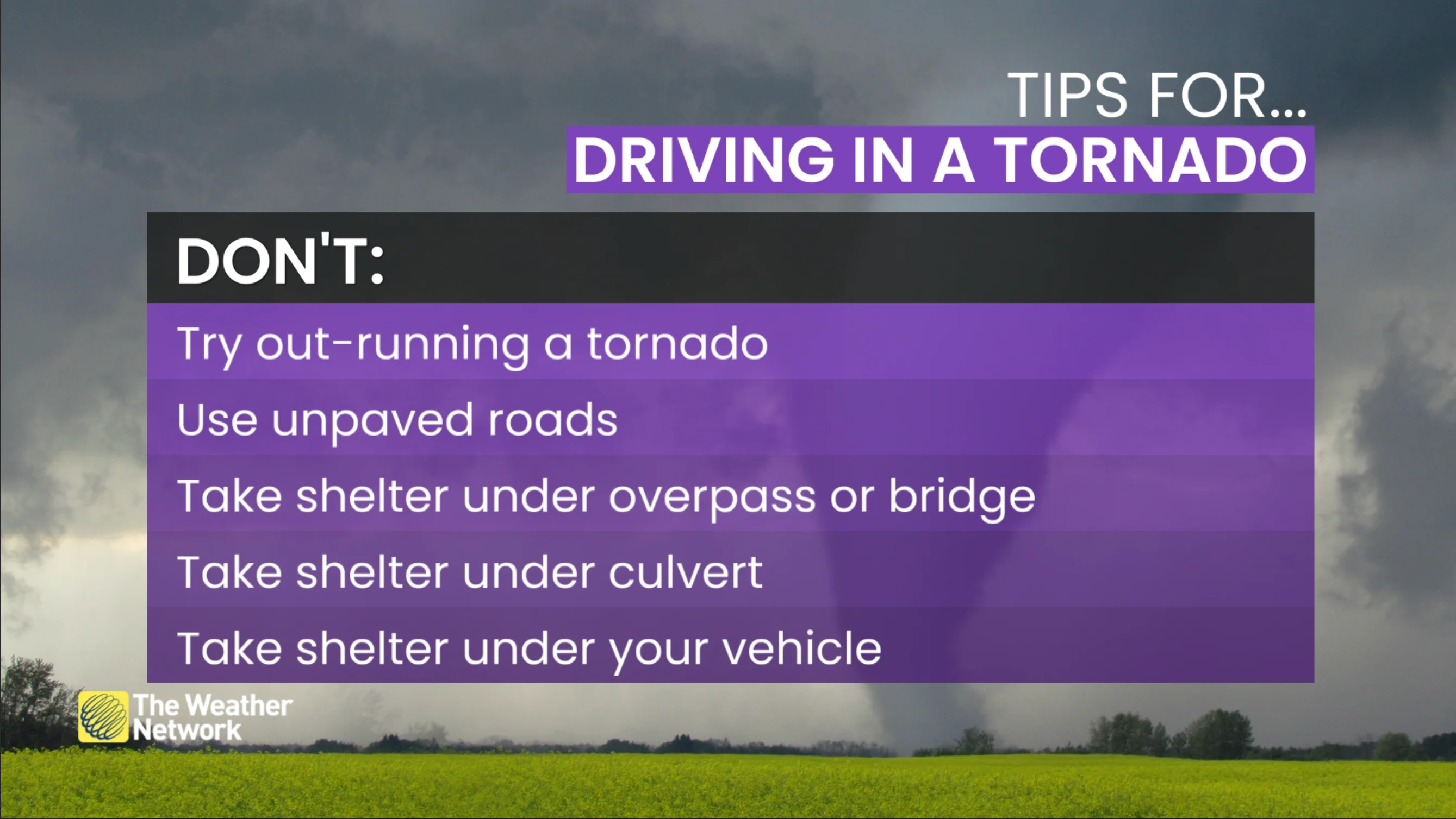
Additionally, flash flooding can happen in a matter of minutes during, or shortly after, a major rain event. Do not attempt to drive through floodwaters as you as it only takes a small amount of moving water to sweep a vehicle away.

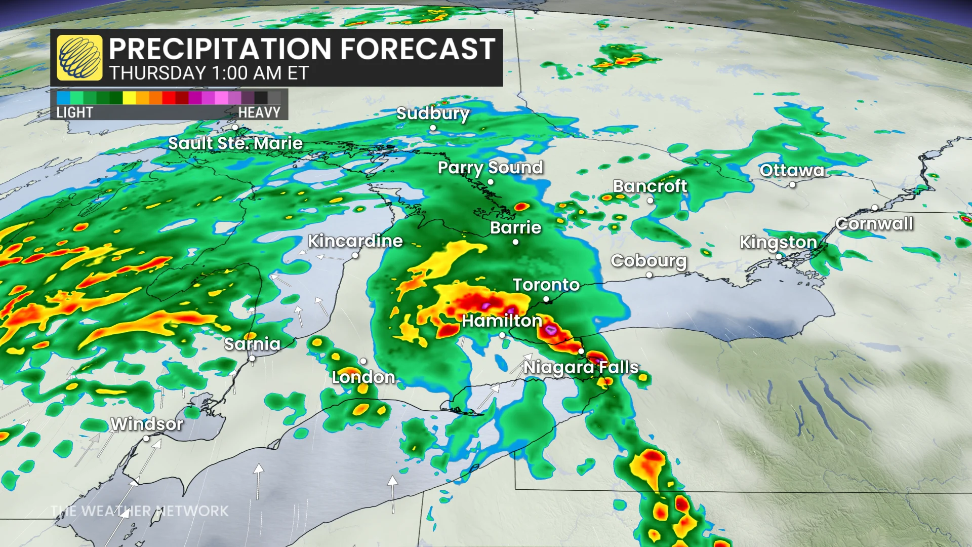
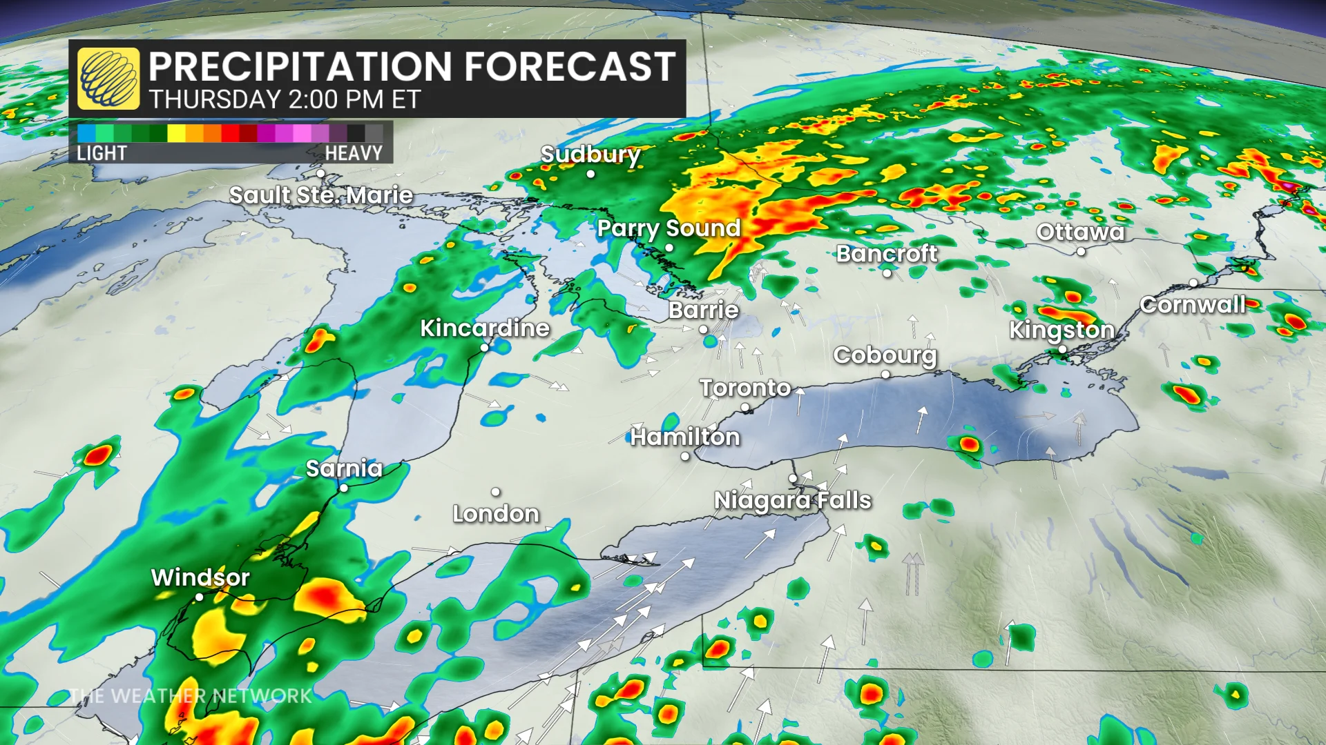
Thursday: Rain lingers, with thunderstorm risk confined to southwestern Ontario
Thursday will be unsettled once again for some areas.
Rainfall will continue through the day in central Ontario, Grey Bruce and surrounding areas.
There is also the chance for a thunderstorm or two in extreme southwestern Ontario in the late-afternoon hours on Thursday, but should remain non-severe in nature.
Thumbnail courtesy of [Todd/X/@todd2428/(https://x.com/todd2428/status/1935498114141389122)], taken in Essex, Ont.