November fever: Northern warmth defies the typical Arctic chill

This month has seen the Far North running a fever, and continuing the extraordinary warmth that followed a record-breaking October. Get the details on what’s driving this rare November warmth.
As the sun barely peeks above the horizon across Nunavut, the classic Canadian Arctic air has been a no-show.
This November, the Far North is running a fever and continuing the extraordinary warmth that followed a record-breaking October, when Cambridge Bay logged its warmest October in recorded history.
SEE ALSO: What happens if the mega-earthquake hits California tomorrow?
Both Cambridge Bay and Baker Lake have been basking in temperatures well above normal, and as much as 8°C above average so far this November.
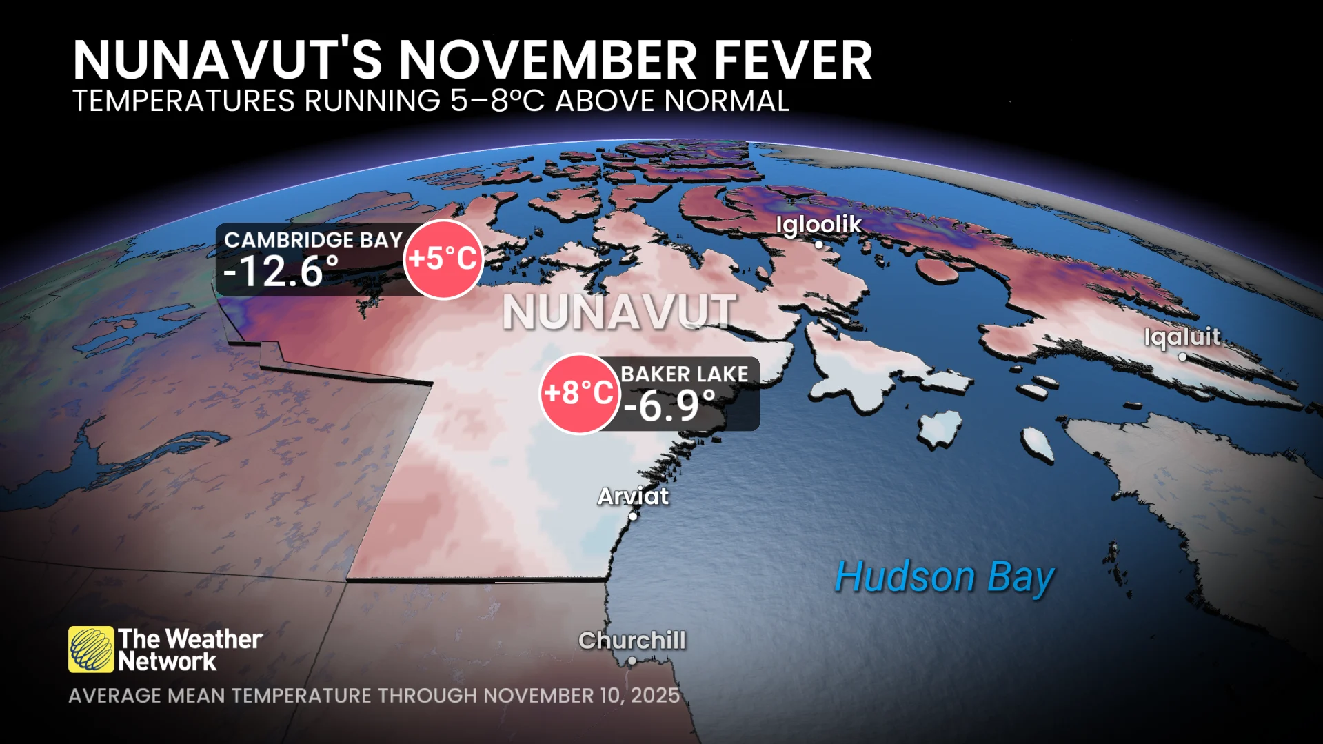
Cambridge Bay: Mean temperature −12.6°C (+5°C above normal)
Baker Lake: Mean temperature −6.9°C (+8°C above normal)
November 2025 could likely challenge or surpass the warmest ever recorded for this part of the world. The warmest, historical benchmarks include Cambridge Bay (−15.2°C, 2024) and Baker Lake (−11.8°C, 1998).

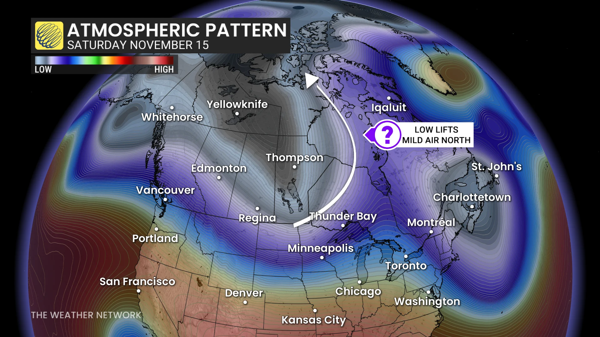
Pattern behind the warmth
At the heart of the warm air intrusion lies a stubborn, atmospheric setup that’s been pumping mild, Pacific-sourced air deep into Northern Canada. Strong lows near Labrador are also flushing milder air into the region.
It’s this pattern that has opened a direct pipeline of warmer air that extends from the lower latitudes into the upper Arctic.
A rare and widespread heat anomaly
A 10°C temperature anomaly is significant for a day, but stretching that out 10 days is an exceptional feat.
The warmth also isn’t discriminating, with a warm anomaly enveloping the entire two million-square-kilometre territory.
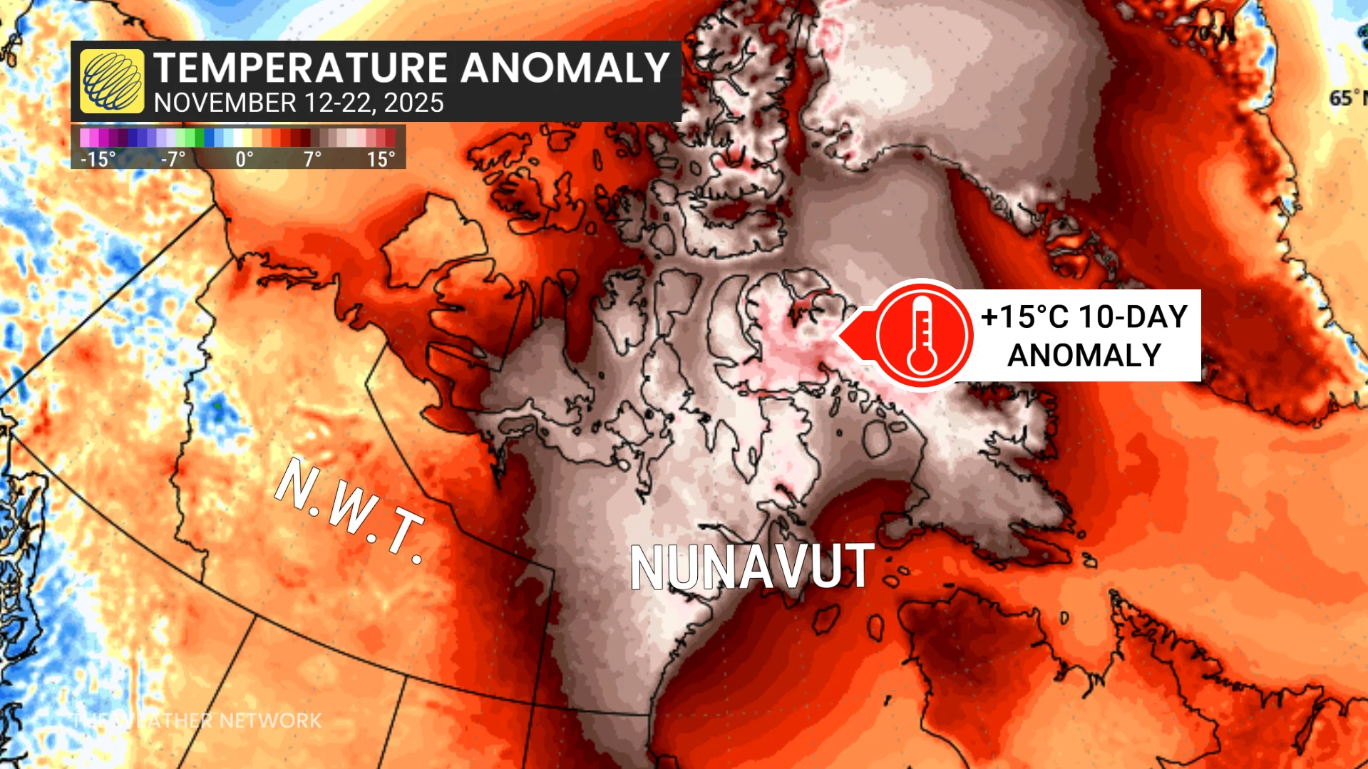
The most extreme departures are focused on eastern Nunavut and Baffin Island, where anomalies peak near +15°C over the next 10 days.
That kind of persistent warmth will significantly delay the freeze-up of Hudson Bay, which typically chills in late November into early December. At this rate, the bay may not fully freeze until early 2026.
Defying the Arctic playbook
This is normally the time of year when highs plunge into the -20s, but as you can see, this month’s forecast tells a vastly different story:
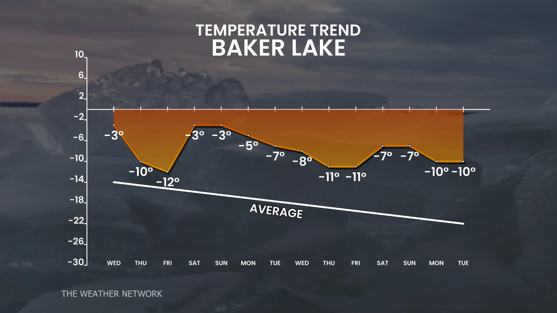
This is the type of temperature outlook that keeps average monthly mean temperatures from dropping and following the typical seasonal slope.
The upcoming pattern keeps the average monthly mean from following its usual downward slope, as seen in the local temperature trends for Baker Lake and Cambridge Bay, where readings remain stubbornly above the seasonal line:

For the next couple of weeks, Nunavut remains under the influence of exceptionally mild air and a continued southerly flow. Daytime highs will hover closer to −5°C than the typical −20°C, meaning the territory is on track for one of the warmest Novembers ever observed in Canada’s Arctic.