Toronto records its hottest temperature in nine years amid heat wave
The extreme heat has already seen some Ontario cities beat their all-time heat records, with soaring temperatures and humidity continuing into the week. Take action to protect yourself and others, as extreme heat can affect everyone’s health
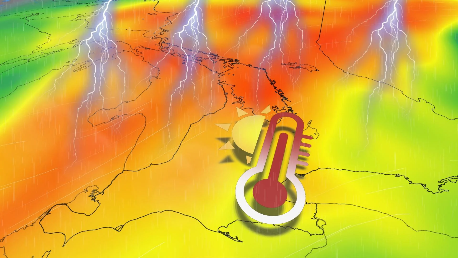
Southern Ontario has been enduring a multi-day stretch of extreme heat and humidity, which began on Sunday, with temperatures climbing into the low- to mid-30s and humidex values rising toward the mid-40s.
In fact, heat alerts stretch from Denver, Colo., and New Orleans, La., to Ottawa, Ont., as hazardous heat and humidity lock into place heading into the final full week of June. Heat warnings were also expanded to include parts of northern and eastern Ontario.
Ontario can expect to see a similar level of high temperatures and humidex numbers, with heat warnings still in effect through Tuesday.
DON’T MISS: What is a mesoscale convective system? How an 'MCS' can spell danger
On Monday, Toronto recorded its hottest temperature (36°C) since July 13, 2016, when we last saw that reading at the airport.
Cities break heat records, with more to come
We’ve already seen temperatures and humidity increase to dangerously high levels as the ridge of high pressure intensified Sunday.
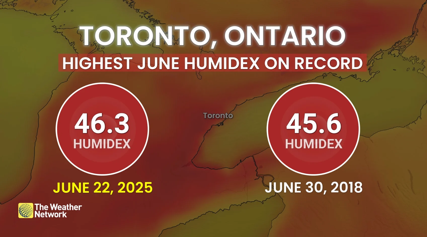
At its highest, Toronto broke its record humidity for June, jumping to 46.3, 0.7 points higher than its former all-time peak on June 30th, 2018.
Toronto also recorded its hottest temperature in nine years, with the airport registering a 36-degree reading on Monday.
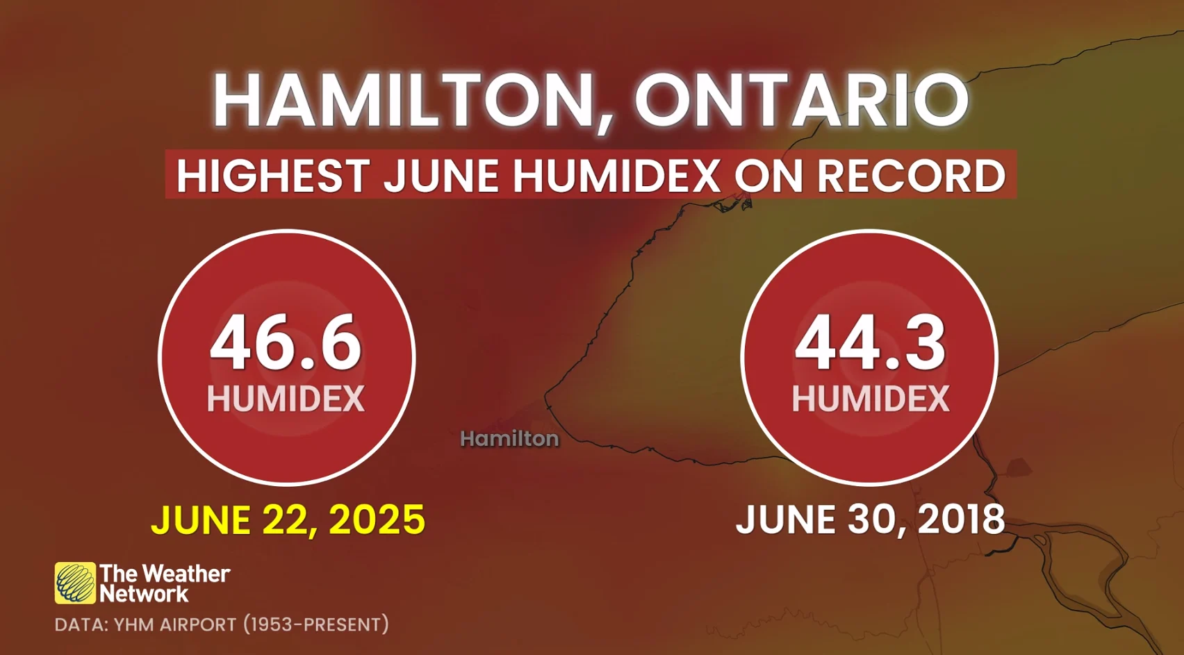
It was the same with Hamilton, which saw the humidex jump by 2.3 points higher than its peak from June of 2018, reaching 46.6. Downtown Hamilton was also the country's hotspot on Sunday, with air temperatures reaching 35.3°C.
SEE ALSO: Don't overlook your eyes when protecting yourself from the sun
Toronto and Hamilton weren’t the only ones heating up; Burlington had a high of 34°C with a humidex of 44. Sarnia was sitting at 33.9°C, feeling like 46, and Peterborough had the biggest gap, with temperatures reaching 31.7°C but feeling like 45.
This level of heat is only going to continue into Monday, with a focus on the extreme heat and humidity, while heat warnings are spread across a wide swath of Ontario.
WATCH: Multi-day extreme heat event has residents seeking relief
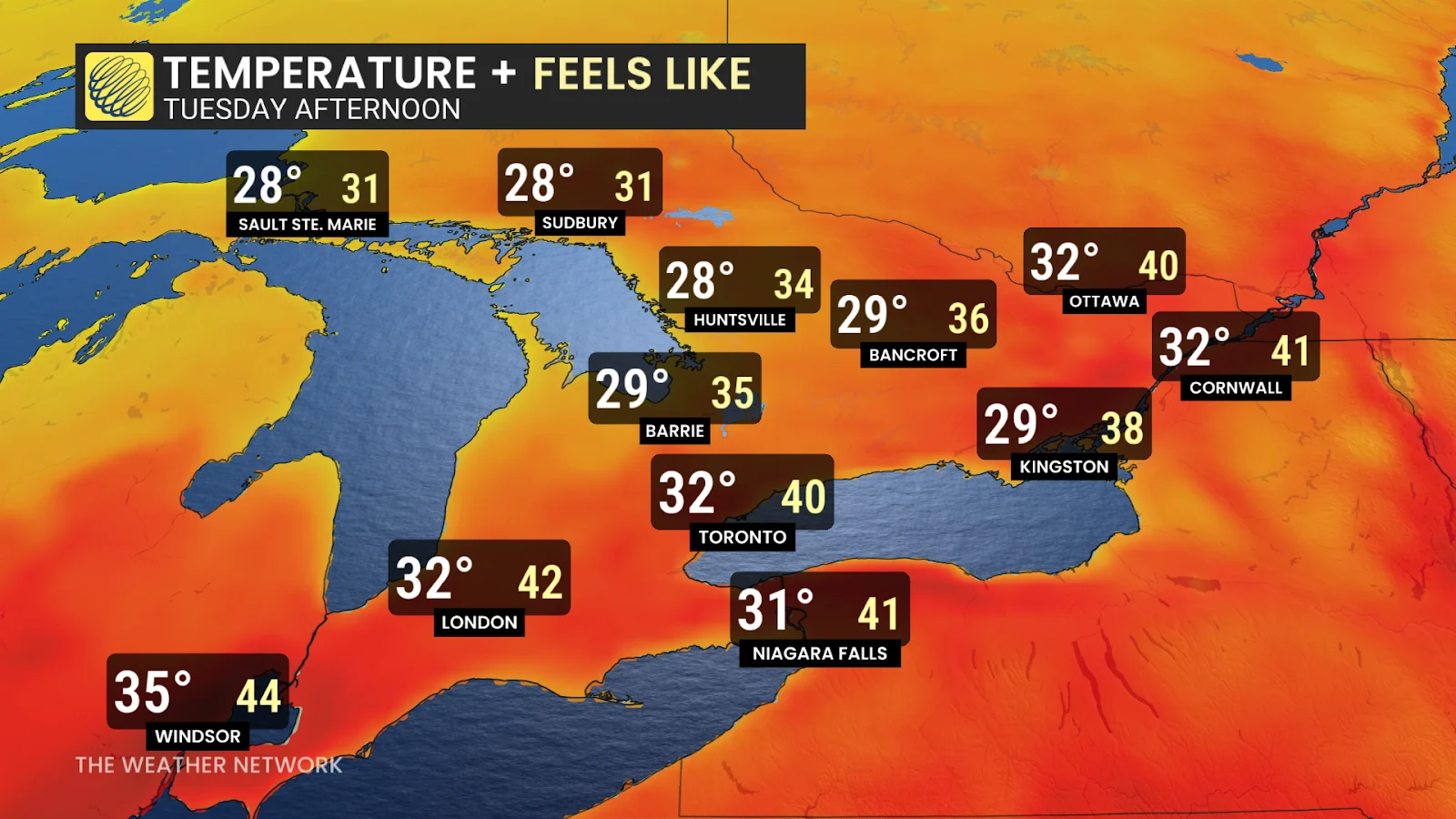
We’re expecting at least three days of temperatures of 32°C or higher across most of the GTA and southwest—with daytime humidex values continuing in the mid-40s.
Overnight lows will remain in the mid-20s, providing little relief for those living without reliable access to air conditioning.
Tuesday will be the "colder" day of this multi-day heat event, although temperatures will still be sitting in the low 30s and feeling closer to the 40s.
Record-breaking or not, this is an impressive heat wave that needs to be taken seriously.
The extreme heat should begin to break on Wednesday, with air temperatures settling back to seasonal levels. The humidex, however, will still make the air feel like it feel like the low to mid-30s.
Hot weather safety tips
Drink plenty of water. Avoid caffeine and alcohol, which can be dehydrating.
Avoid direct sunlight, especially during peak hours and when the UV rating is high.
Wear lightweight, loose-fitting clothing.
Use air conditioning when possible. If you do not have access to air conditioning, consider visiting a cooling centre, a shopping centre, or a public library.
Check on elderly relatives and other vulnerable neighbors.
Avoid strenuous activities during the hottest parts of the day.
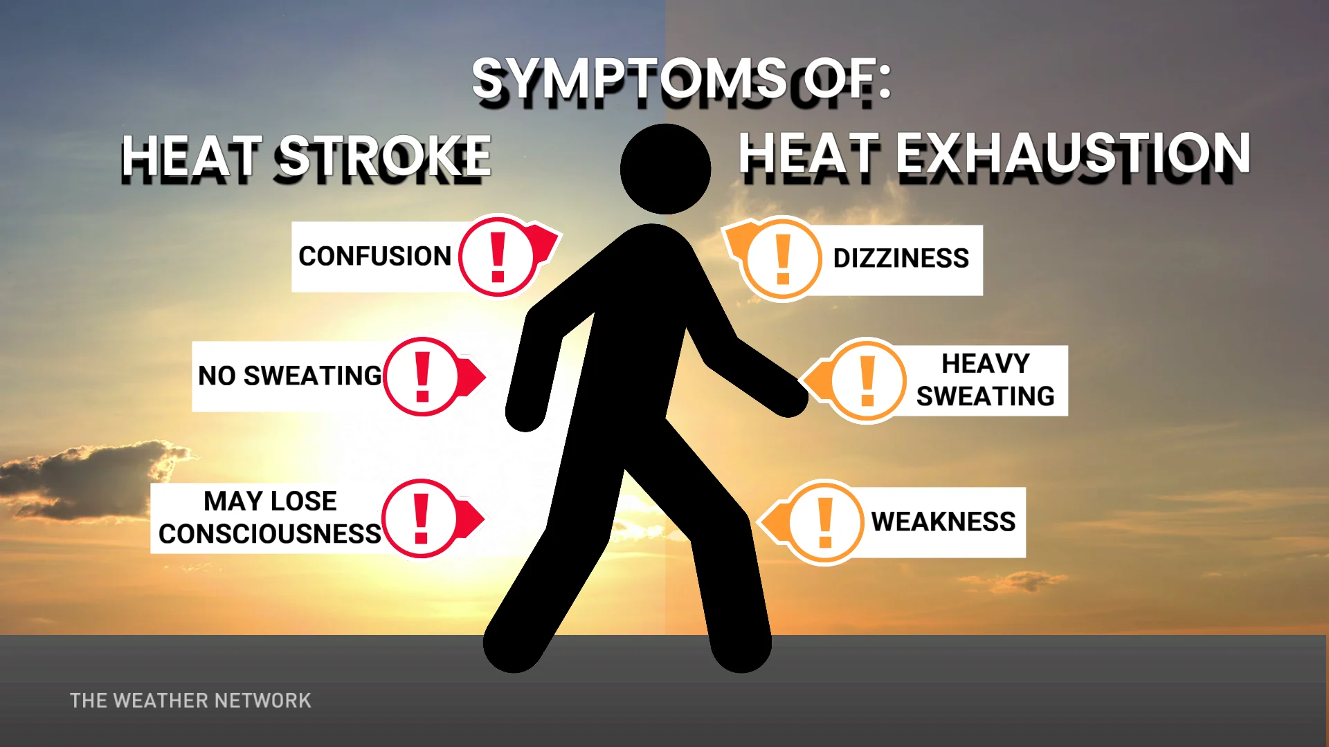
If you experience symptoms of heat-related illnesses like dizziness, nausea, or confusion, seek medical attention.
Stay with The Weather Network for all the latest on conditions across Ontario.