Spring shows its colours in southern Ontario with storm risk, then cooldown
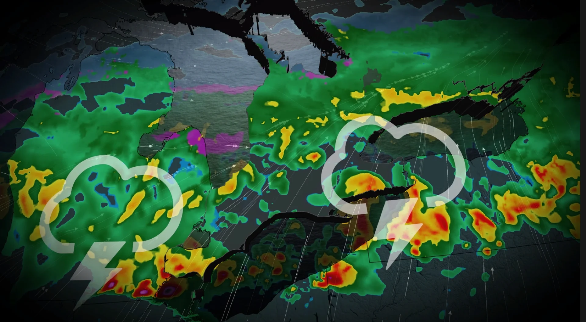
Get ready for a potentially turbulent Thursday evening in southern Ontario, with widespread rain and a risk of thunderstorms, which could reach severe limits in in southwestern regions. Friday will see a dramatic plunge in temperatures after the cold front swings through
You know spring is well underway once the threat of thunderstorms starts to pop up in southern Ontario, with even a severe risk for some.
Thursday will bring that threat for parts of the region as milder air ahead of a cold front will create that showers and risk of thunderstorms. Southwestern areas could even see severe storms fire up.
DON'T MISS: Blazing hot: 1,000+ records fall in brutal March heat wave
Don't get used to the warmth, though, as the cold front will leave behind a significant temperature drop for Friday.
Warmth and thunderstorm risk in southern Ontario
The cross-Canada clipper will ride north of the second round of the heat dome over the central U.S.
It will be a win-win for people in southern Ontario, but the warmth won’t have enough time to spread over all of southern Ontario

While temperatures in northern Ohio may climb into the mid-20s, Lake Erie’s cooling effect will prevent similar warmth over Ontario.
Windsor could be the only location in the province to reach 20°C on Thursday afternoon.
A cold front linked to the clipper system will sweep across southern Ontario from Thursday evening into the overnight hours.
SEE ALSO: Storm cleanup: Some Sudbury school bus routes finally rolling again

The greatest confidence for severe thunderstorms is Essex county with the risk of lightning, heavy rainfall, and a possible and isolated risk of small hail.
The evening cold front will try to develop a line of storms for Kitchener to Windsor before the front crosses Lake Erie.
Regardless of the strength of the storms, the cold front will be efficient, dropping temps by 15° to 20° by Friday morning.
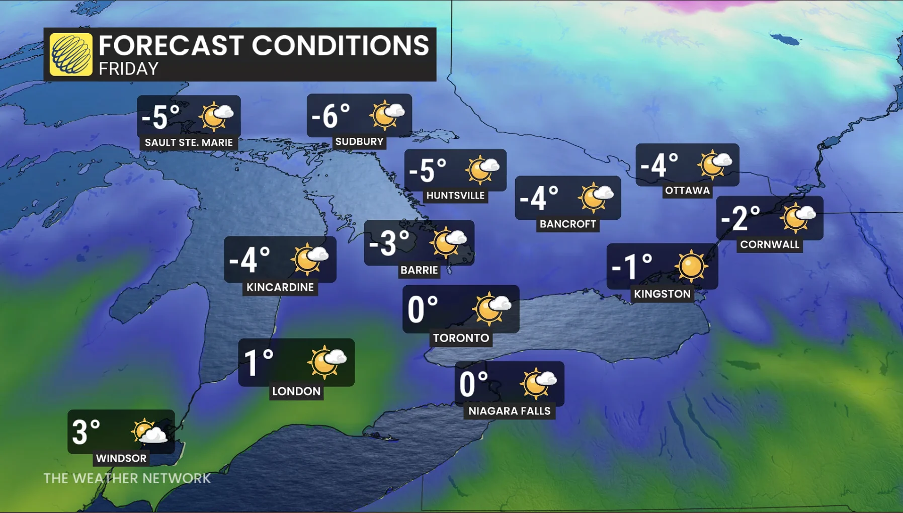
Temperatures will drop significantly behind the cold front, falling 15°C to 20°C by Friday morning.
Any April warm spell is likely to be short-lived
Early April is expected to be warmer than late March, but the extent of the warmth remains uncertain.
A warm pattern is set to develop in the Great Lakes region, with temperatures reaching the 20s in southwestern Ontario for several days. However, the warmth may struggle to extend into the GTA. Any warm spell is likely to be short-lived.