
Ontario campers beware: Severe storm, tornado risk builds Saturday
Folks across Ontario should pay close attention to watches and warnings on Saturday as thunderstorms fire up
Conditions favourable for severe thunderstorms will build across portions of Ontario on Saturday as a low-pressure system from northern Ontario sweeps over the Great Lakes region.
Heat warnings are in place for much of southern Ontario as the hot and humid weather settles in this weekend. This instability will fuel a risk for strong to severe storms—including the risk for one or two tornadoes.
Make sure you keep an eye on the radar—especially if you have outdoor plans—and stay aware of any severe weather watches or warnings issued in your area.
DON’T MISS: La Niña could return in a quick burst this fall and winter
Saturday storms could turn severe
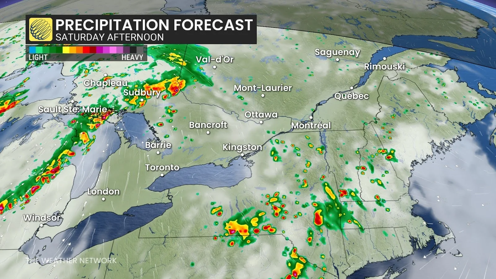
Parts of northwestern Ontario already received a helping of thunderous weather early Saturday morning, but we'll see the risk of thunderstorms continue to shift southeast throughout the day as the low-pressure system treks across the province.
Strong thunderstorms are expected to develop in the early to mid-afternoon hours and continue through the evening across northeastern Ontario, moving southeast into cottage country. A warm front and upper-level trough will increase the risk for severe storms to develop.
While the storm risk extends across much of southern Ontario, the greatest risk for severe weather will fall along the shores of Lake Huron and Georgian Bay, extending north toward the Greater Sudbury Area and North Bay. There is also an isolated risk of one or two tornadoes in these areas on Saturday. The storms will form into a line and continue moving east across parts of central Ontario.
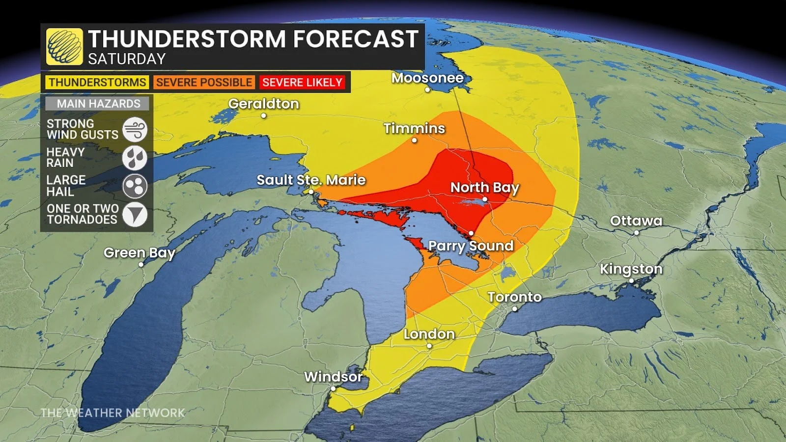
Forecasters are also looking at the risk of rotating storms developing around the Parry Sound area and through a chunk of cottage country.
RELATED: Tornado warning safety: Here’s what you should do
The greatest risk with Saturday’s strongest storms will be hail 2+ cm in diameter, strong wind gusts of 90+ km/h, and heavy downpours that could produce 30-50 mm of rainfall.
Many people are at cottages and camping in this region. Falling trees and lightning strikes are both deadly hazards.
If you are in the region, please stay on top of severe weather alerts and know what to do and where to go in the event severe weather approaches. If you know anyone in northeastern Ontario or cottage country this weekend, please ensure they’re aware of Saturday’s severe weather threat.
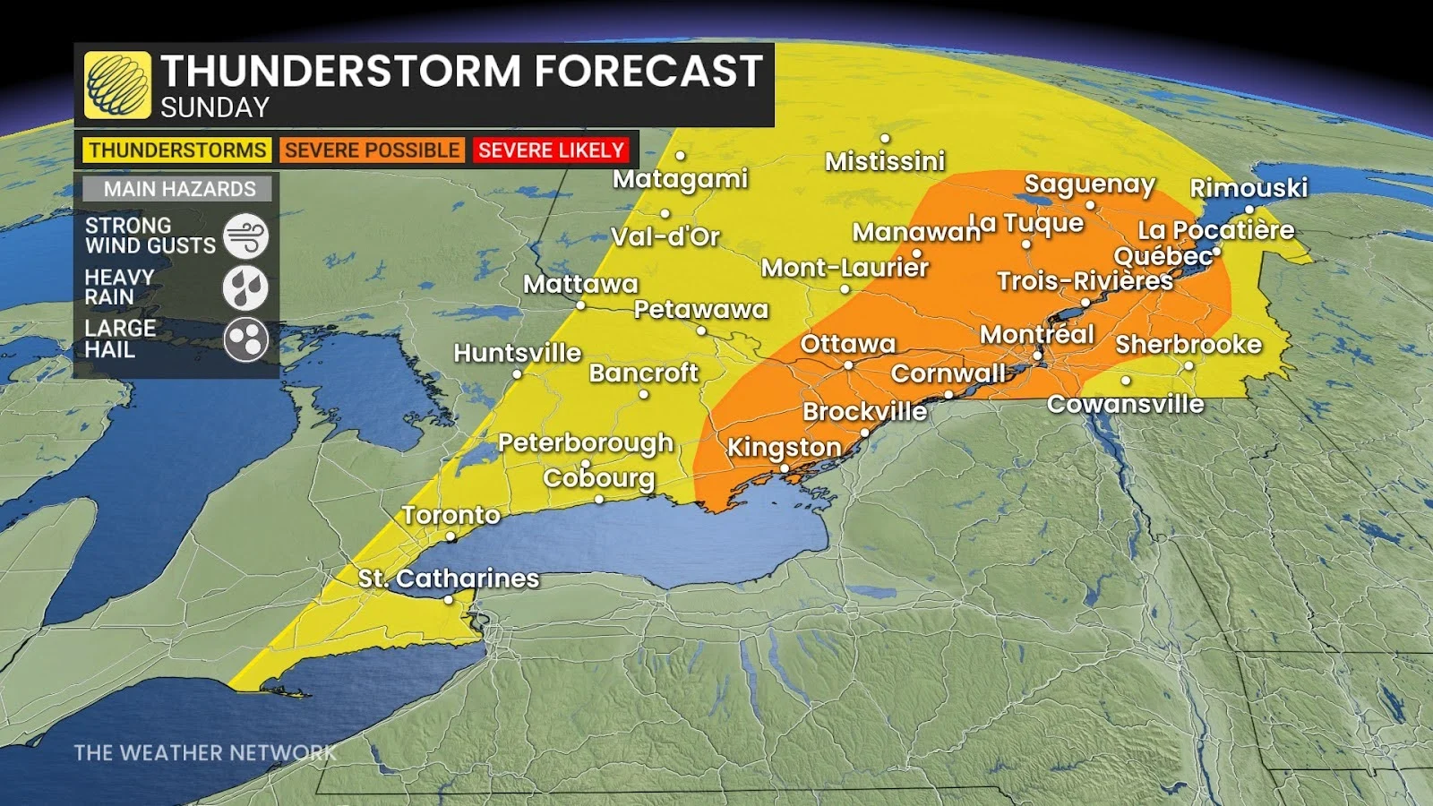
A risk for thunderstorms will redevelop on Sunday as a cold front pushes into an unstable atmosphere across the Greater Toronto Area and into eastern Ontario, including Kingston and Ottawa, and into southern Quebec. We could once again see some of Sunday’s storms turn severe.
WATCH: In a tornado warning? Here’s what you should do
Stay with The Weather Network for more information and updates on your weather across Ontario.