
Ontario slowly creeps out of dreary, rainy rut, but for how long?
The stubborn, multi-day period of chilly temperatures and rainy conditions in Ontario will finally relax, but how long will the reprieve last for?
Southern Ontario has been trapped under dreary, cloudy skies and periods of showers for several days now, but things are finally drying out.
Well, for a short time anyway, before another round of widespread rainfall makes its way into the region midweek. While there will be chances of showers to start the week, with some sunny breaks to offset the dreary weather, the next bout of heavier precipitation will arrive by Wednesday.
DON’T MISS: Rare 3 a.m. twister awakens Ontario's 2025 tornado season
We still have several days left in the month, but many areas have already received their monthly tally of rainfall for May, as of the 23rd. Toronto (city) has recorded 87.3 mm (average 76.4 mm), Hamilton has seen 88.7 mm (average 81.0 mm) and Peterborough has documented 97.4 mm (average 79.4 mm) so far.
Ontario to start climbing out of rainy rut, but...
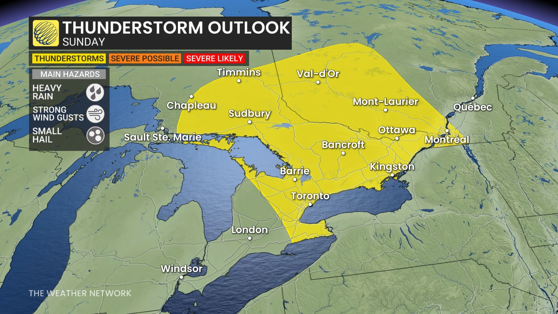
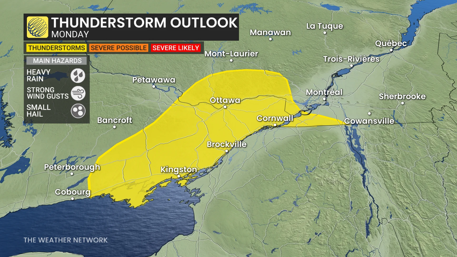
While the stubborn low-pressure system has moved east, there is a trailing trough that will trigger a few showers and isolated thunderstorms Sunday and Monday, especially through central and eastern Ontario.
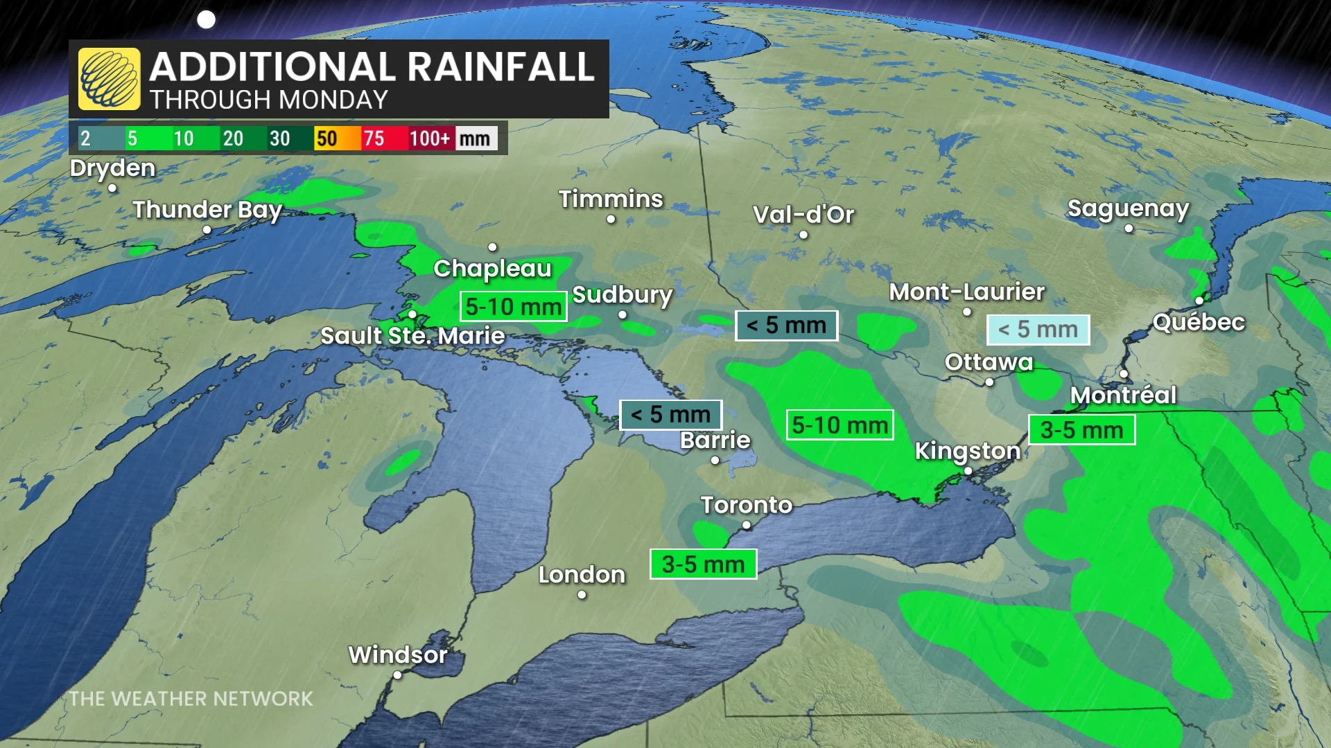
Sunday morning showers will continue across northeastern Ontario, east of Lake Superior and north of Georgian Bay. Scattered afternoon showers will occur across central and eastern Ontario as the trough slumps southward, bringing 5-10 mm in spots through Monday.
DON'T MISS: As the Great Lakes warm, researchers say more winter science is crucial
There will also be an isolated thunderstorm risk on Sunday across southern Ontario. But eastern and central Ontario have a better chance of storms firing up.
There will be a slim chance for light showers in the Greater Toronto Area (GTA) Sunday and Monday, with a higher probability in the west end of Lake Ontario, extending to the Niagara region. Generally, less less than 5 mm amounts through Monday.
There will be an isolated thunderstorm risk on Monday for hHighway 7 and areas southward, east of Peterborough and extending into the Ottawa region. The sun has been struggling to peek through this weekend, with a mix of sun and cloud Sunday and Monday, although with the chance for showers.
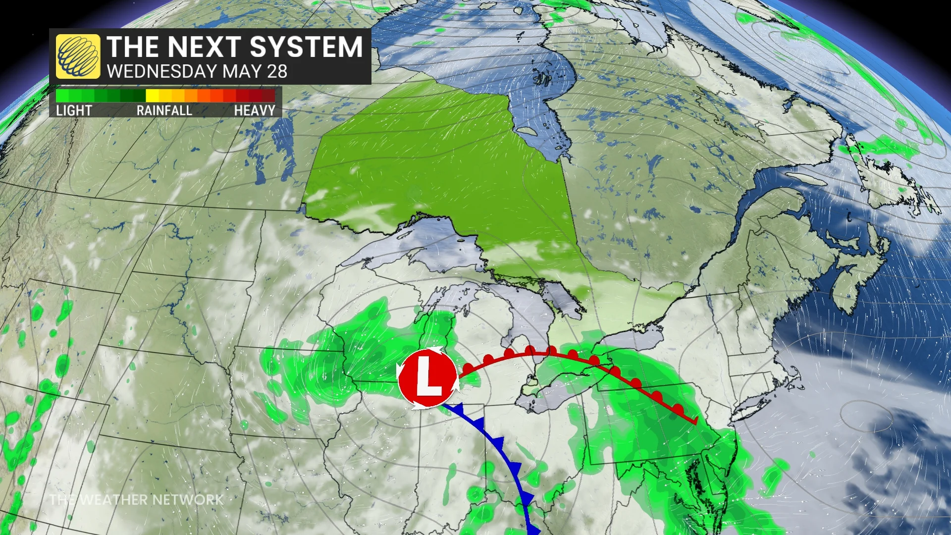
Enjoy the brief sighting, as clouds will build back in ahead of widespread showers on Wednesday.
Low pressure tracking from the central U.S. to the Great Lakes will bring a threat for showers Wednesday night and Thursday, and possibly into Friday.
As well, a cold front will track across the region with a threat for showers as we head into and through the weekend. Temperatures will be several degrees cooler than seasonal late week and weekend.
Early June should bring some pleasant weather, but no sustained heat is in sight as temperatures will be near seasonal or on the cool side of it for the first week of June.
WATCH: Violent storms stretch from Minneapolis to Ontario, Beyoncé concert delayed
Stay with The Weather Network for more information and updates on your weather across Ontario.
Thumbnail image courtesy: Unsplash