Lingering storms may dampen Canada Day in parts of Ontario, Quebec
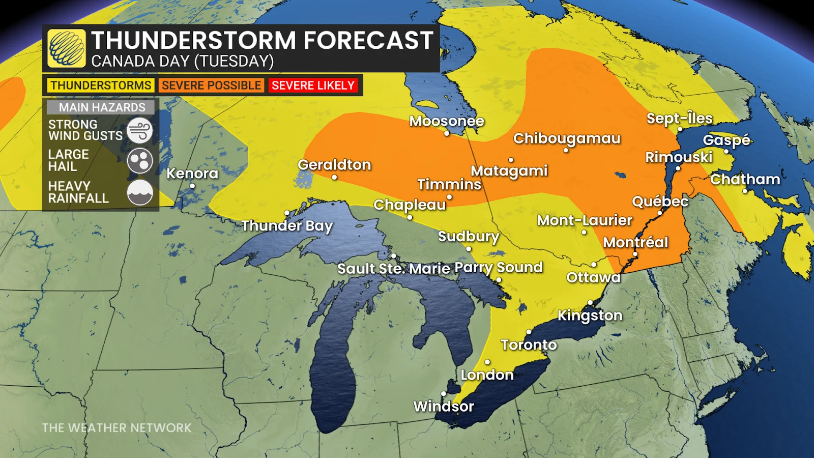
Scattered and isolated thunderstorms to continue making a boom across Ontario through Tuesday, with the threat also spilling into Quebec.
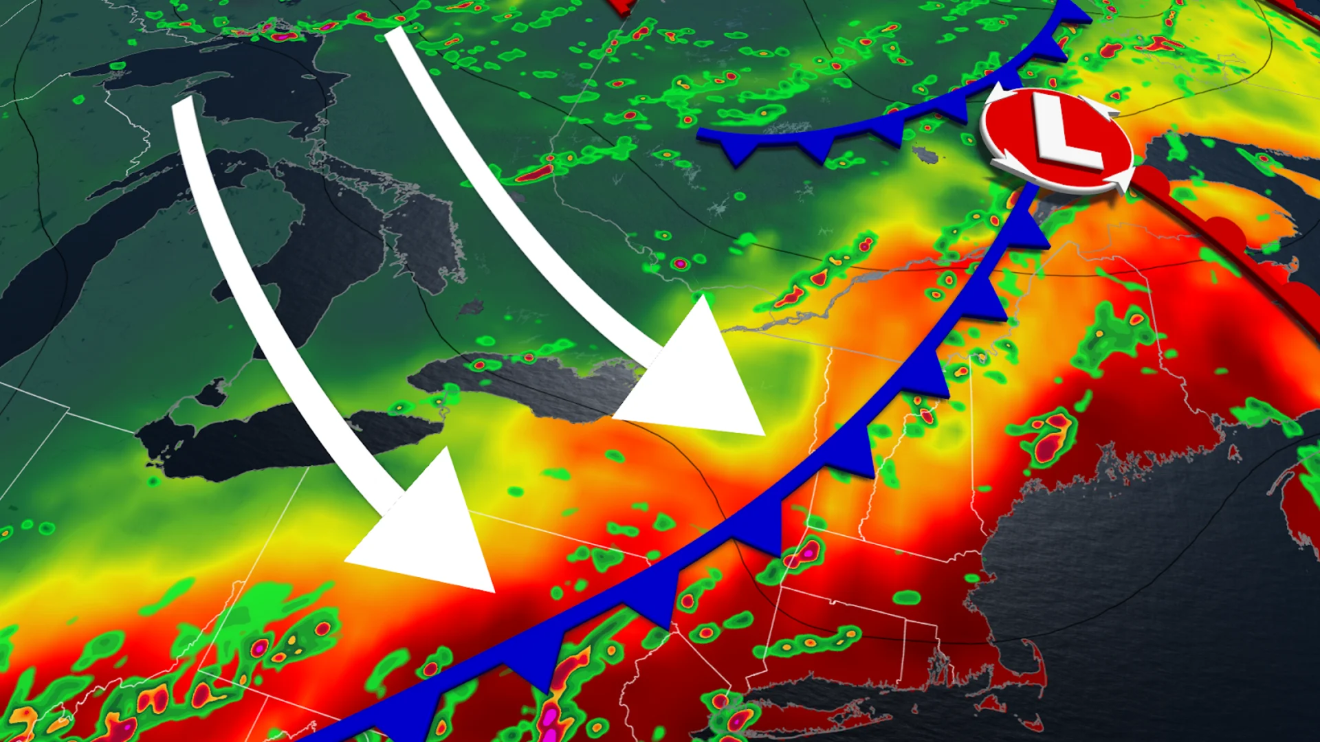
Southern Ontario was battered with moisture-laden thunderstorms Monday, as an upsurge of humid air collided with an approaching cold front, resulting in downpours, gusty winds and localized damage—including reports of a tornado near Lucan, Ont., along Highway 4.

We also saw some training thunderstorms south Georgian Bay on Monday, resulting in over 75 mm of rain falling over the area.
Now, July is expected to kick off with some rumbles, as isolated thunderstorms are expected to linger through Tuesday across Ontario and Quebec while a weak front sweeps across the provinces.
The stormy pattern is forecast to continue through the rest of the week as well.
CHECK OUT: Ontario's biggest Canadian flag now flying high over Hwy 400 in Barrie
Stormy weather lingers through Tuesday in Ontario and Quebec
Some residual instability from Monday's storms will linger into Tuesday, allowing for storms to attempt to fire up south of and along Hwy 401, with breezes off lakes Erie and Ontario serving as the trigger.
The storms are forecast to stay non-severe and will track southeastward, lowering the risk of localized flooding.
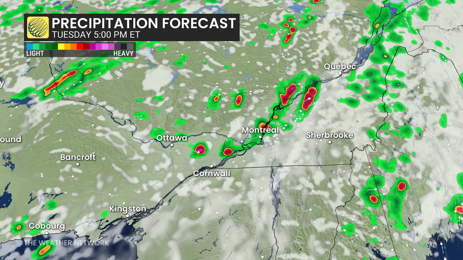
Conditions in the Greater Toronto Area should clear in time for evening fireworks, whereas Ottawa may experience morning showers and embedded storms before gradually improving by late afternoon.
SEE ALSO: A symbol of unity: How Canada chose its iconic maple leaf flag
A weak front will move through the GTA Tuesday morning and into southern Quebec by the late afternoon/evening hours, breaking some of the humidity that has been plaguing the regions.
This will, however, bring some rumbly weather up into Quebec. Luckily, the bulk of the severe storms are forecast to remain stateside, but we will see some scattered storms make it into the Ottawa Valley in the mid-afternoon and the St. Lawrence region by the evening.
We'll also see widespread scattered storms persist across northeastern Ontario and western Quebec through the day.
Mid-week brings lake-breeze storms, upper trough
Looking ahead, isolated lake-breeze thunderstorms are likely in parts of southwestern Ontario on Wednesday and Thursday, particularly north of Lake Erie and Ontario.
An upper-level trough is also expected to move through early Thursday, bringing more showers and storms to Quebec.
Weather models have increased their confidence in thunderstorm activity in southern Ontario through Tuesday evening, highlighting the value of residents remaining alert to rapidly shifting conditions and having contingency plans ready.
Stay with The Weather Network for more information and updates on your weather across Ontario and Quebec.