
Ontario storm risk may upend your long weekend plans
Stay aware of rapidly changing conditions and have a safe place to go if you’re outdoors when storms approach your area
Folks across Ontario should have alternate plans for their long holiday weekend as a renewed threat for strong to severe thunderstorms bubbles up across the region.
We’ll see the potential for storms build on Monday as favourable dynamics sweep into the region. Stay aware of the forecast for your area, and as always, have a way to receive severe weather watches and warnings the moment they’re issued.
DON’T MISS: What is a mesoscale convective system? How an 'MCS' can spell danger
Severe storm risk arrives on Monday
Soak up Sunday’s pleasant weather across southern Ontario while it lasts. Monday will see a warm front lift across the region, dragging a humid airmass north of the border.
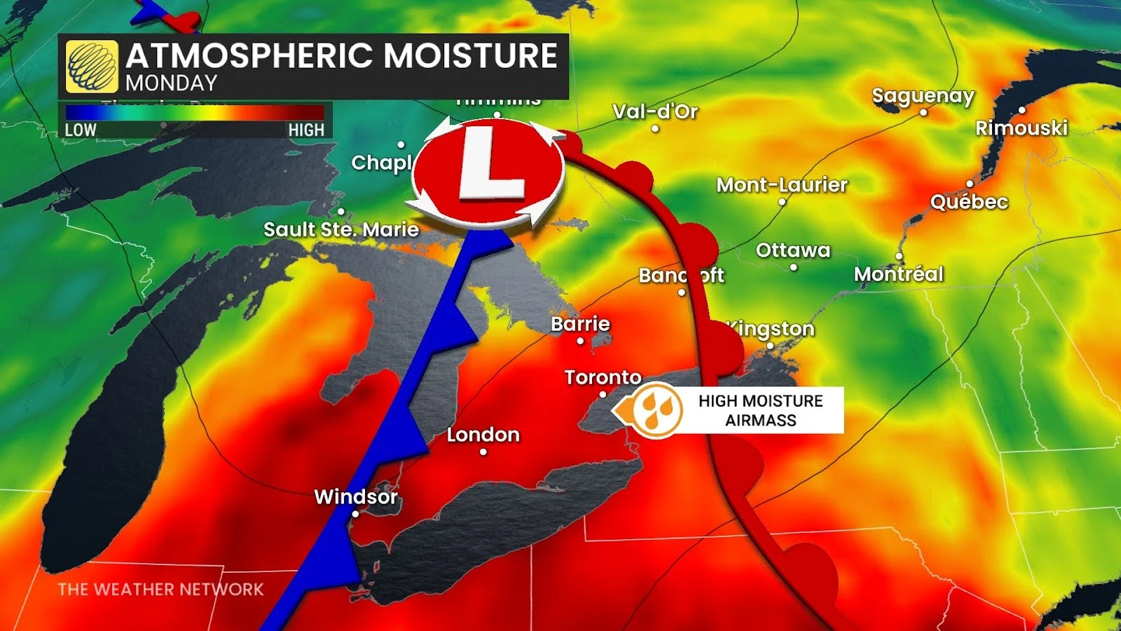
Elevated moisture, daytime heating, and an approaching cold front will spark and fuel a risk for thunderstorms across most of southern Ontario, stretching into northeastern sections of the province. This includes the Greater Toronto Area.
Dynamics are most favourable for severe thunderstorms from Windsor north through Sudbury, including London, Barrie, and Parry Sound.
Forecasters expect clusters of thunderstorms to develop along the cold front, bringing the potential for very strong wind gusts. Large hail is possible across cottage country into northeastern Ontario.
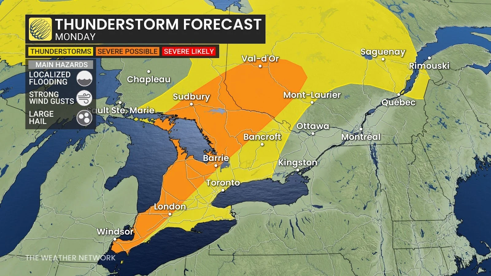
Given the excess moisture in the atmosphere, a risk for localized flash flooding will develop beneath the heavier thunderstorms.
The timing of the storms remains uncertain as they depend on the arrival of the cold front. The most likely window for thunderstorms on Monday will stretch from 2:00 p.m. through 8:00 p.m.
Severe weather safety
Lots of folks have plans to spend time outdoors during the long Canada Day weekend. Severe weather safety is paramount when you’re outdoors enjoying the summer weather.
Remember: if you hear thunder, you’re close enough to be struck by lightning.
Have a way to receive severe weather warnings the moment they’re issued. Stay close to safe shelter in case a thunderstorm approaches your location. Strong wind gusts can knock down trees and power lines. Large hail can cause serious injury.
Never try to drive across a flooded roadway. It’s impossible to tell how deep the water is until it’s too late. It only takes a small amount of water to cause a vehicle to lose grip with the roadway and become stranded. Just 15-30 cm of moving water can carry a vehicle away.
Header image created using graphics and imagery from Canva.