
Expect Mother Nature to interrupt Ontario Victoria Day weekend plans
The long-awaited and unofficial start to the summer season is nearly here, but will southern Ontario's forecast favour plans for the outdoors or indoors?
The warm week in southern Ontario will continue for the next couple of days, but there will be a change coming on the Victoria Day long weekend.
If you have any outdoor plans in southern Ontario this holiday long weekend, you may want to have some backup strategies for the indoors just in case. There is rain and scattered thunderstorms in the forecast at times, but it won't be a washout or a writeoff.
RELATED: March or May? Duelling season to slice through Atlanic Canada
It could start off mild and unsettled, but it will end on a calm, and cool note come Monday--with a chance of frost appearing for some areas beyond the long weekend.
Stormy start to the May long weekend?
The system from the Prairies will impact the Great Lakes region, including cottage country and areas east, on Friday with thunderstorms and rain.
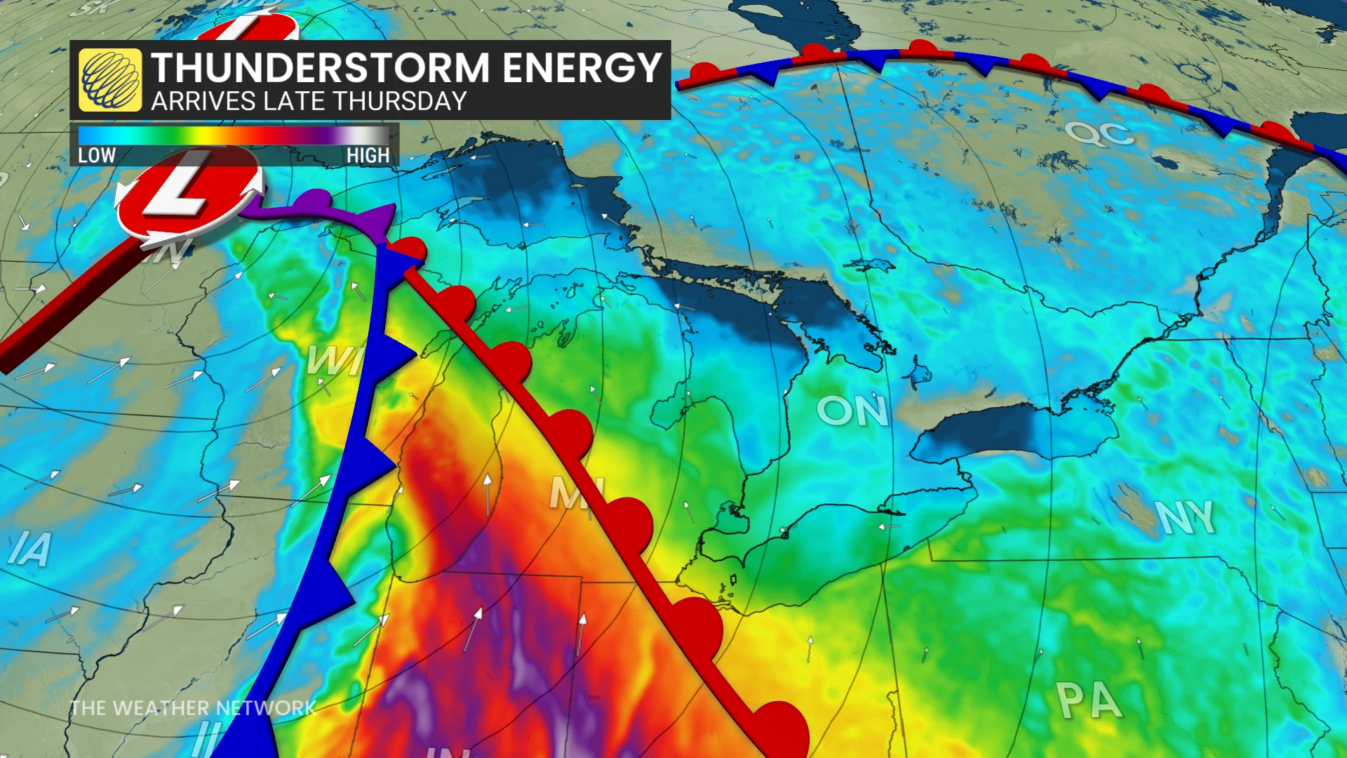
But southwestern Ontario could see a few storms could pop into the region late Thursday.
DON'T MISS: Plant communities in the Arctic are changing along with climate, study finds
However, timing of the system could favour a good start to the long weekend for southern Ontario.
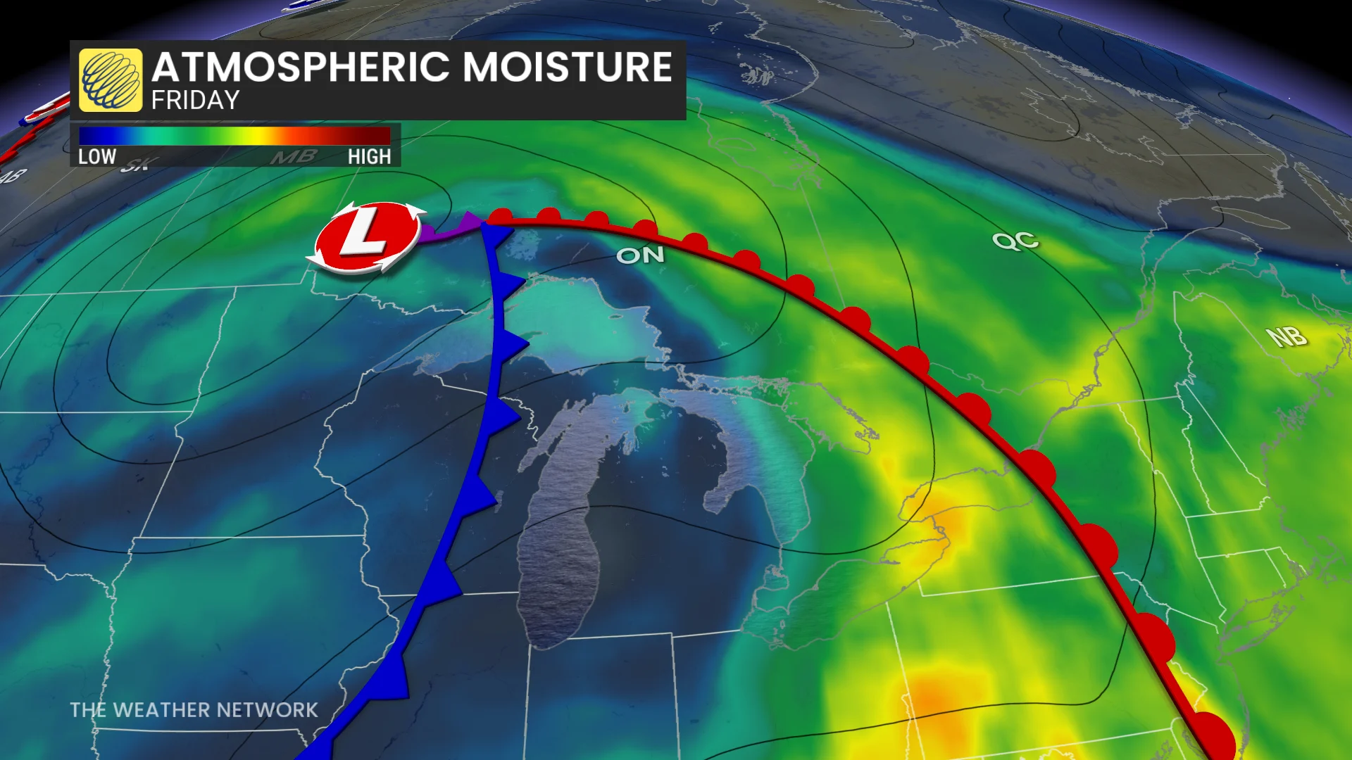
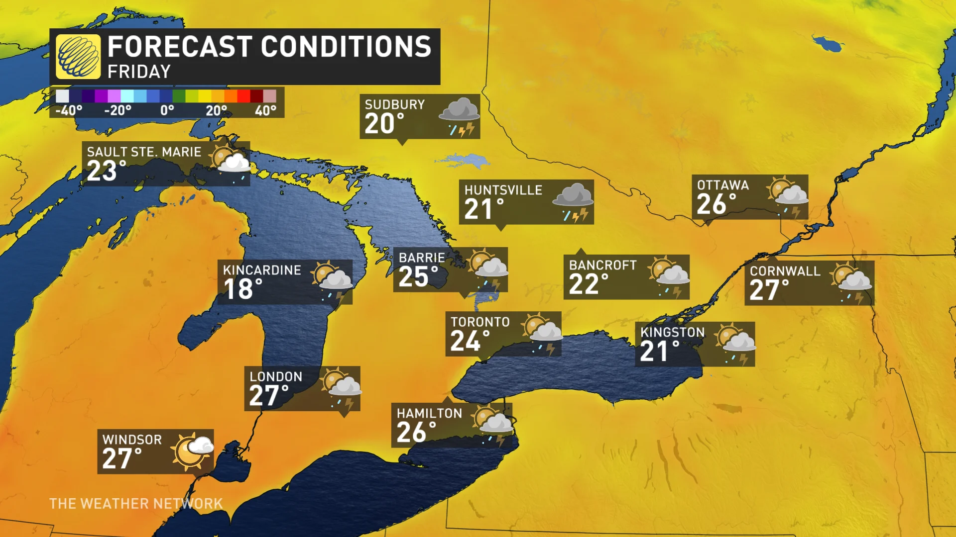
A period of rain and thunderstorms is likely on Friday morning as a warm front moves through the Greater Toronto Area (GTA). It will be followed in the afternoon by some sunshine, a gusty, southwesterly wind and warm temperatures--reaching the mid-20s across much of southern Ontario.
However, a few showers and thunderstorms are expected for central and eastern Ontario Friday afternoon. Those regions will just crack the 20-degree mark, but some areas, including the GTA, have the potential to reach the upper 20s.
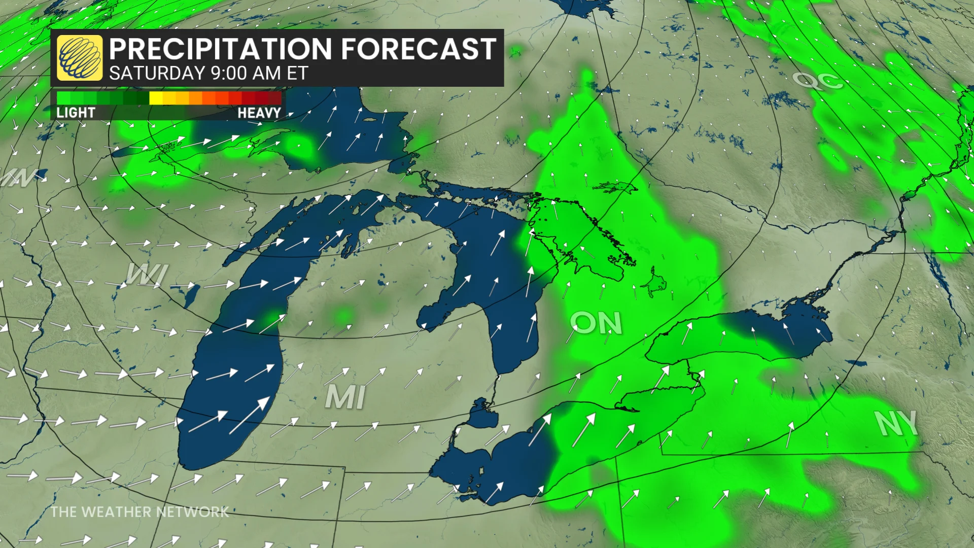
Saturday morning and afternoon will bring a mix of sun and cloudy periods with a threat for scattered showers and thunderstorms in southern Ontario, with near-seasonal temperatures in the upper teens to lower 20s and a gusty wind. Eastern Ontario will see the storm risk arise in the afternoon on Saturday, with slightly cooler temperatures than Friday.
Sunday will feature similar conditions in the south but will be drier than Saturday. Cottage country and eastern Ontario will see scattered thunderstorms pop up, but there will be some breaks in southern Ontario.
Monday will be more of a pleasant day, with cooler-than-normal temperatures dominating. Sunday ad Monday will see temperatures more reminiscent of Easter weekend than the May long weekend.
Overnight low temperatures will hover close to the freezing mark in cottage country.
Temperatures are expected to be changeable, but overall, cooler-than-seasonal temperatures are expected to dominate the rest of next week and well into the following week, with a threat for frost, especially for rural areas.
WATCH: Late-season snow collides with summer-like heat across Canada
Be sure to check back for the latest weather updates across Ontario.