Stay alert: More severe storms expected on the Prairies into Sunday
Stay alert for additional severe thunderstorms across the Prairies into the day Sunday
A spell of severe weather affecting the western Prairies continued on Saturday as severe thunderstorms prompted another round of tornado warnings across Saskatchewan.
Spotters in the region reported at least one tornado north of Saskatoon. Saturday’s severe weather follows Friday’s storms, which produced reports of tornadoes and funnel clouds throughout the region.
Pay close attention to watches and warnings in your area as isolated severe thunderstorms continue Saturday evening.
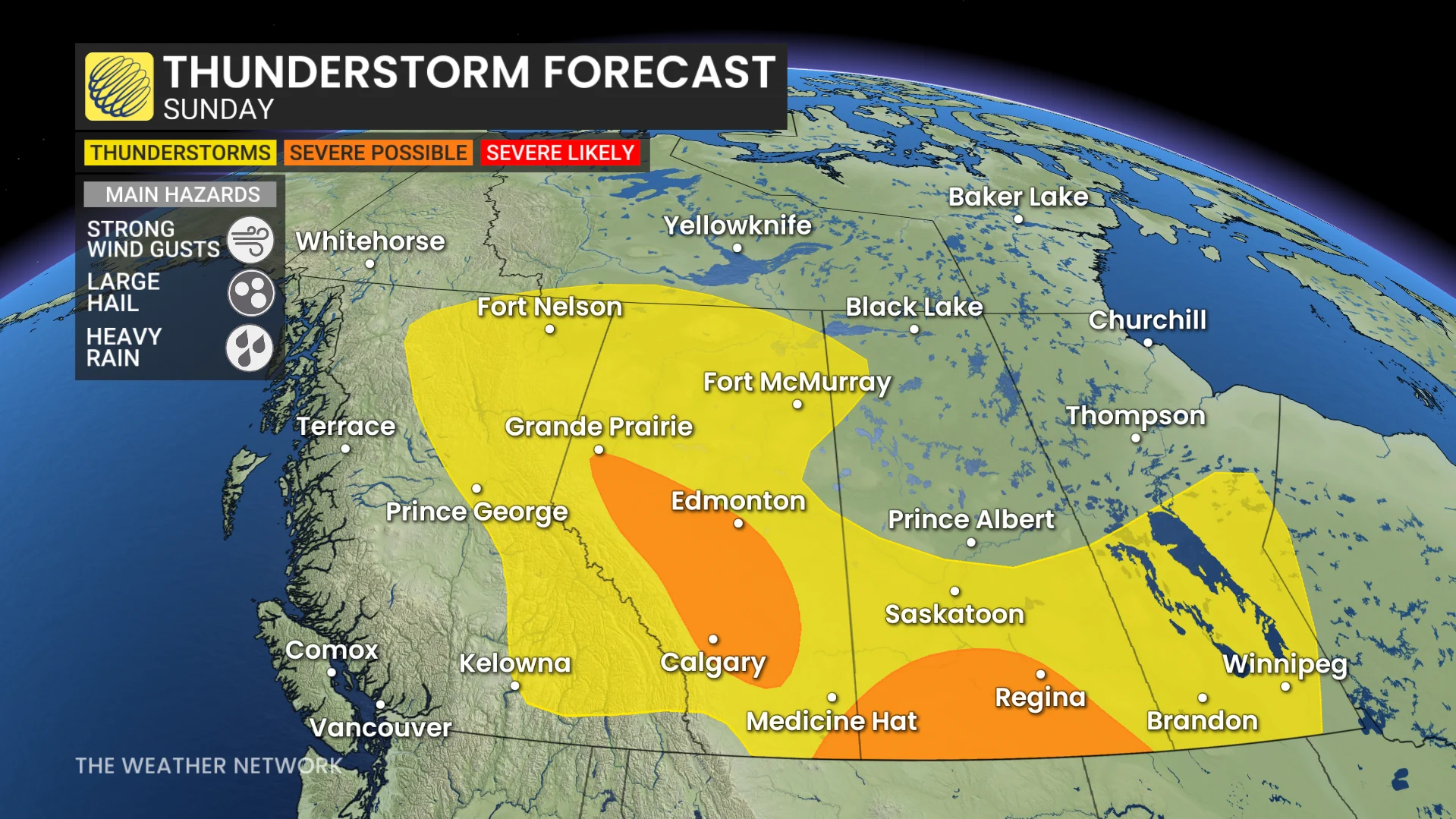
Expect another active day on Sunday as an expansive risk for thunderstorms covers much of the Prairies. Forecasters will monitor two areas for potential severe weather.
Thunderstorms that form across the Alberta foothills could turn severe as they move toward the QE2 during the late-afternoon hours. This includes Calgary, Red Deer, and Edmonton. Large hail and damaging winds will be the primary threats in Alberta’s stronger storms.
A secondary area of severe weather could develop across southern Saskatchewan, including Regina, as a system south of the border spills favourable dynamics into the region. Clusters of thunderstorms developing into the evening hours will carry a risk for heavy rain and damaging winds.
Header image courtesy of Unsplash.
Stay with The Weather Network for all the latest on conditions across the Prairies.