PHOTOS: Southern Ontario coated by its first widespread fall snowfall
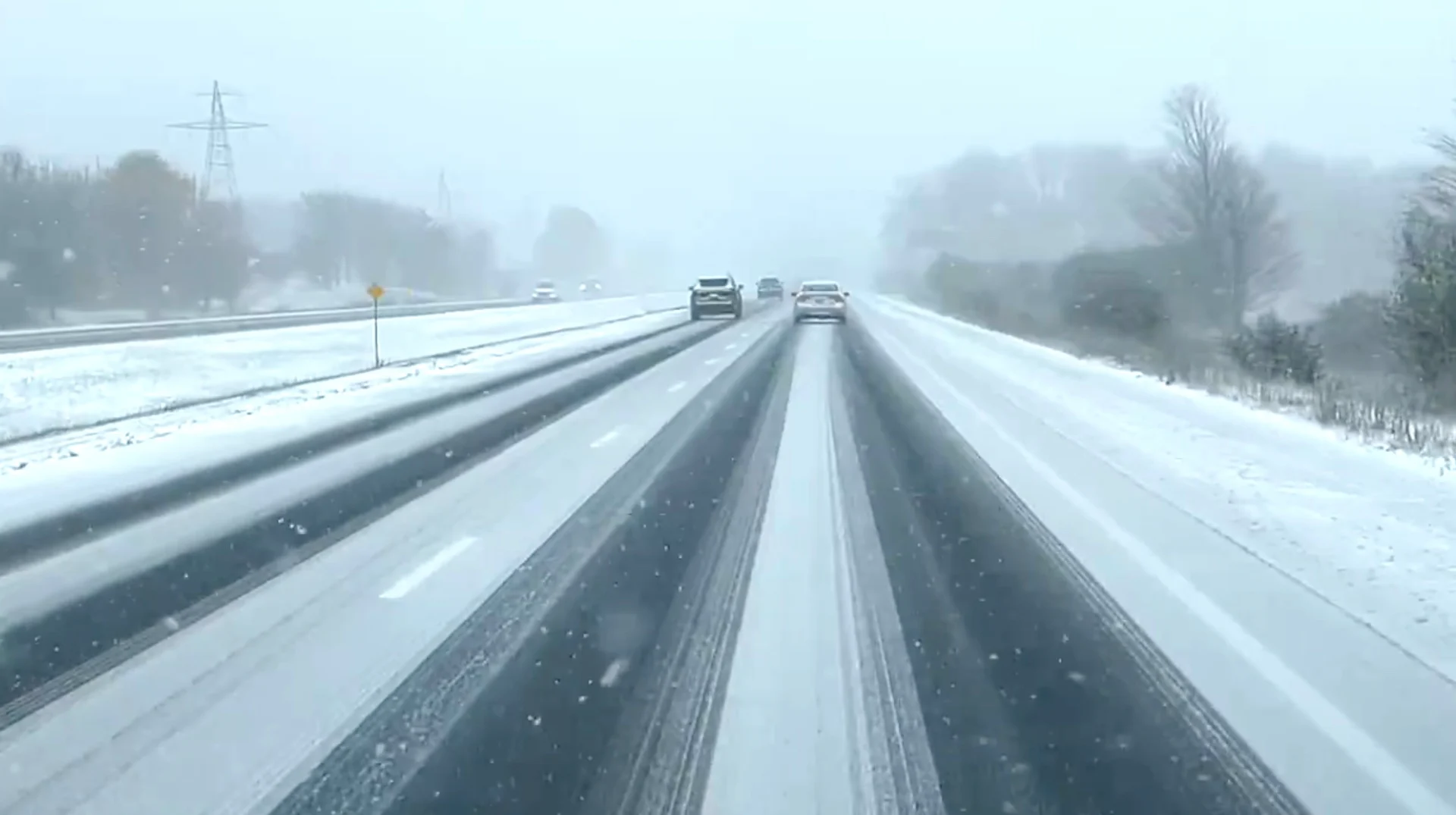
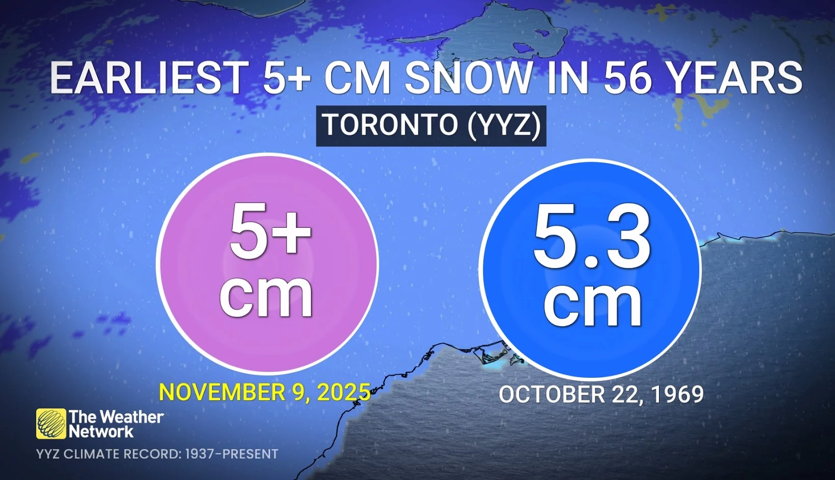
A good portion of southern Ontario is seeing its first snowfall of the season on Sunday, enough to cause difficult travel as roads become slippery and coated with accumulations in many areas. Toronto has seen its earliest occurrence of 5+ cm of snowfall since Oct. 22, 1969
Sunday's early-season snowfall in southern Ontario is a good reminder for folks to prepare for shifting driving conditions and ensure vehicles are winter-ready.
When we say early, it actually is, according to statistics. A snowfall event like this typically happens in early- to mid-December for Pearson airport. The average first 5-cm accumulation is Dec. 12 with the median date of the first 10-cm total happening on Dec. 27.
RELATED: Why the first snowfall of the season can catch drivers by surprise
Toronto has already recorded 5 cm, enough to make Nov. 9, 2025 the earliest occurrence of that much snow for the airport since Oct. 22, 1969.
Some accumulations have been reported from various Ontario airports as of 3 p.m. on Sunday.
Hamilton: 12 cm
Toronto: 8 cm
Trenton: 5 cm
London: 4 cm
Ottawa: 3 cm
Social media reports:
Kitchener-Waterloo: 9 cm
Chatham: 8 cm
Kingston: 7 cm
The initial wave of snow moved into the Greater Toronto Area (GTA) on early Sunday morning. Snow quickly accumulating on grassy surfaces as it is melted on surface. Heavier bursts have been observed in areas from Kitchener to Orangeville as temperatures plummeted below the freezing mark.
For the rest of Sunday, residents are advised to monitor any developing weather alerts and to prepare for potentially slippery roads and reduced visibility in affected areas.
Sunday evening: Localized heavier snow bursts continue across the Niagara Peninsula, with the GTA tapering to flurries.
Toronto and GTA core could see approximately 5 cm, while higher elevations and north-end GTA suburbs may see 5+cm. Lakeshores will see less than 5 cm due to warmer temperatures.
WATCH: Early-season snowfall in southern Ontario may pick up through the afternoon
As the low exits east, Hamilton and Niagara could overachieve with some heavier bursts of snow across higher terrain, possibly approaching 10 cm.
Following the system, persistent Arctic air will stick around and drive multiple days of lake-effect snow in the traditional snowbelt regions on Monday evening through Tuesday morning.
Winter travel and possibly road closures may be expected by Monday evening and overnight during the worst squall activity off Lake Huron.
Below is a selection of visuals currently making the rounds on social media.
Header image created using graphics and imagery from Canva.