Polar vortex disrupted: Rare, atmospheric shift could enhance winter’s path

An extreme warming event high in the atmosphere is threatening to disrupt the polar vortex. We break down what that could mean for Canadians
A rare, early, stratospheric warming event could shake up the final weeks of 2025 and the start of 2026.
Can warming 30 kilometres above the North Pole really influence our weather patterns? Surprisingly, yes.
SEE ALSO: What is the polar vortex? How it’s responsible for dangerous cold

A sudden stratospheric warming (SSW) is a rapid temperature spike high above the Arctic that can knock the polar vortex off balance, stretching or pushing it away from the pole.
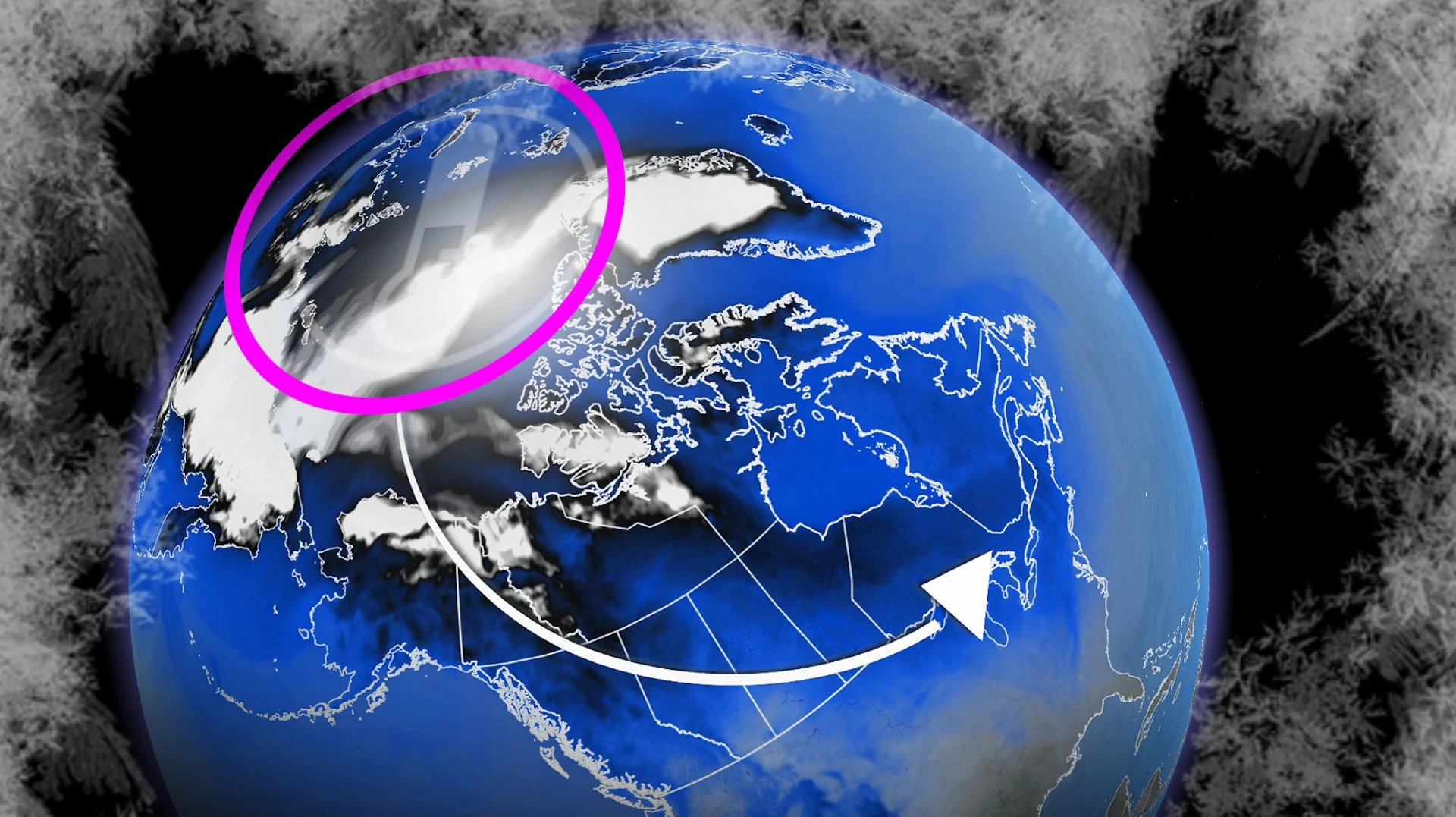
When that circulation weakens, it means Arctic air will reach more southern latitudes. The polar vortex doesn’t create extra cold; it merely displaces it. Arctic air will shift southward across the Northern Hemisphere, but where it settles can vary.
Europe? Asia? North America? How about all of the above?

Just a couple of weeks ago, the polar vortex was healthy, symmetric, and tightly spinning over the Far North. Now, temperatures in the upper stratosphere are forecast to surge more than 30°C above normal, helping build a powerful, high-pressure ridge aloft–the key ingredient that begins to disturb the vortex.
It’s all about the timing
The strange part is how early this is all unfolding. In fact, only three November SSW events have been documented in 70 years.

So, why should we care down here?
There have only been three November SSWs on record, so the historical sample is limited, but in those cases, December trended downright frigid across portions of Canada. Early-December SSWs in the historical record have also shown a similar tendency toward colder patterns.
The disruption is working its way down

Models now show the disruption descending from the upper stratosphere. Forecasters monitor the lower stratosphere (around 16 km), where a slowdown in west-to-east (zonal) winds signals that the disturbance is beginning to couple downward with the troposphere. That is the layer where our day-to-day weather forms.
Once that connection is made, the pattern can shift at the surface, increasing the likelihood of Arctic air intrusions, blocking highs, and a wavier jet stream. Some regions, including parts of the Arctic itself, can actually run warmer than normal during these patterns!

The atmosphere was already gearing up for a shift
Even before the SSW appeared, other teleconnections were pointing toward a significant pattern change, suggesting colder conditions were already possible. The SSW is now a new, wild card player that could extend or reinforce a colder pattern late into December and into early 2026.
What happens next with the polar vortex?
That’s the million-dollar question.
A weakened vortex will be shoved off the pole, elongated, or in even more dramatic fashion, literally split in two. If the disruption to the polar vortex continues to descend and couple to the troposphere, buckle up for sustained winter weather that’ll feature all of these components:

Over the coming weeks, we’ll be tracking the disruption to the polar vortex and how it’ll influence our winter season ahead. Our official Winter Forecast will be released on Wednesday, Nov. 26.