Powerful nor'easter set to slam Atlantic Canada with heavy snow and strong winds
A moisture-packed storm will bring heavy snow, strong winds and challenging travel throughout the region.
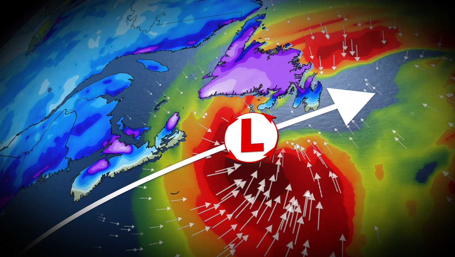
A powerful nor'easter is shaping up to sweep across Atlantic Canada on Tuesday evening, bringing a mix of snow, rain and strong winds to the Maritimes before moving into Newfoundland on Wednesday.
The system is expected to rapidly intensify over the Atlantic as cold Arctic air collides with rich Gulf moisture.
Forecasters say the conditions necessary for a sharply deepening storm are all present: A strong jet stream, plenty of cold air and unusually warm ocean temperatures to fuel its formation.
CHECK OUT: How the weather could influence your music taste

Maritimes to face rain, heavy snow and fierce winds
Snow is thought to begin in the Maritimes on Tuesday evening as the low moves along Nova Scotia's south coast overnight. Conditions will continue to worsen into Wednesday morning, with stronger winds and more precipitation.
Southern Nova Scotia is expected to receive the most rain, with over 40 millimetres and wind gusts of 70-90 km/h. Forecasters warn about ponding and pooling on roads.
Cold air will remain in place farther north, including Saint John, Moncton, Charlottetown, the Annapolis Highlands and the Cobequid Mountains. These areas could receive 10-20 centimetres of snow, along with gusts of 50-70 km/h.
Commuters should expect difficult conditions Wednesday morning, with possible delays or closures on the Confederation Bridge.
LOOK: Eco-friendly tips for keeping a healthy pet and planet
WATCH: What to expect from this weeks nor'easter in Atlantic Canada
Newfoundland to see blizzard-like conditions Wednesday
Wednesday will be Newfoundland's turn, with snow and strong winds spreading across the island in the morning and intensifying by the afternoon. Snowfall rates could reach 3-5 centimetres an hour, with coastal winds gusting to 90-110 km/h. Inland winds could reach 70-90 km/h.

The combination of heavy snow and strong winds may cause whiteout or near-blizzard conditions, slick roads and the possibility of road, school and business closures. There is also the possibility of localized power outages.
The forecast for southeastern Newfoundland remains somewhat uncertain. The Avalon and Burin peninsulas may see snow turn to ice pellets or rain as the low moves south of the region later Wednesday, potentially affecting snowfall totals.
MUST SEE: A winter storm's track can make or break your forecast
West and central Newfoundland are more likely to remain cold enough for snow, with 15-30 centimetres expected by Thursday morning.
Conditions are anticipated to improve Wednesday night, but cold Arctic air will stay behind the system. On Thursday, wind chill values in some parts of New Brunswick could reach -10 to -20.

Stay with The Weather Network for the latest across Atlantic Canada