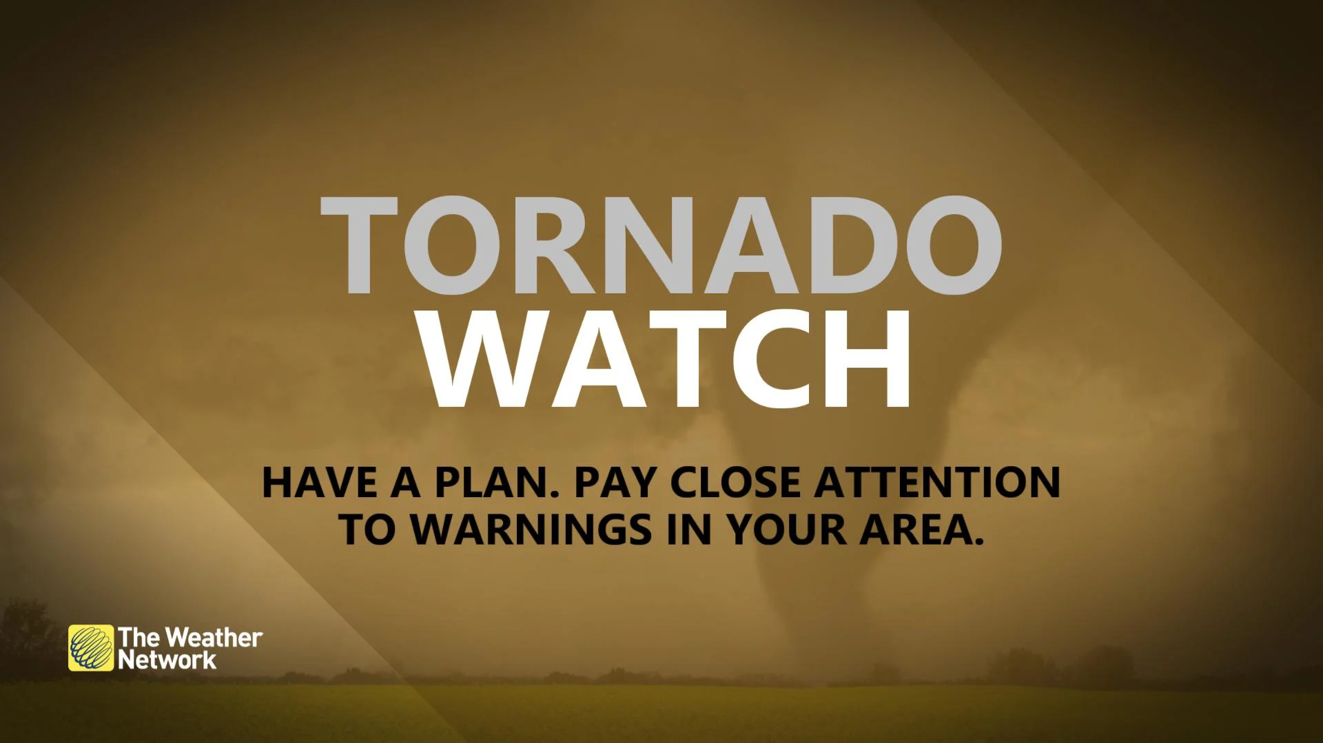
Tornado watch issued as severe storms fire up on the Prairies
Tornado watches have been issued across parts of the Prairies alongside other severe storms
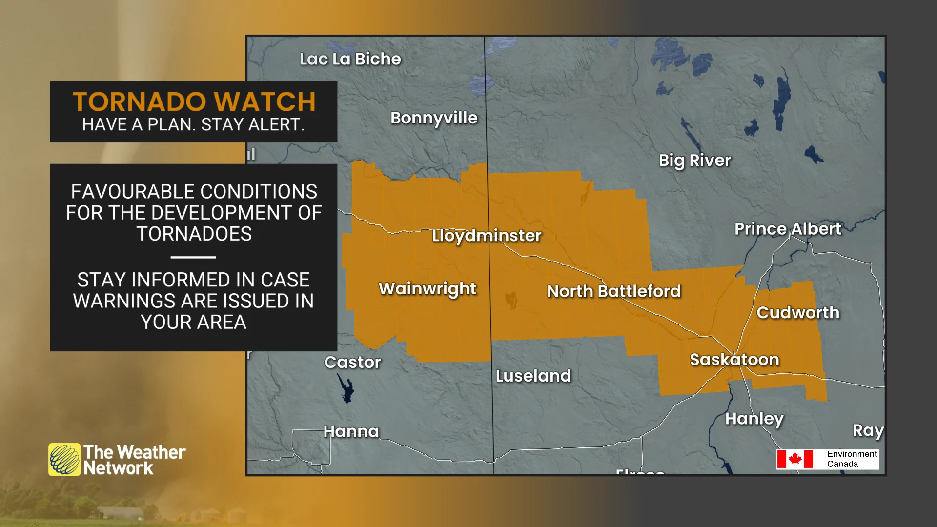
12:23 p.m. MT - A tornado watch is in effect across Alberta and Saskatchewan amid a severe storm threat June 25th. A tornado watch means that conditions are favourable for the development of tornadoes.
Pay close attention to the latest alerts in case the tornado watch is upgraded to a tornado warning in your area. Have a plan in place to seek safe shelter in case severe weather threatens your home, your office, or while you’re driving.
CURRENT TORNADO WATCHES (Alberta and Saskatchewan):
North Battleford - Wainwright -City of Lloydminster - City of Saskatoon - R.M. of Aberdeen including Aberdeen and more
The original article with the full forecast for Prairies continues below.
Severe thunderstorms are expected to impact large areas of Alberta and Saskatchewan on Wednesday, with additional strong storms shifting into Manitoba later in the week, as well.
These storms threaten powerful wind gusts between 90-100+ km/h, as well as the potential for large hail ranging from 2-4 cm in size.
Severe thunderstorms can contain updrafts of 120-150+ km/h, which are usually sufficient to support the weight of large, damaging hail.Supercell thunderstorms can pack updrafts of more than 200 km/h, which can support hail the size of baseballs or even larger.
SEE ALSO: From nuisance to nightmare: Huge hail is an extreme danger
Be sure to monitor local weather alerts and incoming conditions throughout the day.
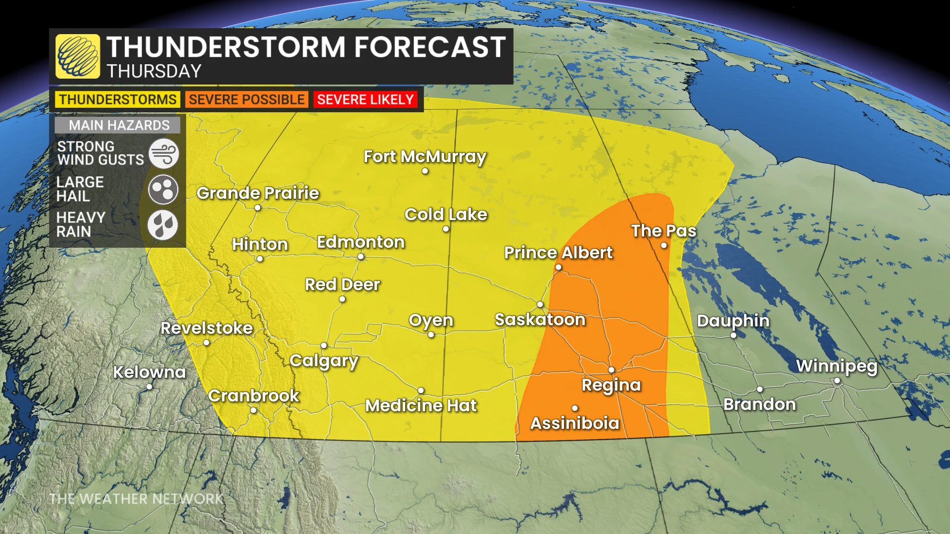
Severe thunderstorms could produce damaging winds and very large hail Wednesday and Thursday
Severe thunderstorms are expected in parts of the Prairies on Wednesday, including the southern and central foothills, northern Alberta, and much of Saskatchewan.
In Alberta, storms will form along the foothills and move eastward throughout the day. Some may evolve into supercell-type storms, with the potential to produce hail exceeding 2 cm in size and wind gusts over 90 km/h, particularly near Calgary, Red Deer, and surrounding areas.
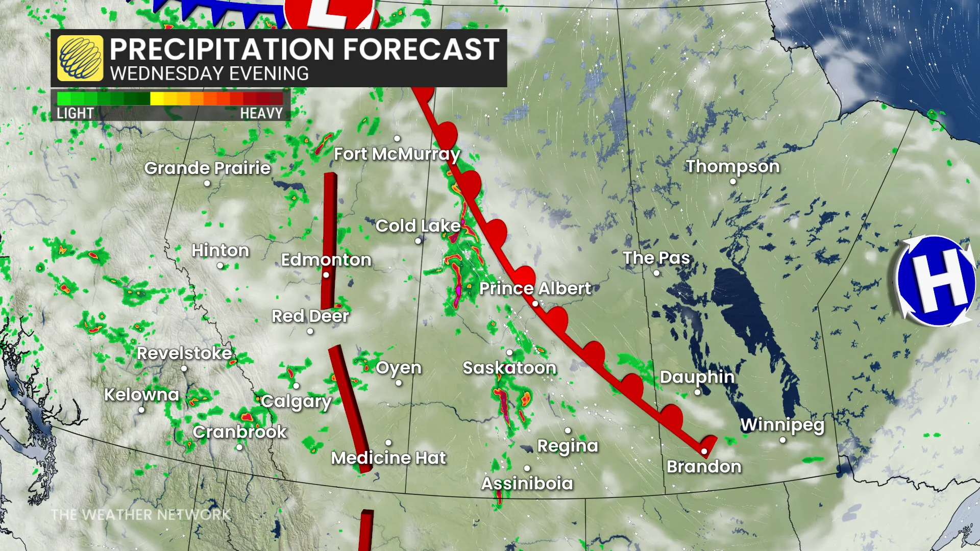
Parts of northern Alberta and Saskatchewan will see storms developing along a trough, leading to clusters of severe weather. These may include a mix of isolated and linear storm systems capable of producing 2-4 cm hail.
Linear storm activity in southern Saskatchewan could bring wind gusts of 90-100+ km/h.

Forecasters are monitoring the low chance of a funnel cloud or landspout tornado in affected areas, as well.
DON'T MISS: The Weather Network's new Fire & Smoke map helps you plan ahead and stay safe
By Thursday, the thunderstorm risk remains across Alberta and Saskatchewan, extending to include northern Manitoba.
The potential for severe weather shifts further east in Saskatchewan, while hail sizes of 2-4 cm and wind gusts exceeding 90 km/h remain possible with both isolated and linear storm systems.
It will be important to stay updated on the evolving weather conditions.
Temperatures trend closer to seasonal values by the weekend
After a rather chilly start to the week, temperatures will trend back to near seasonal by late week. A warmer pattern will develop next week, with above seasonal temperatures forecast for early July.
Western areas are expected to see a few days of drier weather early next week. However, Alberta is likely to experience unsettled, stormy conditions during the latter half of the week.
WATCH BELOW: Can you predict a storm with a straw and a cup?
Stay with The Weather Network for more information and updates on your weather across the Prairies.