
Hold on: Powerful winds set to sweep through Ontario on Friday
Wind warnings are in effect for portions of the province as blustery conditions are expected through the day Friday
The rain and storms we dealt with across portions of Ontario on Thursday will give way to windy conditions on Friday as a low-pressure system flexes its muscles over the region.
Wind warnings and special weather statements are in effect as gusts up to 90 km/h are possible in some areas. Residents are advised to secure loose objects, and prepare for choppy waters on the lakes.
DON’T MISS: Keep your furniture from flying around in strong winds with this simple hack

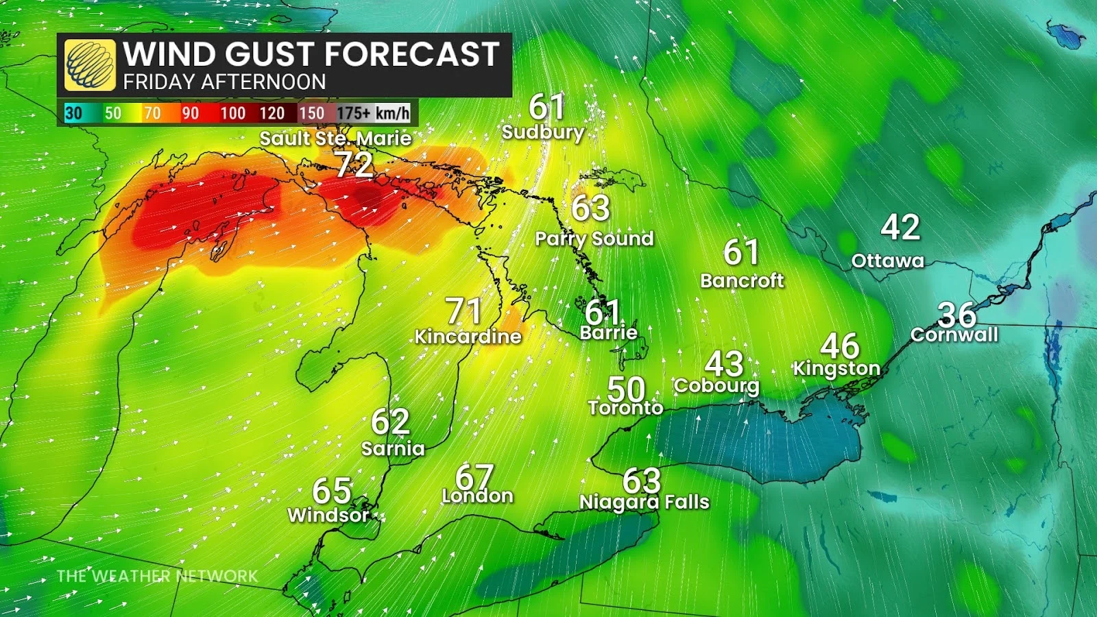
The strong low-pressure system over northeastern Ontario that brought us active weather on Thursday will steer a secondary system across the province through the day Friday.
We’ll see another round of rainfall move through northeastern Ontario with this system’s arrival.
However, the bigger threat will be the gusty winds expected over northeastern and southern portions of Ontario during the day.
Widespread wind gusts of 50-80 km/h are on tap for southern Ontario, with gusts up to 90 km/h possible on Manitoulin Island.
Secure loose objects like decorations, potted plants, and trampolines—all of which can easily blow around in gusty winds.
Blustery conditions will also bring the risk for choppy waters on the lakes. Lake Huron could see the highest waves, especially off Bruce County where wave heights could reach 3 metres. Wave heights of up to 2 metres are possible across Georgian Bay and the shores of Lake Erie.
The southerly flow will also help drag seasonable temperatures into the region to end the week. Cooler conditions are on the way.
A large upper-level low will direct cooler air into Ontario by this weekend, pushing temperatures a few degrees below seasonal for this time of year. Expect daytime highs in the middle to upper teens in the Greater Toronto Area this weekend, along with chilly mornings.
Header image created using graphics and imagery from Canva and Unsplash.