
Prairies brace for more severe storms as risk moves east Saturday
Prepare for another day of busy weather across portions of the Prairies as a dynamic setup swings through the region
Severe thunderstorms bubbled over the Prairies on Friday with strong winds, hail, and even some rotation.
We’ll see the risk for strong to severe thunderstorms push east heading into the beginning of the weekend. Saturday will be a day to watch the skies over southern Manitoba and portions of northwestern Ontario.
Stay safe by keeping up with the latest severe weather watches and warnings in your area.
RELATED: Tornado season is underway in Canada. Here’s what you need to know
Severe weather threat renews on Saturday
An environment capable of supporting severe thunderstorms will continue moving east across the Prairies into the day Saturday.
Ample thunderstorm energy and favourable dynamics could allow any storms in the region to turn severe.
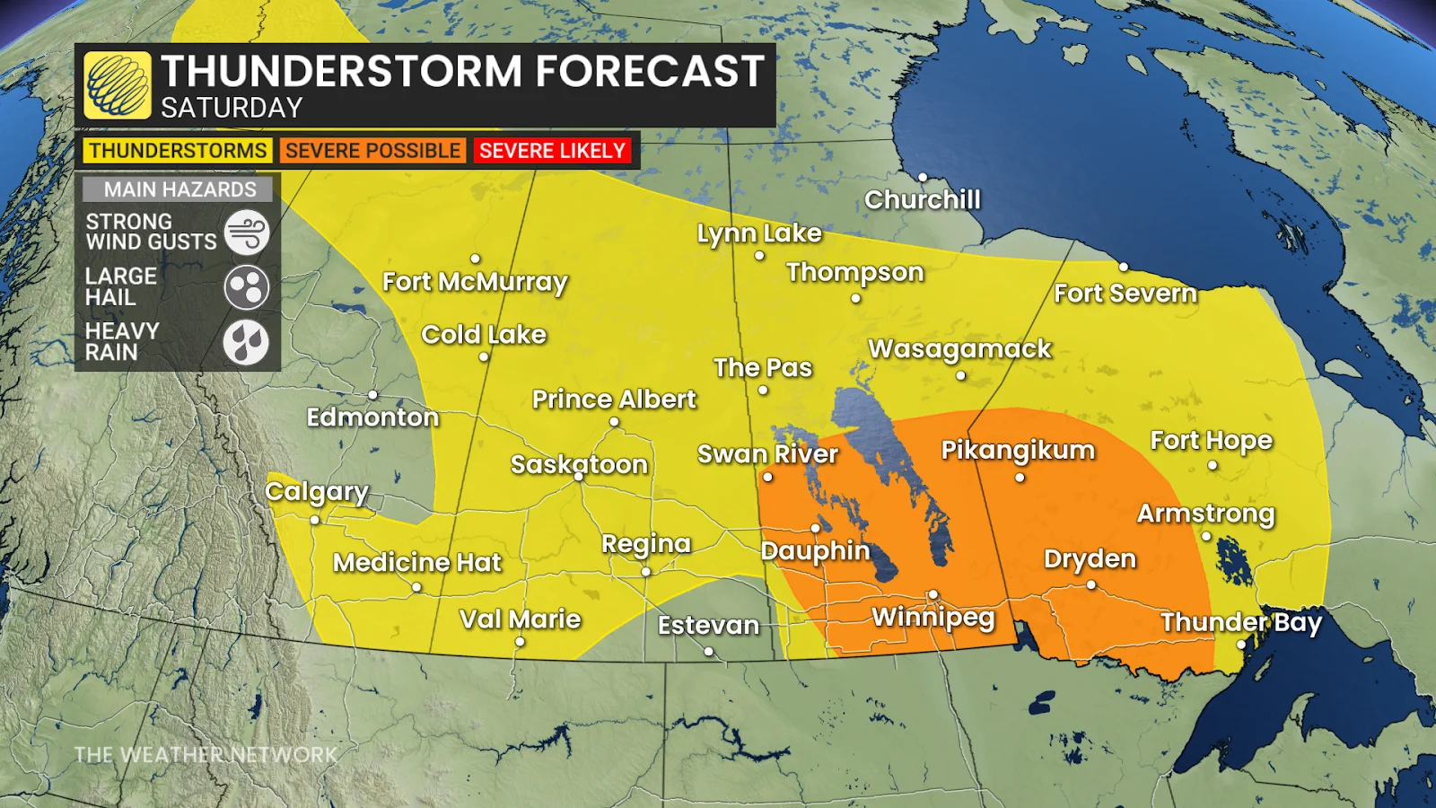
This risk includes Winnipeg, Brandon, and Dauphin in Manitoba, as well as Fort Frances, Dryden, and Kenora in northwestern Ontario.
Strong winds of 90-100 km/h, large hail up to the size of ping pong balls, and very heavy rainfall are possible in the most intense storms. Localized flooding may develop beneath any slow-moving cells. Supercells and rotating storms are possible east of the Interlake region into northwestern Ontario.
While there’s still some uncertainty surrounding the timing of Saturday’s storm threat, the bulk of the activity is expected through the late afternoon and into the evening hours.
Stay with The Weather Network for the latest on conditions across the Prairies.
Header image courtesy of NOAA/Unsplash.