
Prairie wildfire threat remains high as heat peaks and storms roll in
The wildfire risk intensifies across the Prairies this weekend as hot, dry weather conditions shift.
Significant wildfires continue to impact much of the Prairies, with upcoming weather conditions expected to play a pivotal role in fire management efforts in the days ahead.
DON'T MISS: Get the latest wildfire news and safety tips to help you stay safe
Manitoba has declared a provincewide state of emergency as wildfires intensify. Roughly 17,000 residents will evacuate from northern and eastern regions.
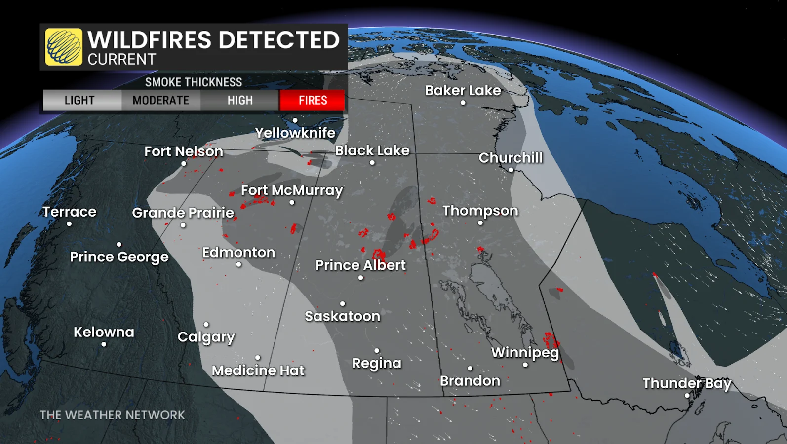
In Saskatchewan, Premier Scott Moe declared a provincial state of emergency on Thursday, as wildfires burning across northern areas of the province have forced thousands of residents to evacuate their homes.
RELATED: First Nations plead for help as wildfires devastate northern Sask.
Extreme heat, low humidity, and strong winds have fuelled a wildfire threat in northern Alberta, forcing hundreds of residents to leave their homes earlier this week. A mandatory evacuation order was issued for Chipewyan Lake.
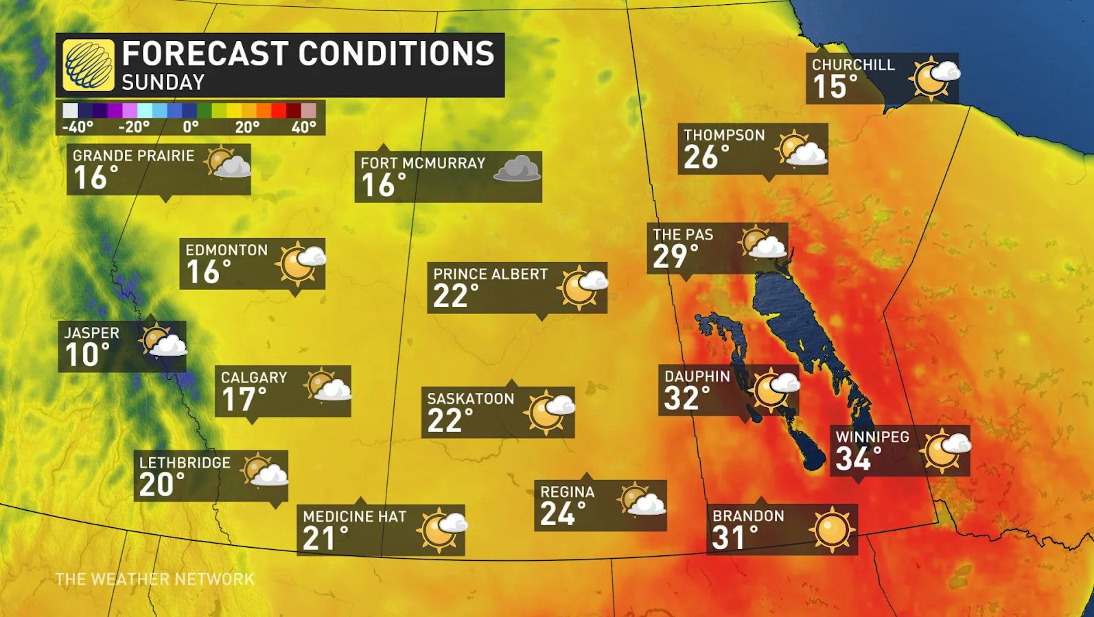
High heat and dry conditions spell trouble for this weekend
Saturday will be the last day of 30°C heat in Alberta and Saskatchewan, but the searing temperatures will continue to linger until Sunday across Manitoba.
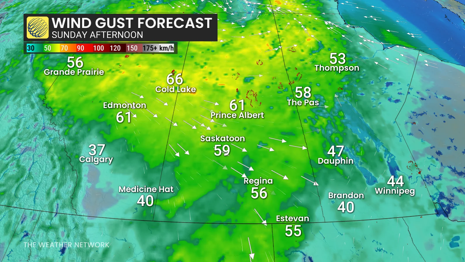
Winds and lightning could fuel the wildfire growth
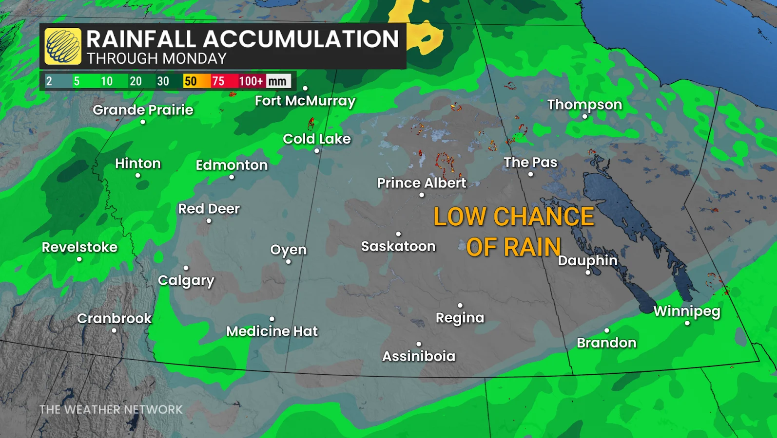
A cold front moving through the region Sunday could see scattered storms, particularly along and north of the Yellowhead Highway. While some rain is expected, the majority of it is likely to miss the major fire zones.
There is also the possibility of lightning strikes, which may ignite new fires.
DON'T MISS: The Weather Network's wildfire hub
Winds will move from south to northwest and grow, with gusts reaching 50-70 km/h on Sunday evening and Monday, potentially spreading fires even further.
Northwest wind gusts of 40-60 km/h are forecast along the trough, which could contribute to further wildfire spread in central Saskatchewan and Manitoba.
With cooler temperatures in place in Alberta, a more noticeable cooldown for the eastern Prairies expected is expected in the second half of the weekend, and into Monday.
However, the combination of limited rainfall, elevated temperatures, and increasing winds means the fire danger rating will stay high to extreme throughout the weekend.
SEE ALSO: Satellites capture thick smoke pouring out of Canadian blazes
Widespread wildfire smoke is also likely to increase, affecting the Prairies and other areas of Canada as upper-level winds distribute the smoke. Residents are advised to monitor air quality conditions closely, and take necessary precautions as needed.
Start of June offers more help with wildfire concerns
The weather for the first week of June features less heat and more rain than we initially expected.
This will include some much-needed rain from the central Rockies, across central and northern Alberta, northern Saskatchewan and Manitoba, and into adjacent parts of the Northwest Territories. A wetter pattern is also expected across parts of southern Manitoba as we turn the page on the new month.
WATCH BELOW: Poor drought outlook in southern Alberta has some taking action
Stay with The Weather Network for more information and updates on your weather across the Prairies.