Prairies: Tornado watches issued ahead of potential flooding weekend rains
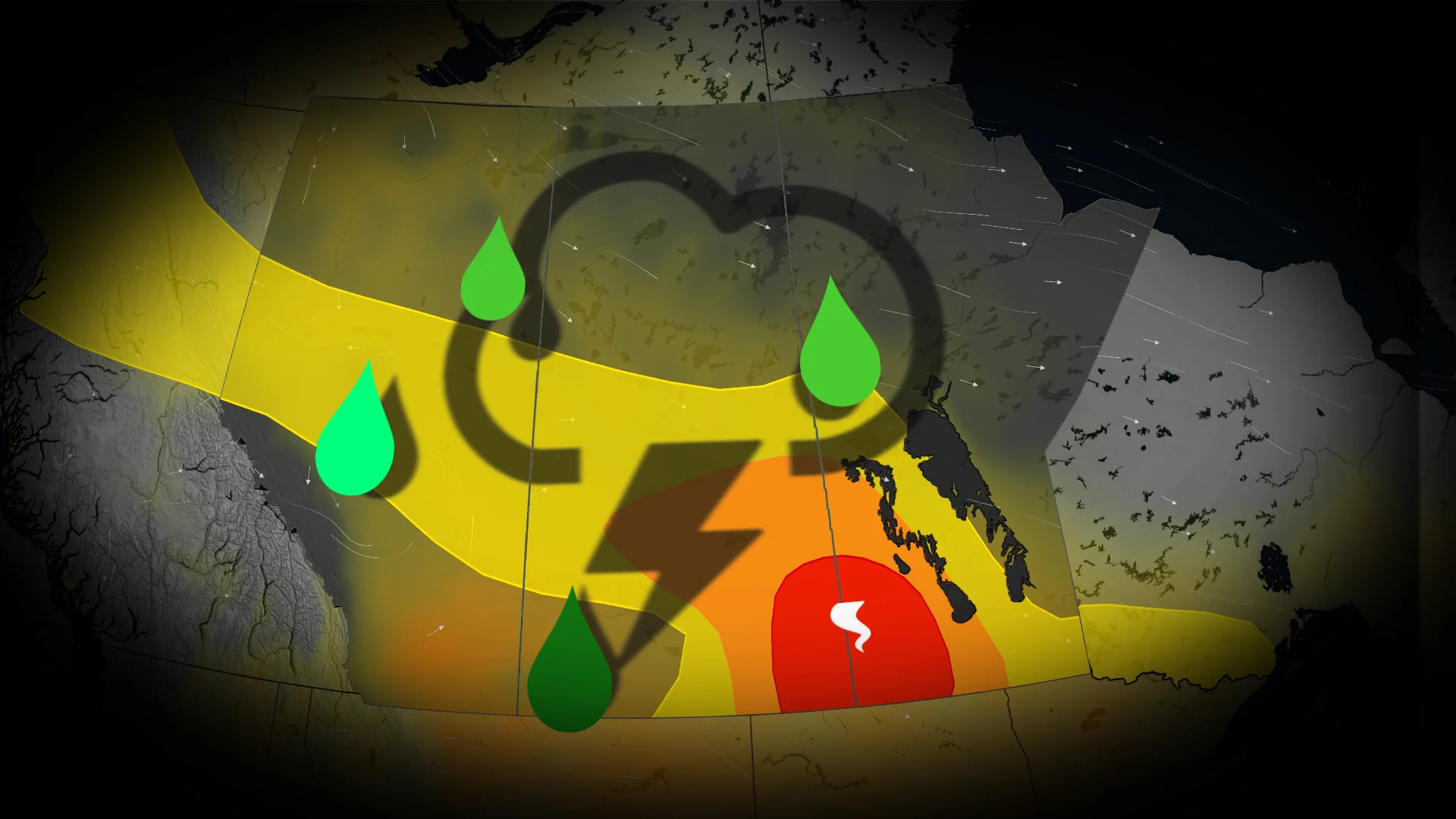
A severe weather threat spans parts of the Prairies on Thursday, followed by a heightened flood risk with some substantial weekend rain
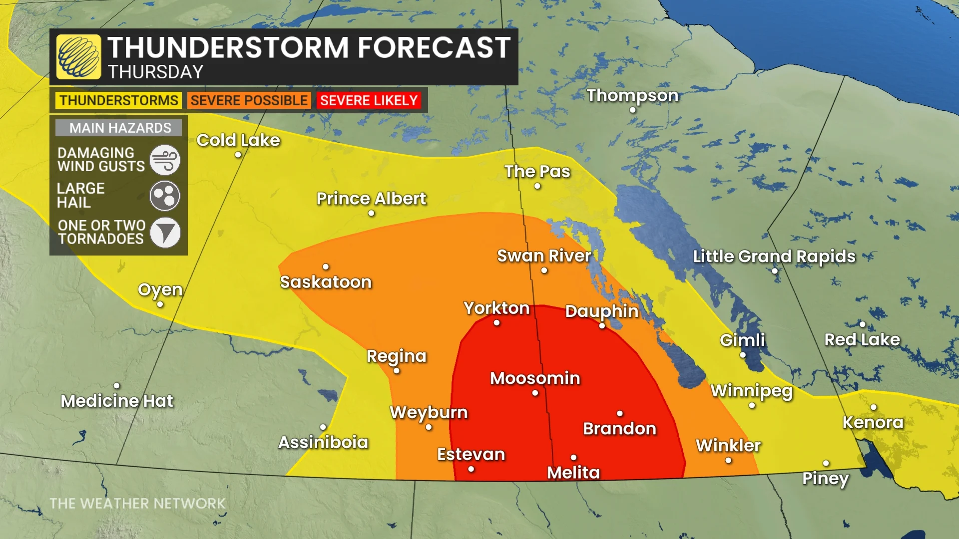
12:19 p.m. CST - A tornado watch is in effect across portions of southern Saskatchewan and southern Manitoba amid a severe storm threat on Thursday afternoon. A tornado watch means that conditions are favourable for the development of tornadoes.
“Large hail up to 6 cm, wind gusts to 110 km/h, and heavy rain are also likely,” Environment and Climate Change Canada (ECCC) added in its watch.
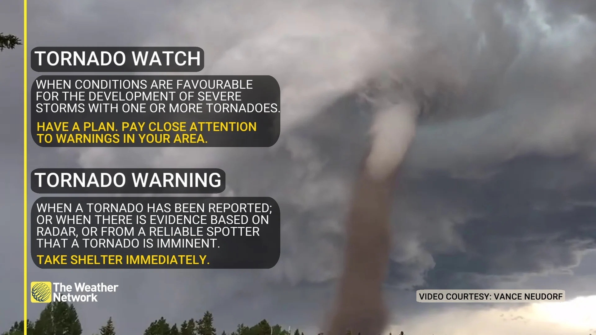
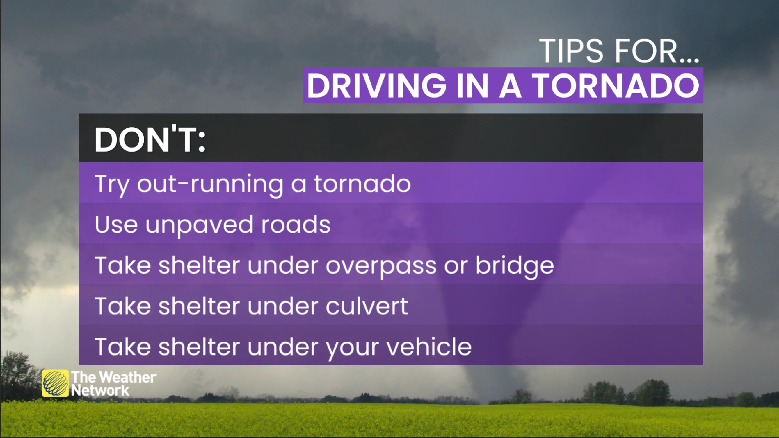
Pay close attention to the latest alerts in case the tornado watch is upgraded to a tornado warning in your area. Have a plan in place to seek safe shelter in case severe weather threatens your home, your office, or while you’re driving.
The original article with the full forecast for the Prairies continues below.
The risk for severe weather remains in place for parts of the Prairies on Thursday, with the threat for large hail, damaging winds, and the possibility of rotating storms hitting the Saskatchewan-Manitoba border.
DON'T MISS: Weather pattern flips hit Canada's summer for July and August
Following Thursday's severe weather risk, heavy rain and much cooler, spring-like conditions are expected to end off the week, with some areas set to sit 5-10°C below seasonal as summer officially begins. Between 50-100+ mm of rain could fall in some of the harder-hit regions this weekend, with a substantial threat for flooding building for southern Alberta, including the Calgary area.
Be sure to pay close attention to any weather watches and warnings in your area.
Thursday: Severe thunderstorm risk targets parts of Saskatchewan and Manitoba
A low pressure system tracking across the Prairies is setting the stage for an active weather day. Heat and humidity throughout Thursday will create a prime environment for afternoon instability, with a sharp cold front moving in to trigger isolated storms.
Damaging winds are expected along the leading edge of these storms, posing a risk to property and trees. Large hail is also a major concern in areas with severe storm potential.
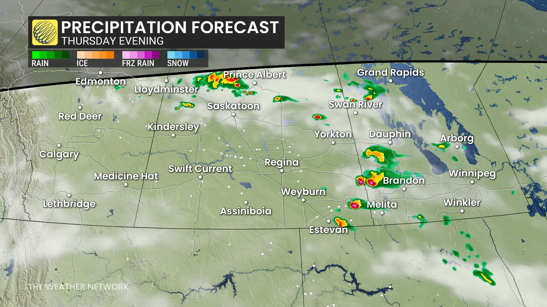
The Saskatchewan–Manitoba border is likely to experience the most significant impacts, with conditions favourable for supercells and the possibility of rotating storms. Stay prepared for rapidly changing weather conditions.
Weekend outlook: Heightened flood threat with heavy rain, cool temperatures
Focus will shift from the storms to the incoming cooler conditions this weekend, with temperatures during the first few days of summer forecast to be 5-10°C below seasonal averages. This cool and unsettled weather pattern is then set to dominate the latter half of June.
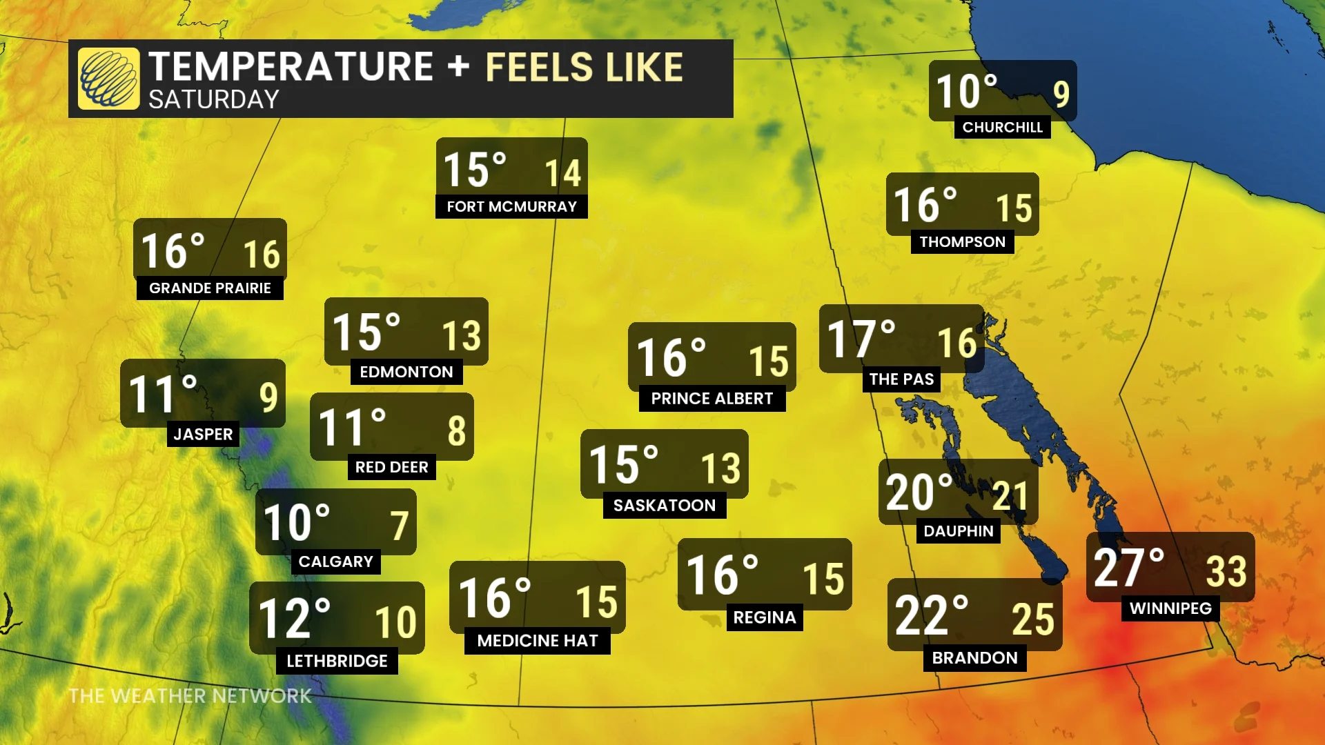
Southern Alberta, including the Calgary area, is bracing for a significant rainfall event this weekend, raising concerns about flooding.
Rain is expected to begin late Friday and persist through Sunday, with total accumulations ranging from 50-100+ mm, and localized areas potentially seeing 100-150+ mm.

While excessive rain poses challenges for specific locations, this system will also deliver much-needed precipitation to agricultural regions in western Canada. Areas in southern B.C., central Alberta, southern and central Saskatchewan, and parts of Manitoba could receive widespread rain amounts of 30-60+ mm, accompanied by occasional thunderstorms.
DON'T MISS: Get the latest wildfire news and safety tips to help you stay safe
Be weather-aware
Monitor The Weather Network's app or TV channel, and pay attention to local announcements for severe weather warnings and watches.
In case of a tornado warning, identify a safe place in your home where household members and pets will gather during a tornado: A basement, storm cellar or an interior room on the lowest floor with no windows.

In case of frequent lightning, even indoors, you have to take safety precautions in order to prevent receiving an electric shock from a lightning bolt. Below are some helpful tips to keep in mind:
Stay away from windows.
Unplug appliances.
Do not use a landline telephone.
Avoid running tap water.
Additionally, flash flooding can happen in a matter of minutes during, or shortly after, a major rain event. Do not attempt to drive through floodwaters as you as it only takes a small amount of moving water to sweep a vehicle away

Stay with The Weather Network for all the latest on conditions across the Prairies.