
Prepare for severe storms in parts of Ontario, Quebec on Sunday
Pay close attention to watches and warnings as you head out and about on Sunday across much of Ontario and Quebec
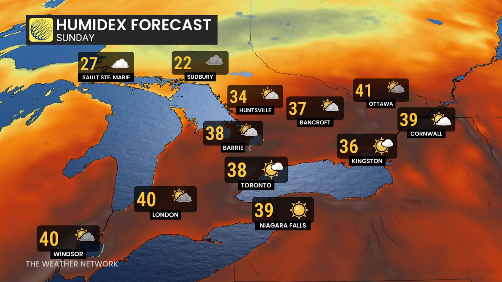
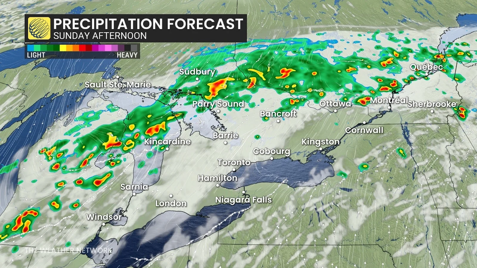
High heat and humidity will fuel a widespread risk for thunderstorms across portions of Ontario and Quebec to end the weekend.
Some of the storms could turn severe, especially in southwestern Ontario, the Ottawa Valley, and much of southern Quebec.
Keep an eye on the radar as you go about your day and pay attention to watches and warnings in your area.
DON'T MISS: Texas storms triggered a ‘large and deadly flood wave’
Heat, humidity, and a front to spark thunderstorms
Anyone who’s stepped outside this weekend has felt the warmth and mugginess parked across the region. This summery airmass will provide ample instability to any thunderstorms that form.
A cold front pushing in from the west will serve as the spark needed for widespread thunderstorm development heading into the day Sunday.
While thunderstorms are possible just about anywhere from Windsor to Quebec City, we’re watching two areas for the potential for severe weather.
Severe storm risk builds in two regions
The cold front will arrive across the shores of Lake Huron and Georgian Bay in the early evening hours, bringing the risk for severe storms to cottage country and the shorelines.
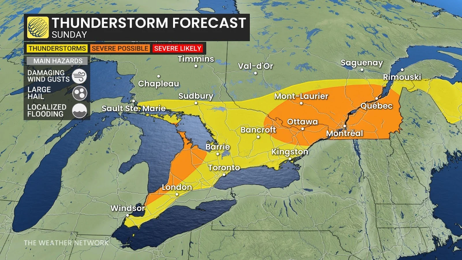
The main concern here will be localized flooding, as well as the risk for large hail and strong wind gusts.
A much more potent setup will build in eastern Ontario and southern Quebec, where a warm front will provide a boost and focus for strong to severe thunderstorms to develop.
Storms here are expected to develop in the afternoon and stretch into the evening hours.
The main risk will be damaging wind gusts of 110 km/h and nickel sized hail. Rotation can’t be ruled out. Localized flooding is possible due to the rich reserve of moisture available for storms to tap into.
Be sure to check back for all the latest forecast information in your area.
Header image submitted by Krista B.