Prime setup for severe storms kicks off Ontario's Victoria Day weekend
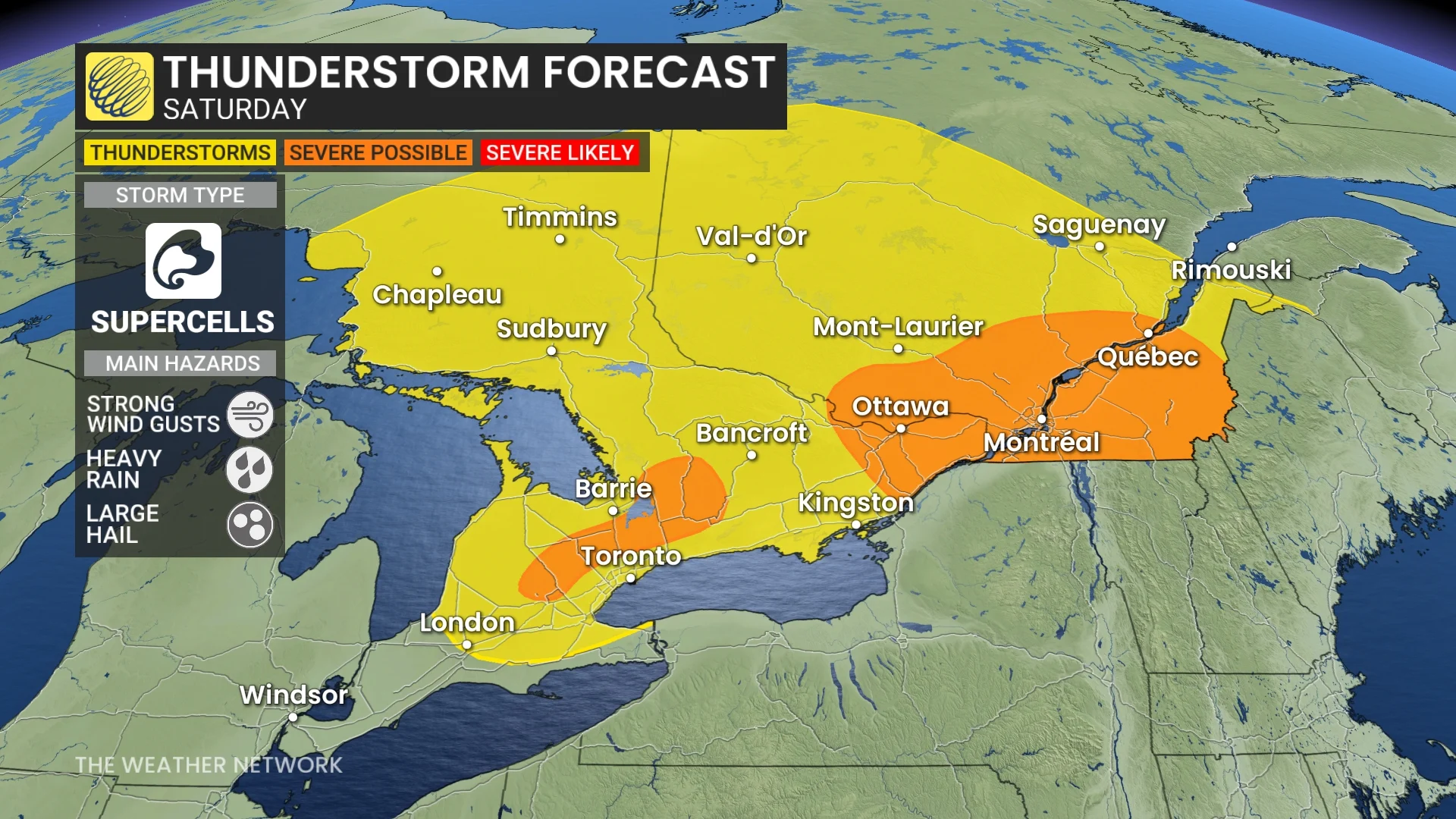
Mother Nature may provide parts of Ontario with its own fireworks on Saturday, with a renewed risk of thunderstorms in the afternoon and evening. Cottage country and eastern Ontario will be the focus of possible severe storms
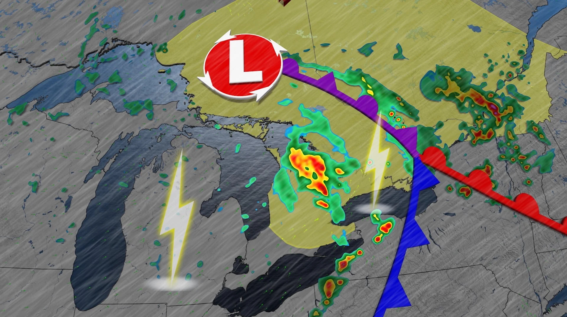
After a stormy Friday night and early Saturday morning in southern Ontario, we may soon see a repeat performance--especially in cottage country and eastern areas.
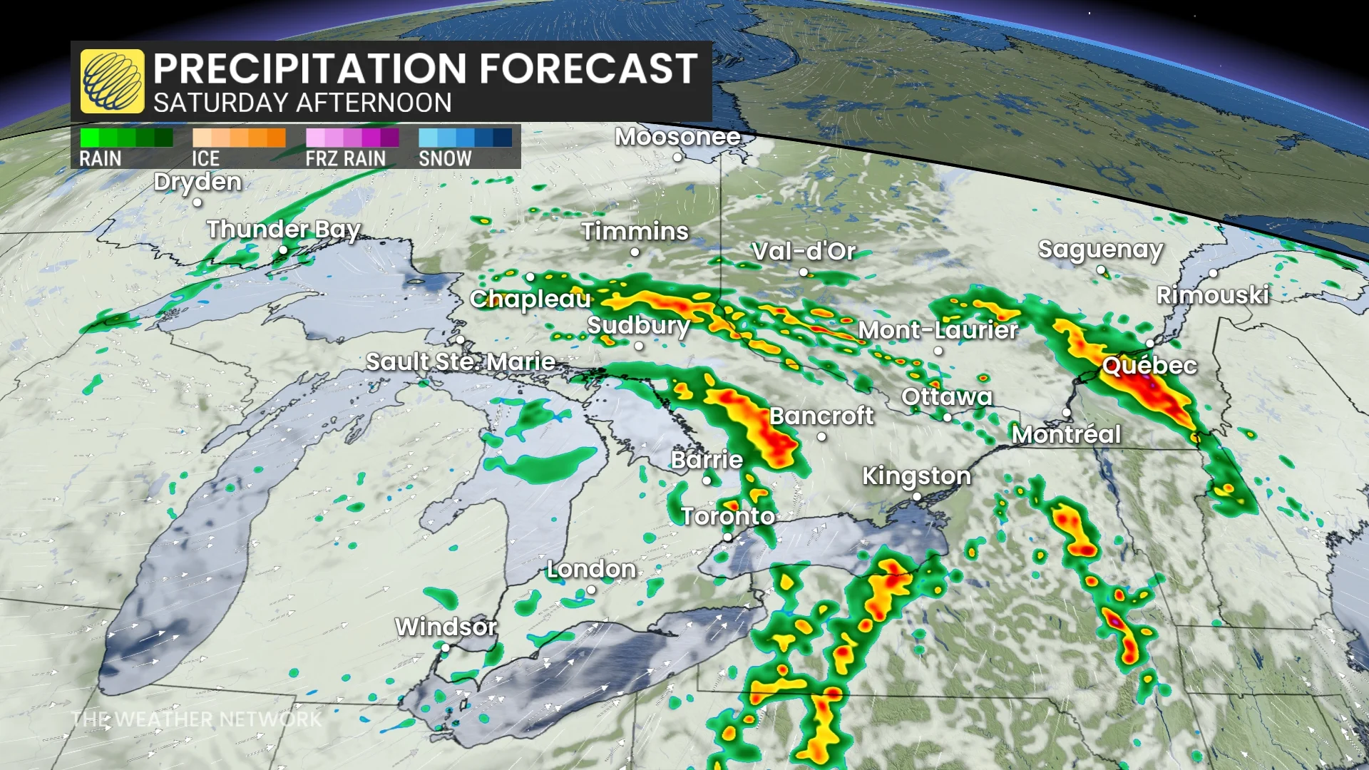
A line of thunderstorms is expected to redevelop on Saturday in parts of southern Ontario and track eastward through the afternoon hours. Severe thunderstorm watches are already in place in eastern Ontario. The main hazards include large hail, strong wind gusts and heavy downpours.
DON’T MISS: The pyrotechnic science behind Victoria Day firework displays
The rest of the long weekend will see improving conditions, sprinkled with some lingering showers for some areas at times, but temperatures will take a considerable nosedive, so ensure you add extra layers on if you plan on spending time outdoors on Sunday and Monday.
Keep an eye on local weather alerts for your area before heading out and be prepared to adjust any outdoor plans this weekend, especially on Saturday.
Saturday could feel like déjà vu
A low is expected to spin up multiple rounds of heavy downpours and lightning-filled storms throughout the day on Saturday. After morning thunderstorms, there is likely to be another round Saturday afternoon.
DON'T MISS: Kenora firefighters stay on standby as wildfires blaze in northwest Ontario
Some of the storms that redevelop could become severe. Forecasters will be watching cottage country and eastern Ontario in the afternoon, as well as a swath north of Toronto--from around Fergus to Peterborough.
Intense lightning, strong winds, heavy rain and hail are all associated risks with these storms. There is even a risk of a tornado for southeastern Ontario, but the threat is low.
By the late afternoon into early evening period, wraparound showers across the Greater Toronto Area (GTA) westward, while the thunderstorm risk lingers for eastern Ontario and southern Quebec.
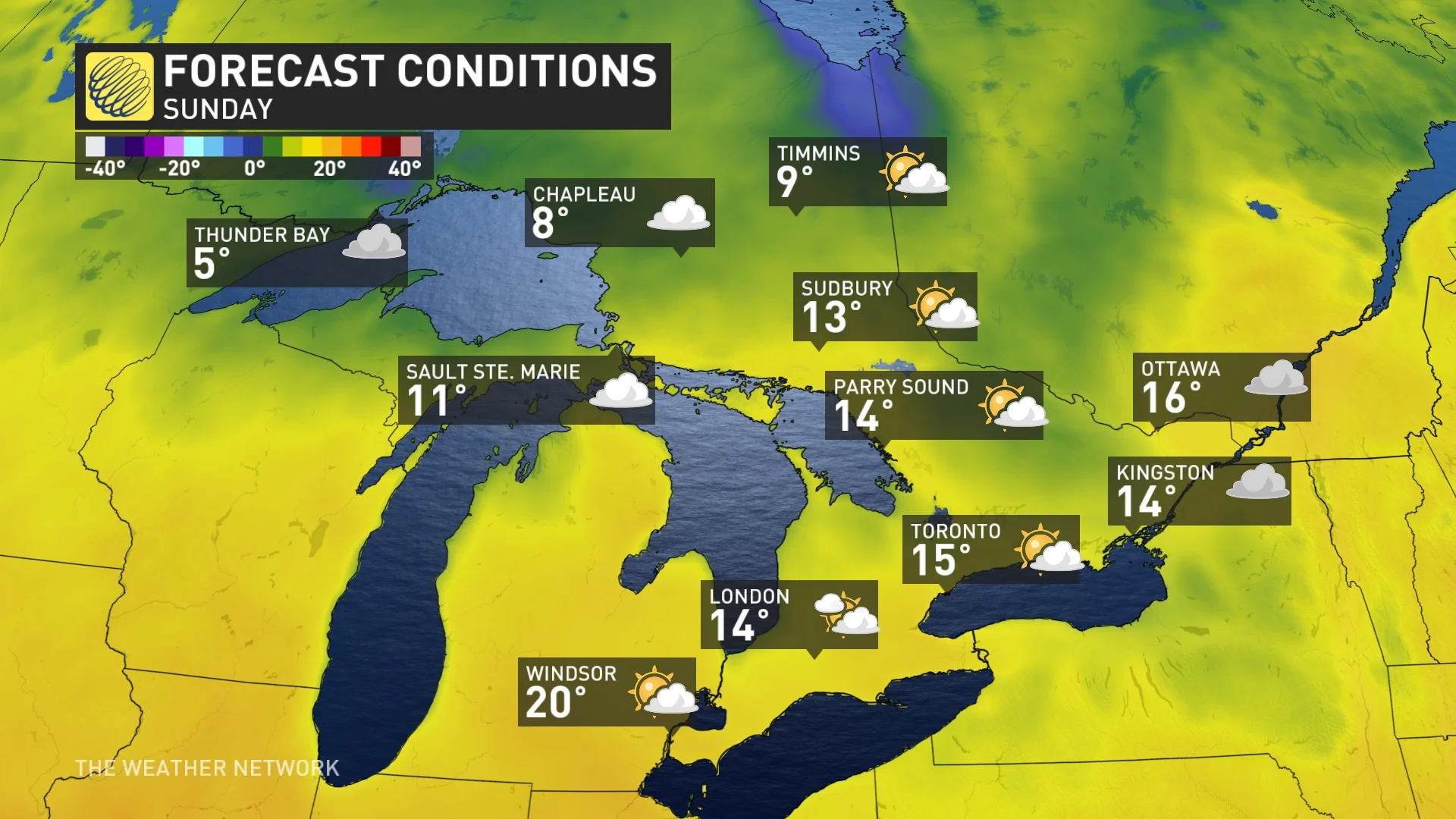
On Sunday, the morning starts off cloudy with light sprinkles for the GTA and areas west, as well as parts of cottage country, but conditions will dry out as the day progresses
Elsewhere, showers linger through the Ottawa Valley through the afternoon and evening, but partly cloudy skies emerge outside of the region.
The best day of the long weekend will be on Monday as the region will see mostly sunny skies. However, some clouds will linger from Kingston to Ottawa, and locales eastward.
Temperatures will run cooler than normal for Sunday and Monday, and winds will be a bit gusty, making for a bit of a chilly end to the long weekend.
Much cooler-than-seasonal temperatures will dominate through next weekend and into the following week. Temperatures should trend back to near seasonal as we head into the start of June.
WATCH: Violent storms stretch from Minneapolis to Ontario, Beyoncé concert delayed
Stay with The Weather Network for more information and updates on your weather across Ontario.