
A radical temperature shift takes shape for the end of August
First taste of fall, as Hurricane Erin impacts late August temperatures across Ontario and Quebec
Both Ontario and Quebec are on track for a significant temperature drop as a taste of early fall arrives by the end of August.
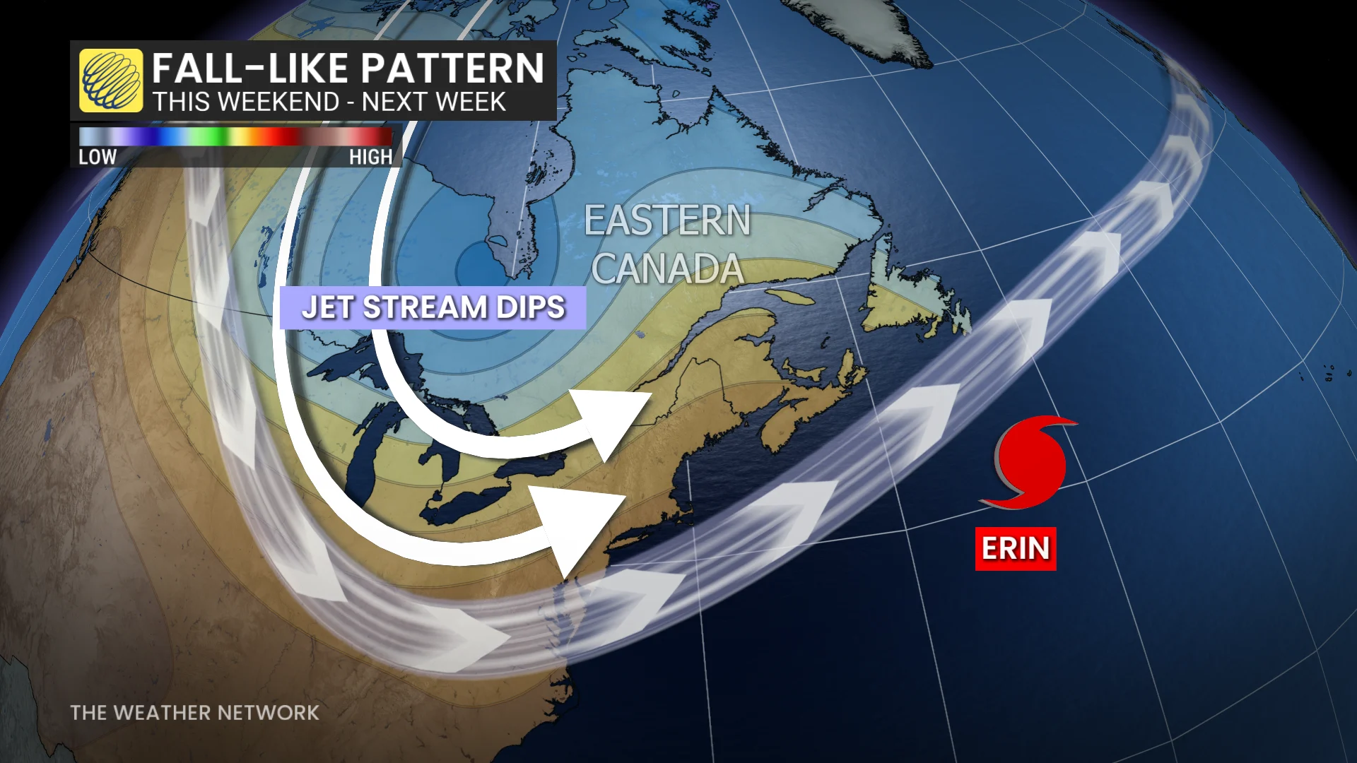
Hurricane Erin’s track across the Atlantic is making waves beyond the ocean, influencing the jet stream over Eastern Canada with a deep trough settling over the region early next week.
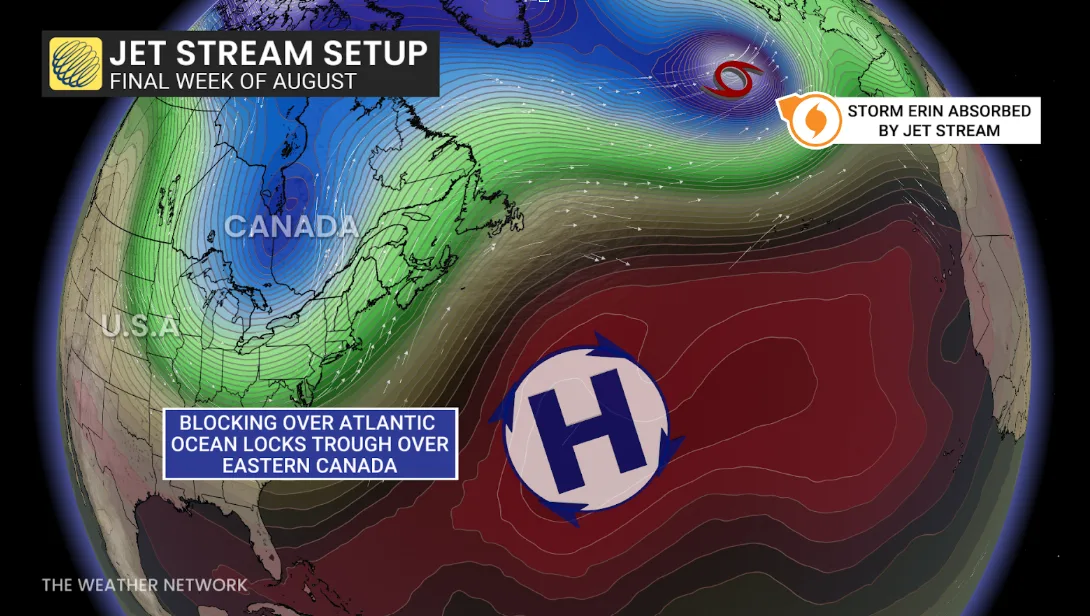
As Erin merges with a secondary low moving from Greenland towards Europe, atmospheric patterns are expected to lock the trough over the Great Lakes.
DON'T MISS: U.S., Canada East Coast braces for Erin's dangerous swells, rip currents
High pressure over the Atlantic will reinforce this setup, leading to unseasonably cool weather for Ontario and Quebec.
A cold front will sweep through on Sunday, bringing the potential for thunderstorms before the colder, drier air settles over the region.
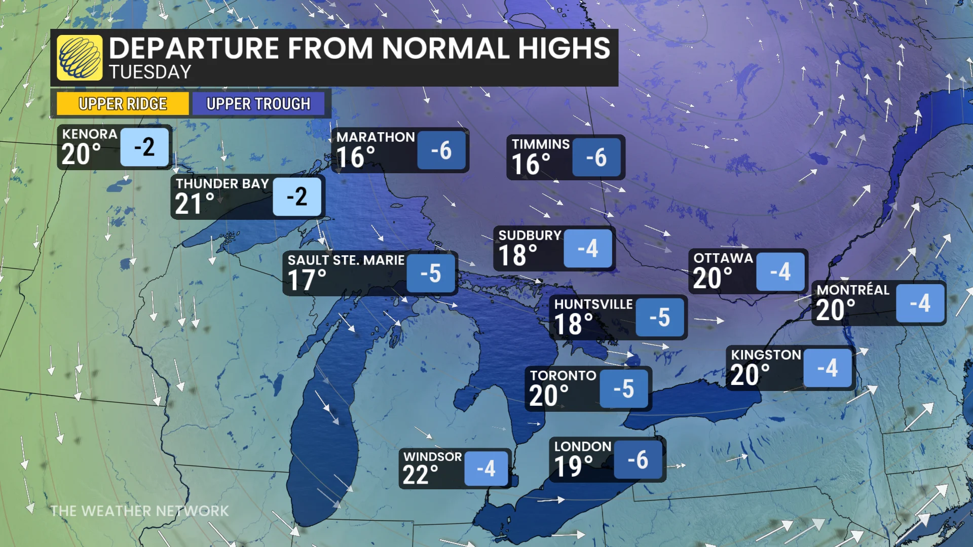
Temperatures will drop significantly, with Monday highs in Toronto expected to reach the low 20s -- about 5°C below seasonal norms. Early June was the last time most major cities have seen daytime highs at just 20°C.
SEE ALSO: Parts of Ontario end the 65-day heat streak
In Timmins, temperatures could plunge to 14°C, with single-digit overnight lows for many communities across northern Ontario.
The cooler weather over the warm waters of the Great Lakes will also increase the potential for waterspouts and some lake-effect showers. Expect reduced temperatures to persist into early September before trending back towards seasonal into the Labour Day long weekend.
WATCH: Surfers await Hurricane Erin’s mighty waves in Nova Scotia
Be sure to check back for the latest weather updates across Ontario and Quebec.