
Rain relief reaches Atlantic Canada though some areas still miss out
Much-needed rain heading to the Maritimes, but not everyone will see relief
A couple of cold fronts are set to move across Atlantic Canada in the coming days. These systems will bring showers and thunderstorms, with isolated areas experiencing heavy downpours.
Some temporary and localized relief from the ongoing dry conditions is expected; however, rainfall amounts will fall short of addressing the broader precipitation deficit in most regions.
DON'T MISS: Canada’s rain gauge runs dry, cities top weeks without rain
Much of the Maritimes have received less than 40 per cent of their average summer rainfall, resulting in extremely dry conditions and heightened fire danger.
Recent heat waves have also set multiple monthly and all-time temperature records across the region.
RELATED: Dry July raises major concerns for N.S. farmers
Heat breaks with the arrival of some significant rain through Friday
The intense heat across the Maritimes is coming to an end. While most regions will remain warm on Thursday and Friday, with highs in the mid to upper 20s, a cold front is set to deliver some relief in the form of rain.
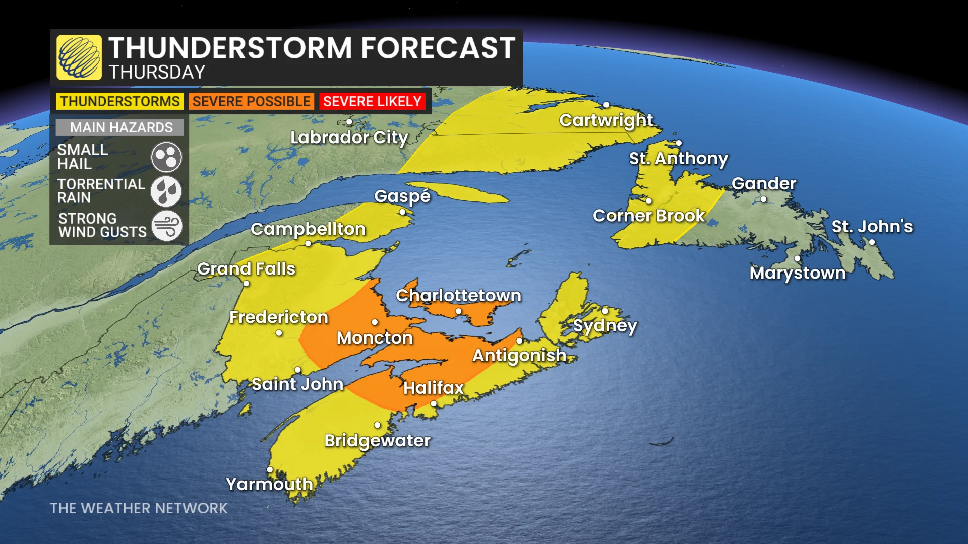
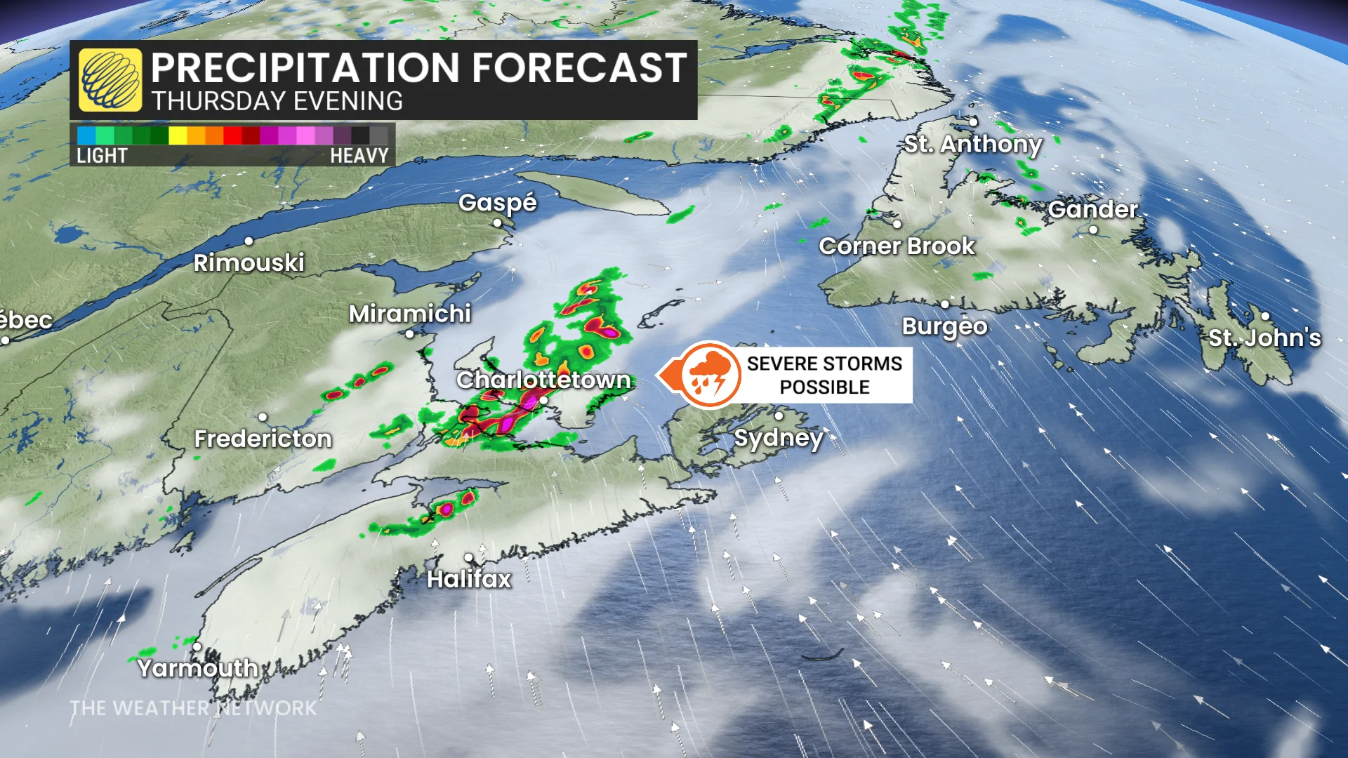
Thunderstorms, possibly severe, are forecast for P.E.I. and southeastern New Brunswick Thursday afternoon, moving into northern Nova Scotia later in the evening.
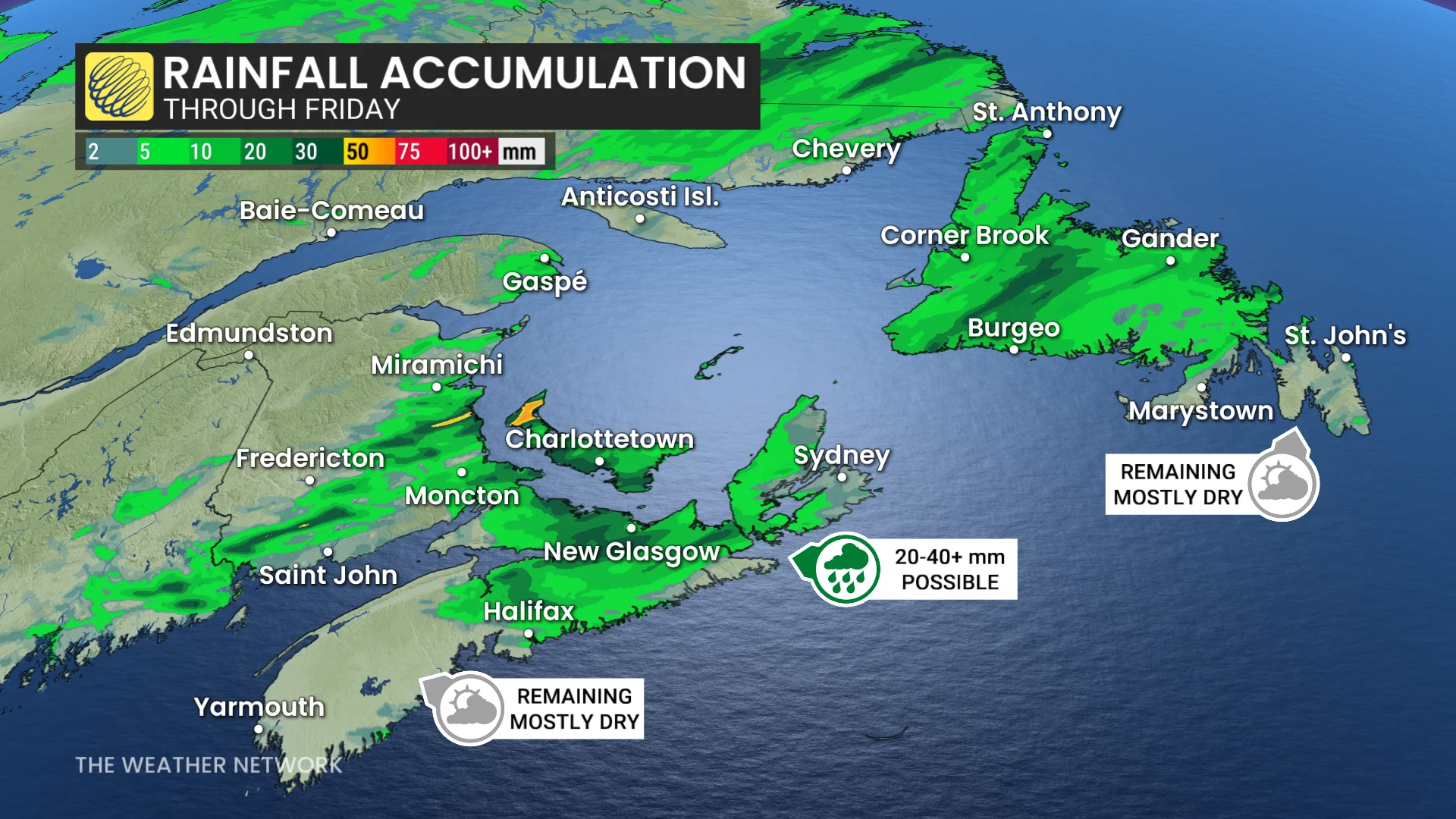
The primary risk with these storms is torrential rainfall, with localized totals of 20–40+ mm possible over a short period.
However, southern Nova Scotia, including areas impacted by new wildfires, is likely to miss out on this rain.
RELATED: Wildfire burning near Halifax business park being held
Newfoundland will see spotty showers around Gander Thursday, with steadier rainfall arriving Friday as the cold front moves across the island. Heavy rain is possible in western and central Newfoundland during the morning before tapering to light, scattered showers as it moves toward the Avalon Peninsula by Friday afternoon. The Avalon is expected to receive only about 5 mm of rain.
Much cooler weather dominates into next week
As the system exits, winds will shift to a cooler northeasterly flow.

By Saturday, Newfoundland will cool significantly, with highs in the teens—a stark contrast to recent August heat. The Maritimes will remain warm into Saturday, ahead of another cold front arriving Sunday into Monday.
Closely watching the track of Tropical Storm Erin
Tropical Storm Erin is forecast to intensify into a hurricane later this week and could become a major hurricane by the weekend as it travels across the southern Atlantic. This will be a long-lived system, with its progression expected to be monitored closely over the next 10+ days.
DON'T MISS: Tropical Storm Erin's path uncertain as steering patterns shift in Atlantic
Erin is projected to eventually curve northward, most likely staying well east of the U.S. East Coast. However, its exact track remains uncertain, and an impact to the U.S. coastline cannot be ruled out entirely at this stage.
For Atlantic Canada, the potential impacts depend on where Erin makes its turn and whether the storm remains offshore or tracks closer to the region. It is still far too early to determine its exact trajectory, but those in Atlantic Canada are encouraged to stay updated on the storm's progress over the coming days.