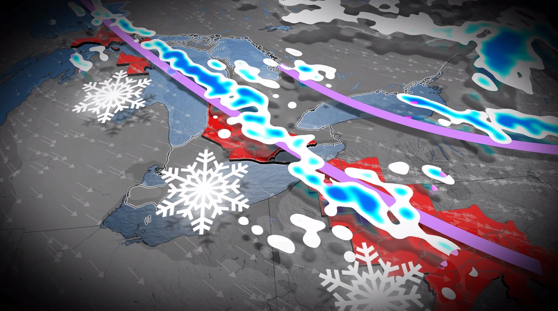
Rare, mega-squall snaking from Lake Superior to the Atlantic Ocean

A prime environment for snow squall development will have one band potentially stretch 1,600 km as it could drop more than 30 cm in Canada and U.S.
It takes an exceptional setup to generate a squall more than 1,000 kilometres long. Over the next 24 hours, a multi-lake squall setup will create impacts across Ontario, Michigan, Pennsylvania, and New York state.
Upstream, ample moisture pinwheeling around a trough that brought a wintry mess across eastern Ontario and Quebec is travelling across Lake Superior, gathering more moisture and energy from the Great Lakes.
SEE ALSO: Rare November thunderstorms bring hail to southern Ontario
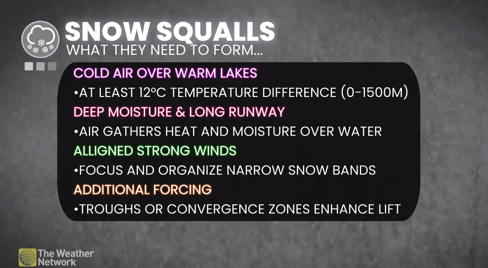
Near-perfect wind alignment
A continuous and stable northwest flow will create a predictable environment for a massive lake-effect band, with similar wind directions at the surface to a few kilometres above.
A predictable wind direction allows a point of convergence to develop, generating a near-continuous band of heavy snowfall that stretches more than 1,000 kilometres in length.
A time of chain reaction occurs between the lakes, where the lake-effect’s energy and ingredients can be passed from lake to lake.

Lake effect initiates from Lake Superior, intensifies across Lake Huron, moves inland across southern Ontario, and then picks up additional moisture over Lake Erie before pushing well inland across Pennsylvania.
Extreme instability
Even though a minimum temperature difference, which is required from the lake surface to 1500 metres, is 12°C, we’re working with about 20°C, which creates extreme instability.

Snow squalls in Owen Sound, Ont., on Dec. 12, 2024. (April Walker/The Weather Network)
Since the temperature changes more drastically with height, and with moisture in the region that generates snowflakes, we’ve created a massive, snow-making machine.
The impacts
Along with the near-continuous ribbon of heavy snow, whiteouts and changing road conditions, and localized snowfall, near 40 cm is possible downwind of Lake Huron.

The squall pushes well inland from the traditional snowbelts, making this an extreme case of a more widespread snowfall event. It’s not your typical, localized snow squall event.