Renewed storm, funnel cloud potential shifts on the Prairies
Storms and funnel clouds are on the table on Saturday for the Prairies and northwestern Ontario, with some areas at risk of seeing large hail, strong winds, heavy rain, and even supercells
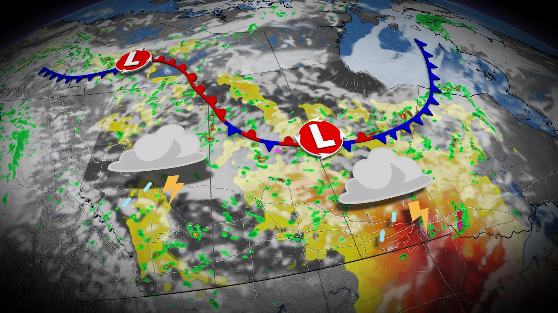
After a Friday evening filled with severe thunderstorm warnings, and a tornado warning, on parts of the Prairies, Saturday could see a similar situation come to fruition in southern Manitoba and northwestern Ontario as the threat shifts eastward.
A significant amount of available thunderstorm energy could fuel severe storms Saturday afternoon and evening, potentially affecting Brandon, Winnipeg and Interlake region in Manitoba, stretching into northwestern Ontario, as well. The threat does include a discrete supercell chance in southeast Manitoba, including around the Winnipeg area, and into northwestern Ontario.
RELATED: Tornado season is underway in Canada. Here’s what you need to know
As well, there is a funnel cloud risk in parts of Alberta, Saskatchewan and Manitoba on Saturday.
Stay safe by keeping up with the latest severe weather watches and warnings in your area.
Severe weather threat renews on Saturday
An environment capable of supporting severe thunderstorms will continue moving east across the Prairies into the day Saturday.
Ample thunderstorm energy and favourable dynamics could allow any storms in the region to turn severe.
This risk includes Winnipeg, Brandon, and Dauphin in Manitoba, as well as Fort Frances, Dryden, and Kenora in northwestern Ontario.
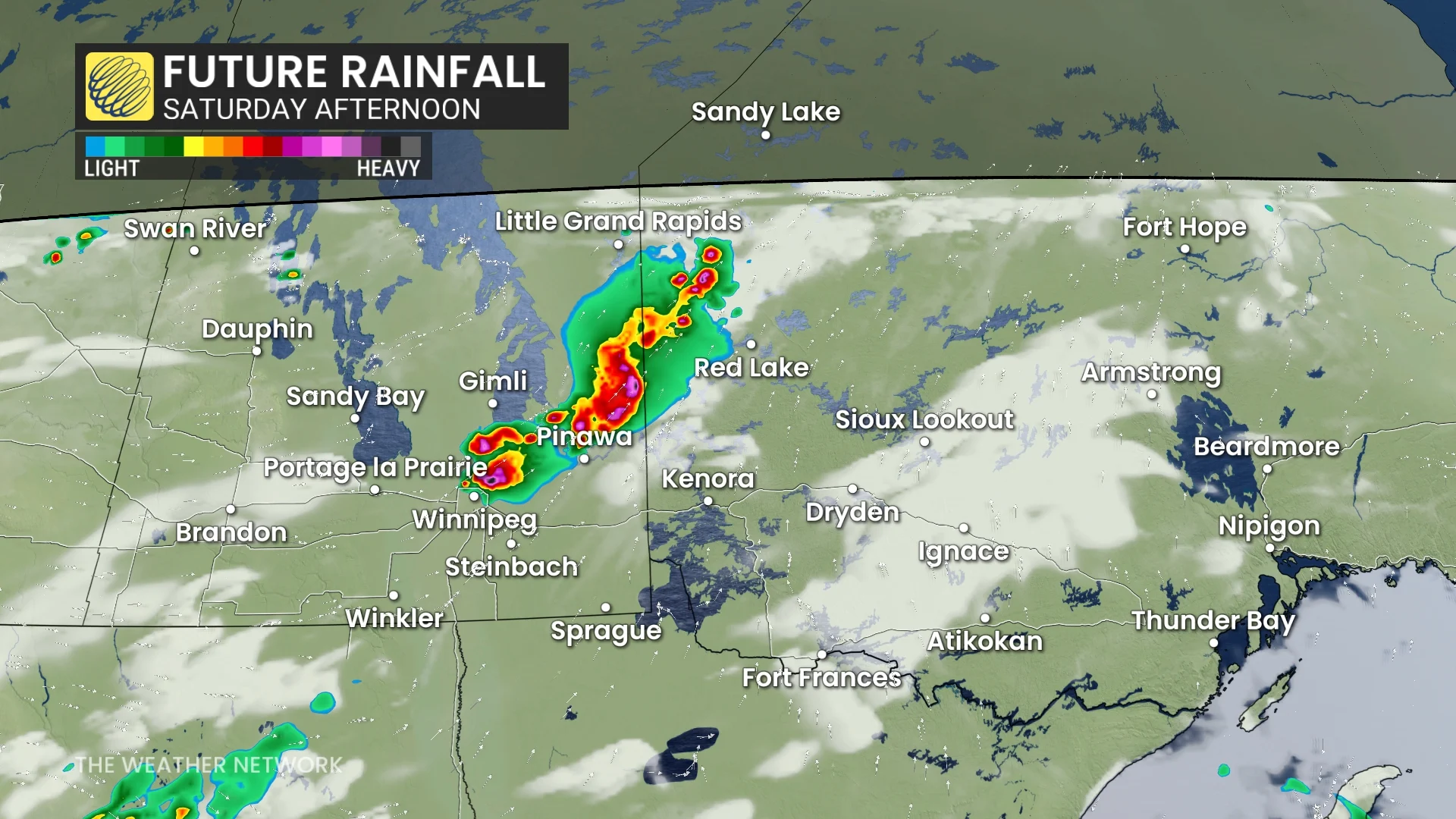
Strong winds of 90-100 km/h, large hail up to the size of ping pong balls, and very heavy rainfall are possible in the most intense storms. Localized flooding may develop beneath any slow-moving cells.
Discrete supercells producing heavy rain and large hail are possible across southeastern Manitoba, including around the Winnipeg area, and into northwestern Ontario.
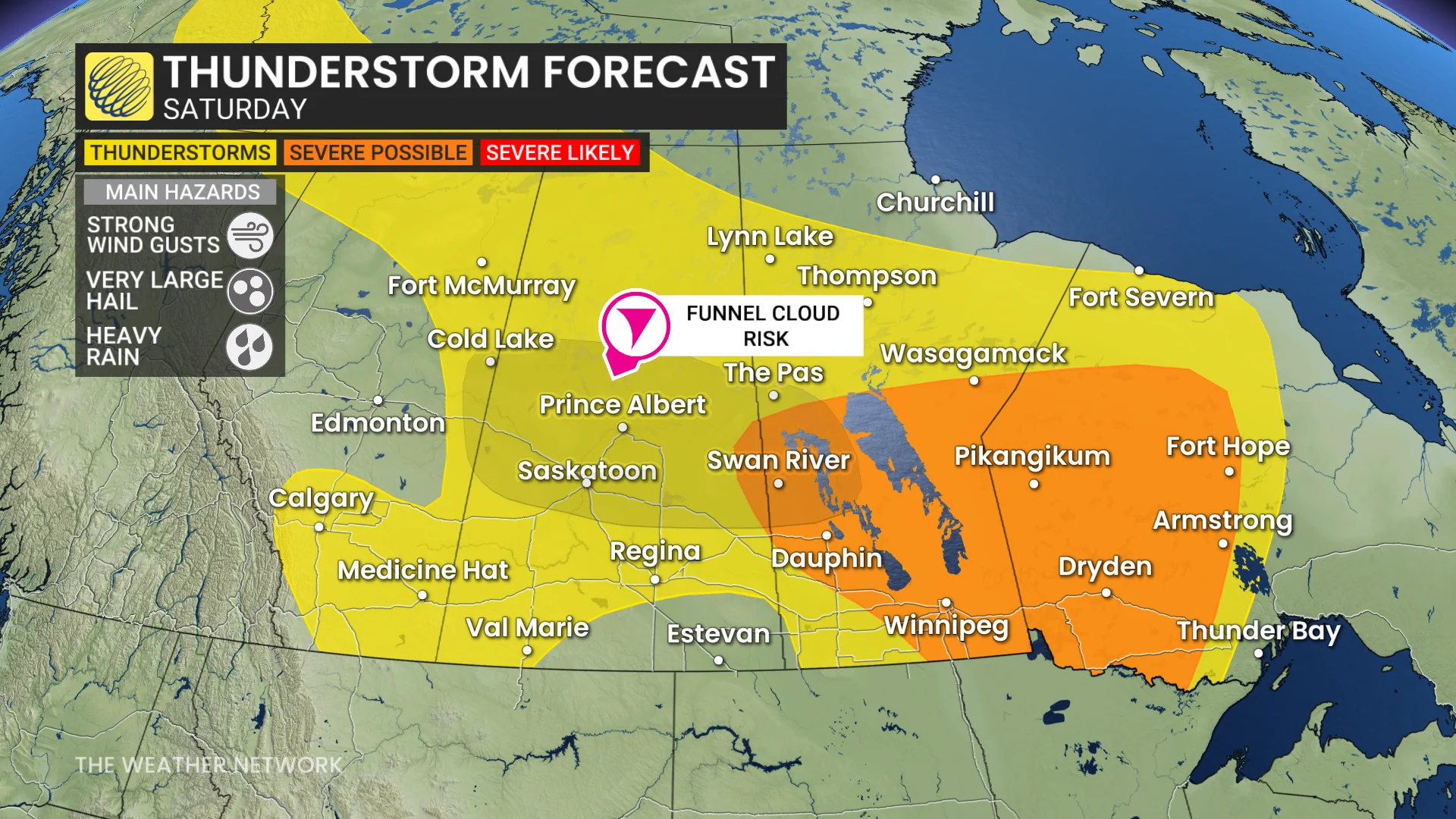
Farther west, there is also the risk of funnel clouds in parts of Alberta and Saskatchewan, as well as Manitoba, so stay weather-aware on Saturday. While not dangerous as funnel clouds, if they can do make contact with the ground, they can become landspout tornadoes.
There is still uncertainty in terms of the timing of the storms, but they will most likely occur from 2 p.m. to 8 p.m. local time, stretching from the southern Lake Winnipeg area and continuing southeastward.
With this being an extended weekend, many folks will be travelling to celebrate the upcoming Canada Day holiday. So, it’s advised to stay weather-aware. Download The Weather Network app to received the most up-to-date information and weather alerts.
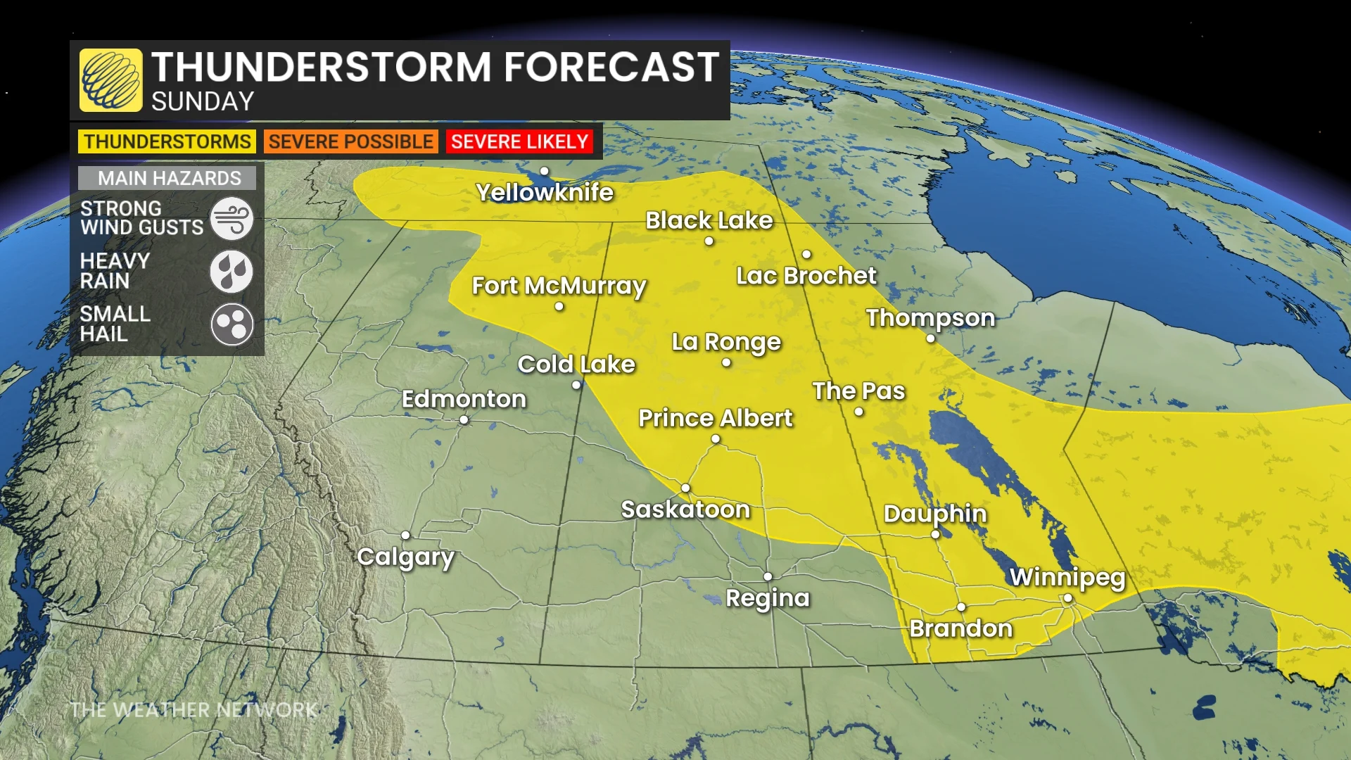
The thunderstorm risk will pop up again on Sunday, covering similar regions as Saturday, also extending westward into parts of Saskatchewan and Alberta. However, the severe risk will remain confined to parts of the northwestern Ontario. The threat on the Prairies should remain scattered and non-severe in nature.
Conditions will be dry for most of Alberta and Saskatchewan on Monday, except for far northern areas, but scattered showers and thunderstorms are expected again in southern Manitoba. Most of the region will be dry for Canada Day but the threat for showers and thunderstorms will return to western Alberta, including Calgary.
Warmer-than-normal temperatures will dominate across the region during the first week of July--and well beyond--with the potential for some very hot weather with daytime highs in the low- to mid-30s. However, temperatures will be locally cooler at times when storms occur.
Stay with The Weather Network for the latest on conditions across the Prairies.